
Cosumnes River
Encyclopedia
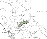
The Cosumnes River is a river in northern
California
in the United States
. It rises on the western slope of the Sierra Nevada and flows approximately 52.5 miles (84.5 km) into the Central Valley, emptying into the Mokelumne River
in the Sacramento-San Joaquin Delta.
rivers were, using the -umne suffix meaning "people of" as well as the cos- prefix meaning "salmon" or "fish". (Salmon runs are rarely, if ever, seen above Rancho Murieta
as a result of diversions in the area.) The Cosumnes is often mis-pronounced as "ka-SOOM-ness" or "kun-SOOM-ness", which is incongruent with pronunciation of other regional rivers with the same root (e.g., Tuolumne, Mokelumne).
and Amador County
Gold Country
before converging just east of Highway 49
. The river proper begins at the confluence of the North and Middle Forks near Enterprise. It then winds through the scenic Sierra foothills before passing into southern Sacramento County in the Sacramento Valley
, joining with the Mokelumne River which in turn empties into the San Joaquin River
.
The Cosumnes is the only river in the western Sierra without major dams, although two small diversion dams do cross the river just upstream from Rancho Murieta near Van Vleck Park. The Nature Conservancy's Cosumnes River Preserve
is located just upstream from the Delta. Towns and cities along the Cosumnes River include Plymouth
, Rancho Murieta, Sloughhouse
, Wilton
, and Elk Grove
.
above Rancho Murieta, which would open much of the lower Cosumnes River valley to development. Such proposals are still the subject of ongoing debate.
38.2554703°N 121.4391183°W
Northern California
Northern California is the northern portion of the U.S. state of California. The San Francisco Bay Area , and Sacramento as well as its metropolitan area are the main population centers...
California
California
California is a state located on the West Coast of the United States. It is by far the most populous U.S. state, and the third-largest by land area...
in the United States
United States
The United States of America is a federal constitutional republic comprising fifty states and a federal district...
. It rises on the western slope of the Sierra Nevada and flows approximately 52.5 miles (84.5 km) into the Central Valley, emptying into the Mokelumne River
Mokelumne River
The Mokelumne River is a river in Northern California. The Upper Mokelumne River originates in the Sierra Nevada mountain range and flows into Pardee Reservoir and then Camanche Reservoir in the Sierra foothills. The Lower Mokelumne River refers to the portion of the river below Camanche Dam...
in the Sacramento-San Joaquin Delta.
Name
The Cosumnes River is thought to have been named as the Mokelumne and TuolumneTuolumne River
The Tuolumne River is a California river that flows nearly from the central Sierra Nevada to the San Joaquin River in the Central Valley...
rivers were, using the -umne suffix meaning "people of" as well as the cos- prefix meaning "salmon" or "fish". (Salmon runs are rarely, if ever, seen above Rancho Murieta
Rancho Murieta, California
Rancho Murieta is a census-designated place and guard-gated community in Sacramento County, California, United States. It is part of the Sacramento–Arden-Arcade–Roseville Metropolitan Statistical Area. The population was 5,488 at the 2010 census, up from 4,193 at the 2000 census...
as a result of diversions in the area.) The Cosumnes is often mis-pronounced as "ka-SOOM-ness" or "kun-SOOM-ness", which is incongruent with pronunciation of other regional rivers with the same root (e.g., Tuolumne, Mokelumne).
Geography
Flowing from the western slope of the central Sierra Nevada mountains, the Cosumnes starts as North, Middle and South forks cutting canyons through the El DoradoEl Dorado County, California
El Dorado County is a county located in the historic Gold Country in the Sierra Nevada Mountains and foothills of the U.S. state of California. The 2010 population was 181,058. The El Dorado county seat is in Placerville....
and Amador County
Amador County, California
Amador County is a county located in the Sierra Nevada of the U.S. state of California. As of the 2010 census, the population was 38,091. The county seat is Jackson.Amador County bills itself as "The Heart of the Mother Lode" and lies within the Gold Country...
Gold Country
Gold Country
Gold Country is a region in the central and northeastern part of California, United States. It is famed for the mineral deposits and gold mines that attracted waves of immigrants, known as the 49ers, during the 1849 California Gold Rush.-Geography:State Route 49 was built through the Gold Country,...
before converging just east of Highway 49
California State Route 49
State Route 49 is a north–south state highway in the U.S. state of California that passes through many historic mining communities of the 1849 California gold rush. Highway 49 is numbered after the "49ers", the waves of immigrants who swept into the area looking for gold, and a portion of it...
. The river proper begins at the confluence of the North and Middle Forks near Enterprise. It then winds through the scenic Sierra foothills before passing into southern Sacramento County in the Sacramento Valley
Sacramento Valley
The Sacramento Valley is the portion of the California Central Valley that lies to the north of the San Joaquin-Sacramento Delta in the U.S. state of California. It encompasses all or parts of ten counties.-Geography:...
, joining with the Mokelumne River which in turn empties into the San Joaquin River
San Joaquin River
The San Joaquin River is the largest river of Central California in the United States. At over long, the river starts in the high Sierra Nevada, and flows through a rich agricultural region known as the San Joaquin Valley before reaching Suisun Bay, San Francisco Bay, and the Pacific Ocean...
.
The Cosumnes is the only river in the western Sierra without major dams, although two small diversion dams do cross the river just upstream from Rancho Murieta near Van Vleck Park. The Nature Conservancy's Cosumnes River Preserve
Cosumnes River Preserve
The Cosumnes River Preserve is a nature preserve of located 20 miles south of Sacramento, in the US state of California. The preserve protects a Central Valley remnant that once contained one of the largest expanses of oak tree savanna, riparian oak forest and wetland habitat in North America...
is located just upstream from the Delta. Towns and cities along the Cosumnes River include Plymouth
Plymouth, California
Plymouth is a city in Amador County, California, United States. The population was 980 at the 2000 census. The town was originally named Pokerville, when it was settled during the time of the Gold Rush...
, Rancho Murieta, Sloughhouse
Sloughhouse, California
Sloughhouse is an unincorporated community in Sacramento County, California, United States. Sloughhouse is located on California State Route 16 east-southeast of downtown Sacramento. Sloughhouse has a post office with ZIP code 95683, which was established in 1916. Jared Sheldon, who built a...
, Wilton
Wilton, California
Wilton is a census-designated place in Sacramento County, California, United States. It is part of the Sacramento–Arden-Arcade–Roseville Metropolitan Statistical Area. The population was 5,363 at the 2010 census, up from 4,551 at the 2000 census.-Geography and environment:Wilton is...
, and Elk Grove
Elk Grove, California
Elk Grove is a city in Sacramento County, California, located just south of the state capital of Sacramento. It is part of the Sacramento–Arden-Arcade–Roseville Metropolitan Statistical Area. As of the 2010 census, the population of the city is 153,015...
.
River modifications
As the last undammed river flowing from the west slope of the Sierra, the Cosumnes poses a major flooding hazard to southern Sacramento County and may dry up in some years due to the lack of river regulation. Dams have been proposed to be built on the river to control flows, but these plans have largely stalled because of the river's unique free-flowing status. Sacramento County officials continue to lobby for the construction of a flood-control dry damDry dam
A dry dam is a dam constructed for the purpose of flood control. Dry dams typically contain no gates or turbines, and are intended to allow the channel to flow freely during normal conditions...
above Rancho Murieta, which would open much of the lower Cosumnes River valley to development. Such proposals are still the subject of ongoing debate.
External links
- Cosumnes Research Group
- Cosumnes River Task Force
- Lower Cosumnes-Lower Mokelumne Watershed Profile US EPA Region 9
- Cosumnes River Preserve
- Cosumnes River Watershed Project datasets - California Environmental Information Catalog (Geographic Names Information SystemGeographic Names Information SystemThe Geographic Names Information System is a database that contains name and locative information about more than two million physical and cultural features located throughout the United States of America and its territories. It is a type of gazetteer...
)
38.2554703°N 121.4391183°W