
Copmanthorpe
Encyclopedia
Copmanthorpe is a village and civil parish in the City of York in the English
county of North Yorkshire
, 4 miles (6.4 km) south west of York
, west of Bishopthorpe
and close to Acaster Malbis
, Askham Bryan
and Askham Richard
. According to the 2001 census the parish had a population of 4,262. Until 1996 it had been part of the Selby
district. The village is part of the York Outer constituency.
The village is mentioned in the Domesday Book
as Copemantorp, from Old Norse
Kaupmanna þorp, meaning Traders’ Village or Craftsmen’s Village. The area of Copmanthorpe covering Main Street, Church Street and Low Green became a Conservation Area
in 1978.
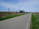
Copmanthorpe is bounded to the north by the A64
, while the East Coast Main Line
runs through its south-east periphery, to the west lies open countryside.
(Eboracum) to Tadcaster
(Calcaria) runs to the north of the village centre, along what are now Top Lane, Hallcroft Lane and Colton Lane.
It is recorded that the Lord of Copmanthorpe Manor was an Anglo-Saxon, named Gospatrick, at the time of the Norman invasion of England
. According to the Domesday book, the title was handed to Erneis de Burun in 1084, when he became Sherriff of Yorkshire.
Copmanthorpe was the site of a preceptory of the Knights Templar
, on land given to the Templar Knights by the Malbis family (see Acaster Malbis
). A Preceptor, Robert de Reygate, of the Temple is recorded as early as 1291 In 1672 the manor was sold to the Wood family.
The Copmanthorpe rail crash
was a railway accident that occurred on 25 September 2006. One person was killed when the 14:25 Plymouth to Edinburgh Virgin Cross Country service collided with a car that had veered off Moor Lane and onto the tracks, causing the front carriage of the Voyager train set to derail and the car driver to die. The accident happened at approximately 21:01 BST. The train involved was already running late on its journey towards York.
.
There are numerous village functions throughout the year, including the Carnival in summer, and the Fayre in Spring. The local branch of the Women's Institute was formed in 1924 and moved into a purpose built Hall in 1928. Other clubs and societies include a Mother's Union, Drama Group, Youth Club and both Scouts and Girl Guide Troops.
and by the Yorkshire Coastliner Service both run by First Group and by one service run by Harrogate Coach Travel as part of the York to Colton route.
There was a railway station in the village that opened in 1839 on the York & North Midland line. The station was closed to passengers in 1959 and closed altogether in 1964. Plans have been put forward to reopen the station along with others in York’s surrounding area, but have failed to materialise as of 2010.
Primary education is currently catered for at Copmanthorpe Primary School with students usually going to Tadcaster Grammar School
, a co-educational Comprehensive School, for their secondary and further education.
in the village, around 1788. The modern Chapel was built in 1958 in Main Street by the architects Greenwood and Nicholls.
England
England is a country that is part of the United Kingdom. It shares land borders with Scotland to the north and Wales to the west; the Irish Sea is to the north west, the Celtic Sea to the south west, with the North Sea to the east and the English Channel to the south separating it from continental...
county of North Yorkshire
North Yorkshire
North Yorkshire is a non-metropolitan or shire county located in the Yorkshire and the Humber region of England, and a ceremonial county primarily in that region but partly in North East England. Created in 1974 by the Local Government Act 1972 it covers an area of , making it the largest...
, 4 miles (6.4 km) south west of York
York
York is a walled city, situated at the confluence of the Rivers Ouse and Foss in North Yorkshire, England. The city has a rich heritage and has provided the backdrop to major political events throughout much of its two millennia of existence...
, west of Bishopthorpe
Bishopthorpe
Bishopthorpe is a village and civil parish three miles south of York in the City of York unitary authority and ceremonial county of North Yorkshire, England. It is close to the River Ouse, and has a population of 3,174. Prior to 1996 it was part of the Selby district...
and close to Acaster Malbis
Acaster Malbis
Acaster Malbis is a village and civil parish in the unitary authority of the City of York, England. It is located on the River Ouse, almost 5 miles south of York...
, Askham Bryan
Askham Bryan
Askham Bryan is a village and civil parish in the unitary authority of City of York in the north of England, 6 miles south west of York, west of Bishopthorpe, and close to Askham Richard and Copmanthorpe. According to the 2001 census the parish had a population of 582. Prior to 1996 it formed...
and Askham Richard
Askham Richard
Askham Richard is a village and civil parish in the unitary authority of City of York in the north of England, six and a half miles south west of York, close to Copmanthorpe, Bilbrough and Askham Bryan. Prior to 1996 it formed part of the district of Selby. The village became a Conservation Area in...
. According to the 2001 census the parish had a population of 4,262. Until 1996 it had been part of the Selby
Selby (district)
Selby is a local government district of North Yorkshire, England. The local authority, Selby District Council, is based in the town of Selby and provides services to an area which includes Tadcaster and a host of villages....
district. The village is part of the York Outer constituency.
The village is mentioned in the Domesday Book
Domesday Book
Domesday Book , now held at The National Archives, Kew, Richmond upon Thames in South West London, is the record of the great survey of much of England and parts of Wales completed in 1086...
as Copemantorp, from Old Norse
Old Norse
Old Norse is a North Germanic language that was spoken by inhabitants of Scandinavia and inhabitants of their overseas settlements during the Viking Age, until about 1300....
Kaupmanna þorp, meaning Traders’ Village or Craftsmen’s Village. The area of Copmanthorpe covering Main Street, Church Street and Low Green became a Conservation Area
Conservation area
A conservation areas is a tract of land that has been awarded protected status in order to ensure that natural features, cultural heritage or biota are safeguarded...
in 1978.
Copmanthorpe is bounded to the north by the A64
A64 road
The A64 is a road in North and West Yorkshire, England which links Leeds, York and Scarborough. The A64 starts as the A64 ring road motorway in Leeds and then is a dual carriageway for the rest of its route, except parts of the road from Malton to Scarborough.The road approximates a section of the...
, while the East Coast Main Line
East Coast Main Line
The East Coast Main Line is a long electrified high-speed railway link between London, Peterborough, Doncaster, Wakefield, Leeds, York, Darlington, Newcastle and Edinburgh...
runs through its south-east periphery, to the west lies open countryside.
History
The Roman road from YorkYork
York is a walled city, situated at the confluence of the Rivers Ouse and Foss in North Yorkshire, England. The city has a rich heritage and has provided the backdrop to major political events throughout much of its two millennia of existence...
(Eboracum) to Tadcaster
Tadcaster
Tadcaster is a market town and civil parish in the Selby district of North Yorkshire, England. Lying on the Great North Road approximately east of Leeds and west of York. It is the last town on the River Wharfe before it joins the River Ouse about downstream...
(Calcaria) runs to the north of the village centre, along what are now Top Lane, Hallcroft Lane and Colton Lane.
It is recorded that the Lord of Copmanthorpe Manor was an Anglo-Saxon, named Gospatrick, at the time of the Norman invasion of England
Norman conquest of England
The Norman conquest of England began on 28 September 1066 with the invasion of England by William, Duke of Normandy. William became known as William the Conqueror after his victory at the Battle of Hastings on 14 October 1066, defeating King Harold II of England...
. According to the Domesday book, the title was handed to Erneis de Burun in 1084, when he became Sherriff of Yorkshire.
Copmanthorpe was the site of a preceptory of the Knights Templar
Knights Templar
The Poor Fellow-Soldiers of Christ and of the Temple of Solomon , commonly known as the Knights Templar, the Order of the Temple or simply as Templars, were among the most famous of the Western Christian military orders...
, on land given to the Templar Knights by the Malbis family (see Acaster Malbis
Acaster Malbis
Acaster Malbis is a village and civil parish in the unitary authority of the City of York, England. It is located on the River Ouse, almost 5 miles south of York...
). A Preceptor, Robert de Reygate, of the Temple is recorded as early as 1291 In 1672 the manor was sold to the Wood family.
The Copmanthorpe rail crash
Copmanthorpe rail crash
The Copmanthorpe train accident occurred on 25 September 2006, at Moor Lane, Copmanthorpe, North Yorkshire, England, on the East Coast Main Line, south of York. A 55-year-old man died when 221 136, Yuri Gagarin, a British Rail Class 221 Virgin Super Voyager, on the 14:25 Virgin Trains service from...
was a railway accident that occurred on 25 September 2006. One person was killed when the 14:25 Plymouth to Edinburgh Virgin Cross Country service collided with a car that had veered off Moor Lane and onto the tracks, causing the front carriage of the Voyager train set to derail and the car driver to die. The accident happened at approximately 21:01 BST. The train involved was already running late on its journey towards York.
Governance
The village is part of the Rural West Ward of the Unitary Authority of the City of York. As of 2011, it is represented on the City Council by Councillors Ian Gillies, Paul Healey and Chris Steward who are all members of the local Conservative PartyConservative Party (UK)
The Conservative Party, formally the Conservative and Unionist Party, is a centre-right political party in the United Kingdom that adheres to the philosophies of conservatism and British unionism. It is the largest political party in the UK, and is currently the largest single party in the House...
.
Geography
Copmanthorpe lies 4 miles south-west of York City Centre. The village lies on Glacial Moraine of sandstone overlain with boulder clay. The highest point of the village is on Top Lane at 81 feet above sea level. The village has two greens, Low Green and the smaller Memorial Green.Demography
The population of the village has almost trebled over the past hundred years since the first census in 1881, rising from 311 in 1881 to 1,027 in 1961. In the 2001 census the village parish notes the population as 4,262. The largest Age Group within the population, 30.5% between 45 and 64 years old with 26.1% were between 30 and 44 years old. Of the population aged between 16 and 74 years old, 69.3% declared they were in some form of employment and 25.3 % said they were retired. Of the 1,699 households, 35% were Semi-Detached or terraced and 64.3% were Detached. The level of household ownership was 91%.Economy
Originally the village was a place for tradesmen and farming, but currently Copmanthorpe is a functional commuter village, with two churches, a post-office, a butchers, a library, a coffee shop, newsagents, two hair dressers, pharmacy, a small food shop, one pub, and several takeaways.Culture and community
Copmanthorpe Recreation Centre (”the Rec”) provides most of the sporting and many of the social facilities in the village. It is a registered charity for the benefit of the whole village. There is also a children's play area with a variety of equipment on a safety surface. Allotments, with fifty four plots, can be found on Temple Lane and are run by Copmanthorpe Parish Council.There are numerous village functions throughout the year, including the Carnival in summer, and the Fayre in Spring. The local branch of the Women's Institute was formed in 1924 and moved into a purpose built Hall in 1928. Other clubs and societies include a Mother's Union, Drama Group, Youth Club and both Scouts and Girl Guide Troops.
Transport
The village is served by one regular local bus service from YorkYork
York is a walled city, situated at the confluence of the Rivers Ouse and Foss in North Yorkshire, England. The city has a rich heritage and has provided the backdrop to major political events throughout much of its two millennia of existence...
and by the Yorkshire Coastliner Service both run by First Group and by one service run by Harrogate Coach Travel as part of the York to Colton route.
There was a railway station in the village that opened in 1839 on the York & North Midland line. The station was closed to passengers in 1959 and closed altogether in 1964. Plans have been put forward to reopen the station along with others in York’s surrounding area, but have failed to materialise as of 2010.
Education
The original village school opened in 1869 on the site now occupied by the health centre. The current junior school, opened in 1968, was designed to take over from the Victorian building, but as the population grew an infants school was also built alongside in 1972.Primary education is currently catered for at Copmanthorpe Primary School with students usually going to Tadcaster Grammar School
Tadcaster Grammar School
Tadcaster Grammar School is a secondary school near Tadcaster, North Yorkshire, England founded in 1557 by Owen Oglethorpe as an all boys school. The school is no longer situated in the brewery town of Tadcaster, rather in the hamlet of Toulston just outside the town...
, a co-educational Comprehensive School, for their secondary and further education.
Religion
St Giles Church on Church Street was built in 1180 and much remains of the original Norman design. St Giles did not become a parish church in its own right until 1866, as Copmanthorpe was previously part of the parish of St Mary Bishophill Junior in York. Church Street was also the site of the first Methodist ChapelMethodism
Methodism is a movement of Protestant Christianity represented by a number of denominations and organizations, claiming a total of approximately seventy million adherents worldwide. The movement traces its roots to John Wesley's evangelistic revival movement within Anglicanism. His younger brother...
in the village, around 1788. The modern Chapel was built in 1958 in Main Street by the architects Greenwood and Nicholls.