
Connecticut Route 89
Encyclopedia
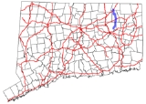
Route 89 is a state highway in northeastern Connecticut
, running from eastern Mansfield
to southern Union
. It connectes the villages of Mansfield Center, Warrenville, and Westford. It is a two-lane rural collector road
throughout its entire length following the path of the Mount Hope River.
in the village of Mansfield Center
as Warrenville Road and heads north through the northeast portion of the town of Mansfield
. Along the way it passes by the north side of Mansfield Hollow Lake
then runs parallel to Mount Hope River as it heads into the town of Ashford
. Once in Ashford, the road name changes to Mansfield Road until it reaches the village of Warrenville, where it has a juunction with U.S. Route 44
. Route 89 continues north as Westford Road, still parallel to the Mount Hope River, into the village of Westford. The road turns west on Turnpike Road as it departs the village, then turns north on Ferrence Road towards the town of Union
. At the town line, it has an interchange with I-84
(Exit 72). Route 89 ends about 0.6 mile (0.965604 km) later at an intersection with Route 190
in the southwest corner of Union.
to Union
via Mansfield Center
and Westford was designated as State Highway 146 in 1922. In the 1932 state highway renumbering
, State Highway 146 was renumbered to Route 89, with a southward extension from Willimantic to Lebanon
, ending at modern Route 87. This early Route 89 followed modern Route 289 from Lebanon to Willimantic, then modern Route 195 to Mansfield Center then modern Route 89 to its current end in Union, with the exception of a section north of Westford village that used Waterfall Road instead of Ferrence Road.
In 1942, the Waterfall Road alignment in Ashford was relocated to its current route over Turnpike and Ferrence Roads. In 1964, Route 195 was extended along Route 89 from Mansfield Center to Willimantic. The southern terminus of Route 89 was moved to its current location, with the former section of Route 89 south of the Route 32-Route 66 overlap re-designated as Route 289.
Connecticut
Connecticut is a state in the New England region of the northeastern United States. It is bordered by Rhode Island to the east, Massachusetts to the north, and the state of New York to the west and the south .Connecticut is named for the Connecticut River, the major U.S. river that approximately...
, running from eastern Mansfield
Mansfield, Connecticut
Mansfield is a town in Tolland County, Connecticut, United States. The population was 20,720 at the 2000 census.Mansfield was incorporated in October 1702 from the Town of Windham, in Hartford County. When Windham County was formed on 12 May 1726, Mansfield then became part of that county...
to southern Union
Union, Connecticut
Union is a town in Tolland County, Connecticut, United States. The population was 854 at the 2010 census, making it the least populous town in Connecticut and the second-least populous municipality in Connecticut; only the Borough of Fenwick has fewer people...
. It connectes the villages of Mansfield Center, Warrenville, and Westford. It is a two-lane rural collector road
Collector road
A collector road or distributor road is a low to moderate-capacity road which serve to move traffic from local streets to arterial roads. Unlike arterials, collectors are also designed to provide access to residential properties...
throughout its entire length following the path of the Mount Hope River.
Route description
Route 89 begins at an intersection with Route 195Connecticut Route 195
Route 195 is a state highway in northeastern Connecticut, running from the Willimantic section of Windham to the town center of Tolland via the Storrs section of Mansfield...
in the village of Mansfield Center
Mansfield Center, Connecticut
Mansfield Center is a census-designated place within the town of Mansfield in Tolland County, Connecticut, United States. The population was 973 at the 2000 census. The CDP includes the town center of Mansfield also sometimes known as Mansfield Village.-Geography:According to the United States...
as Warrenville Road and heads north through the northeast portion of the town of Mansfield
Mansfield, Connecticut
Mansfield is a town in Tolland County, Connecticut, United States. The population was 20,720 at the 2000 census.Mansfield was incorporated in October 1702 from the Town of Windham, in Hartford County. When Windham County was formed on 12 May 1726, Mansfield then became part of that county...
. Along the way it passes by the north side of Mansfield Hollow Lake
Mansfield Hollow Lake
Mansfield Hollow Lake is a reservoir resting on the border of Windham County and Tolland County, Connecticut. It was created by the Mansfield Hollow Dam and is entirely contained within Mansfield Hollow State Park. Designed and constructed by the United States Army Corps of Engineers, this dam...
then runs parallel to Mount Hope River as it heads into the town of Ashford
Ashford, Connecticut
President George Washington, returning from his tour of the country in the fall of 1789, was chagrined to be involuntarily abandoned in the village on a Sunday...
. Once in Ashford, the road name changes to Mansfield Road until it reaches the village of Warrenville, where it has a juunction with U.S. Route 44
U.S. Route 44
U.S. Route 44 is an east–west United States highway that runs for 237 miles through four states in the Northeastern region of the United States. The western terminus is at U.S. Route 209 and New York State Route 55 in Kerhonkson, a hamlet in the Hudson Valley region of New York...
. Route 89 continues north as Westford Road, still parallel to the Mount Hope River, into the village of Westford. The road turns west on Turnpike Road as it departs the village, then turns north on Ferrence Road towards the town of Union
Union, Connecticut
Union is a town in Tolland County, Connecticut, United States. The population was 854 at the 2010 census, making it the least populous town in Connecticut and the second-least populous municipality in Connecticut; only the Borough of Fenwick has fewer people...
. At the town line, it has an interchange with I-84
Interstate 84 (east)
Interstate 84 is an Interstate Highway extending from Dunmore, Pennsylvania at an interchange with Interstate 81 to Sturbridge, Massachusetts, at an interchange with the Massachusetts Turnpike . I-84 has mile-log junction numbering in Pennsylvania; otherwise, exit numbers are roughly sequential...
(Exit 72). Route 89 ends about 0.6 mile (0.965604 km) later at an intersection with Route 190
Connecticut Route 190
Route 190 is a state route in the northern part of the U.S. state of Connecticut. It starts at Route 75 in the town of Suffield and proceeds eastward across the Connecticut River through the towns of Enfield, Somers, and Stafford. It ends at Route 171, in the town of Union. Route 190 was...
in the southwest corner of Union.
History
The road connecting WillimanticWillimantic, Connecticut
Willimantic is a census-designated place and former city located in the town of Windham in Windham County, Connecticut, United States. The population was estimated at 15,823 at the 2000 census. It is home to Eastern Connecticut State University, as well as the Windham Textile and History Museum....
to Union
Union, Connecticut
Union is a town in Tolland County, Connecticut, United States. The population was 854 at the 2010 census, making it the least populous town in Connecticut and the second-least populous municipality in Connecticut; only the Borough of Fenwick has fewer people...
via Mansfield Center
Mansfield Center, Connecticut
Mansfield Center is a census-designated place within the town of Mansfield in Tolland County, Connecticut, United States. The population was 973 at the 2000 census. The CDP includes the town center of Mansfield also sometimes known as Mansfield Village.-Geography:According to the United States...
and Westford was designated as State Highway 146 in 1922. In the 1932 state highway renumbering
1932 state highway renumbering (Connecticut)
In 1932, the Highway Department of the U.S. state of Connecticut , decided to completely renumber all its state highways. The only exceptions were the U.S. Highways and some of the New England Interstate Routes. Between 1922 and 1932, Connecticut used a state highway numbering system shared with...
, State Highway 146 was renumbered to Route 89, with a southward extension from Willimantic to Lebanon
Lebanon, Connecticut
Lebanon is a town in New London County, Connecticut, United States. The population was 6,907 at the 2000 census. The town lies just to the northwest of Norwich, north of New London, and east of Hartford...
, ending at modern Route 87. This early Route 89 followed modern Route 289 from Lebanon to Willimantic, then modern Route 195 to Mansfield Center then modern Route 89 to its current end in Union, with the exception of a section north of Westford village that used Waterfall Road instead of Ferrence Road.
In 1942, the Waterfall Road alignment in Ashford was relocated to its current route over Turnpike and Ferrence Roads. In 1964, Route 195 was extended along Route 89 from Mansfield Center to Willimantic. The southern terminus of Route 89 was moved to its current location, with the former section of Route 89 south of the Route 32-Route 66 overlap re-designated as Route 289.
Junction list
| Town | Road names | Major junctions | Milepost |
|---|---|---|---|
| Mansfield Mansfield, Connecticut Mansfield is a town in Tolland County, Connecticut, United States. The population was 20,720 at the 2000 census.Mansfield was incorporated in October 1702 from the Town of Windham, in Hartford County. When Windham County was formed on 12 May 1726, Mansfield then became part of that county... (5.48 miles) |
Warrenville Road | 0.00 | |
| Ashford Ashford, Connecticut President George Washington, returning from his tour of the country in the fall of 1789, was chagrined to be involuntarily abandoned in the village on a Sunday... (10.19 miles) |
Mansfield Road, Westford Road, Turnpike Road, Ferrence Road |
7.62 | |
| (Junction at Ashford-Union town line) | 15.62-15.80 | ||
| Union Union, Connecticut Union is a town in Tolland County, Connecticut, United States. The population was 854 at the 2010 census, making it the least populous town in Connecticut and the second-least populous municipality in Connecticut; only the Borough of Fenwick has fewer people... (0.58 miles) |
Fish Point Road | 16.25 |