
Connecticut Route 111
Encyclopedia
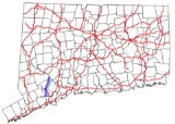
Route 111 is a state highway
in southwestern Connecticut
, United States, running from the Merritt Parkway
in Trumbull
to Route 34
in Monroe
. The junction with the Merritt Parkway is currently the only single-point urban interchange
(SPUI) in the entire state.
) in Trumbull
, just north of the Bridgeport
city line. South of Route 15, Main Street continues for another 0.3 mile (0.482802 km) to the Bridgeport line as an unsigned state highway with designation State Road 731 and provides access to the Westfield Trumbull
mall. Route 111 proceeds north, traveling near Island Brook Park, before intersecting Route 127
about 1.8 miles (2.9 km) north of Route 15. Route 111 continues north, paralleling Route 25 through the Long Hill section of Trumbull, then turns northeast to intersecting Route 25. Beyond the junction with Route 25, Route 111 is known as the Monroe Turnpike, which heads on a northerly track towards Monroe
. It passes by the Century Plaza shopping center in Monroe and intersects Route 110
at the town center. It continues north, reaching its end at Route 34 in the Stevenson section of Monroe.
in May 1826 and was formally known as the Monroe and Zoar Bridge Turnpike. Operations of the turnpike continued through 1852 when the portion north of Monroe center was discontinued. At that time, the road from Bridgeport to Trumbull was already a toll road known as the Bridgeport and Newtown Turnpike, connecting its namesake towns and had been in operation since 1801.
In 1922, the former Monroe and Zoar Bridge Turnpike (more commonly known as simply the Monroe Turnpike) became part of the Connecticut state highway system. It was given the designation State Highway 308 and ran from modern Route 25 to modern Route 34. The continuation into Bridgeport, which would later become Route 25, was at the time part of State Highway 122.
Modern Route 111 was created in the 1932 state highway renumbering
from old State Highway 308. In 1982, with the opening of the Route 25 freeway, the former southern section of Route 25 within Trumbull was reassigned to Route 111, while the portion in Bridgeport reverted to the town.
State highway
State highway, state road or state route can refer to one of three related concepts, two of them related to a state or provincial government in a country that is divided into states or provinces :#A...
in southwestern Connecticut
Connecticut
Connecticut is a state in the New England region of the northeastern United States. It is bordered by Rhode Island to the east, Massachusetts to the north, and the state of New York to the west and the south .Connecticut is named for the Connecticut River, the major U.S. river that approximately...
, United States, running from the Merritt Parkway
Merritt Parkway
The Merritt Parkway is a historic limited-access parkway in Fairfield County, Connecticut. The parkway is known for its scenic layout, its uniquely styled signage, and the architecturally elaborate overpasses along the route. It is designated as a National Scenic Byway and is also listed in the...
in Trumbull
Trumbull, Connecticut
Trumbull, a town in Fairfield County, Connecticut in the New England region of the United States, is bordered by the towns of Monroe, Shelton, Stratford, Bridgeport, Fairfield and Easton along Connecticut's Gold Coast. The population was 36,018 according to the 2010 census.Family Circle magazine...
to Route 34
Route 34 (Connecticut)
Route 34 is a primary state highway in the U.S. state of Connecticut. Route 34 is long, and extends from Washington Street near I-84/US 6 in Newtown to the junction of I-95 and I-91 in New Haven. The highways connects the New Haven and Danbury areas via the Lower Naugatuck River Valley...
in Monroe
Monroe, Connecticut
Monroe is a town in Fairfield County, Connecticut, United States. The population was 19,479 at the 2010 census. The current first selectman is Steve Vavrek....
. The junction with the Merritt Parkway is currently the only single-point urban interchange
Single-point urban interchange
A single-point urban interchange , also called a single-point interchange or single-point diamond interchange , is a type of highway interchange...
(SPUI) in the entire state.
Route description
Route 111 starts as Main Street at an intersection with the Meritt Parkway (Route 15Route 15 (Connecticut)
Route 15 is a state highway in the U.S. state of Connecticut that runs from a connection with New York's Hutchinson River Parkway in Greenwich, Connecticut to its northern terminus intersecting with Interstate 84 in East Hartford, Connecticut...
) in Trumbull
Trumbull, Connecticut
Trumbull, a town in Fairfield County, Connecticut in the New England region of the United States, is bordered by the towns of Monroe, Shelton, Stratford, Bridgeport, Fairfield and Easton along Connecticut's Gold Coast. The population was 36,018 according to the 2010 census.Family Circle magazine...
, just north of the Bridgeport
Bridgeport, Connecticut
Bridgeport is the most populous city in the U.S. state of Connecticut. Located in Fairfield County, the city had an estimated population of 144,229 at the 2010 United States Census and is the core of the Greater Bridgeport area...
city line. South of Route 15, Main Street continues for another 0.3 mile (0.482802 km) to the Bridgeport line as an unsigned state highway with designation State Road 731 and provides access to the Westfield Trumbull
Westfield Trumbull
Westfield Trumbull is one of two shopping malls in Trumbull, Connecticut. The mall is a two-story structure located on Main Street . Current anchor stores include JCPenney, Lord and Taylor, Macy's and Target. Built in 1964, the Trumbull Shopping Park was the first enclosed shopping mall in...
mall. Route 111 proceeds north, traveling near Island Brook Park, before intersecting Route 127
Connecticut Route 127
Route 127 is a state highway in southwestern Connecticut, running entirely from Bridgeport to Trumbull. It serves as a minor arterial, connecting all four major limited access highways in the Bridgeport area.-Route description:...
about 1.8 miles (2.9 km) north of Route 15. Route 111 continues north, paralleling Route 25 through the Long Hill section of Trumbull, then turns northeast to intersecting Route 25. Beyond the junction with Route 25, Route 111 is known as the Monroe Turnpike, which heads on a northerly track towards Monroe
Monroe, Connecticut
Monroe is a town in Fairfield County, Connecticut, United States. The population was 19,479 at the 2010 census. The current first selectman is Steve Vavrek....
. It passes by the Century Plaza shopping center in Monroe and intersects Route 110
Connecticut Route 110
Route 110 is a state highway in Connecticut running for from US 1 in Stratford to Route 111 in Monroe.-Route description:Route 110 begins at an intersection with US 1 in Stratford and heads north along the west bank of the Housatonic River, intersecting Route 15 before continuing into Shelton...
at the town center. It continues north, reaching its end at Route 34 in the Stevenson section of Monroe.
History
The road from Trumbull to Stevenson via Monroe center was chartered as a turnpikeToll road
A toll road is a privately or publicly built road for which a driver pays a toll for use. Structures for which tolls are charged include toll bridges and toll tunnels. Non-toll roads are financed using other sources of revenue, most typically fuel tax or general tax funds...
in May 1826 and was formally known as the Monroe and Zoar Bridge Turnpike. Operations of the turnpike continued through 1852 when the portion north of Monroe center was discontinued. At that time, the road from Bridgeport to Trumbull was already a toll road known as the Bridgeport and Newtown Turnpike, connecting its namesake towns and had been in operation since 1801.
In 1922, the former Monroe and Zoar Bridge Turnpike (more commonly known as simply the Monroe Turnpike) became part of the Connecticut state highway system. It was given the designation State Highway 308 and ran from modern Route 25 to modern Route 34. The continuation into Bridgeport, which would later become Route 25, was at the time part of State Highway 122.
Modern Route 111 was created in the 1932 state highway renumbering
1932 state highway renumbering (Connecticut)
In 1932, the Highway Department of the U.S. state of Connecticut , decided to completely renumber all its state highways. The only exceptions were the U.S. Highways and some of the New England Interstate Routes. Between 1922 and 1932, Connecticut used a state highway numbering system shared with...
from old State Highway 308. In 1982, with the opening of the Route 25 freeway, the former southern section of Route 25 within Trumbull was reassigned to Route 111, while the portion in Bridgeport reverted to the town.
Junction list
| Town | Road names | Junction | Milepost |
|---|---|---|---|
| Trumbull Trumbull, Connecticut Trumbull, a town in Fairfield County, Connecticut in the New England region of the United States, is bordered by the towns of Monroe, Shelton, Stratford, Bridgeport, Fairfield and Easton along Connecticut's Gold Coast. The population was 36,018 according to the 2010 census.Family Circle magazine... (4.91 miles) |
Main Street, Monroe Turnpike | 0.02 | |
| 1.79 | |||
| 4.08 | |||
| Monroe Monroe, Connecticut Monroe is a town in Fairfield County, Connecticut, United States. The population was 19,479 at the 2010 census. The current first selectman is Steve Vavrek.... (6.80 miles) |
Monroe Turnpike | 11.71 |