
Connecticut Route 110
Encyclopedia
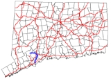
Route 110 is a state highway
in Connecticut
running for 15.95 miles (25.7 km) from US 1
in Stratford to Route 111 in Monroe.
, intersecting Route 15 before continuing into Shelton
. In Shelton, it continues north along the Housatonic, intersecting Route 8, then turns northwest through the center of town and west to Monroe. In Monroe, Route 110 continues west to end at an intersection with Route 111.
, was reassigned to Route 110. Former Route 8A was renumbered to SR 708. In 1963, the section south of the current intersection with Route 113 was reassigned to Route 113 and the southernmost part of Route 110 was designated at its current route on East Main Street (former SR 708).
State highway
State highway, state road or state route can refer to one of three related concepts, two of them related to a state or provincial government in a country that is divided into states or provinces :#A...
in Connecticut
Connecticut
Connecticut is a state in the New England region of the northeastern United States. It is bordered by Rhode Island to the east, Massachusetts to the north, and the state of New York to the west and the south .Connecticut is named for the Connecticut River, the major U.S. river that approximately...
running for 15.95 miles (25.7 km) from US 1
U.S. Route 1 in Connecticut
In the U.S. state of Connecticut, U.S. Route 1 is a major east–west state highway along Long Island Sound. It has been replaced by Interstate 95 as a through route, which it closely parallels, and now primarily serves as a local business route...
in Stratford to Route 111 in Monroe.
Route description
Route 110 begins at an intersection with US 1 in Stratford and heads north along the west bank of the Housatonic RiverHousatonic River
The Housatonic River is a river, approximately long, in western Massachusetts and western Connecticut in the United States. It flows south to southeast, and drains about of southwestern New England into Long Island Sound...
, intersecting Route 15 before continuing into Shelton
Shelton, Connecticut
Shelton is a city in Fairfield County, Connecticut, United States. The population was 39,559 at the 2010 census.-Origins:Shelton was settled by the English as part of the town of Stratford, Connecticut, in 1639...
. In Shelton, it continues north along the Housatonic, intersecting Route 8, then turns northwest through the center of town and west to Monroe. In Monroe, Route 110 continues west to end at an intersection with Route 111.
History
The road from Monroe to Shelton was designated as State Highway 173 in 1922. South of Shelton, most of the route following the west bank of the Housatonic River to Stratford was part of the original alignment of New England Route 8. The East Main Street portion in Stratford was Route 8A. Route 110 was commissioned in 1935, originally running from Route 111 in Monroe to Route 8 in Shelton. In 1952, Route 8 was moved west and the former section of Route 8, including the current Route 113Connecticut Route 113
Route 113 is a Connecticut state highway running from the Bridgeport-Stratford town line around the Lordship section of Stratford to the eastern part of the town.-Route description:...
, was reassigned to Route 110. Former Route 8A was renumbered to SR 708. In 1963, the section south of the current intersection with Route 113 was reassigned to Route 113 and the southernmost part of Route 110 was designated at its current route on East Main Street (former SR 708).
Junction list
| Town | Road names | Junction | Milepost |
|---|---|---|---|
| Stratford Stratford, Connecticut Stratford is a town in Fairfield County, Connecticut, United States, located on Long Island Sound at the mouth of the Housatonic River. It was founded by Puritans in 1639.... (4.35 miles) |
E. Main St., Main St., River Rd. | 0.00 | |
| 1.30 | |||
| 3.13-3.48 | |||
| Shelton Shelton, Connecticut Shelton is a city in Fairfield County, Connecticut, United States. The population was 39,559 at the 2010 census.-Origins:Shelton was settled by the English as part of the town of Stratford, Connecticut, in 1639... (9.95 miles) |
River Rd., Howe Ave., Leavenworth Rd. | 8.79-8.82 | |
| 9.17 | |||
| Monroe Monroe, Connecticut Monroe is a town in Fairfield County, Connecticut, United States. The population was 19,479 at the 2010 census. The current first selectman is Steve Vavrek.... (1.65 miles) |
Shelton Road | 15.95 |