

Colorado State Highway 94
Encyclopedia
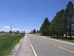
State Highway 94 is an 85.5 miles (137.6 km) long east–west Colorado state highway
that goes east beginning from US 24 just east of Colorado Springs and ending at U.S. Highway 40/U.S. Highway 287 in rural Cheyenne County
west of Wild Horse
. The highway serves Schriever Air Force Base
and the towns of Ellicott
, Yoder
, and Rush
, where it then crosses through rural country. It also serves the Punkin Center
area where it comes to a junction with SH 71
. It then passes through more very rural country until it reaches a stop at US 40
/287
west of the unincorporated town of Wild Horse
.
Throughout most of its length, the highway runs due east–west, pointing exactly at Pikes Peak
. Under good conditions, the peak can be seen as far east as the rise between mileposts 78 and 79.
"Garbage Hill" gets its name from the Colorado Springs landfill
located north of the highway. Originally, the entrance to the landfill was partway up the hill, but currently the entrance is from Blaney Road at the top of the hill. At the bottom of the hill, which is the eastern side of Jimmy Camp Creek valley, there are wrecking yard
s and two motocross
tracks. This hill is one of the most severe hills on Highway 94, having a climbing lane.
. By 1954, the eastern end no longer swerved north, and by 1970 the eastern end was extended to US 40
/287
near Aroya
with the entire highway paved.
State highways in Colorado
The system of State highways in Colorado is a system of public paved roads funded and maintained by the Colorado Department of Transportation; in the U.S. State of Colorado comprises State Highways , U.S. Routes, and Interstate Highways...
that goes east beginning from US 24 just east of Colorado Springs and ending at U.S. Highway 40/U.S. Highway 287 in rural Cheyenne County
Cheyenne County, Colorado
Cheyenne County is the fifth least densely populated of the 64 counties of the state of Colorado of the United States. The county population was 2,231 at U.S. Census 2000...
west of Wild Horse
Wild Horse, Colorado
Wild Horse is an unincorporated town and a U.S. Post Office in Cheyenne County, Colorado, United States. The Wild Horse Post Office has the ZIP Code 80862.-Geography:Wild Horse is located at ....
. The highway serves Schriever Air Force Base
Schriever Air Force Base
Schriever Air Force Base is a base of the United States Air Force located approximately 10 miles east of Peterson AFB near Colorado Springs in El Paso County, Colorado, United States.-Overview:...
and the towns of Ellicott
Ellicott, Colorado
Ellicott is a census-designated place located in El Paso County, Colorado. The population as of the 2010 Census was 1,131.The U.S. Post Office at Calhan now serves the Ellicott postal address....
, Yoder
Yoder, Colorado
Yoder is an unincorporated town and a U.S. Post Office located in El Paso County, Colorado, United States. The Yoder Post Office has the ZIP Code 80864....
, and Rush
Rush, Colorado
Rush is an unincorporated town and a U.S. Post Office located in El Paso County, Colorado, United States. The Rush Post Office has the ZIP Code 80833.-Geography:...
, where it then crosses through rural country. It also serves the Punkin Center
Punkin Center, Colorado
Punkin Center is a small, rural unincorporated community in Lincoln County, Colorado, United States at the intersection of State Highway 94 and State Highway 71. John Stevens built the first store at the farmers crossroads in 1920. He painted each new building a pumpkin color, inspiring the name....
area where it comes to a junction with SH 71
Colorado State Highway 71
State Highway 71 is a long state highway passing several other highways in northern and central Colorado. The route runs south from the Nebraska border to La Junta.-Route description:...
. It then passes through more very rural country until it reaches a stop at US 40
U.S. Route 40
U.S. Route 40 is an east–west United States highway. As with most routes whose numbers end in a zero, U.S. 40 once traversed the entire United States. It is one of the original 1920s U.S. Highways, and its first termini were San Francisco, California, and Atlantic City, New Jersey...
/287
U.S. Route 287
U.S. Route 287 is a north–south United States highway. It is long. It serves as the major truck route between the Texas cities of Fort Worth and Amarillo...
west of the unincorporated town of Wild Horse
Wild Horse, Colorado
Wild Horse is an unincorporated town and a U.S. Post Office in Cheyenne County, Colorado, United States. The Wild Horse Post Office has the ZIP Code 80862.-Geography:Wild Horse is located at ....
.
Throughout most of its length, the highway runs due east–west, pointing exactly at Pikes Peak
Pikes Peak
Pikes Peak is a mountain in the Front Range of the Rocky Mountains, west of Colorado Springs, Colorado, in El Paso County in the United States of America....
. Under good conditions, the peak can be seen as far east as the rise between mileposts 78 and 79.
"Garbage Hill" gets its name from the Colorado Springs landfill
Landfill
A landfill site , is a site for the disposal of waste materials by burial and is the oldest form of waste treatment...
located north of the highway. Originally, the entrance to the landfill was partway up the hill, but currently the entrance is from Blaney Road at the top of the hill. At the bottom of the hill, which is the eastern side of Jimmy Camp Creek valley, there are wrecking yard
Wrecking yard
A scrapyard or junkyard is the location of a dismantling business where wrecked or decommissioned vehicles are brought, their usable parts are sold for use in operating vehicles, while the unusable metal parts, known as scrap metal parts, are sold to metal-recycling companies...
s and two motocross
Motocross
Motocross is a form of motorcycle sport or all-terrain vehicle racing held on enclosed off road circuits. It evolved from trials, and was called scrambles, and later motocross, combining the French moto with cross-country...
tracks. This hill is one of the most severe hills on Highway 94, having a climbing lane.
History
The route was established in the 1920s, with the eastern end swerving north then east, ending at BoyeroBoyero, Colorado
Boyero is an unincorporated town in Lincoln County, Colorado, United States. The U.S. Post Office at Hugo now serves Boyero postal addresses....
. By 1954, the eastern end no longer swerved north, and by 1970 the eastern end was extended to US 40
U.S. Route 40
U.S. Route 40 is an east–west United States highway. As with most routes whose numbers end in a zero, U.S. 40 once traversed the entire United States. It is one of the original 1920s U.S. Highways, and its first termini were San Francisco, California, and Atlantic City, New Jersey...
/287
U.S. Route 287
U.S. Route 287 is a north–south United States highway. It is long. It serves as the major truck route between the Texas cities of Fort Worth and Amarillo...
near Aroya
Aroya, Colorado
Aroya is a small, rural unincorporated community in Cheyenne County, Colorado, United States at the eastern end of State Highway 94 near its junction with U.S. Highway 40/U.S. Highway 287. The name Arroyo appears on some older maps. The town was named "Aroya" because of a gulch nearby . The gulch...
with the entire highway paved.
Major intersections
| County | Location | Mile | Destinations | Notes |
|---|---|---|---|---|
| El Paso El Paso County, Colorado El Paso County is the most populous of the 64 counties of the state of Colorado of the United States, now more populous than Denver County. The United States Census Bureau concluded that the county population was 622,371 in 2010. In recent years, the population had come closer to that of Denver... |
Colorado Springs | 0.0 | Western terminus of SH 94 | |
| 0.4 | Marksheffel Road – Peterson Air Force Base Peterson Air Force Base Peterson Air Force Base is a base of the United States Air Force located at Colorado Springs in El Paso County, Colorado, United States and it provides runways for the adjacent City of Colorado Springs Municipal Airport under a shared joint civil-military airport arrangement... |
Traffic light | ||
| 1 | To US 24 U.S. Route 24 in Colorado U.S. Route 24 is a major east–west route in the U.S. state of Colorado.-Route description:It traverses the Rocky Mountains, starting near Minturn. It then continues east for about 30 miles Leadville where it turns south and goes to Buena Vista where it becomes concurrent with US 285. It... / Space Village Avenue |
|||
| 6.5 | Blaney Road | Top of "Garbage Hill" | ||
| Schriever Air Force Base Schriever Air Force Base Schriever Air Force Base is a base of the United States Air Force located approximately 10 miles east of Peterson AFB near Colorado Springs in El Paso County, Colorado, United States.-Overview:... |
7.5 | Curtis Road – alternate access to Schriever | Traffic light A sign "Delivery trucks access via Irwin Lane" |
|
| 8.5 | Enoch Road – main access to Schriever | Traffic light Turnoff using exit/entrance ramps south on Enoch Road to West Gate |
||
| 12.5 | Peyton Highway – Peyton Peyton, Colorado Peyton is a census-designated place and a U.S. Post Office in El Paso County, Colorado, United States. The population as of the 2010 Census was 250. The nearby unincorporated area of Falcon also uses zip code 80831... |
|||
| Ellicott Ellicott, Colorado Ellicott is a census-designated place located in El Paso County, Colorado. The population as of the 2010 Census was 1,131.The U.S. Post Office at Calhan now serves the Ellicott postal address.... |
15.5 | Log Road – Colorado Springs East Airport Colorado Springs East Airport Colorado Springs East Airport is a public airport located 25 miles east of the central business district of the city of Colorado Springs, and 3 miles northwest of the central business district of the city of Ellicott in El Paso County, Colorado, United States. The airport is privately owned by... |
||
| 16.5 | Ellicott Highway | No motorist services for 95 miles heading east on SH 94 | ||
| 23 | Calhan Highway – Calhan Calhan, Colorado The town of Calhan is a Statutory Town in El Paso County, Colorado, United States. Calhan straddles U.S. Route 24. The population was 896 at the 2000 census... |
|||
| Yoder Yoder, Colorado Yoder is an unincorporated town and a U.S. Post Office located in El Paso County, Colorado, United States. The Yoder Post Office has the ZIP Code 80864.... |
25.5 | Yoder Road | ||
| Rush Rush, Colorado Rush is an unincorporated town and a U.S. Post Office located in El Paso County, Colorado, United States. The Rush Post Office has the ZIP Code 80833.-Geography:... |
31 | Rush Road | ||
| Lincoln Lincoln County, Colorado Lincoln County is the tenth most extensive of the 64 counties of the State of Colorado of the United States. The county population was 6,087 at U.S. Census 2000... |
Hall Station Hall Station, Colorado Hall Station is a small rural locale in Lincoln County, Colorado, United States on the northeast corner of the intersection of State Highway 94 and County Road 11. Hall Station is a 101 by 211 ft grass/dirt area, suitable for parking, and fenced on three sides... |
45 | County Road 11 | |
| Punkin Center Punkin Center, Colorado Punkin Center is a small, rural unincorporated community in Lincoln County, Colorado, United States at the intersection of State Highway 94 and State Highway 71. John Stevens built the first store at the farmers crossroads in 1920. He painted each new building a pumpkin color, inspiring the name.... |
54.5 | |||
| 63.5 | County Road 29 – Karval Karval, Colorado Karval is an unincorporated town and a U.S. Post Office in Lincoln County, Colorado, United States. The Karval Post Office has the ZIP Code 80823.-External links:*... |
|||
| 66.5 | County Highway 109 – Hugo Hugo, Colorado The Town of Hugo is a Statutory Town that is the county seat of Lincoln County, Colorado, United States. The town population was 885 at the U.S... , Karval Karval, Colorado Karval is an unincorporated town and a U.S. Post Office in Lincoln County, Colorado, United States. The Karval Post Office has the ZIP Code 80823.-External links:*... |
|||
| Cheyenne Cheyenne County, Colorado Cheyenne County is the fifth least densely populated of the 64 counties of the state of Colorado of the United States. The county population was 2,231 at U.S. Census 2000... |
Aroya Aroya, Colorado Aroya is a small, rural unincorporated community in Cheyenne County, Colorado, United States at the eastern end of State Highway 94 near its junction with U.S. Highway 40/U.S. Highway 287. The name Arroyo appears on some older maps. The town was named "Aroya" because of a gulch nearby . The gulch... |
85 | County Road U/39/44 – Boyero Boyero, Colorado Boyero is an unincorporated town in Lincoln County, Colorado, United States. The U.S. Post Office at Hugo now serves Boyero postal addresses.... , Aroya Aroya, Colorado Aroya is a small, rural unincorporated community in Cheyenne County, Colorado, United States at the eastern end of State Highway 94 near its junction with U.S. Highway 40/U.S. Highway 287. The name Arroyo appears on some older maps. The town was named "Aroya" because of a gulch nearby . The gulch... |
Union Pacific Railroad Union Pacific Railroad The Union Pacific Railroad , headquartered in Omaha, Nebraska, is the largest railroad network in the United States. James R. Young is president, CEO and Chairman.... crossing |
| 86 | County Road 2 – JOD Ranch Aroya, Colorado Aroya is a small, rural unincorporated community in Cheyenne County, Colorado, United States at the eastern end of State Highway 94 near its junction with U.S. Highway 40/U.S. Highway 287. The name Arroyo appears on some older maps. The town was named "Aroya" because of a gulch nearby . The gulch... |
|||
| 86 | Eastern terminus of SH 94 No motorist services for 70 miles heading west on SH 94 |