
Colorado State Highway 71
Encyclopedia
State Highway 71 is a 224 miles (360.5 km) long state highway passing several other highways in northern and central Colorado
. The route runs south from the Nebraska
border to La Junta
.
, where it is signed as Phantom Avenue. The highway continues northward to a junction with Interstate 70
adjacent to U.S. Highway 24.
In La Junta, the highway continues north for several miles to Ordway, then it takes a northeast turn to Limon. It then goes back north and skirts the town of Brush. It then heads through rural country to Nebraska
In Stoneham, the state portion of the road overlaps County Road 142 and heads to the north. The route takes a northeast turn and continues in to Nebraska as Nebraska Highway 71
.
!County
!Location
!Mile
!Junction
!Notes
|-
|rowspan=4|Otero
|
|0
|
|Southern terminus of SH 71
|-
|
|9
|
|
|-
|rowspan=2|Rocky Ford
|bgcolor=#ddffdd|14
|bgcolor=#ddffdd|
|bgcolor=#ddffdd|Eastern end of US 50 overlap
|-
|bgcolor=#ddffdd|16.5
|bgcolor=#ddffdd|
|bgcolor=#ddffdd|Western end of US 50 overlap
|-
|rowspan=2|Crowley
|rowspan=2|Ordway
|26.5
|
|
|-
|27
|
|
|-
|rowspan=3|Lincoln
|Punkin Center
|72.5
|
|
|-
|rowspan=2|Limon
|bgcolor=#ddffdd|101
|bgcolor=#ddffdd|
|bgcolor=#ddffdd|Western end of US 24/40/287 overlap
|-
|bgcolor=#ddffdd|102
|bgcolor=#ddffdd|
|bgcolor=#ddffdd|Eastern end of US 24/40/287 overlap
|-
|Washington
|Last Chance
|138
|
|
|-
|rowspan=3|Morgan
|
|bgcolor=#ddffdd|175
|bgcolor=#ddffdd|
|bgcolor=#ddffdd|Eastern end of US 34 overlap
|-
|rowspan=2|Brush
|bgcolor=#ddffdd|176
|bgcolor=#ddffdd|
|bgcolor=#ddffdd|Western end of US 34 overlap
|-
|177
|
|
|-
|rowspan=3|Weld
|
|bgcolor=#ddffdd|199
|bgcolor=#ddffdd|
|bgcolor=#ddffdd|Eastern end of SH 14 overlap
|-
|Stoneham
|bgcolor=#ddffdd|204
|bgcolor=#ddffdd|
|bgcolor=#ddffdd|Western end of SH 14 overlap
|-
|
|224
|
|Northern terminus of SH 71
|-
Colorado
Colorado is a U.S. state that encompasses much of the Rocky Mountains as well as the northeastern portion of the Colorado Plateau and the western edge of the Great Plains...
. The route runs south from the Nebraska
Nebraska
Nebraska is a state on the Great Plains of the Midwestern United States. The state's capital is Lincoln and its largest city is Omaha, on the Missouri River....
border to La Junta
La Junta, Colorado
The City of La Junta is a Home Rule Municipality that is the county seat and the most populous city of Otero County, Colorado, United States. The city population was 7,568 at the U.S. Census 2000. La Junta is located on the Arkansas River in southeastern Colorado east of Pueblo.-History:During...
.
Route description
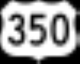
SH 71 begins at its southern terminus with US Highway 350 in La Junta, Colorado. It proceeds north into Crowley County and the city of OrdwayOrdway, Colorado
The Town of Ordway is a Statutory Town that is the county seat and most populous town of Crowley County, Colorado, United States. The population was 1,248 at the U.S...
, where it is signed as Phantom Avenue. The highway continues northward to a junction with Interstate 70
Interstate 70
Interstate 70 is an Interstate Highway in the United States that runs from Interstate 15 near Cove Fort, Utah, to a Park and Ride near Baltimore, Maryland. It was the first Interstate Highway project in the United States. I-70 approximately traces the path of U.S. Route 40 east of the Rocky...
adjacent to U.S. Highway 24.
In La Junta, the highway continues north for several miles to Ordway, then it takes a northeast turn to Limon. It then goes back north and skirts the town of Brush. It then heads through rural country to Nebraska
Nebraska
Nebraska is a state on the Great Plains of the Midwestern United States. The state's capital is Lincoln and its largest city is Omaha, on the Missouri River....
In Stoneham, the state portion of the road overlaps County Road 142 and heads to the north. The route takes a northeast turn and continues in to Nebraska as Nebraska Highway 71
Nebraska Highway 71
Nebraska Highway 71 is a highway in western Nebraska. Its southern terminus is at the Colorado border south of Kimball, as a continuation of Colorado State Highway 71...
.
Major intersections
{| class="wikitable"!County
!Location
!Mile
!Junction
!Notes
|-
|rowspan=4|Otero
Otero County, Colorado
Otero County is one of the 64 counties of the State of Colorado of the United States. The county was named for Miguel Antonio Otero, one of the founders of the town of La Junta and a member of a prominent Hispanic family. The county population was 20,311 at U.S. Census 2000...
|
|0
|
|Southern terminus of SH 71
|-
|
|9
|
|
|-
|rowspan=2|Rocky Ford
Rocky Ford, Colorado
The City of Rocky Ford is a Statutory City located in Otero County, Colorado, United States. The population was 4,286 at the United States Census 2000.-Geography:Rocky Ford is located at ....
|bgcolor=#ddffdd|14
|bgcolor=#ddffdd|
|bgcolor=#ddffdd|Eastern end of US 50 overlap
|-
|bgcolor=#ddffdd|16.5
|bgcolor=#ddffdd|
|bgcolor=#ddffdd|Western end of US 50 overlap
|-
|rowspan=2|Crowley
Crowley County, Colorado
Crowley County is one of the 64 counties of the State of Colorado of the United States. The county population was 5,518 at U.S. Census 2000. The county seat is Ordway.- History :...
|rowspan=2|Ordway
Ordway, Colorado
The Town of Ordway is a Statutory Town that is the county seat and most populous town of Crowley County, Colorado, United States. The population was 1,248 at the U.S...
|26.5
|
|
|-
|27
|
|
|-
|rowspan=3|Lincoln
Lincoln County, Colorado
Lincoln County is the tenth most extensive of the 64 counties of the State of Colorado of the United States. The county population was 6,087 at U.S. Census 2000...
|Punkin Center
Punkin Center, Colorado
Punkin Center is a small, rural unincorporated community in Lincoln County, Colorado, United States at the intersection of State Highway 94 and State Highway 71. John Stevens built the first store at the farmers crossroads in 1920. He painted each new building a pumpkin color, inspiring the name....
|72.5
|
|
|-
|rowspan=2|Limon
Limon, Colorado
Limon is a Statutory Town that is the most populous town in Lincoln County, Colorado, United States immediately east of Elbert County. The population was 2,071 at the 2000 census. Limon has been called the "Hub City" of Eastern Colorado because Interstate 70, U.S. Highways 24, 40, and 287, and...
|bgcolor=#ddffdd|101
|bgcolor=#ddffdd|
|bgcolor=#ddffdd|Western end of US 24/40/287 overlap
|-
|bgcolor=#ddffdd|102
|bgcolor=#ddffdd|
|bgcolor=#ddffdd|Eastern end of US 24/40/287 overlap
|-
|Washington
Washington County, Colorado
Washington County is the 12th most extensive of the 64 counties of the State of Colorado of the United States. The county population was 4,926 at U.S. Census 2000. The county was named in honor of the United States President George Washington...
|Last Chance
Last Chance, Colorado
Last Chance is an unincorporated community in Washington County, Colorado, United States. Last Chance is situated at the intersection of U.S. Highway 36 and State Highway 71 in a sparsely populated area of eastern Colorado. The town was supposedly so named because it was once the only place for...
|138
|
|
|-
|rowspan=3|Morgan
Morgan County, Colorado
Morgan County is the 18th most populous of the 64 counties of the State of Colorado of the United States. The county was named after old Fort Morgan, which in turn was named in honor of Colonel Christopher A. Morgan. The county population was 27,171 at U.S. Census 2000. The county seat is the...
|
|bgcolor=#ddffdd|175
|bgcolor=#ddffdd|
|bgcolor=#ddffdd|Eastern end of US 34 overlap
|-
|rowspan=2|Brush
Brush, Colorado
The City of Brush is a Statutory City located in Morgan County, Colorado, United States. The population was 5,117 at the 2000 census.-Geography:Brush is located at ....
|bgcolor=#ddffdd|176
|bgcolor=#ddffdd|
|bgcolor=#ddffdd|Western end of US 34 overlap
|-
|177
|
|
|-
|rowspan=3|Weld
Weld County, Colorado
As of the census of 2000, there were 180,936 people, 63,247 households, and 45,221 families residing in the county. The population density was 45 people per square mile . There were 66,194 housing units at an average density of 17 per square mile...
|
|bgcolor=#ddffdd|199
|bgcolor=#ddffdd|
|bgcolor=#ddffdd|Eastern end of SH 14 overlap
|-
|Stoneham
Stoneham, Colorado
Stoneham is an unincorporated town and a U.S. Post Office located in Weld County, Colorado, United States. The Stoneham Post Office has the ZIP Code 80754.Stoneham is northeast of Denver.- Geography :Stoneham is located at ....
|bgcolor=#ddffdd|204
|bgcolor=#ddffdd|
|bgcolor=#ddffdd|Western end of SH 14 overlap
|-
|
|224
|
|Northern terminus of SH 71
|-
External links
- Colorado Routes 60-79 the The Highways of Colorado