
Colindale
Encyclopedia
Transport
- Colindale tube stationColindale tube stationColindale tube station is a London Underground station in Colindale, a suburb of north London. The station is on the north-south Edgware branch of the Northern Line, between Burnt Oak and Hendon Central stations, and in Travelcard Zone 4.-History:...
, on the Northern LineNorthern LineThe Northern line is a London Underground line. It is coloured black on the Tube map.For most of its length it is a deep-level tube line. The line carries 206,734,000 passengers per year. This is the highest number of any line on the London Underground system, but the Northern line is unique in...
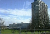
Edgware branch, is situated on the north side of the east-west Colindale Lane.
Development
Parts of Colindale have been designated by the Mayor of LondonMayor of London
The Mayor of London is an elected politician who, along with the London Assembly of 25 members, is accountable for the strategic government of Greater London. Conservative Boris Johnson has held the position since 4 May 2008...
in his London Plan
London Plan
The London Plan is a planning document written by the Mayor of London, England in the United Kingdom and published by the Greater London Authority. The plan was first published in final form on 10 February 2004 and has since been amended. The current version was published in February 2008...
as a 'proposed area of intensification'. As a result, Barnet Council designated a 'Colindale Area Action Plan
Area Action Plan
An area action plan is an optional development plan document specified in United Kingdom planning law forming part of a local development framework...
' (AAP) and carried out public consulation events. The Council has finalised its preferred plan in mid-2009, and it will be examined at a public hearing by the Planning Inspectorate
Planning Inspectorate
The Planning Inspectorate for England and Wales is an executive agency of the Department for Communities and Local Government of the United Kingdom Government. It is responsible for determining final outcomes of planning and enforcement appeals and public examination of local development plans...
, for anticipated approval by the Council in 2010.
Transport development
In early 2008, the Campaign for Better Transport published an (unfunded) plan for an off-road, mainly orbital North and West London Light railwayNorth and West London Light Railway
The North and West London Light Railway , formerly proposed-named as Brent Cross Railway, is a potential light rail service proposed by the London group of the Campaign for Better Transport, intended to serve parts of north, northwest and west London, being similar to the Docklands Light Railway...
, taking over the western-most of the two Midland Main Line
Midland Main Line
The Midland Main Line is a major railway route in the United Kingdom, part of the British railway system.The present-day line links London St...
freight lines which run north from West Hampstead
West Hampstead
West Hampstead is an area in northwest London, England, situated between Childs Hill to the north, Frognal and Hampstead to the north-east, Swiss Cottage to the east, and South Hampstead to the south. Until the late 19th century, the locale was a small village called West End...
, via Cricklewood
Cricklewood
Cricklewood is a district of North London, England whose northeastern part is in the London Borough of Barnet, western part is the London Borough of Brent and southeastern part is in London Borough of Camden.-History:...
, Brent Cross
Brent Cross
Brent Cross is an area of north London, in the London Borough of Barnet. It is located near the A41 Brent Cross Flyover over the A406 North Circular Road. Brent Cross is best known for its shopping centre and the proposed Brent Cross Cricklewood development....
and Hendon
Hendon
Hendon is a London suburb situated northwest of Charing Cross.-History:Hendon was historically a civil parish in the county of Middlesex. The manor is described in Domesday , but the name, 'Hendun' meaning 'at the highest hill', is earlier...
, and end on the eastern border of the Colindale AAP.