Clarendon, South Australia
Encyclopedia


Adelaide Hills
The Adelaide Hills are part of the Mount Lofty Ranges, east of the city of Adelaide in the state of South Australia. It is unofficially centred on the largest town in the area, Mount Barker, which has a population of around 29,000 and is also one of Australia's fastest growing towns.- History :The...
, about 30 km south of the Adelaide
Adelaide
Adelaide is the capital city of South Australia and the fifth-largest city in Australia. Adelaide has an estimated population of more than 1.2 million...
CBD.
The Clarendon Weir
Clarendon Weir
The Clarendon Weir is a small weir on the Onkaparinga River, near Adelaide in South Australia. Built in 1894–96 as part of the early Onkaparinga Water Scheme, the weir was designed to pool water from the Mount Bold Reservoir, on the Onkaparinga, which is often boosted with water from the River Murray...
is located in the town area on the Onkaparinga River
Onkaparinga River
The Onkaparinga River runs from its source between Mount Torrens and Charleston in the Mount Lofty Ranges, and flows south westerly to an estuary at Port Noarlunga. The catchment is over 500 km² in area, and is in part located in the Onkaparinga River National Park.The Onkaparinga River is the...
.
History
- See also: European settlement of South Australia
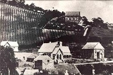
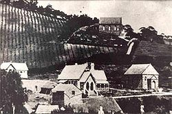
In 21 October 1840, Richard Blundell was granted the title to Section 801 Hundred of Noarlunga. This was subsequently subdivided and by 1866 the town was described as a regional centre ‘in the midst of a fine agricultural district, where wheat, peas, and potatoes are largely grown’.
Early trade was built around local vineyards and around proximity to the Onkaparinga River
Onkaparinga River
The Onkaparinga River runs from its source between Mount Torrens and Charleston in the Mount Lofty Ranges, and flows south westerly to an estuary at Port Noarlunga. The catchment is over 500 km² in area, and is in part located in the Onkaparinga River National Park.The Onkaparinga River is the...
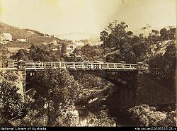
. From 1894 to 1896 the Clarendon Weir was constructed, enhancing the local economy.
In the last 20 years a restoration programme has seen the town's heritage buildings restored.
External links
- ClarendonSA.com.au – Book detailing the historic buildings in the local area, written and illustrated by a local artist

