
Chillerton, Isle of Wight
Encyclopedia
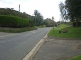
Chillerton is a village between Newport
and Chale
on the Isle of Wight
in southern England
. Chillerton is in the middle of a farming community.
The nearby Chillerton Down is the site of an unfinished Iron Age
promontory fort
and a 229 metres (751 ft) antenna for the Isle of Wight radio station broadcasting on 107.00 MHz, as well as several other stations. It is the village's most prominent feature and can be seen from most parts of the island. It is known as the Chillerton Down transmitting station
. Chillerton Down is flown by Paragliders in a E to SE wind and on days with good thermals the top of the mast can be reached.
In 1907 a deal was signed by Charles Seely
to ensure residents in properties older than 1907 in Chillerton and nearby Gatcombe
are entitled to free water, while newer homes receive it at a reduced rate. However recently Southern Water
have proposals for everyone to pay the same rate claiming that the initial pact has now run its course and the cost from the land used for the construction of water works has long since been paid off.
Chillerton and Rookley
Primary School is located on the High Street in Chillerton. It is a small village school with a total of 43 students on roll from local areas. However, education changes
look likely to see the school close in the near future. The school is likely to amalgamate with primary schools in Godshill
and Wroxall
to form one new school over two existing sites at Godshill and Wroxall.
Public transport is provided by Southern Vectis
bus route 6
, which runs between Newport
and Ventnor
and Wightbus
route 36, running between Newport and Moortown
.
Newport, Isle of Wight
Newport is a civil parish and a county town of the Isle of Wight, an island off the south coast of England. Newport has a population of 23,957 according to the 2001 census...
and Chale
Chalé
Chalé is a Brazilian municipality located in the state of Minas Gerais. The city belongs to the mesoregion of Zona da Mata and to the microregion of Manhuaçu.-See also:* List of municipalities in Minas Gerais-References:...
on the Isle of Wight
Isle of Wight
The Isle of Wight is a county and the largest island of England, located in the English Channel, on average about 2–4 miles off the south coast of the county of Hampshire, separated from the mainland by a strait called the Solent...
in southern England
England
England is a country that is part of the United Kingdom. It shares land borders with Scotland to the north and Wales to the west; the Irish Sea is to the north west, the Celtic Sea to the south west, with the North Sea to the east and the English Channel to the south separating it from continental...
. Chillerton is in the middle of a farming community.
The nearby Chillerton Down is the site of an unfinished Iron Age
Iron Age
The Iron Age is the archaeological period generally occurring after the Bronze Age, marked by the prevalent use of iron. The early period of the age is characterized by the widespread use of iron or steel. The adoption of such material coincided with other changes in society, including differing...
promontory fort
Promontory fort
A promontory fort is a defensive structure located above a steep cliff, often only connected to the mainland by a small neck of land, thus utilizing the topography to reduce the ramparts needed. Although their dating is problematic, most seem to date to the Iron Age...
and a 229 metres (751 ft) antenna for the Isle of Wight radio station broadcasting on 107.00 MHz, as well as several other stations. It is the village's most prominent feature and can be seen from most parts of the island. It is known as the Chillerton Down transmitting station
Chillerton Down transmitting station
The Chillerton Down transmitter is a broadcasting facility for FM and DAB radio at Chillerton Down on the Isle of Wight off the south coast of England...
. Chillerton Down is flown by Paragliders in a E to SE wind and on days with good thermals the top of the mast can be reached.
In 1907 a deal was signed by Charles Seely
Sir Charles Seely, 1st Baronet
Colonel Sir Charles Seely, 1st Baronet KGStJ was a British industrialist and politician.Seely was Liberal Party Member of Parliament for Nottingham from 1869 to 1874 and 1880 to 1885, and for Nottingham West from 1885 to 1886, and Liberal Unionist MP for Nottingham West from 1892 to 1895...
to ensure residents in properties older than 1907 in Chillerton and nearby Gatcombe
Gatcombe
Gatcombe is a village and civil parish on the Isle of Wight. It is located four kilometres from Newport in the centre of the island. St. Olave's Church, Gatcombe was dedicated in 1292, serving as chapel to Gatcombe House...
are entitled to free water, while newer homes receive it at a reduced rate. However recently Southern Water
Southern Water
Southern Water is the utility responsible for wastewater collection and treatment in Hampshire, the Isle of Wight, West Sussex, East Sussex and Kent, and for water supply and distribution in the approximately half of this area...
have proposals for everyone to pay the same rate claiming that the initial pact has now run its course and the cost from the land used for the construction of water works has long since been paid off.
Chillerton and Rookley
Rookley
Rookley is a village and civil parish on the Isle of Wight. It is located five kilometres south of Newport near the centre of the Island.It has a country park on the site of the last working Isle of Wight brickworks. There is a pub at the country park and another pub, the "Chequers" a short...
Primary School is located on the High Street in Chillerton. It is a small village school with a total of 43 students on roll from local areas. However, education changes
Education reforms on the Isle of Wight
Education reforms on the Isle of Wight is part of a process to change the Isle of Wight's education from a three-tier system to a two-tier system. The debate as to how this should occur was first started in 2004, lasting until 2008. Three options were put forward at the start of 2008 as to what...
look likely to see the school close in the near future. The school is likely to amalgamate with primary schools in Godshill
Godshill
Godshill is a village and civil parish on the Isle of Wight with a population of 1,465 according to the 2001 census. It is located between Newport and Ventnor in the southeast of the Island.-History:...
and Wroxall
Wroxall, Isle of Wight
Wroxall is a village and civil parish in the central south of the Isle of Wight.It is close to Appuldurcombe House. The parish church is St. John's Church, Wroxall....
to form one new school over two existing sites at Godshill and Wroxall.
Public transport is provided by Southern Vectis
Southern Vectis
The Southern Vectis Omnibus Company Limited is the dominant bus operator on the Isle of Wight. It was purchased by the Go-Ahead Group in 2005 and is a part of the company's Go South Coast division. The firm employs 299 staff, with 105 single deck, double deck and open-top buses and coaches...
bus route 6
Southern Vectis route 6
Southern Vectis route 6 is a bus service operated on the Isle of Wight by Southern Vectis between Newport, Blackgang and Ventnor. It also runs via Carisbrooke, Chillerton, Chale Green, Chale, Niton, St Lawrence and Whitwell. Five journeys are made in each direction Monday to Saturday, with four on...
, which runs between Newport
Newport, Isle of Wight
Newport is a civil parish and a county town of the Isle of Wight, an island off the south coast of England. Newport has a population of 23,957 according to the 2001 census...
and Ventnor
Ventnor
Ventnor is a seaside resort and civil parish established in the Victorian era on the south coast of the Isle of Wight, England. It lies underneath St Boniface Down , and is built on steep slopes and cliffs leading down to the sea...
and Wightbus
Wightbus
Not to be confused with Wrightbus, the bus manufacturerWightbus was a bus operator on the Isle of Wight, owned by the Isle of Wight Council...
route 36, running between Newport and Moortown
Moortown, Isle of Wight
Moortown is a part of Brighstone on the west side of the island. The area is known as the Back of the Wight. The only form of public transport to pass through the village is infrequent Wightbus service 36, connecting the village with Newport and Brighstone....
.