

Chandoli National Park
Encyclopedia
Chundolli National Park an 317.67 km² India
n National Park
, established in May 2004,
earlier a Wildlife Sanctuary declared in 1985, is located near the Chandoli Dam between longitudes 73°40' E and 73°53' E and latitudes 17°03'N and 17°20'N near Sangli
in Western Maharashtra
. It is located at the junction of Sangli District
, Kolhapur District
, Satara District
and Ratnagiri District
. It lies between the Koyna Wildlife Sanctuary
and Radhanagri Wildlife Sanctuary
and is part of the Sahyadri Tiger Reserve.
 The historical places of the park include the 17th century Prachitgad
and Bhairavgad
forts of the Maratha
kings Shivaji Maharaj and his son Sambhaji Maharaj
. Ruins of the Bhavani
temples palatial buildings in Prachitigad and Kalavantin vihir depict the ancient glory of the Maratha Empire
. Most of the protected area was used an open jail for the "prisoners of war" of the early Imperial Maratha Conquests
during Shivaji Maharaj's rule. Sambhaji Maharaj used Prachitgad as an observation point and recreational place.
. It forms and protects many perennial water channels, water holes and the Vasant Sagar Reservoir. Altitude of the park ranges from 589 m to 1,044 m.
.
The park receives its water supply from the Warna river and reservoir as well as several other small streams and rivers.
Flat topped mountains, rocky, lateritic plateaus called 'Saddas', almost devoid of vegetation, large boulders and caves are distinctive to the protected areas in the Sahyadri region of the Western Ghats.
, jamun (Syzygium cumini), pisa Actinodaphne angustifolia, fig Ficus glomerata, Olea diocia, spinous kino tree or katak Bridelia retusa, nana Lagerstroemia lanceolata, kinjal Terminalia paniculata
, kokum tree Garcinia indica
and false kelat or phanasi Carallia brachiat. Other trees dominating the landscape include Indian laurel or asan wood or ain Terminalia tomentosa, Indian gooseberry or amla Emblica officinalis, devil fig or umbar Ficus hispida and chebulic myrobalan or harra Terminalia chebula
.
Grasses commonly seen here include bangala Andropogon
sp., golden beard grass or dongari Chrysopogon fulvus, black spear grass, tangle grass or kalikusli Heteropogon contortus
, buffel grass or anjan grass Cenchrus ciliaris, grader grass, kangaroo grass or karad Themeda quadrivalvis and grasses belonging to Poaceae
family, like saphet-kusli Aristida funiculata. Insectivorous plant species like Drosera and Utricularia sp. are also found in this protected area.
.
and Koyna Wildlife Sanctuary
was declared by The National Tiger Conservation Authority
(Project Tiger
) on May 21, 2007. The Sahyadri Tiger Reserve was estimated to have nine tigers
and 66 leopards
in 2007.
.
.
Best time to visit is October to February. June to September have heavy rainfall (over 3500 mm.).
MSRTC Buses and private cars are available from Sangli and Miraj.
Sangmeshwar lie on the Mumbai-Goa Highway
Islampur and Karad lie on the Mumbai-Banglore national highway NH4.
Sangli is 40 km from NH4(Peth Naka).
Accommodation can be reserved at the Irrigation Rest House, which has 4 suites, including 1 VIP suite and a dormitory for 16 persons, by contacting: Ex. Engineer, Irrigation Department at Mandur, Kolhapur, Maharashtra, 416 002
Administrator of the park is:
Deputy Conservator of Forests/Wildlife,
Bindu chowk, Ganji Galli, Kolhapur, Maharashtra, 416 002
Phone: 00-91-231-2542766
India
India , officially the Republic of India , is a country in South Asia. It is the seventh-largest country by geographical area, the second-most populous country with over 1.2 billion people, and the most populous democracy in the world...
n National Park
National park
A national park is a reserve of natural, semi-natural, or developed land that a sovereign state declares or owns. Although individual nations designate their own national parks differently A national park is a reserve of natural, semi-natural, or developed land that a sovereign state declares or...
, established in May 2004,
earlier a Wildlife Sanctuary declared in 1985, is located near the Chandoli Dam between longitudes 73°40' E and 73°53' E and latitudes 17°03'N and 17°20'N near Sangli
Sangli
Sangli is a city in the state of Maharashtra of India. Sangli is known as the Turmeric city for its vast production of Turmeric. Sangli is situated on the banks of river Krishna and is the largest market place for Turmeric in Asia and houses many sugar factories, which it is also noted for...
in Western Maharashtra
Maharashtra
Maharashtra is a state located in India. It is the second most populous after Uttar Pradesh and third largest state by area in India...
. It is located at the junction of Sangli District
Sangli district
Sangli district is a district of Maharashtra state in west-central India. Sangli city is the district headquarters. The district is 24.51% urban. Sangli and Miraj are the largest cities. The industrial town of Kirloskarwadi is also located in the Sangli District...
, Kolhapur District
Kolhapur District
Kolhapur district is located in Maharashtra state. The city of Kolhapur is the district headquarters. The district had a population of 3,523,162 of which 29.81% were urban as of 2001...
, Satara District
Satara district
Satara District is a district of Maharashtra state in western India with an area of 10,480 km² and a population of 2,808,994 of which 14.17% were urban . Satara is the capital of the district and other major towns include Wai, Karad, Koregaon, Koyananagar, Rahimatpur, Phaltan, Mahabaleshwar...
and Ratnagiri District
Ratnagiri District
Ratnagiri district is one of the 35 districts of Maharashtra state in western India. Ratnagiri is the district headquarters of the district. The district is 11.33% urban. The district is bounded by the Arabian Sea to the west, Sindhudurg district to the south, Raigad district to the north and...
. It lies between the Koyna Wildlife Sanctuary
Koyna Wildlife Sanctuary
Koyna Wildlife Sanctuary is a wildlife sanctuary located in Satara district of the Indian state of Maharashtra. The sanctuary is nested in the Western Ghats, covering an area of around 426.52 and with an altitude ranging from 600 to 1,100 meters...
and Radhanagri Wildlife Sanctuary
Radhanagri Wildlife Sanctuary
Radhanagri Wildlife Sanctuary, is the first wildlife sanctuary of Maharashtra India, was notified in 1958. It lies at the southern end of the Sahyadri sub-cluster and is popularly known as "Bison Sanctuary" as the Indian Bison or gaur is the flagship species of the area.It consists of the...
and is part of the Sahyadri Tiger Reserve.
History
Prachitgad
Prachitgad is a in the Sahyadri mountain range in Maharashtra, India. It covers an area of .- Location :It is located within Ratnagiri district at Shringarpur. The closest city is Sangameshwar which is approximately 22 km away.-Major Features:It has an outer wall and an inner wall. The outer wall...
and Bhairavgad
Bhairavgad
Bhairavgad is a fort in India, twenty miles south-west of Patan, Maharashtra and about four miles west of Mala, from which it is pretty easily accessible by a rough footpath through dense jungle, is a rounded hill situated on the face of the Sahyadri range and jutting about a hundred feet into the...
forts of the Maratha
Maratha
The Maratha are an Indian caste, predominantly in the state of Maharashtra. The term Marāthā has three related usages: within the Marathi speaking region it describes the dominant Maratha caste; outside Maharashtra it can refer to the entire regional population of Marathi-speaking people;...
kings Shivaji Maharaj and his son Sambhaji Maharaj
Sambhaji
Sambhaji Raje Bhosle was the eldest son and successor to Emporer Shivaji, the founder of the Maratha empire.- Early life :...
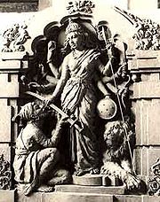
. Ruins of the Bhavani
Bhavani
Bhavani is a ferocious aspect of the Hindu goddess Parvati. Bhavani means "giver of life", the power of nature or the source of creative energy. In addition to her ferocious aspect, she is also known as Karunaswaroopini, "filled with mercy"....
temples palatial buildings in Prachitigad and Kalavantin vihir depict the ancient glory of the Maratha Empire
Maratha Empire
The Maratha Empire or the Maratha Confederacy was an Indian imperial power that existed from 1674 to 1818. At its peak, the empire covered much of South Asia, encompassing a territory of over 2.8 million km²....
. Most of the protected area was used an open jail for the "prisoners of war" of the early Imperial Maratha Conquests
Imperial Maratha Conquests
The Imperial Maratha Conquests were a series of conquests in the Indian subcontinent which led to the building of the Maratha Empire. These conquests were started by Shivaji Maharaj in 1659 from the victory at the Battle of Pratapgad...
during Shivaji Maharaj's rule. Sambhaji Maharaj used Prachitgad as an observation point and recreational place.
Geography
The park spreads along the crest of the Sahyadri Range of the Western GhatsWestern Ghats
The Western Ghats, Western Ghauts or the Sahyādri is a mountain range along the western side of India. It runs north to south along the western edge of the Deccan Plateau, and separates the plateau from a narrow coastal plain along the Arabian Sea. The Western Ghats block rainfall to the Deccan...
. It forms and protects many perennial water channels, water holes and the Vasant Sagar Reservoir. Altitude of the park ranges from 589 m to 1,044 m.
.
The park receives its water supply from the Warna river and reservoir as well as several other small streams and rivers.
Flat topped mountains, rocky, lateritic plateaus called 'Saddas', almost devoid of vegetation, large boulders and caves are distinctive to the protected areas in the Sahyadri region of the Western Ghats.
Flora
The forest types seen here are a mix of western tropical hill forests, west coast semi-evergreen forests and southern moist mixed deciduous forests. In the dwarf evergreen forests, tree species commonly seen are the ironwood tree or anjani Memecylon umbellatumMemecylon umbellatum
Memecylon umbellatum, commonly known as Ironwood, Anjani , or Alli , is a small tree found in India, the Andaman islands and the coastal region of the Deccan....
, jamun (Syzygium cumini), pisa Actinodaphne angustifolia, fig Ficus glomerata, Olea diocia, spinous kino tree or katak Bridelia retusa, nana Lagerstroemia lanceolata, kinjal Terminalia paniculata
Terminalia paniculata
Terminalia paniculata is a tree native to southwest India . Known in the timber trade as kindal, it has a variety of names in local languages....
, kokum tree Garcinia indica
Garcinia indica
Garcinia indica, a plant in the mangosteen family , commonly known as kokum, is a fruit-bearing tree that has culinary, pharmaceutical, and industrial uses....
and false kelat or phanasi Carallia brachiat. Other trees dominating the landscape include Indian laurel or asan wood or ain Terminalia tomentosa, Indian gooseberry or amla Emblica officinalis, devil fig or umbar Ficus hispida and chebulic myrobalan or harra Terminalia chebula
Terminalia chebula
Terminalia chebula is a species of Terminalia, native to southern Asia from India and Nepal east to southwestern China , and south to Sri Lanka, Malaysia and Vietnam.It is a deciduous tree growing to tall, with a trunk up to in diameter...
.
Grasses commonly seen here include bangala Andropogon
Andropogon
Andropogon is a genus of grasses. Andropogon gerardii, big bluestem, is the official state grass of Illinois.Broomsedge is found along the eastern United States...
sp., golden beard grass or dongari Chrysopogon fulvus, black spear grass, tangle grass or kalikusli Heteropogon contortus
Heteropogon contortus
Heteropogon contortus is a tropical, perennial tussock grass with a native distribution encompassing Southern Africa, southern Asia, Northern Australia and Oceania. The species has also become a naturalised weed in tropical and subtropical regions in the Americas and East Asia. The plant grows to ...
, buffel grass or anjan grass Cenchrus ciliaris, grader grass, kangaroo grass or karad Themeda quadrivalvis and grasses belonging to Poaceae
Poaceae
The Poaceae is a large and nearly ubiquitous family of flowering plants. Members of this family are commonly called grasses, although the term "grass" is also applied to plants that are not in the Poaceae lineage, including the rushes and sedges...
family, like saphet-kusli Aristida funiculata. Insectivorous plant species like Drosera and Utricularia sp. are also found in this protected area.
Fauna
Nearly 23 species of mammals, 122 species of birds, 20 species of amphibians and reptiles are known to be resident in the forests of Chandoli. Tigers (Panthera tigris), Indian bison or gaur Bos gaurus, sambar Cervus unicolor, leopard cats Prionailurus bengalensis, sloth bears Melursus ursinus and Indian giant squirrels Ratufa indica are quite conspicuous here. Many species of ungulates like barking deer Muntiacus muntjak, mouse deer Moschiola meminna and blackbuck Antilope cervicapra are also present. A census carried out in 2002 by the Forest Department showed a rise in the number of tigers, leopards Panthera pardus, gaur, barking deer, mouse deer, sloth bears and blackbuck. A similar census carried out in 2004 showed a rise in gaur population in the Kohlapur Wildlife Division from 88 to 243..
Sahyadri Tiger Reserve
The 741.22 km2 Sahyadri Tiger Reserve, including all of Chandoli National ParkChandoli National Park
Chundolli National Park an 317.67 km² Indian National Park, established in May 2004, earlier a Wildlife Sanctuary declared in 1985, is located near the between longitudes 73°40' E and 73°53' E and latitudes 17°03'N and 17°20'N near Sangli in Western Maharashtra...
and Koyna Wildlife Sanctuary
Koyna Wildlife Sanctuary
Koyna Wildlife Sanctuary is a wildlife sanctuary located in Satara district of the Indian state of Maharashtra. The sanctuary is nested in the Western Ghats, covering an area of around 426.52 and with an altitude ranging from 600 to 1,100 meters...
was declared by The National Tiger Conservation Authority
National Tiger Conservation Authority
The National Tiger Conservation Authority was established in December 2005 following a recommendation of the Tiger Task Force, constituted by the Prime Minister of India for reorganized management of Project Tiger...
(Project Tiger
Project Tiger
Project Tiger was launched in 1972 in India. The project aims at ensuring a viable population of tigers in their natural habitats and preserving areas of biological importance as a natural heritage for the people. The selection of areas for the reserves represented as close as possible the...
) on May 21, 2007. The Sahyadri Tiger Reserve was estimated to have nine tigers
Bengal
Bengal is a historical and geographical region in the northeast region of the Indian Subcontinent at the apex of the Bay of Bengal. Today, it is mainly divided between the sovereign land of People's Republic of Bangladesh and the Indian state of West Bengal, although some regions of the previous...
and 66 leopards
Indian leopard
The Indian leopard is a leopard subspecies widely distributed on the Indian subcontinent. It is one of the five big cats found in India, apart from Asiatic lion, Bengal tiger, snow leopard and clouded leopard....
in 2007.
.
Development
Work undertaken for habitat improvement and development in the Chandoli National Park include removal of invading species, soil & water conservation, vaccination of cattle, research, fire tracing, providing salt licks, demarcation of boundary, erection of watch towers, maintenance of nature trails, desalting water holes, development of grasslands, and procurement of wireless equipment.
Threats
The Maharashtra government has plans to set up a hydro-electric project (Karadi-Bhogiv project) in the catchment area of the Warna dam that is expected to use up 6.78 km2 of forest land. On a positive note, nearly 7,894 people and a significant cattle population resident on 84.29 km2 area of land in 32 villages within the park have been successfully relocated to areas outside. This measure has helped to preserve and regenerate some of the vegetation in this protected area.Visitor Information
Scenic places like Kandhardoh and Kandhardoh Falls, Tanali falls and Vasant Sagar Reservoir are places of tourist importance in the park. Scenic points like Kokna darshan, Zolambi sada and the virgin forest of Rundiv add to the recreation value.Best time to visit is October to February. June to September have heavy rainfall (over 3500 mm.).
How to reach Chandoli
- Mumbai - 380 km
- Pune - 210 km
- Sangli - 75 km
- Kolhapur - 80 km
- Bangalore - 720 km
Nearest Railway Stations
- SangliSangliSangli is a city in the state of Maharashtra of India. Sangli is known as the Turmeric city for its vast production of Turmeric. Sangli is situated on the banks of river Krishna and is the largest market place for Turmeric in Asia and houses many sugar factories, which it is also noted for...
- 75 km - MirajMirajMiraj , is an historic town in southern Maharashtra, India. The history of the town dates back to the early 10th century, and the town is known for its rich tradition of Hindustani classical music and for religious harmony. It served as a stronghold and a strategic bastion because of its location...
rail junction - 85 km - Kolhapur - 80 km
- KaradKaradKarad is a town and a municipal council in Satara district in the Indian state of Maharashtra. It lies at the confluence of Koyna River and the Krishna River. The two rivers originate at Mahabaleshwar which is around 100 km from Karad. They diverge at their origin and then meet again in...
- 47 km
MSRTC Buses and private cars are available from Sangli and Miraj.
By Road
You can reach Chandoli by taking National Highway MH4.- From MumbaiMumbaiMumbai , formerly known as Bombay in English, is the capital of the Indian state of Maharashtra. It is the most populous city in India, and the fourth most populous city in the world, with a total metropolitan area population of approximately 20.5 million...
/PunePunePune , is the eighth largest metropolis in India, the second largest in the state of Maharashtra after Mumbai, and the largest city in the Western Ghats. Once the centre of power of the Maratha Empire, it is situated 560 metres above sea level on the Deccan plateau at the confluence of the Mula ...
- Take right turn after karad below 2nd flyover . - From BangaloreBangaloreBengaluru , formerly called Bengaluru is the capital of the Indian state of Karnataka. Bangalore is nicknamed the Garden City and was once called a pensioner's paradise. Located on the Deccan Plateau in the south-eastern part of Karnataka, Bangalore is India's third most populous city and...
- Take left turn at Peth Naka(Sangli district).
Nearest Airports
- Pune - 210 km
- Mumbai - 380 km
- Kolhapur - 80 km (only one flight from Mumbai)
- Sangli New Airport (Kavathe Piran) is just 45 km from Chandoli and will be operational by 2011.
- Karad - 55 km (Used for training purpose)
- Sangli(Old Airport) - 65 km Closed for runway extension
Nearest Cities / Towns
- Sangli - 65 km
- Islampur - 35 km
- Karad 55 km
- Sangmeshwar 40 km
Sangmeshwar lie on the Mumbai-Goa Highway
Islampur and Karad lie on the Mumbai-Banglore national highway NH4.
Sangli is 40 km from NH4(Peth Naka).
Nearby Tourist Attractions
- kamatipura (mandur 1 km)
- Ganesh Temple, Sangli
- Miraj Musical Instrument Industry
- Sagareshwar Wild Life Sanctuary
- Dandoba Wild Life Sanctuary
- Krishna Valley Wine Park, Palus
- Audumber Temple
- Ramling Temple
- Bijapur Historical Place
- Pandharpur
Accommodation can be reserved at the Irrigation Rest House, which has 4 suites, including 1 VIP suite and a dormitory for 16 persons, by contacting: Ex. Engineer, Irrigation Department at Mandur, Kolhapur, Maharashtra, 416 002
Administrator of the park is:
Deputy Conservator of Forests/Wildlife,
Bindu chowk, Ganji Galli, Kolhapur, Maharashtra, 416 002
Phone: 00-91-231-2542766