
.gif)
Cerro Catedral (Uruguay)
Encyclopedia
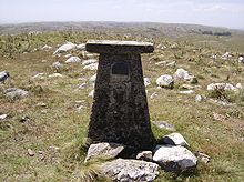
Cerro Catedral also known as Cerro Cordillera, is a peak and the highest point of Uruguay
, with an altitude of 513.66 m (1,685.2 ft). It is located north of Maldonado Department
, in the municipality of Aiguá
, in a hill range named Sierra Carapé
, which constitutes part of a larger range named Cuchilla Grande
. Its name derived from the curious forms of the rocky elevations of its summit, which are very common in the southern part of this country.
(formerly known as Mirador Nacional), with an elevation of 501 m (1,643.7 ft), was considered the highest point of Uruguay. However, in that year, a group of scientists of the Servicio Geográfico Militar (Military Geographic Service) changed the measure of Cerro Catedral.
 Sierra Carapé, formed in Precambrian
time, crosses the Maldonado Department from west to east and enters the Rocha Department
. It constitutes the border between the departments of Lavalleja
and Maldonado. Cerro Catedral, or Cerro Cordillera, is situated in the region of Las Cañas, in the 8th Judicial Section and the 9th Police Section of the Maldonado Department. Near Cerro Catedral there are the source of José Ignacio Stream (Arroyo José Ignacio), which runs from north to south, and the source of Coronilla Stream (Arroyo Coronilla), running to the northwest, which drains into Aiguá.
The hill is situated in an area of the range which its formation is mainly granitic
and gneiss
ic.
between the rocks. Above the altitude of 400 m (1,312.3 ft), tough grasses, xerophile vegetation, Baccharis articulata
and marcela
predominate.
or oceanic
(described by the Köppen climate classification
as Cfb), with mild to warm summer
s and chilly to cool winter
s (with frequent frost
s). Strong winds are a common occurrence. The precipitation
is evenly distributed throughout the year and snow
falls are uncommon.
Uruguay
Uruguay ,officially the Oriental Republic of Uruguay,sometimes the Eastern Republic of Uruguay; ) is a country in the southeastern part of South America. It is home to some 3.5 million people, of whom 1.8 million live in the capital Montevideo and its metropolitan area...
, with an altitude of 513.66 m (1,685.2 ft). It is located north of Maldonado Department
Maldonado Department
The Maldonado Department , with an area of and 140,192 inhabitants, is located to the southeast of Uruguay. Its capital is Maldonado.-Geography and climate:...
, in the municipality of Aiguá
Aiguá
Aiguá is a city of the Maldonado Department in Uruguay. It is located at the north of the department, at the intersection of Route 39 with Route 109, north of the capital city, Maldonado. Its status was elevated to the category of "City" on 4 January 1956 by decree Ley No. 12.265...
, in a hill range named Sierra Carapé
Sierra Carapé
Sierra Carapé or Sierra de Carapé is a hill range located in Maldonado Department, in southern Uruguay. The range crosses the Maldonado Department from west to east and enters the Rocha Department. It constitutes the border between the departments of Lavalleja and Maldonado...
, which constitutes part of a larger range named Cuchilla Grande
Cuchilla Grande
Cuchilla Grande is a hill range that crosses the west part of Uruguay from north to south. It extends from the south part of Cerro Largo Department, through the departments of Treinta y Tres and Lavalleja and ends in Maldonado Department where it forms its highest peaks.-Noted features:In the...
. Its name derived from the curious forms of the rocky elevations of its summit, which are very common in the southern part of this country.
History
Until 1973, Cerro de las ÁnimasCerro de las Ánimas
Cerro de las Ánimas is a peak and the second highest point of Uruguay, with an altitude of 501 metres .-Location and features:...
(formerly known as Mirador Nacional), with an elevation of 501 m (1,643.7 ft), was considered the highest point of Uruguay. However, in that year, a group of scientists of the Servicio Geográfico Militar (Military Geographic Service) changed the measure of Cerro Catedral.
Location and geology
Precambrian
The Precambrian is the name which describes the large span of time in Earth's history before the current Phanerozoic Eon, and is a Supereon divided into several eons of the geologic time scale...
time, crosses the Maldonado Department from west to east and enters the Rocha Department
Rocha Department
Rocha is a department in the east of Uruguay. It has natural beauties like Cabo Polonio, Valizas, Santa Teresa. Rocha is well known for its beach towns which swell during the summer holidays...
. It constitutes the border between the departments of Lavalleja
Lavalleja Department
The Department of Lavalleja is a department of Uruguay. The capital is Minas. It is located in the southeast of the country, bordered to the north by the department of Treinta y Tres to the east with Rocha, to the south with Canelones and Maldonado, and to the west to Florida.The department is...
and Maldonado. Cerro Catedral, or Cerro Cordillera, is situated in the region of Las Cañas, in the 8th Judicial Section and the 9th Police Section of the Maldonado Department. Near Cerro Catedral there are the source of José Ignacio Stream (Arroyo José Ignacio), which runs from north to south, and the source of Coronilla Stream (Arroyo Coronilla), running to the northwest, which drains into Aiguá.
The hill is situated in an area of the range which its formation is mainly granitic
Granite
Granite is a common and widely occurring type of intrusive, felsic, igneous rock. Granite usually has a medium- to coarse-grained texture. Occasionally some individual crystals are larger than the groundmass, in which case the texture is known as porphyritic. A granitic rock with a porphyritic...
and gneiss
Gneiss
Gneiss is a common and widely distributed type of rock formed by high-grade regional metamorphic processes from pre-existing formations that were originally either igneous or sedimentary rocks.-Etymology:...
ic.
Vegetation
In the highest areas of Cerro Catedral, the vegetation practically does not exist, with the sparse appearance of a shrub called Myrtus ugniUgni molinae
Ugni molinae, commonly known as Chilean guava, or strawberry myrtle, is a shrub native to Chile and adjacent regions of southern Argentina. The Mapuche Native American name is "Uñi"...
between the rocks. Above the altitude of 400 m (1,312.3 ft), tough grasses, xerophile vegetation, Baccharis articulata
Baccharis
Baccharis is a genus of perennials and shrubs in the aster family . They are commonly known as baccharises but sometimes referred to as "brooms", because many members have small thin leaves resembling the true brooms. They are not at all related to these however, but belong to an entirely...
and marcela
Achyrocline satureioides
Achyrocline satureioides, also known as Macela or Marcela in Portuguese, Marcela in Spanish and Eloyatei-caá in a Tupi–Guarani language, is a medicinal plant, which cited as medicinal plant symbol of Rio Grande do Sul state in Brazil.-External links:...
predominate.
Climate
The climate in this locality is humid subtropicalHumid subtropical climate
A humid subtropical climate is a climate zone characterized by hot, humid summers and mild to cool winters...
or oceanic
Oceanic climate
An oceanic climate, also called marine west coast climate, maritime climate, Cascadian climate and British climate for Köppen climate classification Cfb and subtropical highland for Köppen Cfb or Cwb, is a type of climate typically found along the west coasts at the middle latitudes of some of the...
(described by the Köppen climate classification
Köppen climate classification
The Köppen climate classification is one of the most widely used climate classification systems. It was first published by Crimea German climatologist Wladimir Köppen in 1884, with several later modifications by Köppen himself, notably in 1918 and 1936...
as Cfb), with mild to warm summer
Summer
Summer is the warmest of the four temperate seasons, between spring and autumn. At the summer solstice, the days are longest and the nights are shortest, with day-length decreasing as the season progresses after the solstice...
s and chilly to cool winter
Winter
Winter is the coldest season of the year in temperate climates, between autumn and spring. At the winter solstice, the days are shortest and the nights are longest, with days lengthening as the season progresses after the solstice.-Meteorology:...
s (with frequent frost
Frost
Frost is the solid deposition of water vapor from saturated air. It is formed when solid surfaces are cooled to below the dew point of the adjacent air as well as below the freezing point of water. Frost crystals' size differ depending on time and water vapour available. Frost is also usually...
s). Strong winds are a common occurrence. The precipitation
Precipitation (meteorology)
In meteorology, precipitation In meteorology, precipitation In meteorology, precipitation (also known as one of the classes of hydrometeors, which are atmospheric water phenomena is any product of the condensation of atmospheric water vapor that falls under gravity. The main forms of precipitation...
is evenly distributed throughout the year and snow
Snow
Snow is a form of precipitation within the Earth's atmosphere in the form of crystalline water ice, consisting of a multitude of snowflakes that fall from clouds. Since snow is composed of small ice particles, it is a granular material. It has an open and therefore soft structure, unless packed by...
falls are uncommon.