
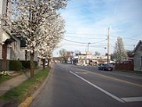
Ceredo, West Virginia
Encyclopedia

Wayne County, West Virginia
As of the census of 2000, there were 42,903 people, 17,239 households, and 12,653 families residing in the county. The population density was 85 people per square mile . There were 19,107 housing units at an average density of 38 per square mile...
, West Virginia
West Virginia
West Virginia is a state in the Appalachian and Southeastern regions of the United States, bordered by Virginia to the southeast, Kentucky to the southwest, Ohio to the northwest, Pennsylvania to the northeast and Maryland to the east...
, along the Ohio River
Ohio River
The Ohio River is the largest tributary, by volume, of the Mississippi River. At the confluence, the Ohio is even bigger than the Mississippi and, thus, is hydrologically the main stream of the whole river system, including the Allegheny River further upstream...
. The population was 1,675 at the 2000 census. Ceredo is a part of the Huntington
Huntington, West Virginia
Huntington is a city in Cabell and Wayne counties in the U.S. state of West Virginia, along the Ohio River. Most of the city is in Cabell County, for which it is the county seat. A small portion of the city, mainly the neighborhood of Westmoreland, is in Wayne County. Its population was 49,138 at...
-Ashland
Ashland, Kentucky
Ashland, formerly known as Poage Settlement, is a city in Boyd County, Kentucky, United States, nestled along the banks of the Ohio River. The population was 21,981 at the 2000 census. Ashland is a part of the Huntington-Ashland, WV-KY-OH, Metropolitan Statistical Area . As of the 2000 census, the...
, WV
West Virginia
West Virginia is a state in the Appalachian and Southeastern regions of the United States, bordered by Virginia to the southeast, Kentucky to the southwest, Ohio to the northwest, Pennsylvania to the northeast and Maryland to the east...
-KY
Kentucky
The Commonwealth of Kentucky is a state located in the East Central United States of America. As classified by the United States Census Bureau, Kentucky is a Southern state, more specifically in the East South Central region. Kentucky is one of four U.S. states constituted as a commonwealth...
-OH
Ohio
Ohio is a Midwestern state in the United States. The 34th largest state by area in the U.S.,it is the 7th‑most populous with over 11.5 million residents, containing several major American cities and seven metropolitan areas with populations of 500,000 or more.The state's capital is Columbus...
, Metropolitan Statistical Area (MSA). As of the 2000 census, the MSA had a population of 288,649.
The city is also near the location of the Southern Airways Flight 932 aviation disaster. On November 14, 1970, a McDonnell Douglas DC-9
McDonnell Douglas DC-9
The McDonnell Douglas DC-9 is a twin-engine, single-aisle jet airliner. It was first manufactured in 1965 with its maiden flight later that year. The DC-9 was designed for frequent, short flights. The final DC-9 was delivered in October 1982.The DC-9 was followed in subsequent modified forms by...
airplane carrying the Marshall University
Marshall University
Marshall University is a coeducational public research university in Huntington, West Virginia, United States founded in 1837, and named after John Marshall, the fourth Chief Justice of the United States....
football team crashed on a hillside on approach to the Tri-State Airport
Tri-State Airport
Tri-State Airport , also known as Milton J. Ferguson Field, is a public-use airport in Wayne County, West Virginia, United States. The airport is located three nautical miles south of the central business district of Huntington, West Virginia, near the cities of Ceredo and Kenova...
, killing all on board. A movie about the tragedy
Tragedy (event)
A tragedy is an event in which one or more losses, usually of human life, occurs that is viewed as mournful. Such an event is said to be tragic....
, We Are Marshall
We Are Marshall
We Are Marshall is a 2006 American drama film directed by Joseph McGinty Nichol about the aftermath of the 1970 plane crash that killed 37 football players on the Marshall University Thundering Herd football team as well as five coaches, two athletic trainers, the athletic director, 25 boosters and...
, was released in 2006.
Geography
Ceredo is located at 38°23′36"N 82°33′37"W (38.393406, -82.560246).According to the United States Census Bureau
United States Census Bureau
The United States Census Bureau is the government agency that is responsible for the United States Census. It also gathers other national demographic and economic data...
, the city has a total area of 2.0 square miles (5.2 km²), of which, 1.3 square miles (3.5 km²) of it is land and 0.7 square miles (1.8 km²) of it (33.66%) is water.
Demographics
As of the censusCensus
A census is the procedure of systematically acquiring and recording information about the members of a given population. It is a regularly occurring and official count of a particular population. The term is used mostly in connection with national population and housing censuses; other common...
of 2000, there were 1,675 people, 821 households, and 466 families residing in the city. The population density
Population density
Population density is a measurement of population per unit area or unit volume. It is frequently applied to living organisms, and particularly to humans...
was 1,246.5 people per square mile (482.6/km²). There were 888 housing units at an average density of 660.8 per square mile (255.9/km²). The racial makeup of the city was 97.73% White, 0.06% Native American, 0.78% Asian, 0.12% Pacific Islander, 0.30% from other races
Race (United States Census)
Race and ethnicity in the United States Census, as defined by the Federal Office of Management and Budget and the United States Census Bureau, are self-identification data items in which residents choose the race or races with which they most closely identify, and indicate whether or not they are...
, and 1.01% from two or more races. Hispanic or Latino of any race were 0.90% of the population.
There were 821 households out of which 19.0% had children under the age of 18 living with them, 43.8% were married couples
Marriage
Marriage is a social union or legal contract between people that creates kinship. It is an institution in which interpersonal relationships, usually intimate and sexual, are acknowledged in a variety of ways, depending on the culture or subculture in which it is found...
living together, 10.5% had a female householder with no husband present, and 43.2% were non-families. 41.0% of all households were made up of individuals and 23.6% had someone living alone who was 65 years of age or older. The average household size was 2.01 and the average family size was 2.69.
In the city the population was spread out with 17.9% under the age of 18, 7.7% from 18 to 24, 22.7% from 25 to 44, 25.6% from 45 to 64, and 26.1% who were 65 years of age or older. The median age was 46 years. For every 100 females there were 73.0 males. For every 100 females age 18 and over, there were 68.6 males.
The median income for a household in the city was $24,323, and the median income for a family was $33,700. Males had a median income of $30,735 versus $21,615 for females. The per capita income
Per capita income
Per capita income or income per person is a measure of mean income within an economic aggregate, such as a country or city. It is calculated by taking a measure of all sources of income in the aggregate and dividing it by the total population...
for the city was $14,733. About 10.4% of families and 15.0% of the population were below the poverty line, including 9.0% of those under age 18 and 13.6% of those age 65 or over.
History
Abolitionists founded Ceredo to demonstrate the superiority of an economic system not based on slaveSlavery
Slavery is a system under which people are treated as property to be bought and sold, and are forced to work. Slaves can be held against their will from the time of their capture, purchase or birth, and deprived of the right to leave, to refuse to work, or to demand compensation...
labor. Eli Thayer
Eli Thayer
Eli Thayer was a member of the United States House of Representatives from 1857 to 1861. Thayer was born in Mendon, Massachusetts. He graduated from Worcester Academy in 1840, from Brown University in 1845, and in 1848 founded Oread Institute, a school for young women in Worcester, Massachusetts...
, an abolitionist congressman from Massachusetts
Massachusetts
The Commonwealth of Massachusetts is a state in the New England region of the northeastern United States of America. It is bordered by Rhode Island and Connecticut to the south, New York to the west, and Vermont and New Hampshire to the north; at its east lies the Atlantic Ocean. As of the 2010...
, believed that bringing abolitionists like himself into southern states could ultimately bring about the end of slavery. While some welcomed the newcomers, several area newspapers published opinions against this "invasion." The newspaper of nearby Ashland, Kentucky
Ashland, Kentucky
Ashland, formerly known as Poage Settlement, is a city in Boyd County, Kentucky, United States, nestled along the banks of the Ohio River. The population was 21,981 at the 2000 census. Ashland is a part of the Huntington-Ashland, WV-KY-OH, Metropolitan Statistical Area . As of the 2000 census, the...
, however, supported this move. By 1857, the city was fully established with a newspaper of its own and several industries.
With John Brown's
John Brown (abolitionist)
John Brown was an American revolutionary abolitionist, who in the 1850s advocated and practiced armed insurrection as a means to abolish slavery in the United States. He led the Pottawatomie Massacre during which five men were killed, in 1856 in Bleeding Kansas, and made his name in the...
raid at Harpers Ferry
Harpers Ferry, West Virginia
Harpers Ferry is a historic town in Jefferson County, West Virginia, United States. In many books the town is called "Harper's Ferry" with an apostrophe....
in 1859 and the outbreak of the Civil War in 1861, the situation for this abolitionist colony appeared bleak. Its purpose to bring about the peaceful end of slavery over, several residents volunteered for pro-Union regiments.
The Z. D. Ramsdell House
Z. D. Ramsdell House
Z. D. Ramsdell House, also known as The Ramsdell House, is a historic home located at Ceredo, Wayne County, West Virginia, atop a mound claimed to be an Indian burial mound. It was built in 1857-1858, and is a two story red brick and frame dwelling measuring 30 feet wide and 48 feet deep. It sits...
was listed on the National Register of Historic Places
National Register of Historic Places
The National Register of Historic Places is the United States government's official list of districts, sites, buildings, structures, and objects deemed worthy of preservation...
in 1983.
Famous residents
- Dagmar, TV star of the 1950s lived in Ceredo in the 1990s
- Beau SmithBeau SmithBeau Smith is anAmerican comic book writer and columnist, best known for hiswork for DC Comics, Image Comics, IDW Publishing and as vice president of marketing for Eclipse Comics.-Early career:...
, comic book writer, publicist, columnist - James Dixon Williams - Hollywood movie pioneer and co-founder of First National Pictures was born in Ceredo about 1877
External links
- Town of Ceredo - official site