Cathey Peak
Encyclopedia

Sacramento Mountains
The Sacramento Mountains are a mountain range in the south-central part of the U.S. state of New Mexico, lying just east of Alamogordo in Otero County...
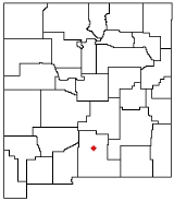
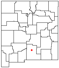
, in the south-central part of the US State of New Mexico
New Mexico
New Mexico is a state located in the southwest and western regions of the United States. New Mexico is also usually considered one of the Mountain States. With a population density of 16 per square mile, New Mexico is the sixth-most sparsely inhabited U.S...
. It lies in Otero County
Otero County, New Mexico
-2010:Whereas according to the 2010 U.S. Census Bureau:*72.7% White*3.5% Black*6.7% Native American*1.2% Asian*0.2% Native Hawaiian or Pacific Islander*4.2% Two or more races*11.2% Other races*34.5% Hispanic or Latino -2000:...
, 10 miles (16 km) southeast of the community of Alamogordo
Alamogordo, New Mexico
Alamogordo is the county seat of Otero County and a city in south-central New Mexico, United States. A desert community lying in the Tularosa Basin, it is bordered on the east by the Sacramento Mountains. It is the nearest city to Holloman Air Force Base. The population was 35,582 as of the 2000...
.
Sacramento Peak, at 9262 feet (2,823 m),
is a nearby subpeak of Cathey Peak, and is more widely known due to the presence of several observatories
Observatory
An observatory is a location used for observing terrestrial or celestial events. Astronomy, climatology/meteorology, geology, oceanography and volcanology are examples of disciplines for which observatories have been constructed...
on or near its summit. It is located at 32.7878701°N 105.8208140°W,
1.6 miles (2.6 km) southwest of Cathey Peak, and has a topographic prominence
Topographic prominence
In topography, prominence, also known as autonomous height, relative height, shoulder drop , or prime factor , categorizes the height of the mountain's or hill's summit by the elevation between it and the lowest contour line encircling it and no higher summit...
of approximately 115 feet (35 m). One of the two locations of the National Solar Observatory
National Solar Observatory
The mission of the National Solar Observatory is to advance knowledge of the Sun, both as an astronomical object and as the dominant external influence on Earth, by providing forefront observational opportunities to the research community...
is on the summit itself, and the small town of Sunspot
Sunspot, New Mexico
Sunspot is an unincorporated community in the Sacramento Mountains in Otero County, New Mexico, United States. It is located within the Lincoln National Forest, 18 miles south of Cloudcroft. Its elevation is 9200 feet....
is less than one-half mile (0.8 km) to the northeast. The Apache Point Observatory
Apache Point Observatory
The Apache Point Observatory is located in the Sacramento Mountains in Sunspot, New Mexico 18 miles south of Cloudcroft. The observatory consists of the Astrophysical Research Consortium's 3.5-meter telescope, the Sloan Digital Sky Survey 2.5-m telescope with a 20" photometric telescope,...
is located on a promontory about one-half mile (0.8 km) south of the summit,
and a cosmic ray
Cosmic ray
Cosmic rays are energetic charged subatomic particles, originating from outer space. They may produce secondary particles that penetrate the Earth's atmosphere and surface. The term ray is historical as cosmic rays were thought to be electromagnetic radiation...
observatory lies just over a mile (1.6 km) to the northeast.
Both peaks lie on the high western crest of the Sacramento Mountains, and hence have gentle, forested eastern slopes, and a steep, high escarpment to the west, descending to the Tularosa Basin
Tularosa Basin
The Tularosa Basin is a graben basin in the Basin and Range Province and within the Chihuahuan Desert, east of the Rio Grande in southern New Mexico, in the Southwestern United States.-Geography:...
. Both peaks can be accessed using New Mexico Scenic Byway 6563 from Cloudcroft
Cloudcroft, New Mexico
Cloudcroft is a village in Otero County, New Mexico and is within the Lincoln National Forest. The population was 749 at the 2000 census. Despite being located in an otherwise arid region, its extremely high elevation allows for a relatively mild summer that makes it a popular tourist attraction...
.

