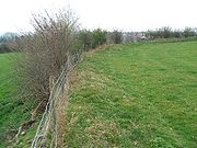
Castle Close
Encyclopedia

Earthworks (archaeology)
In archaeology, earthwork is a general term to describe artificial changes in land level. Earthworks are often known colloquially as 'lumps and bumps'. Earthworks can themselves be archaeological features or they can show features beneath the surface...
located near Stoodleigh
Stoodleigh
Stoodleigh is a village and civil parish in the Mid Devon district of Devon, England, located north of Tiverton and south of Bampton. It is situated above the Exe Valley, close to the Devon / Somerset border...
in Mid Devon
Mid Devon
Mid Devon is a local government district in Devon, England. Its council is based in Tiverton.The district was formed under the Local Government Act 1972, on 1 April 1974 by the merger of the borough of Tiverton and Crediton urban district together with Tiverton Rural District, and Crediton Rural...
, England
England
England is a country that is part of the United Kingdom. It shares land borders with Scotland to the north and Wales to the west; the Irish Sea is to the north west, the Celtic Sea to the south west, with the North Sea to the east and the English Channel to the south separating it from continental...
at OS
Ordnance Survey
Ordnance Survey , an executive agency and non-ministerial government department of the Government of the United Kingdom, is the national mapping agency for Great Britain, producing maps of Great Britain , and one of the world's largest producers of maps.The name reflects its creation together with...
grid reference SS937181. It is described on maps as a settlement. Situated some 208 metres above sea level, overlooking the River Exe, it is most likely to be an Iron Age
Iron Age
The Iron Age is the archaeological period generally occurring after the Bronze Age, marked by the prevalent use of iron. The early period of the age is characterized by the widespread use of iron or steel. The adoption of such material coincided with other changes in society, including differing...
Hill fort
Hill fort
A hill fort is a type of earthworks used as a fortified refuge or defended settlement, located to exploit a rise in elevation for defensive advantage. They are typically European and of the Bronze and Iron Ages. Some were used in the post-Roman period...
or enclosure.
While the earthworks do not appear as pronounced as others nearby at Huntsham castle
Huntsham castle
Huntsham Castle, Devon, England is an Iron Age Hill fort enclosure, located 260M above sea level on the edge of the former Parish of Tiverton....
, Cranmore Castle
Cranmore Castle
Cranmore Castle is an Iron Age earthwork situated on a hillside above the Devon town of Tiverton in south-west England. Its National Grid reference is SS958118...
and Cadbury Castle, Devon
Cadbury Castle, Devon
Cadbury Castle is an Iron Age Hillfort close to Bickleigh, Devon, England. It was later encamped by the Parliamentarian forces during the English Civil War under Thomas Fairfax when he laid siege to Bickleigh Castle....
they are still in a classical layout typical of an Iron Age hill fort or enclosure. These other Devon Hill forts are all in plain view from the centre of the enclosure, pointing to their all having being in use at the same time.

