
Campo Limpo de Goiás
Encyclopedia
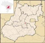
| Campo Limpo de Goiás | |
|---|---|
| State | Goiás Goiás Goiás is a state of Brazil, located in the central part of the country. The name Goiás comes from the name of an indigenous community... |
| Area: | 156.0 km² |
| Population: | 5,596 (IBGE 2007) |
| Elevation: | 880m |
| Postcode (CEP): | 74085-000 |
| IBGE statistical microregion: | Anápolis Microregion Anápolis Microregion The Anápolis Microregion is a region of central Goiás state, Brazil, including municipalities surrounding the city of Anápolis. For a map see *Population: 517,221 inhabitants *Cities: 19*Total Area: 8,386.80 km²... |
| Became a city: | 2002 |
| Distance to Goiânia Goiânia -Climate:The city has a tropical wet and dry climate with an average temperature of . There's a wet season, from October to April, and a dry one, from May to September. Annual rainfall is around 1,520 mm.... : |
75 km. |
| Website: | none |
| Coordinates: | 16°17′42"S 49°05′05"W |

Town
A town is a human settlement larger than a village but smaller than a city. The size a settlement must be in order to be called a "town" varies considerably in different parts of the world, so that, for example, many American "small towns" seem to British people to be no more than villages, while...
and municipality
Municipality
A municipality is essentially an urban administrative division having corporate status and usually powers of self-government. It can also be used to mean the governing body of a municipality. A municipality is a general-purpose administrative subdivision, as opposed to a special-purpose district...
in central Goiás
Goiás
Goiás is a state of Brazil, located in the central part of the country. The name Goiás comes from the name of an indigenous community...
state, Brazil
Brazil
Brazil , officially the Federative Republic of Brazil , is the largest country in South America. It is the world's fifth largest country, both by geographical area and by population with over 192 million people...
. It separated from the municipality of Anápolis
Anápolis
Anápolis is the third largest city in the State of Goiás in Brazil. It lies in the center of a rich agricultural region and has become a leader in food processing and pharmaceutical plants.-Location and population:...
in 1997.
The distance to the state capital, Goiânia
Goiânia
-Climate:The city has a tropical wet and dry climate with an average temperature of . There's a wet season, from October to April, and a dry one, from May to September. Annual rainfall is around 1,520 mm....
, is 75 km and connections are made by BR-153, passing through Anápolis
Anápolis
Anápolis is the third largest city in the State of Goiás in Brazil. It lies in the center of a rich agricultural region and has become a leader in food processing and pharmaceutical plants.-Location and population:...
, and then taking GO-330.
Demographic and Political Data
- IBGE statistical microregion: Anápolis MicroregionAnápolis MicroregionThe Anápolis Microregion is a region of central Goiás state, Brazil, including municipalities surrounding the city of Anápolis. For a map see *Population: 517,221 inhabitants *Cities: 19*Total Area: 8,386.80 km²...
- Population density in 2007: 35.83 inhab/km²
- Urban population in 2007: 4,534
- Rural population in 2007: 1,062
- Eligible voters in 2007: 4,798
- Mayor: Joaquim Silveira Duarte
- Vice-mayor: Carlos Alberto de Carvalho
Economy
The economy is based on cattle raising (17,500 head in 2006), both for meat and dairy. There are also banana, corn, rice, sugarcane, and soybean plantations.- Industrial establishments: 14
- Retail commerce establishments: 36
- Automobiles: 299 (2007)
- Banks: none (August 2007)
Agricultural data 2006
- Number of Farms: 228
- Total area: 10,413 ha.
- Area of permanent crops: 503 ha.
- Area of perennial crops: 1,122 ha.
- Area of natural pasture: 6,839 ha.
- Area of woodland and forests: 1,231 ha.
- Persons dependent on farming: 2,350
- Farms with tractors: 38
- Number of tractors: 53
- Cattle herd: 17,500 head IBGE
Health and education
- Schools in activity: 2 (2006)
- Classrooms: 26
- Teachers: 62
- Total number of students: 1,622
- Hospitals: none (2007)
- Walk-in health clinics: 1 (2005)