
California State Route 47
Encyclopedia
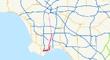
State Route 47 is a state highway
in the U.S. state
of California
, connecting Terminal Island
to the mainland in the Los Angeles area. From its south end at I-110
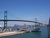
in San Pedro, it heads east across the Vincent Thomas Bridge
to the island and the end of state maintenance. The state highway begins again at the junction with I-710 on Terminal Island, crossing the Schuyler Heim Bridge
north to the mainland and the second terminus, where SR 103
begins. Signage continues along a locally maintained route, mainly Alameda Street, to the Gardena Freeway (SR 91
) in Compton
, and an unconstructed alignment follows the same corridor to the Santa Monica Freeway (I-10
) near downtown Los Angeles
.
The entire route is part of the California Freeway and Expressway System
, and both constructed segments are freeways, officially known as parts of the Seaside Freeway (which continues to SR 1
via I-710) and Terminal Island Freeway (which continues to SR 1 via SR 103
). However, there are several at-grade intersection
s along the gap on Terminal Island, and Alameda Street is a surface roadway, albeit one with few intersections, as it runs alongside the Alameda Corridor
rail line.
) in the Los Angeles
neighborhood of San Pedro and heads east to the Vincent Thomas Bridge
, with only one interchange - at Harbor Boulevard - before the 1963 suspension bridge
over the main channel of Los Angeles Harbor. After coming back to ground level on Terminal Island
, SR 47 becomes the locally-maintained Seaside Avenue at the interchange with Ferry Street, where there was a toll plaza until 2000. The freeway ends just beyond at Navy Way, after which the road enters Long Beach
and becomes Ocean Boulevard, which was rebuilt as a freeway in 2007. However, SR 47 must exit the freeway onto its frontage road
s, intersecting Henry Ford Avenue before turning north onto the Terminal Island Freeway. Ocean Boulevard leads east over the Gerald Desmond Bridge
and becomes Interstate 710, with access to downtown Long Beach.
State maintenance begins again on the Terminal Island Freeway, which is also signed as State Route 103
. After a partial interchange with New Dock Street, only allowing access to and from the north, SR 47 crosses the Cerritos Channel on the Schuyler Heim Bridge
, a lift bridge
opened in 1948. Just beyond the bridge, SR 47 leaves the freeway, which continues northeast as SR 103, onto Henry Ford Avenue, and state maintenance ends. The remainder of what is signed as SR 47, along Henry Ford Avenue and Alameda Street to the Redondo Beach Freeway (SR 91
), is locally maintained. Henry Ford Avenue quickly crosses the Dominguez Channel
and Anaheim Street, and merges with Alameda Street, which continues southwest into Wilmington as a local street. The part of Alameda Street rebuilt during the Alameda Corridor
project begins here, and the roadway passes under all cross streets - Pacific Coast Highway (SR 1
), Sepulveda Boulevard
, 223rd Street (at the San Diego Freeway
/I-405
interchange), Carson Street, Del Amo Boulevard, and Artesia Boulevard (at the Redondo Beach Freeway/SR 91 interchange) - with two-way connector ramps. The one major at-grade intersection
here is the split with Santa Fe Avenue north of Del Amo Boulevard, just south of the underpass where Alameda Street moves from the east to the west side of the rail line. (Before the corridor was built, the crossover was further south, at Dominguez Street, halfway between Carson Street and Del Amo Boulevard.)
 North of Artesia Boulevard, the rail line descends into the 10-mile (16 km) Mid-Corridor Trench, with two streets straddling it at ground level: Alameda Street to the west and a local frontage road to the east. All cross streets are thus grade-separated from the rail line while intersecting the streets at grade, except for Rosecrans Avenue, which bridges over all three. Crossings along this segment include the Century Freeway (I-105
, no access), Imperial Highway
, Firestone Boulevard (former SR 42), and Slauson Avenue
. Just south of 25th Street, the rail line curves northeast out of the trench, and the two roadways join to become a single Alameda Street, which soon interchanges with the Santa Monica Freeway (I-10
), at the north end of what is legislated as Route 47. The street continues north through the east side of downtown Los Angeles
, crossing the Santa Ana Freeway
(US 101) just west of Union Station
, and ending soon after at Elmyra Street, where it becomes Spring Street. In addition, it also passes the Little Tokyo/Arts District, Union
, and Chinatown stations; all of which are served by the LACMTA Gold Line, and the Union Station is also served by the Red and Purple lines, as well as Metrolink
and Amtrak
.
decided in mid-1916, at the urging of the Harbor Truck Highway Association (formed mid-1914), to build a Harbor Truck Boulevard stretching about 10 miles (15 km) between Los Angeles
and Compton
, intended to be used by truck
s to the Port of Los Angeles
at San Pedro. After that portion was completed, an extension to Wilmington was opened on February 2, 1924, resulting in a completely independent truck route to the port. This roadway, which lay about halfway between Wilmington Avenue and Long Beach Boulevard
, extended the existing Alameda Street, which ran along—to Slauson Avenue
—and then west of the Southern Pacific Railroad
's San Pedro Branch to Oris Street, the north limit of Compton. The truck boulevard continued along the west side to Dominguez Street (lying between the SP's San Pedro Branch and Pacific Electric Railway
's Dominguez Line beyond Dominguez Junction), and crossed there to the east side for the rest of the route to Anaheim Street in Wilmington. There trucks could turn east and south to Terminal Island
via Henry Ford Avenue, or continue southwest through Wilmington to San Pedro. The highway soon came to be known as Alameda Street all the way to Wilmington. It did not become a state highway; instead the state took over Figueroa Street
(SR 11) to the west and Atlantic Avenue (SR 15) to the east.
Plans for freeways in Los Angeles County evolved from a 1937 Automobile Club of Southern California
plan, which was modified by the city's Transportation Engineering Board (TEB) in 1939. The former included a single freeway connecting Los Angeles to Long Beach, beginning at Pasadena
and heading south-southwest to Lynwood
, then paralleling Long Beach Boulevard to Long Beach. The TEB's plan shifted this route farther east to near the present Long Beach Freeway, while keeping the route near Long Beach Boulevard as a second freeway leaving the Ramona Parkway (San Bernardino Freeway) east of downtown and heading south near Alameda Street and Long Beach Boulevard to Long Beach. This second freeway came to be known as the Long Beach Parkway or Alamitos Parkway, and connected in north Long Beach with a Terminal Island Freeway southwest to Terminal Island
. Because the Long Beach Naval Shipyard
was located on the island, the U.S. Navy paid for the construction of the $14 million freeway from the island to Willow Street, including the $5.3 million Schuyler Heim Lift Bridge. Construction began in early 1946, and the completed link was dedicated on January 10, 1948, replacing the older Henry Ford Bridge
.
Early plans also included a north–south freeway on each side of the Los Angeles Central Business District, splitting at the merge of the Harbor Parkway (Harbor Freeway) and Venice Parkway northeast of the University of Southern California
, and rejoining at the split between the Arroyo Seco Parkway (Pasadena Freeway) and Riverside Parkway
south of Dodger Stadium
. Initially known as the East By-Pass and West By-Pass, the latter later became part of the Harbor Parkway, while the former remained as a separate route roughly along Main Street
. The state legislature added the East By-Pass to the state highway system in 1947 as Route 222. The Los Angeles City Planning Commission approved a revised master plan in mid-1955, based on various studied that had been made. A new Industrial Freeway replaced the Terminal Island Freeway and Alamitos Parkway between Terminal Island and downtown Los Angeles, where it then continued north along the former East By-Pass (which was not kept south of the Santa Monica Freeway) and the southern part of the Riverside Parkway to the interchange of the Glendale Freeway and Golden State Freeway (which had replaced the rest of the Riverside Parkway). The Industrial Freeway south of the Santa Monica Freeway became Route 270 in 1959, but the ex-Riverside Parkway piece north of the Arroyo Seco Parkway never became a state highway.
In the 1964 renumbering, the Industrial Freeway became Route 47, and the former East By-Pass became Route 241. The latter was deleted the next year, and the former was extended west from its south end on Terminal Island to San Pedro, replacing part of SR 7, which was truncated to SR 1
in Long Beach
at the same time. (I-710, which later replaced SR 7, has since been re-extended to SR 47 on Terminal Island.) This extension, which had been added to the state highway system in 1949 as part of Route 231, included the 1963 Vincent Thomas Bridge
. Construction on the $5.8 million freeway link from that bridge west to the Harbor Freeway in San Pedro—officially the Seaside Freeway, but called an extension of the Harbor Freeway by the media—began in March 1968, and it was dedicated on July 9, 1970. The two parts of SR 47 were, and still are, connected by the Los Angeles-maintained Seaside Avenue and Long Beach-maintained Ocean Boulevard. (A freeway upgrade of the latter was completed in June 2007, but traffic signals remain on the former and on the ramps connecting Ocean Boulevard with the Terminal Island Freeway.)
Early maps show that the Terminal Island Freeway was to extend north to the Long Beach Freeway (I-710) near the San Diego Freeway
(I-405
), but the location for SR 47 adopted by the California Highway Commission
on January 22, 1969 led northwest from the Terminal Island Freeway's end at Carson Street to I-405 near Alameda Street, and then paralleled that street into Los Angeles. A 1982 state law specified that SR 47 shall use Henry Ford Avenue and Alameda Street between the Heim Bridge and the Redondo Beach Freeway (SR 91
), rather than the adopted alignment to the east, and in 1984 the legislature created State Route 103 to replace the former alignment on the Terminal Island Freeway between SR 47 and the Pacific Coast Highway (SR 1
). Due to the cancellation of the Industrial Freeway and planned port expansions, the Alameda Corridor
project was created, including an improved rail line and a widening of Alameda Street from four to six lanes south of SR 91. Alameda Street was rebuilt for the project, with grade separation
s at most major streets south of SR 91, and is now signed as part of SR 47 there, but remains mostly four lanes. As part of a project to replace the Heim Bridge, Caltrans and the Alameda Corridor Transportation Authority plan to improve the connection near the south end of Alameda Street, possibly by building a new expressway
replacement for SR 47 south of SR 1, or by extending SR 103 northwest via the originally-planned alignment to Alameda Street south of I-405.
The entire route is in Los Angeles County
.
{| class=wikitable
!Location
!Postmile
!Exit
!Destinations
!Notes
|-
|rowspan=7|Los Angeles
|R0.00
|1A
|Gaffey Street (SR 110 south) – San Pedro
|Southbound exit and northbound entrance
|-
|R0.00
|1B
|
|Southbound exit and northbound entrance
|-
|R0.43
0.72
|1C
|Harbor Boulevard – San Pedro
|Signed as exit 1A northbound
|-
|0.86
|colspan=3 align=center|Vincent Thomas Bridge
over Los Angeles Harbor
|-
|2.30
|1B
|Ferry Street
|No exit number southbound
|-
|colspan=4 align=center|North end of freeway and state maintenance
|-
|
|
|Navy Way – Berths 301-305, Berths 401-406
|
|-
|rowspan=5|Long Beach
|
|
|Pier S Avenue to Henry Ford Avenue, New Dock Street – Pier S
|
|-
|3.50
|
| – Piers B-J and T, Downtown Long Beach
|Interchange
|-
|colspan=4 align=center|South end of freeway and state maintenance
|-bgcolor=#ffdddd
|3.58
|4
|New Dock Street
|Southbound exit and northbound entrance
|-
|rowspan=2|3.88
|rowspan=2 colspan=3 align=center|Schuyler Heim Bridge
over Cerritos Channel
|-
|rowspan=7|Los Angeles
|-bgcolor=#ffdddd
|4.57
|
|
|Northbound left exit and southbound left entrance
|-
|colspan=4 align=center|North end of freeway and state maintenance
|-
|
|
|Anchorage Road, Henry Ford Avenue, Pier A Way
|
|-
|
|
|Anaheim Street
|
|-
|
|
|Alameda Street
|
|-
|
|
|
|Interchange
|-
|rowspan=5|Carson
|
|
|Sepulveda Boulevard
|Interchange
|-
|
|
|223rd Street
|Interchange
|-
|
|
|
|Interchange; former SR 7
|-
|
|
|Carson Street
|Interchange
|-
|
|
|Del Amo Boulevard
|Interchange
|-
|
|
|
|Santa Fe Avenue
|
|-
|rowspan=3|Compton
|
|
|
|Interchange
|-
|
|
|
|Interchange
|-
|
|
|Alameda Street
|Continuation beyond SR 91
State highway
State highway, state road or state route can refer to one of three related concepts, two of them related to a state or provincial government in a country that is divided into states or provinces :#A...
in the U.S. state
U.S. state
A U.S. state is any one of the 50 federated states of the United States of America that share sovereignty with the federal government. Because of this shared sovereignty, an American is a citizen both of the federal entity and of his or her state of domicile. Four states use the official title of...
of California
California
California is a state located on the West Coast of the United States. It is by far the most populous U.S. state, and the third-largest by land area...
, connecting Terminal Island
Terminal Island
Terminal Island is an island located in Los Angeles County, California between Los Angeles Harbor and Long Beach Harbor. Originally a mudflat known to the Spanish as Isla Raza de Buena Gente, and later called Rattlesnake Island, it has officially been Terminal Island since 1918...
to the mainland in the Los Angeles area. From its south end at I-110
Interstate 110 (California)
Route 110, consisting of two segments of State Route 110 joined by Interstate 110 , is a state highway in the Los Angeles area of the U.S. state of California, mostly built to freeway standards...
in San Pedro, it heads east across the Vincent Thomas Bridge
Vincent Thomas Bridge
The Vincent Thomas Bridge is a long suspension bridge, opened in 1963, crossing the Los Angeles Harbor in the U.S. state of California, linking San Pedro, Los Angeles, with Terminal Island. The bridge is signed as part of State Route 47. It is named for California Assemblyman Vincent Thomas of San...
to the island and the end of state maintenance. The state highway begins again at the junction with I-710 on Terminal Island, crossing the Schuyler Heim Bridge
Schuyler Heim Bridge
The Commodore Schuyler F. Heim Bridge is a vertical-lift bridge in the Port of Los Angeles.The bridge, dedicated on January 10, 1948, allows State Route 47 to cross over the Cerritos Channel. It is the largest vertical lift bridge on the West Coast...
north to the mainland and the second terminus, where SR 103
California State Route 103
State Route 103, part of the Terminal Island Freeway, is a short state highway in Los Angeles and Long Beach. It runs from a split with State Route 47 northeast to a cloverleaf interchange with State Route 1. Beyond SR 1, the freeway is owned by the city of Long Beach to its end at Willow Street...
begins. Signage continues along a locally maintained route, mainly Alameda Street, to the Gardena Freeway (SR 91
California State Route 91
State Route 91 is a major east–west freeway located entirely within Southern California and serving several regions of the Greater Los Angeles metropolitan area...
) in Compton
Compton, California
Compton is a city in southern Los Angeles County, California, United States, southeast of downtown Los Angeles. The city of Compton is one of the oldest cities in the county and on May 11, 1888, was the eighth city to incorporate. The city is considered part of the South side by residents of Los...
, and an unconstructed alignment follows the same corridor to the Santa Monica Freeway (I-10
Interstate 10 in California
Interstate 10 , the major east–west Interstate Highway in the Southern United States, runs in the U.S. state of California east from Santa Monica, on the Pacific Ocean, through Los Angeles and San Bernardino to the border with Arizona...
) near downtown Los Angeles
Downtown Los Angeles
Downtown Los Angeles is the central business district of Los Angeles, California, United States, located close to the geographic center of the metropolitan area...
.
The entire route is part of the California Freeway and Expressway System
California Freeway and Expressway System
The California Freeway and Expressway System is a system of existing or planned freeways and expressways in the U.S. state of California. It is defined by the Streets and Highways Code.-List of roads in the system:*State Route 1 *State Route 2...
, and both constructed segments are freeways, officially known as parts of the Seaside Freeway (which continues to SR 1
California State Route 1
State Route 1 , more often called Highway 1, is a state highway that runs along much of the Pacific coast of the U.S. state of California. It is famous for running along some of the most beautiful coastlines in the world, leading to its designation as an All-American Road.Highway 1 does not run...
via I-710) and Terminal Island Freeway (which continues to SR 1 via SR 103
California State Route 103
State Route 103, part of the Terminal Island Freeway, is a short state highway in Los Angeles and Long Beach. It runs from a split with State Route 47 northeast to a cloverleaf interchange with State Route 1. Beyond SR 1, the freeway is owned by the city of Long Beach to its end at Willow Street...
). However, there are several at-grade intersection
At-grade intersection
An at-grade intersection is a junction at which two or more transport axes cross at the same level .-Traffic management:With areas of high or fast traffic, an at-grade intersection normally requires a traffic control device such as a stop sign, traffic light or railway signal to manage conflicting...
s along the gap on Terminal Island, and Alameda Street is a surface roadway, albeit one with few intersections, as it runs alongside the Alameda Corridor
Alameda Corridor
The Alameda Corridor is a 20 mile freight rail "expressway" owned by the Alameda Corridor Transportation Authority , connecting the national rail system near downtown Los Angeles, California to the ports of Los Angeles and Long Beach, running parallel to Alameda Street...
rail line.
Route description
State Route 47 begins at the south end of the Harbor Freeway (I-110Interstate 110 (California)
Route 110, consisting of two segments of State Route 110 joined by Interstate 110 , is a state highway in the Los Angeles area of the U.S. state of California, mostly built to freeway standards...
) in the Los Angeles
Los Angeles, California
Los Angeles , with a population at the 2010 United States Census of 3,792,621, is the most populous city in California, USA and the second most populous in the United States, after New York City. It has an area of , and is located in Southern California...
neighborhood of San Pedro and heads east to the Vincent Thomas Bridge
Vincent Thomas Bridge
The Vincent Thomas Bridge is a long suspension bridge, opened in 1963, crossing the Los Angeles Harbor in the U.S. state of California, linking San Pedro, Los Angeles, with Terminal Island. The bridge is signed as part of State Route 47. It is named for California Assemblyman Vincent Thomas of San...
, with only one interchange - at Harbor Boulevard - before the 1963 suspension bridge
Suspension bridge
A suspension bridge is a type of bridge in which the deck is hung below suspension cables on vertical suspenders. Outside Tibet and Bhutan, where the first examples of this type of bridge were built in the 15th century, this type of bridge dates from the early 19th century...
over the main channel of Los Angeles Harbor. After coming back to ground level on Terminal Island
Terminal Island
Terminal Island is an island located in Los Angeles County, California between Los Angeles Harbor and Long Beach Harbor. Originally a mudflat known to the Spanish as Isla Raza de Buena Gente, and later called Rattlesnake Island, it has officially been Terminal Island since 1918...
, SR 47 becomes the locally-maintained Seaside Avenue at the interchange with Ferry Street, where there was a toll plaza until 2000. The freeway ends just beyond at Navy Way, after which the road enters Long Beach
Long Beach, California
Long Beach is a city situated in Los Angeles County in Southern California, on the Pacific coast of the United States. The city is the 36th-largest city in the nation and the seventh-largest in California. As of 2010, its population was 462,257...
and becomes Ocean Boulevard, which was rebuilt as a freeway in 2007. However, SR 47 must exit the freeway onto its frontage road
Frontage road
A frontage road is a non-limited access road running parallel to a higher-speed road, usually a freeway, and feeding it at appropriate points of access...
s, intersecting Henry Ford Avenue before turning north onto the Terminal Island Freeway. Ocean Boulevard leads east over the Gerald Desmond Bridge
Gerald Desmond Bridge
The Gerald Desmond Bridge is a through arch bridge that carries four lanes of Ocean Boulevard from Interstate 710 in Long Beach, California, west across the Cerritos Channel to Terminal Island...
and becomes Interstate 710, with access to downtown Long Beach.
State maintenance begins again on the Terminal Island Freeway, which is also signed as State Route 103
California State Route 103
State Route 103, part of the Terminal Island Freeway, is a short state highway in Los Angeles and Long Beach. It runs from a split with State Route 47 northeast to a cloverleaf interchange with State Route 1. Beyond SR 1, the freeway is owned by the city of Long Beach to its end at Willow Street...
. After a partial interchange with New Dock Street, only allowing access to and from the north, SR 47 crosses the Cerritos Channel on the Schuyler Heim Bridge
Schuyler Heim Bridge
The Commodore Schuyler F. Heim Bridge is a vertical-lift bridge in the Port of Los Angeles.The bridge, dedicated on January 10, 1948, allows State Route 47 to cross over the Cerritos Channel. It is the largest vertical lift bridge on the West Coast...
, a lift bridge
Lift bridge
A vertical-lift bridge or lift bridge is a type of movable bridge in which a span rises vertically while remaining parallel with the deck....
opened in 1948. Just beyond the bridge, SR 47 leaves the freeway, which continues northeast as SR 103, onto Henry Ford Avenue, and state maintenance ends. The remainder of what is signed as SR 47, along Henry Ford Avenue and Alameda Street to the Redondo Beach Freeway (SR 91
California State Route 91
State Route 91 is a major east–west freeway located entirely within Southern California and serving several regions of the Greater Los Angeles metropolitan area...
), is locally maintained. Henry Ford Avenue quickly crosses the Dominguez Channel
Dominguez Channel
Dominguez Channel is a stream in southern Los Angeles County, California that drains the Dominguez Watershed of . The watershed area is 96% developed, largely residential, and artificially bounded by a system of storm drains and flood control channels....
and Anaheim Street, and merges with Alameda Street, which continues southwest into Wilmington as a local street. The part of Alameda Street rebuilt during the Alameda Corridor
Alameda Corridor
The Alameda Corridor is a 20 mile freight rail "expressway" owned by the Alameda Corridor Transportation Authority , connecting the national rail system near downtown Los Angeles, California to the ports of Los Angeles and Long Beach, running parallel to Alameda Street...
project begins here, and the roadway passes under all cross streets - Pacific Coast Highway (SR 1
California State Route 1
State Route 1 , more often called Highway 1, is a state highway that runs along much of the Pacific coast of the U.S. state of California. It is famous for running along some of the most beautiful coastlines in the world, leading to its designation as an All-American Road.Highway 1 does not run...
), Sepulveda Boulevard
Sepulveda Boulevard
Sepulveda Boulevard is a street in Los Angeles, California, which stretches some 42.8 miles from Rinaldi Street at the north end of the San Fernando Valley to the city limits of Hermosa Beach, where it "jumps" east and continues on to Long Beach. It generally runs north-south, passing underneath...
, 223rd Street (at the San Diego Freeway
Interstate 405 (California)
Interstate 405 is a major north–south Interstate Highway in Southern California. It is a bypass of Interstate 5, running along the western areas of the Greater Los Angeles Area from Irvine in the south to near San Fernando in the north...
/I-405
Interstate 405 (California)
Interstate 405 is a major north–south Interstate Highway in Southern California. It is a bypass of Interstate 5, running along the western areas of the Greater Los Angeles Area from Irvine in the south to near San Fernando in the north...
interchange), Carson Street, Del Amo Boulevard, and Artesia Boulevard (at the Redondo Beach Freeway/SR 91 interchange) - with two-way connector ramps. The one major at-grade intersection
At-grade intersection
An at-grade intersection is a junction at which two or more transport axes cross at the same level .-Traffic management:With areas of high or fast traffic, an at-grade intersection normally requires a traffic control device such as a stop sign, traffic light or railway signal to manage conflicting...
here is the split with Santa Fe Avenue north of Del Amo Boulevard, just south of the underpass where Alameda Street moves from the east to the west side of the rail line. (Before the corridor was built, the crossover was further south, at Dominguez Street, halfway between Carson Street and Del Amo Boulevard.)
Interstate 105 (California)
Interstate 105 is an Interstate Highway in southern Los Angeles County, California that runs east–west from near the Los Angeles International Airport to Norwalk...
, no access), Imperial Highway
Imperial Highway
Imperial Highway is a road in Orange and Los Angeles counties in California. It begins at the Anaheim-Orange boundary and runs through several cities until it stops at Dockweiler State Beach in Los Angeles near the Los Angeles International Airport. For much of the way, Imperial Highway is signed...
, Firestone Boulevard (former SR 42), and Slauson Avenue
Slauson Avenue
Slauson Avenue is a major east-west thoroughfare for southern Los Angeles County, California, named for the land developer and Los Angeles Board of Education member J. S. Slauson. It passes through Culver City, Ladera Heights, View Park-Windsor Hills, Baldwin Hills, Inglewood, South Los Angeles,...
. Just south of 25th Street, the rail line curves northeast out of the trench, and the two roadways join to become a single Alameda Street, which soon interchanges with the Santa Monica Freeway (I-10
Interstate 10 in California
Interstate 10 , the major east–west Interstate Highway in the Southern United States, runs in the U.S. state of California east from Santa Monica, on the Pacific Ocean, through Los Angeles and San Bernardino to the border with Arizona...
), at the north end of what is legislated as Route 47. The street continues north through the east side of downtown Los Angeles
Downtown Los Angeles
Downtown Los Angeles is the central business district of Los Angeles, California, United States, located close to the geographic center of the metropolitan area...
, crossing the Santa Ana Freeway
Santa Ana Freeway
The Santa Ana Freeway is one of the principal freeways in Southern California, connecting Los Angeles and its southeastern suburbs including the freeway's namesake, the city of Santa Ana. The freeway begins at the Four Level Interchange in downtown Los Angeles, signed as U.S. Route 101...
(US 101) just west of Union Station
Union Station (Los Angeles)
Los Angeles Union Station is the main railway station in Los Angeles, California. The station has rail services by Amtrak and Amtrak California and Metrolink; light rail/subways are the Metro Rail Red Line, Purple Line, Gold Line. Bus rapid transport runs on the Silver Line...
, and ending soon after at Elmyra Street, where it becomes Spring Street. In addition, it also passes the Little Tokyo/Arts District, Union
Union Station (Los Angeles)
Los Angeles Union Station is the main railway station in Los Angeles, California. The station has rail services by Amtrak and Amtrak California and Metrolink; light rail/subways are the Metro Rail Red Line, Purple Line, Gold Line. Bus rapid transport runs on the Silver Line...
, and Chinatown stations; all of which are served by the LACMTA Gold Line, and the Union Station is also served by the Red and Purple lines, as well as Metrolink
Metrolink (Southern California)
Metrolink is a commuter rail system serving Los Angeles and the surrounding area of Southern California; it currently consists of six lines and 55 stations using of track....
and Amtrak
Amtrak California
Amtrak California is a brand name used by the Caltrans Division of Rail for all state-supported Amtrak rail routes within the U.S. State of California...
.
History
The Los Angeles County Board of SupervisorsLos Angeles County Board of Supervisors
The Los Angeles County Board of Supervisors is the five-member nonpartisan governing board of Los Angeles County, California. Members of the board of supervisors are elected by district. They were as of December 2, 2008:*District 1: Gloria Molina...
decided in mid-1916, at the urging of the Harbor Truck Highway Association (formed mid-1914), to build a Harbor Truck Boulevard stretching about 10 miles (15 km) between Los Angeles
Los Angeles, California
Los Angeles , with a population at the 2010 United States Census of 3,792,621, is the most populous city in California, USA and the second most populous in the United States, after New York City. It has an area of , and is located in Southern California...
and Compton
Compton, California
Compton is a city in southern Los Angeles County, California, United States, southeast of downtown Los Angeles. The city of Compton is one of the oldest cities in the county and on May 11, 1888, was the eighth city to incorporate. The city is considered part of the South side by residents of Los...
, intended to be used by truck
Truck
A truck or lorry is a motor vehicle designed to transport cargo. Trucks vary greatly in size, power, and configuration, with the smallest being mechanically similar to an automobile...
s to the Port of Los Angeles
Port of Los Angeles
The Port of Los Angeles, also called Los Angeles Harbor and WORLDPORT L.A, is a port complex that occupies of land and water along of waterfront. The port is located on San Pedro Bay in the San Pedro neighborhood of Los Angeles, approximately south of downtown...
at San Pedro. After that portion was completed, an extension to Wilmington was opened on February 2, 1924, resulting in a completely independent truck route to the port. This roadway, which lay about halfway between Wilmington Avenue and Long Beach Boulevard
Long Beach Boulevard
Long Beach Boulevard is a north south thoroughfare in Los Angeles County.-Geography:Long Beach Boulevard starts off as a continuation of Pacific Boulevard south of Cudahy Avenue in South Gate. Long Beach Boulevard passes through South Gate, Lynwood, Compton and Long Beach...
, extended the existing Alameda Street, which ran along—to Slauson Avenue
Slauson Avenue
Slauson Avenue is a major east-west thoroughfare for southern Los Angeles County, California, named for the land developer and Los Angeles Board of Education member J. S. Slauson. It passes through Culver City, Ladera Heights, View Park-Windsor Hills, Baldwin Hills, Inglewood, South Los Angeles,...
—and then west of the Southern Pacific Railroad
Southern Pacific Railroad
The Southern Pacific Transportation Company , earlier Southern Pacific Railroad and Southern Pacific Company, and usually simply called the Southern Pacific or Espee, was an American railroad....
's San Pedro Branch to Oris Street, the north limit of Compton. The truck boulevard continued along the west side to Dominguez Street (lying between the SP's San Pedro Branch and Pacific Electric Railway
Pacific Electric Railway
The Pacific Electric Railway , also known as the Red Car system, was a mass transit system in Southern California using streetcars, light rail, and buses...
's Dominguez Line beyond Dominguez Junction), and crossed there to the east side for the rest of the route to Anaheim Street in Wilmington. There trucks could turn east and south to Terminal Island
Terminal Island
Terminal Island is an island located in Los Angeles County, California between Los Angeles Harbor and Long Beach Harbor. Originally a mudflat known to the Spanish as Isla Raza de Buena Gente, and later called Rattlesnake Island, it has officially been Terminal Island since 1918...
via Henry Ford Avenue, or continue southwest through Wilmington to San Pedro. The highway soon came to be known as Alameda Street all the way to Wilmington. It did not become a state highway; instead the state took over Figueroa Street
Figueroa Street
Figueroa Street is a street in Los Angeles County, California named for General José Figueroa , governor of Alta California from 1833 to 1835, who oversaw the secularization of the missions of California...
(SR 11) to the west and Atlantic Avenue (SR 15) to the east.
Plans for freeways in Los Angeles County evolved from a 1937 Automobile Club of Southern California
Automobile Club of Southern California
The Automobile Club of Southern California is the Southern California affiliate of the American Automobile Association federation of motor clubs...
plan, which was modified by the city's Transportation Engineering Board (TEB) in 1939. The former included a single freeway connecting Los Angeles to Long Beach, beginning at Pasadena
Pasadena, California
Pasadena is a city in Los Angeles County, California, United States. Although famous for hosting the annual Rose Bowl football game and Tournament of Roses Parade, Pasadena is the home to many scientific and cultural institutions, including the California Institute of Technology , the Jet...
and heading south-southwest to Lynwood
Lynwood, California
Lynwood is a city in Los Angeles County, California, United States of America. As of the 2010 census, the city had a total population of 69,772, down from 69,845 at the 2000 census. Lynwood is located near South Gate and Compton in the southern portion of the Los Angeles Basin. Incorporated in...
, then paralleling Long Beach Boulevard to Long Beach. The TEB's plan shifted this route farther east to near the present Long Beach Freeway, while keeping the route near Long Beach Boulevard as a second freeway leaving the Ramona Parkway (San Bernardino Freeway) east of downtown and heading south near Alameda Street and Long Beach Boulevard to Long Beach. This second freeway came to be known as the Long Beach Parkway or Alamitos Parkway, and connected in north Long Beach with a Terminal Island Freeway southwest to Terminal Island
Terminal Island
Terminal Island is an island located in Los Angeles County, California between Los Angeles Harbor and Long Beach Harbor. Originally a mudflat known to the Spanish as Isla Raza de Buena Gente, and later called Rattlesnake Island, it has officially been Terminal Island since 1918...
. Because the Long Beach Naval Shipyard
Long Beach Naval Shipyard
thumb|right|300px|Long Beach Naval Shipyard in 1993The Long Beach Naval Shipyard, which closed in 1997, was located at Terminal Island between the city of Long Beach and the San Pedro district of Los Angeles and approximately 23 miles south of the Los Angeles International Airport.The Long Beach...
was located on the island, the U.S. Navy paid for the construction of the $14 million freeway from the island to Willow Street, including the $5.3 million Schuyler Heim Lift Bridge. Construction began in early 1946, and the completed link was dedicated on January 10, 1948, replacing the older Henry Ford Bridge
Henry Ford Bridge
The Henry Ford Bridge carries the Pacific Harbor Line railroad across the Cerritos Channel to Terminal Island and the Port of Los Angeles and Port of Long Beach. The original 1924 bridge was replaced in 1996....
.
Early plans also included a north–south freeway on each side of the Los Angeles Central Business District, splitting at the merge of the Harbor Parkway (Harbor Freeway) and Venice Parkway northeast of the University of Southern California
University of Southern California
The University of Southern California is a private, not-for-profit, nonsectarian, research university located in Los Angeles, California, United States. USC was founded in 1880, making it California's oldest private research university...
, and rejoining at the split between the Arroyo Seco Parkway (Pasadena Freeway) and Riverside Parkway
Riverside Parkway
The Riverside Parkway is a , five-lane limited-access road in the lower central business district of Grand Junction. Paralleling the Colorado River, it connects several of the major highways in the city, and has bike lanes in both directions. Billboards are not allowed within of the parkway....
south of Dodger Stadium
Dodger Stadium
Dodger Stadium, also sometimes called Chavez Ravine, is a stadium in Los Angeles. Located adjacent to Downtown Los Angeles, Dodger Stadium has been the home ballpark of Major League Baseball's Los Angeles Dodgers team since 1962...
. Initially known as the East By-Pass and West By-Pass, the latter later became part of the Harbor Parkway, while the former remained as a separate route roughly along Main Street
Main Street (Los Angeles)
Main Street is a major north-south thoroughfare in Los Angeles, California, and is the east-west postal divider for that city. It begins as a continuation of Valley Boulevard west of Mission Road in Lincoln Heights and ends at the Port of Los Angeles. At 9th Street, it merges with Spring Street in...
. The state legislature added the East By-Pass to the state highway system in 1947 as Route 222. The Los Angeles City Planning Commission approved a revised master plan in mid-1955, based on various studied that had been made. A new Industrial Freeway replaced the Terminal Island Freeway and Alamitos Parkway between Terminal Island and downtown Los Angeles, where it then continued north along the former East By-Pass (which was not kept south of the Santa Monica Freeway) and the southern part of the Riverside Parkway to the interchange of the Glendale Freeway and Golden State Freeway (which had replaced the rest of the Riverside Parkway). The Industrial Freeway south of the Santa Monica Freeway became Route 270 in 1959, but the ex-Riverside Parkway piece north of the Arroyo Seco Parkway never became a state highway.
In the 1964 renumbering, the Industrial Freeway became Route 47, and the former East By-Pass became Route 241. The latter was deleted the next year, and the former was extended west from its south end on Terminal Island to San Pedro, replacing part of SR 7, which was truncated to SR 1
California State Route 1
State Route 1 , more often called Highway 1, is a state highway that runs along much of the Pacific coast of the U.S. state of California. It is famous for running along some of the most beautiful coastlines in the world, leading to its designation as an All-American Road.Highway 1 does not run...
in Long Beach
Long Beach, California
Long Beach is a city situated in Los Angeles County in Southern California, on the Pacific coast of the United States. The city is the 36th-largest city in the nation and the seventh-largest in California. As of 2010, its population was 462,257...
at the same time. (I-710, which later replaced SR 7, has since been re-extended to SR 47 on Terminal Island.) This extension, which had been added to the state highway system in 1949 as part of Route 231, included the 1963 Vincent Thomas Bridge
Vincent Thomas Bridge
The Vincent Thomas Bridge is a long suspension bridge, opened in 1963, crossing the Los Angeles Harbor in the U.S. state of California, linking San Pedro, Los Angeles, with Terminal Island. The bridge is signed as part of State Route 47. It is named for California Assemblyman Vincent Thomas of San...
. Construction on the $5.8 million freeway link from that bridge west to the Harbor Freeway in San Pedro—officially the Seaside Freeway, but called an extension of the Harbor Freeway by the media—began in March 1968, and it was dedicated on July 9, 1970. The two parts of SR 47 were, and still are, connected by the Los Angeles-maintained Seaside Avenue and Long Beach-maintained Ocean Boulevard. (A freeway upgrade of the latter was completed in June 2007, but traffic signals remain on the former and on the ramps connecting Ocean Boulevard with the Terminal Island Freeway.)
Early maps show that the Terminal Island Freeway was to extend north to the Long Beach Freeway (I-710) near the San Diego Freeway
Interstate 405 (California)
Interstate 405 is a major north–south Interstate Highway in Southern California. It is a bypass of Interstate 5, running along the western areas of the Greater Los Angeles Area from Irvine in the south to near San Fernando in the north...
(I-405
Interstate 405 (California)
Interstate 405 is a major north–south Interstate Highway in Southern California. It is a bypass of Interstate 5, running along the western areas of the Greater Los Angeles Area from Irvine in the south to near San Fernando in the north...
), but the location for SR 47 adopted by the California Highway Commission
California Highway Commission
The California Highway Commission was established in 1895 and continued until 1978 as the primary state highway bureaucracy in California.Their first noticeable efforts centered on the Lake Tahoe Wagon Road over the Sierra Nevada mountains...
on January 22, 1969 led northwest from the Terminal Island Freeway's end at Carson Street to I-405 near Alameda Street, and then paralleled that street into Los Angeles. A 1982 state law specified that SR 47 shall use Henry Ford Avenue and Alameda Street between the Heim Bridge and the Redondo Beach Freeway (SR 91
California State Route 91
State Route 91 is a major east–west freeway located entirely within Southern California and serving several regions of the Greater Los Angeles metropolitan area...
), rather than the adopted alignment to the east, and in 1984 the legislature created State Route 103 to replace the former alignment on the Terminal Island Freeway between SR 47 and the Pacific Coast Highway (SR 1
California State Route 1
State Route 1 , more often called Highway 1, is a state highway that runs along much of the Pacific coast of the U.S. state of California. It is famous for running along some of the most beautiful coastlines in the world, leading to its designation as an All-American Road.Highway 1 does not run...
). Due to the cancellation of the Industrial Freeway and planned port expansions, the Alameda Corridor
Alameda Corridor
The Alameda Corridor is a 20 mile freight rail "expressway" owned by the Alameda Corridor Transportation Authority , connecting the national rail system near downtown Los Angeles, California to the ports of Los Angeles and Long Beach, running parallel to Alameda Street...
project was created, including an improved rail line and a widening of Alameda Street from four to six lanes south of SR 91. Alameda Street was rebuilt for the project, with grade separation
Grade separation
Grade separation is the method of aligning a junction of two or more transport axes at different heights so that they will not disrupt the traffic flow on other transit routes when they cross each other. The composition of such transport axes does not have to be uniform; it can consist of a...
s at most major streets south of SR 91, and is now signed as part of SR 47 there, but remains mostly four lanes. As part of a project to replace the Heim Bridge, Caltrans and the Alameda Corridor Transportation Authority plan to improve the connection near the south end of Alameda Street, possibly by building a new expressway
Limited-access road
A limited-access road known by various terms worldwide, including limited-access highway, dual-carriageway and expressway, is a highway or arterial road for high-speed traffic which has many or most characteristics of a controlled-access highway , including limited or no access to adjacent...
replacement for SR 47 south of SR 1, or by extending SR 103 northwest via the originally-planned alignment to Alameda Street south of I-405.
Major intersections
- Note: Except where prefixed with a letter, postmiles were measured in 1964, based on the alignment as it existed at that time, and do not necessarily reflect current mileage.
The entire route is in Los Angeles County
Los Angeles County, California
Los Angeles County is a county in the U.S. state of California. As of 2010 U.S. Census, the county had a population of 9,818,605, making it the most populous county in the United States. Los Angeles County alone is more populous than 42 individual U.S. states...
.
{| class=wikitable
!Location
!Postmile
!Exit
Exit number
An exit number is a number assigned to a road junction, usually an exit from a freeway. It is usually marked on the same sign as the destinations of the exit, as well as a sign in the gore....
!Destinations
!Notes
|-
|rowspan=7|Los Angeles
Los Angeles, California
Los Angeles , with a population at the 2010 United States Census of 3,792,621, is the most populous city in California, USA and the second most populous in the United States, after New York City. It has an area of , and is located in Southern California...
|R0.00
|1A
|Gaffey Street (SR 110 south) – San Pedro
|Southbound exit and northbound entrance
|-
|R0.00
|1B
|
|Southbound exit and northbound entrance
|-
|R0.43
0.72
|1C
|Harbor Boulevard – San Pedro
|Signed as exit 1A northbound
|-
|0.86
|colspan=3 align=center|Vincent Thomas Bridge
Vincent Thomas Bridge
The Vincent Thomas Bridge is a long suspension bridge, opened in 1963, crossing the Los Angeles Harbor in the U.S. state of California, linking San Pedro, Los Angeles, with Terminal Island. The bridge is signed as part of State Route 47. It is named for California Assemblyman Vincent Thomas of San...
over Los Angeles Harbor
|-
|2.30
|1B
|Ferry Street
|No exit number southbound
|-
|colspan=4 align=center|North end of freeway and state maintenance
|-
|
|
|Navy Way – Berths 301-305, Berths 401-406
|
|-
|rowspan=5|Long Beach
Long Beach, California
Long Beach is a city situated in Los Angeles County in Southern California, on the Pacific coast of the United States. The city is the 36th-largest city in the nation and the seventh-largest in California. As of 2010, its population was 462,257...
|
|
|Pier S Avenue to Henry Ford Avenue, New Dock Street – Pier S
|
|-
|3.50
|
| – Piers B-J and T, Downtown Long Beach
|Interchange
|-
|colspan=4 align=center|South end of freeway and state maintenance
|-bgcolor=#ffdddd
|3.58
|4
|New Dock Street
|Southbound exit and northbound entrance
|-
|rowspan=2|3.88
|rowspan=2 colspan=3 align=center|Schuyler Heim Bridge
Schuyler Heim Bridge
The Commodore Schuyler F. Heim Bridge is a vertical-lift bridge in the Port of Los Angeles.The bridge, dedicated on January 10, 1948, allows State Route 47 to cross over the Cerritos Channel. It is the largest vertical lift bridge on the West Coast...
over Cerritos Channel
|-
|rowspan=7|Los Angeles
Los Angeles, California
Los Angeles , with a population at the 2010 United States Census of 3,792,621, is the most populous city in California, USA and the second most populous in the United States, after New York City. It has an area of , and is located in Southern California...
|-bgcolor=#ffdddd
|4.57
|
|
|Northbound left exit and southbound left entrance
|-
|colspan=4 align=center|North end of freeway and state maintenance
|-
|
|
|Anchorage Road, Henry Ford Avenue, Pier A Way
|
|-
|
|
|Anaheim Street
|
|-
|
|
|Alameda Street
|
|-
|
|
|
|Interchange
|-
|rowspan=5|Carson
Carson, California
Carson is a city in Los Angeles County, California. As of the 2010 census, Carson had a total population of 91,714. Located south of downtown Los Angeles and approximately 14 miles away from the Los Angeles International Airport, it is known as a suburb of the city....
|
|
|Sepulveda Boulevard
Sepulveda Boulevard
Sepulveda Boulevard is a street in Los Angeles, California, which stretches some 42.8 miles from Rinaldi Street at the north end of the San Fernando Valley to the city limits of Hermosa Beach, where it "jumps" east and continues on to Long Beach. It generally runs north-south, passing underneath...
|Interchange
|-
|
|
|223rd Street
|Interchange
|-
|
|
|
|Interchange; former SR 7
|-
|
|
|Carson Street
|Interchange
|-
|
|
|Del Amo Boulevard
|Interchange
|-
|
|
|
|Santa Fe Avenue
|
|-
|rowspan=3|Compton
Compton, California
Compton is a city in southern Los Angeles County, California, United States, southeast of downtown Los Angeles. The city of Compton is one of the oldest cities in the county and on May 11, 1888, was the eighth city to incorporate. The city is considered part of the South side by residents of Los...
|
|
|
|Interchange
|-
|
|
|
|Interchange
|-
|
|
|Alameda Street
|Continuation beyond SR 91