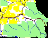
Burns, Colorado
Encyclopedia
Burns is an unincorporated town
and U.S. Post Office
in northern Eagle County
, Colorado
, United States
. The community is located along a remote stretch of the Colorado River
southwest of Kremmling
. It is accessible by dirt and gravel county roads from State Highway 131
and Interstate 70. The community is located on a hillside along the river, along the route of the Denver and Rio Grande Western Railroad
mainline (now the Union Pacific Railroad
) in the sandstone
canyons along the Colorado. It consists of a post office, as well as cluster of houses and trailers. Livestock
ranching is the primary industry in the area. The ZIP Code
of the Burns Post Office
is 80426.
opened on May 14, 1895.
Unincorporated area
In law, an unincorporated area is a region of land that is not a part of any municipality.To "incorporate" in this context means to form a municipal corporation, a city, town, or village with its own government. An unincorporated community is usually not subject to or taxed by a municipal government...
and U.S. Post Office
United States Postal Service
The United States Postal Service is an independent agency of the United States government responsible for providing postal service in the United States...
in northern Eagle County
Eagle County, Colorado
Eagle County is the thirteenth most populous of the 64 counties of the State of Colorado in the United States. The county is named for the Eagle River. The county population was 41,659 at U.S. Census 2000. The county seat is the Town of Eagle...
, Colorado
Colorado
Colorado is a U.S. state that encompasses much of the Rocky Mountains as well as the northeastern portion of the Colorado Plateau and the western edge of the Great Plains...
, United States
United States
The United States of America is a federal constitutional republic comprising fifty states and a federal district...
. The community is located along a remote stretch of the Colorado River
Colorado River
The Colorado River , is a river in the Southwestern United States and northwestern Mexico, approximately long, draining a part of the arid regions on the western slope of the Rocky Mountains. The watershed of the Colorado River covers in parts of seven U.S. states and two Mexican states...
southwest of Kremmling
Kremmling, Colorado
Kremmling is a Statutory Town in Grand County, Colorado, United States. The population was 1,578 at the 2000 census. The town sits along the upper Colorado River in the lower arid section of Middle Park between Byers Canyon and Gore Canyon...
. It is accessible by dirt and gravel county roads from State Highway 131
Colorado State Highway 131
State Highway 131 is a north–south state highway that connects U.S. Highway 40 east of Steamboat Springs to the north with Interstate 70 at Wolcott to the south...
and Interstate 70. The community is located on a hillside along the river, along the route of the Denver and Rio Grande Western Railroad
Denver and Rio Grande Western Railroad
The Denver & Rio Grande Western Railroad , often shortened to Rio Grande or D&RGW, formerly the Denver & Rio Grande Railroad, is a defunct U.S. railroad company. The railroad started as a narrow gauge line running south from Denver, Colorado in 1870; however, served mainly as a transcontinental...
mainline (now the Union Pacific Railroad
Union Pacific Railroad
The Union Pacific Railroad , headquartered in Omaha, Nebraska, is the largest railroad network in the United States. James R. Young is president, CEO and Chairman....
) in the sandstone
Sandstone
Sandstone is a sedimentary rock composed mainly of sand-sized minerals or rock grains.Most sandstone is composed of quartz and/or feldspar because these are the most common minerals in the Earth's crust. Like sand, sandstone may be any colour, but the most common colours are tan, brown, yellow,...
canyons along the Colorado. It consists of a post office, as well as cluster of houses and trailers. Livestock
Livestock
Livestock refers to one or more domesticated animals raised in an agricultural setting to produce commodities such as food, fiber and labor. The term "livestock" as used in this article does not include poultry or farmed fish; however the inclusion of these, especially poultry, within the meaning...
ranching is the primary industry in the area. The ZIP Code
ZIP Code
ZIP codes are a system of postal codes used by the United States Postal Service since 1963. The term ZIP, an acronym for Zone Improvement Plan, is properly written in capital letters and was chosen to suggest that the mail travels more efficiently, and therefore more quickly, when senders use the...
of the Burns Post Office
United States Postal Service
The United States Postal Service is an independent agency of the United States government responsible for providing postal service in the United States...
is 80426.
History
The town is named for Jack Burns, a trapper who built a cabin in the area. The Burns Post OfficeUnited States Postal Service
The United States Postal Service is an independent agency of the United States government responsible for providing postal service in the United States...
opened on May 14, 1895.

