
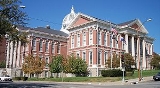
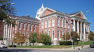
Buchanan County, Missouri
Encyclopedia
U.S. state
A U.S. state is any one of the 50 federated states of the United States of America that share sovereignty with the federal government. Because of this shared sovereignty, an American is a citizen both of the federal entity and of his or her state of domicile. Four states use the official title of...
of Missouri
Missouri
Missouri is a US state located in the Midwestern United States, bordered by Iowa, Illinois, Kentucky, Tennessee, Arkansas, Oklahoma, Kansas and Nebraska. With a 2010 population of 5,988,927, Missouri is the 18th most populous state in the nation and the fifth most populous in the Midwest. It...
. As of 2010, the population was 89,201. Its county seat
County seat
A county seat is an administrative center, or seat of government, for a county or civil parish. The term is primarily used in the United States....
is Saint Joseph
Saint Joseph, Missouri
Saint Joseph is the second largest city in northwest Missouri, only second to Kansas City in size, serving as the county seat for Buchanan County. As of the 2010 census, Saint Joseph had a total population of 76,780, making it the eighth largest city in the state. The St...
. When originally formed in 1838, the county was named Roberts County, after settler Hiram Roberts; it was renamed in 1839 for James Buchanan
James Buchanan
James Buchanan, Jr. was the 15th President of the United States . He is the only president from Pennsylvania, the only president who remained a lifelong bachelor and the last to be born in the 18th century....
, then a U.S. Senator
United States Senate
The United States Senate is the upper house of the bicameral legislature of the United States, and together with the United States House of Representatives comprises the United States Congress. The composition and powers of the Senate are established in Article One of the U.S. Constitution. Each...
, later President of the United States
President of the United States
The President of the United States of America is the head of state and head of government of the United States. The president leads the executive branch of the federal government and is the commander-in-chief of the United States Armed Forces....
. Sarah Davies, a Western Emigrant, in her diary entry of May 22, 1851 states “we camped on the black snake hills of bucannan county” she concludes her entry “beautiful green as fair as the eye can see a more beautiful sight I never saw”. The county, along with Andrew
Andrew County, Missouri
-External links:* from University of Missouri Division of Special Collections, Archives, and Rare Books...
and DeKalb
DeKalb County, Missouri
DeKalb County is a county located in the U.S. state of Missouri. As of 2010, the population is 12,892. The county was organized in 1845 and is named after the American Revolutionary War general Johann de Kalb. The county along with Buchanan and Andrew counties in Missouri and Doniphan County,...
counties in Missouri and Doniphan County, Kansas
Doniphan County, Kansas
Doniphan County is a county located in Northeast Kansas, in the Central United States. As of the 2010 census, the county population was 7,945. Its county seat is Troy and its most populous city is Wathena. The county along with Buchanan, Andrew, and DeKalb counties in Missouri is included in...
, is included in the St. Joseph Metropolitan Statistical Area, which in 2008 had an estimated population of 126,359.
Geography
According to the 2000 census, the county has a total area of 414.57 square miles (1,073.7 km²), of which 409.73 square miles (1,061.2 km²) (or 98.83%) is land and 4.84 square miles (12.5 km²) (or 1.17%) is water.Adjacent counties
- Andrew CountyAndrew County, Missouri-External links:* from University of Missouri Division of Special Collections, Archives, and Rare Books...
(north) - DeKalb CountyDeKalb County, MissouriDeKalb County is a county located in the U.S. state of Missouri. As of 2010, the population is 12,892. The county was organized in 1845 and is named after the American Revolutionary War general Johann de Kalb. The county along with Buchanan and Andrew counties in Missouri and Doniphan County,...
(northeast) - Clinton CountyClinton County, MissouriAs of the census of 2000, there were 18,979 people, 7,152 households, and 5,299 families residing in the county. The population density was 45 people per square mile . There were 7,877 housing units at an average density of 19 per square mile...
(east) - Platte CountyPlatte County, MissouriAs of the census of 2000, there were 73,781 people, 29,278 households, and 20,231 families residing in the county. The population density was 176 people per square mile . There were 30,902 housing units at an average density of 74 per square mile...
(south) - Atchison County, KansasAtchison County, KansasAtchison County is a county located in Northeast Kansas, in the Central United States. As of the 2010 census, the county population was 16,924. Its county seat and most populous city is Atchison. The county is named in honor of David Rice Atchison, a United States Senator from Missouri...
(southwest) - Doniphan County, KansasDoniphan County, KansasDoniphan County is a county located in Northeast Kansas, in the Central United States. As of the 2010 census, the county population was 7,945. Its county seat is Troy and its most populous city is Wathena. The county along with Buchanan, Andrew, and DeKalb counties in Missouri is included in...
(northwest)
Major highways
 Interstate 29
 Interstate 229Interstate 229 (Missouri)Interstate 229 in the state of Missouri, USA, is an approximately 14 mile Interstate Highway spur designed to speed traffic from Interstate 29 to downtown Saint Joseph....
 U.S. Route 36
 U.S. Route 59
 U.S. Route 71
 U.S. Route 169
 Route 6
 Route 31
 Route 116
 Route 371
Demographics
As of the censusCensus
A census is the procedure of systematically acquiring and recording information about the members of a given population. It is a regularly occurring and official count of a particular population. The term is used mostly in connection with national population and housing censuses; other common...
of 2000, there were 85,998 people, 33,557 households, and 21,912 families residing in the county. The population density
Population density
Population density is a measurement of population per unit area or unit volume. It is frequently applied to living organisms, and particularly to humans...
was 210 people per square mile (81/km²). There were 36,574 housing units at an average density of 89 per square mile (34/km²). The racial makeup of the county was 92.73% White
Race (United States Census)
Race and ethnicity in the United States Census, as defined by the Federal Office of Management and Budget and the United States Census Bureau, are self-identification data items in which residents choose the race or races with which they most closely identify, and indicate whether or not they are...
, 4.36% Black
Race (United States Census)
Race and ethnicity in the United States Census, as defined by the Federal Office of Management and Budget and the United States Census Bureau, are self-identification data items in which residents choose the race or races with which they most closely identify, and indicate whether or not they are...
or African American
Race (United States Census)
Race and ethnicity in the United States Census, as defined by the Federal Office of Management and Budget and the United States Census Bureau, are self-identification data items in which residents choose the race or races with which they most closely identify, and indicate whether or not they are...
, 0.42% Native American
Race (United States Census)
Race and ethnicity in the United States Census, as defined by the Federal Office of Management and Budget and the United States Census Bureau, are self-identification data items in which residents choose the race or races with which they most closely identify, and indicate whether or not they are...
, 0.45% Asian
Race (United States Census)
Race and ethnicity in the United States Census, as defined by the Federal Office of Management and Budget and the United States Census Bureau, are self-identification data items in which residents choose the race or races with which they most closely identify, and indicate whether or not they are...
, 0.02% Pacific Islander
Race (United States Census)
Race and ethnicity in the United States Census, as defined by the Federal Office of Management and Budget and the United States Census Bureau, are self-identification data items in which residents choose the race or races with which they most closely identify, and indicate whether or not they are...
, 0.65% from other races
Race (United States Census)
Race and ethnicity in the United States Census, as defined by the Federal Office of Management and Budget and the United States Census Bureau, are self-identification data items in which residents choose the race or races with which they most closely identify, and indicate whether or not they are...
, and 1.37% from two or more races. 2.43% of the population were Hispanic
Race (United States Census)
Race and ethnicity in the United States Census, as defined by the Federal Office of Management and Budget and the United States Census Bureau, are self-identification data items in which residents choose the race or races with which they most closely identify, and indicate whether or not they are...
or Latino
Race (United States Census)
Race and ethnicity in the United States Census, as defined by the Federal Office of Management and Budget and the United States Census Bureau, are self-identification data items in which residents choose the race or races with which they most closely identify, and indicate whether or not they are...
of any race.
There were 33,557 households out of which 30.60% had children under the age of 18 living with them, 49.30% were married couples
Marriage
Marriage is a social union or legal contract between people that creates kinship. It is an institution in which interpersonal relationships, usually intimate and sexual, are acknowledged in a variety of ways, depending on the culture or subculture in which it is found...
living together, 12.00% had a female householder with no husband present, and 34.70% were non-families. 28.90% of all households were made up of individuals and 12.50% had someone living alone who was 65 years of age or older. The average household size was 2.42 and the average family size was 2.98.
In the county the population was spread out with 24.30% under the age of 18, 11.00% from 18 to 24, 28.50% from 25 to 44, 21.20% from 45 to 64, and 15.00% who were 65 years of age or older. The median age was 36 years. For every 100 females there were 96.70 males. For every 100 females age 18 and over, there were 93.90 males.
The median income for a household in the county was $34,704, and the median income for a family was $42,408. Males had a median income of $31,697 versus $21,827 for females. The per capita income
Per capita income
Per capita income or income per person is a measure of mean income within an economic aggregate, such as a country or city. It is calculated by taking a measure of all sources of income in the aggregate and dividing it by the total population...
for the county was $17,882. About 8.50% of families and 12.20% of the population were below the poverty line, including 15.00% of those under age 18 and 9.60% of those age 65 or over.
Villages
- AgencyAgency, MissouriAgency is a village in Buchanan County, Missouri in the United States. The population was 599 at the 2000 census. It is part of the St. Joseph, MO–KS Metropolitan Statistical Area.-Geography:Agency is located at ....
- De KalbDe Kalb, MissouriDe Kalb is a city in Buchanan County, Missouri, United States. The population was 257 at the 2000 census, at which time it was a town. It is part of the St...
- Lewis and Clark VillageLewis and Clark Village, MissouriLewis and Clark Village is a village in Buchanan County, Missouri, United States. The population was 155 at the 2000 census, at which time it was a town. It is part of the St...
- RushvilleRushville, MissouriRushville is a village in Buchanan County, Missouri, United States. The population was 280 at the 2000 census, at which time it was a town. It is part of the St...
Townships
Buchanan County is divided into twelve townshipsTownship (United States)
A township in the United States is a small geographic area. Townships range in size from 6 to 54 square miles , with being the norm.The term is used in three ways....
:
|
Jackson Township, Buchanan County, Missouri Jackson Township is one of twelve townships in Buchanan County, Missouri, USA. As of the 2000 census, its population was 516.-Geography:Jackson Township covers an area of and contains no incorporated settlements. It contains three cemeteries: Brinton, Mount Pleasant and Yates.Benner Lake is... Lake Township, Buchanan County, Missouri Lake Township is one of twelve townships in Buchanan County, Missouri, USA. As of the 2000 census, its population was 49.-Geography:Lake Township covers an area of and contains no incorporated settlements.-References:* -External links:* *... Marion Township, Buchanan County, Missouri Marion Township is one of twelve townships in Buchanan County, Missouri, USA. As of the 2000 census, its population was 1,226.-Geography:Marion Township covers an area of and contains one incorporated settlement, Easton... Platte Township, Buchanan County, Missouri Platte Township is one of twelve townships in Buchanan County, Missouri, USA. As of the 2000 census, its population was 416.-Geography:Platte Township covers an area of and contains no incorporated settlements... |
Rush Township, Buchanan County, Missouri Rush Township is one of twelve townships in Buchanan County, Missouri, USA. As of the 2000 census, its population was 871.-Geography:Rush Township covers an area of and contains two incorporated settlements: Lewis and Clark Village and Rushville. It contains four cemeteries: Armstrong, Gore,... Tremont Township, Buchanan County, Missouri Tremont Township is one of twelve townships in Buchanan County, Missouri, USA. As of the 2000 census, its population was 634.-Geography:Tremont Township covers an area of and contains no incorporated settlements. It contains two cemeteries: Bretz and New Harmony.The stream of Riley Branch runs... Washington Township, Buchanan County, Missouri Washington Township is one of twelve townships in Buchanan County, Missouri, USA. As of the 2000 census, its population was 75,694.-Geography:Washington Township covers an area of and contains one incorporated settlement, St. Joseph... Wayne Township, Buchanan County, Missouri Wayne Township is one of twelve townships in Buchanan County, Missouri, USA. As of the 2000 census, its population was 705.-Geography:Wayne Township covers an area of and contains no incorporated settlements. It contains two cemeteries: Bethel and Kerlin.... |
See also
- List of counties in Missouri
- Missouri census statistical areasMissouri census statistical areasThe United States Census Bureau has defined 3 Combined Statistical Areas , 8 Metropolitan Statistical Areas , and 20 Micropolitan Statistical Areas in the State of Missouri...
- National Register of Historic Places listings in Buchanan County, Missouri
External links
- Buchanan County government's website
- St. Joseph Missouri City Directories
- St. Joseph Missouri Yearbook Indexes
- Digitized 1930 Plat Book of Buchanan County from University of MissouriUniversity of MissouriThe University of Missouri System is a state university system providing centralized administration for four universities, a health care system, an extension program, five research and technology parks, and a publishing press. More than 64,000 students are currently enrolled at its four campuses...
Division of Special Collections, Archives, and Rare Books