
Bristol County, Massachusetts
Encyclopedia
Demographics
As of the censusCensus
A census is the procedure of systematically acquiring and recording information about the members of a given population. It is a regularly occurring and official count of a particular population. The term is used mostly in connection with national population and housing censuses; other common...
of 2000, there were 534,678 people, 205,411 households, and 140,706 families residing in the county. The population density
Population density
Population density is a measurement of population per unit area or unit volume. It is frequently applied to living organisms, and particularly to humans...
was 962 people per square mile (371/km²). There were 216,918 housing units at an average density of 390 per square mile (151/km²). The racial makeup of the county was 90.98% White
Race (United States Census)
Race and ethnicity in the United States Census, as defined by the Federal Office of Management and Budget and the United States Census Bureau, are self-identification data items in which residents choose the race or races with which they most closely identify, and indicate whether or not they are...
, 2.03% Black
Race (United States Census)
Race and ethnicity in the United States Census, as defined by the Federal Office of Management and Budget and the United States Census Bureau, are self-identification data items in which residents choose the race or races with which they most closely identify, and indicate whether or not they are...
or African American
Race (United States Census)
Race and ethnicity in the United States Census, as defined by the Federal Office of Management and Budget and the United States Census Bureau, are self-identification data items in which residents choose the race or races with which they most closely identify, and indicate whether or not they are...
, 0.24% Native American
Race (United States Census)
Race and ethnicity in the United States Census, as defined by the Federal Office of Management and Budget and the United States Census Bureau, are self-identification data items in which residents choose the race or races with which they most closely identify, and indicate whether or not they are...
, 1.26% Asian
Race (United States Census)
Race and ethnicity in the United States Census, as defined by the Federal Office of Management and Budget and the United States Census Bureau, are self-identification data items in which residents choose the race or races with which they most closely identify, and indicate whether or not they are...
, 0.03% Pacific Islander
Race (United States Census)
Race and ethnicity in the United States Census, as defined by the Federal Office of Management and Budget and the United States Census Bureau, are self-identification data items in which residents choose the race or races with which they most closely identify, and indicate whether or not they are...
, 3.12% from other races
Race (United States Census)
Race and ethnicity in the United States Census, as defined by the Federal Office of Management and Budget and the United States Census Bureau, are self-identification data items in which residents choose the race or races with which they most closely identify, and indicate whether or not they are...
, and 2.34% from two or more races. 3.60% of the population was Hispanic
Race (United States Census)
Race and ethnicity in the United States Census, as defined by the Federal Office of Management and Budget and the United States Census Bureau, are self-identification data items in which residents choose the race or races with which they most closely identify, and indicate whether or not they are...
or Latino
Race (United States Census)
Race and ethnicity in the United States Census, as defined by the Federal Office of Management and Budget and the United States Census Bureau, are self-identification data items in which residents choose the race or races with which they most closely identify, and indicate whether or not they are...
of any race. 29.7% were of Portuguese
Portuguese people
The Portuguese are a nation and ethnic group native to the country of Portugal, in the west of the Iberian peninsula of south-west Europe. Their language is Portuguese, and Roman Catholicism is the predominant religion....
, 13.0% Irish
Irish people
The Irish people are an ethnic group who originate in Ireland, an island in northwestern Europe. Ireland has been populated for around 9,000 years , with the Irish people's earliest ancestors recorded having legends of being descended from groups such as the Nemedians, Fomorians, Fir Bolg, Tuatha...
, 8.9% French
French people
The French are a nation that share a common French culture and speak the French language as a mother tongue. Historically, the French population are descended from peoples of Celtic, Latin and Germanic origin, and are today a mixture of several ethnic groups...
, 8.2% English
English people
The English are a nation and ethnic group native to England, who speak English. The English identity is of early mediaeval origin, when they were known in Old English as the Anglecynn. England is now a country of the United Kingdom, and the majority of English people in England are British Citizens...
, 6.8% Italian
Italian people
The Italian people are an ethnic group that share a common Italian culture, ancestry and speak the Italian language as a mother tongue. Within Italy, Italians are defined by citizenship, regardless of ancestry or country of residence , and are distinguished from people...
and 6.4% French Canadian
French Canadian
French Canadian or Francophone Canadian, , generally refers to the descendents of French colonists who arrived in New France in the 17th and 18th centuries...
ancestry according to Census 2000. 79.1% spoke English
English language
English is a West Germanic language that arose in the Anglo-Saxon kingdoms of England and spread into what was to become south-east Scotland under the influence of the Anglian medieval kingdom of Northumbria...
, 13.9% Portuguese
Portuguese language
Portuguese is a Romance language that arose in the medieval Kingdom of Galicia, nowadays Galicia and Northern Portugal. The southern part of the Kingdom of Galicia became independent as the County of Portugal in 1095...
, 2.9% Spanish
Spanish language
Spanish , also known as Castilian , is a Romance language in the Ibero-Romance group that evolved from several languages and dialects in central-northern Iberia around the 9th century and gradually spread with the expansion of the Kingdom of Castile into central and southern Iberia during the...
and 1.6% French
French language
French is a Romance language spoken as a first language in France, the Romandy region in Switzerland, Wallonia and Brussels in Belgium, Monaco, the regions of Quebec and Acadia in Canada, and by various communities elsewhere. Second-language speakers of French are distributed throughout many parts...
as their first language. The United States Census Bureau reported Bristol County as being one of two counties in the United States with a plurality of people of Portuguese
Portuguese people
The Portuguese are a nation and ethnic group native to the country of Portugal, in the west of the Iberian peninsula of south-west Europe. Their language is Portuguese, and Roman Catholicism is the predominant religion....
ancestry (the other being the contiguous Bristol County
Bristol County, Rhode Island
The border with Bristol County, Massachusetts is rather unusual since the counties both share the same name. The only other instances in which two neighboring counties with the same name share a state border are Sabine County, Texas and Sabine Parish, Louisiana, Union Parish, Louisiana and Union...
Rhode Island
Rhode Island
The state of Rhode Island and Providence Plantations, more commonly referred to as Rhode Island , is a state in the New England region of the United States. It is the smallest U.S. state by area...
).
There were 205,411 households out of which 33.00% had children under the age of 18 living with them, 51.60% were married couples
Marriage
Marriage is a social union or legal contract between people that creates kinship. It is an institution in which interpersonal relationships, usually intimate and sexual, are acknowledged in a variety of ways, depending on the culture or subculture in which it is found...
living together, 13.00% had a female householder with no husband present, and 31.50% were non-families. 26.50% of all households were made up of individuals and 11.00% had someone living alone who was 65 years of age or older. The average household size was 2.54 and the average family size was 3.08.
In the county the population was spread out with 24.60% under the age of 18, 8.50% from 18 to 24, 30.50% from 25 to 44, 22.20% from 45 to 64, and 14.10% who were 65 years of age or older. The median age was 37 years. For every 100 females there were 92.40 males. For every 100 females age 18 and over, there were 88.50 males.
The median income for a household in the county was $43,496, and the median income for a family was $53,733. Males had a median income of $39,361 versus $27,516 for females. The per capita income
Per capita income
Per capita income or income per person is a measure of mean income within an economic aggregate, such as a country or city. It is calculated by taking a measure of all sources of income in the aggregate and dividing it by the total population...
for the county was $20,978. About 7.80% of families and 10.00% of the population were below the poverty line, including 13.00% of those under age 18 and 12.00% of that age 65 or over.
Transport
Transportation authorities providing public bus service include the Greater Attleboro Taunton Regional Transit AuthorityGreater Attleboro Taunton Regional Transit Authority
The Greater Attleboro Taunton Regional Transit Authority oversees and coordinates public transportation in the areas of Attleboro and Taunton, Massachusetts and nearby areas. It operates daily on fixed routes and schedules within 26 communities in Bristol, Norfolk, and Plymouth counties...
; and the Southeastern Regional Transit Authority serving the Fall River and New Bedford areas.
Airports include the Mansfield Municipal Airport
Mansfield Municipal Airport
Mansfield Municipal Airport is a public airport located two miles southeast of the central business district of Mansfield, a town in Bristol County, Massachusetts, USA....
, Myricks Airport
Myricks Airport
Myricks Airport, in Berkley, Massachusetts, is a public airport owned by Murray Randall. It has one runway, averages 88 flights per week, and has approximately 9 aircraft based on its field....
, New Bedford Municipal Airport and Taunton Municipal Airport
Taunton Municipal Airport
Taunton Municipal Airport , also known as King Field, is a public use airport located three nautical miles east of the central business district of Taunton, a city in Bristol County, Massachusetts, United States. It is located in the East Taunton neighborhood of the city. The city-owned airport is...
; of these, the New Bedford airport is a commercial airport, with flights serving the Cape Cod
Cape Cod
Cape Cod, often referred to locally as simply the Cape, is a cape in the easternmost portion of the state of Massachusetts, in the Northeastern United States...
, Nantucket and Martha's Vineyard
Martha's Vineyard
Martha's Vineyard is an island located south of Cape Cod in Massachusetts, known for being an affluent summer colony....
area.
The Providence/Stoughton Line
Providence/Stoughton Line
The Providence/Stoughton Line is a line of the MBTA Commuter Rail system running southwest from Boston, Massachusetts, USA. The main line was originally built by the Boston and Providence Rail Road, and now carries service between Boston and T. F. Green Airport, Rhode Island...
of the MBTA commuter rail
MBTA Commuter Rail
The MBTA Commuter Rail serves as the regional rail arm of the Massachusetts Bay Transportation Authority, in the United States. It is operated under contract by the Massachusetts Bay Commuter Railroad Company a joint partnership of Veolia Transportation, Bombardier Transportation and Alternate...
has stops in Mansfield, Attleboro, and South Attleboro. The line provides connections to Providence and Boston (at Back Bay Station and South Station), as well as intermediate stops. An extension has been completed that connects to T.F. Green Airport
T. F. Green Airport (MBTA station)
T. F. Green Airport is a train station and intermodal facility in Warwick, Rhode Island on the Northeast Corridor, adjacent to T. F. Green Airport...
.
Cities, towns, and villages*
- AcushnetAcushnet, MassachusettsAcushnet is a town in Bristol County, Massachusetts, United States. The population was 10,303 at the 2010 census.- History :Acushnet was first settled in 1659. It has been included as a part of three separate towns throughout its history. It was formerly the northeastern section of the town of...
- Acushnet CenterAcushnet Center, MassachusettsAcushnet Center is a census-designated place in the town of Acushnet in Bristol County, Massachusetts, United States. The population was 3,171 at the 2000 census.-Geography:Acushnet Center is located at ....
(a village in Acushnet)
- Acushnet Center
- AttleboroAttleboro, MassachusettsAttleboro is a city in Bristol County, Massachusetts, United States and is immediately north of Pawtucket, Rhode Island. Once known as "The Jewelry Capital of the World" for its many jewelry manufacturers, Attleboro had a population of 42,068 at the 2000 census, and a population of 43,645 as of...
- South AttleboroSouth Attleboro, MassachusettsSouth Attleboro is a neighborhood of Attleboro, a city in Bristol County, Massachusetts, United States. It is perhaps best known for the South Attleboro station on the Attleboro/Stoughton Line of the MBTA Commuter Rail. U.S. 1 and Route 1A pass through the area, which lies just north of the Rhode...
(a village in Attleboro)
- South Attleboro
- BerkleyBerkley, MassachusettsBerkley is a town in Bristol County, Massachusetts, United States. The population was 5,749 at the 2000 census, making it the least populated town in the county.-Geography:...
- MyricksMyricks, MassachusettsMyricks, Massachusetts, is an association community or populated place located in Bristol County, Massachusetts at latitude 41.831 and longitude -71.027. The elevation is 62 feet. Myricks appears on the Assonet U.S. Geological Survey Map....
(a village in Berkley)
- Myricks
- DartmouthDartmouth, MassachusettsDartmouth is a town in Bristol County, Massachusetts, United States established in 1664. The population was 30,665 at the 2000 census. It is the location of the University of Massachusetts Dartmouth....
- Bliss CornerBliss Corner, MassachusettsBliss Corner is a census-designated place in the town of Dartmouth in Bristol County, Massachusetts, United States. The population was 5,466 at the 2000 census.-Geography:Bliss Corner is located at ....
(a village in Dartmouth) - Smith MillsSmith Mills, MassachusettsSmith Mills is a census-designated place in the town of Dartmouth in Bristol County, Massachusetts, United States. The population was 4,432 at the 2000 census.-Geography:Smith Mills is located at ....
(a village in Dartmouth) - PadanaramPadanaramPadanaram is a village in South Dartmouth, Massachusetts, Bristol County, Massachusetts, United States. It lies along the Apponagansett River or Apponagansett Bay....
(a village in Dartmouth)
- Bliss Corner
- DightonDighton, MassachusettsDighton is a town in Bristol County, Massachusetts, United States. The population was 6,175 at the 2000 census. The town is located on the western shore of the Taunton River in the southeastern part of the state.- History :...
- North Dighton (a village in Dighton)
- EastonEaston, MassachusettsEaston is a town in Bristol County, Massachusetts, United States. The population was 23,112 at the 2010 census.Easton is governed by an elected committee of selectmen and a town administrator.- History :...
- FairhavenFairhaven, MassachusettsFairhaven is a town in Bristol County, Massachusetts, in the United States. It is located on the south coast of Massachusetts where the Acushnet River flows into Buzzards Bay, an arm of the Atlantic Ocean...
- Fall RiverFall River, MassachusettsFall River is a city in Bristol County, Massachusetts, in the United States. It is located about south of Boston, southeast of Providence, Rhode Island, and west of New Bedford and south of Taunton. The city's population was 88,857 during the 2010 census, making it the tenth largest city in...
- Flint Village (a village in Fall River)
- Bowensville (a village in Fall River)
- Highlands (a village in Fall River)
- Fall River Station (a village in Fall River)
- Steep Brook (a village in Fall River)
- Globe Village (a village in Fall River)
- FreetownFreetown, MassachusettsFreetown is a town in Bristol County, Massachusetts, United States. The population was 8,870 at the 2010 census.Freetown is one of the oldest communities in the United States, having been settled by the Pilgrims and their descendants in the latter half of the 17th century. The town once included...
- AssonetAssonet, MassachusettsAssonet is one of two villages in the town of Freetown, Massachusetts in Bristol County, Massachusetts, United States. An original part of the town, Assonet was settled in 1659 along with the city of Fall River, then a part of Freetown. It rests on the banks of the Assonet River...
(a village in Freetown) - East FreetownEast Freetown, MassachusettsEast Freetown is one of two villages in the town of Freetown, Bristol County, Massachusetts, United States. Added to the town in 1747, East Freetown was originally an outpost settlement of Tiverton, Rhode Island, then a part of Massachusetts. It rests on the shore of Long Pond.- History :East...
(a village in Freetown)
- Assonet
- MansfieldMansfield, MassachusettsMansfield is a town in Bristol County, Massachusetts, United States. As of the United States 2010 Census, the town population is 23,184. Mansfield is in the south-southwest suburbs of Boston and is also close to Providence, Rhode Island....
- Mansfield CenterMansfield Center, MassachusettsMansfield Center is a census-designated place in the town of Mansfield in Bristol County, Massachusetts, United States. The population was 7,320 at the 2000 census.-Geography:Mansfield Center is located at ....
(a village in Mansfield)
- Mansfield Center
- New BedfordNew Bedford, MassachusettsNew Bedford is a city in Bristol County, Massachusetts, United States, located south of Boston, southeast of Providence, Rhode Island, and about east of Fall River. As of the 2010 census, the city had a total population of 95,072, making it the sixth-largest city in Massachusetts...
- North AttleboroughNorth Attleborough, MassachusettsNorth Attleborough, commonly written North Attleboro, is a town in Bristol County, Massachusetts, United States. The population was 28,712 at the 2010 United States Census.The village of North Attleborough Center is located in the town.-History:...
- North Attleborough CenterNorth Attleborough Center, MassachusettsNorth Attleborough Center is a census-designated place in the town of North Attleborough in Bristol County, Massachusetts, United States. The population was 16,796 at the 2000 census.-Geography:...
(a village in North Attleborough)
- North Attleborough Center
- NortonNorton, MassachusettsNorton is a town in Bristol County, Massachusetts, United States, and contains the village of Norton Center. The population was 18,036 at the 2000 census...
- Norton CenterNorton Center, MassachusettsNorton Center is a census-designated place in the town of Norton in Bristol County, Massachusetts, United States. The population was 2,618 at the 2000 census.-Geography:Norton Center is located at ....
(a village in Norton)
- Norton Center
- RaynhamRaynham, MassachusettsRaynham is a town in Bristol County, Massachusetts, United States. The population was 11,739 at the 2000 census. It has one village, Raynham Center.-History:...
- Raynham CenterRaynham Center, MassachusettsRaynham Center is a census-designated place in the town of Raynham in Bristol County, Massachusetts, United States. The population was 3,633 at the 2000 census.-Geography:Raynham Center is located at ....
(a village in Raynham) - Tracy Corner (a village in Raynham)
- North Raynham (a village in Raynham)
- Squawbetty (a village in Raynham)
- Prattville (a village in Raynham)
- Gushee Pond (a village in Raynham)
- Raynham Center
- RehobothRehoboth, MassachusettsRehoboth is a town in Bristol County, Massachusetts, United States. The population was 10,172 at the 2000 census.-History:It was incorporated in 1643 making it one of the earliest Massachusetts towns to be incorporated. The Rehoboth Carpenter Family is among the founding families...
- Four Corners (a village in Rehoboth)
- Hornbine (a village in Rehoboth)
- Kingmans Corner (a village in Rehoboth)
- North Rehoboth (a village in Rehoboth)
- Pecks Corner (a village in Rehoboth)
- Perrys Corner (a village in Rehoboth)
- Perryville (a village in Rehoboth)
- Rehoboth Village (a village in Rehoboth)
- South Rehoboth (a village in Rehoboth)
- SeekonkSeekonk, MassachusettsSeekonk is a town in Bristol County, Massachusetts, United States, on the Massachusetts border. It was incorporated in 1812 from the western half of Rehoboth. The population was 13,722 at the 2010 census. Until 1862, the town of Seekonk also included what is now the City of East Providence, Rhode...
- North SeekonkNorth Seekonk, MassachusettsNorth Seekonk is a census-designated place in the town of Seekonk in Bristol County, Massachusetts, United States. The population was 2,598 at the 2000 census.-Geography:North Seekonk is located at ....
(a village in Seekonk)
- North Seekonk
- SomersetSomerset, MassachusettsSomerset is a town in Bristol County, Massachusetts, United States. The population was 18,234 at the 2000 census. It is the birthplace and hometown of Clifford Milburn Holland , the chief engineer and namesake of the Holland Tunnel in New York City....
- Pottersville (a village in Somerset)
- SwanseaSwansea, MassachusettsSwansea is a town in Bristol County in southeastern Massachusetts.It is located at the mouth of the Taunton River, just west of Fall River, 47 miles south of Boston; and 12 miles southeast of Providence, Rhode Island....
- Ocean GroveOcean Grove, MassachusettsOcean Grove is a census-designated place in the town of Swansea in Bristol County, Massachusetts, United States on the north shore of Mount Hope Bay near the Cole River. The population was 3,012 at the 2000 census.-Geography:...
(a village in Swansea)
- Ocean Grove
- TauntonTaunton, MassachusettsTaunton is a city in Bristol County, Massachusetts, United States. It is the seat of Bristol County and the hub of the Greater Taunton Area. The city is located south of Boston, east of Providence, north of Fall River and west of Plymouth. The City of Taunton is situated on the Taunton River...
- East TauntonEast Taunton, MassachusettsEast Taunton is a suburban neighborhood of Taunton, Massachusetts, United States.-Economy:East Taunton is home to Massassoit State Park which offers camping, mountain bike trails, and kayaking and fishing on the park's four main lakes, the largest of which is Lake Rico. Other lakes in the park...
(a village in Taunton) - Weir VillageWeir Village, MassachusettsWeir Village is a village of the city of Taunton in Bristol County, Massachusetts, located about one mile south of the city center on the banks of the Taunton River, near the point where it becomes tidal...
(a village in Taunton) - Whittenton Junction (a village in Taunton)
- Britannia (a village in Taunton)
- North TauntonNorth Taunton, MassachusettsNorth Taunton is an unofficial neighborhood in the city of Taunton, Massachusetts. It is not a census-designated area, but is considered by local residents as a municipally designated populated region of the city.- Location :...
(a village in Taunton) - OaklandOakland, MassachusettsOakland is one of five primary historic neighborhoods of the city of Taunton, Massachusetts. Although these neighborhoods are not census-designated areas, they are municipally designated populated regions of the city.-Location:...
(a village in Taunton) - WestvilleWestville, MassachusettsWestville is one of five primary historic neighborhoods of the city of Taunton, Massachusetts. Although these neighborhoods are not census-designated areas, they are municipally designated populated regions of the city.- Location :...
(a village in Taunton) - Wade's Corner (a village in Taunton)
- Whittenton (a village in Taunton)
- East Taunton
- WestportWestport, MassachusettsWestport is a town in Bristol County, Massachusetts, United States. The population was 15,532 at the 2010 census.The village of North Westport lies in the town.- History :...
- North WestportNorth Westport, MassachusettsNorth Westport is a census-designated place in the town of Westport in Bristol County, Massachusetts, United States. The population was 4,533 at the 2000 census.-Geography:North Westport is located at ....
(a village in Westport)
- North Westport
See also
- Bristol Community CollegeBristol Community CollegeBristol Community College is a two-year community college located in Fall River, Massachusetts.-History:The college was originally established in December 1965 when it was instituted by the Massachusetts Board of Regional Community Colleges. Former President John F...
- Horseneck Beach State ReservationHorseneck Beach State ReservationThe Horseneck Beach State Reservation is a large public state beach reservation on Westport River, Westport Harbor, Horseneck Channel, The Let, Rhode Island Sound, and Buzzards Bay, in the southern portion of the town of Westport, Massachusetts, USA....
- Freetown-Fall River State ForestFreetown-Fall River State ForestThe Freetown-Fall River State Forest is a large tract of forest land located in Freetown and Fall River, Massachusetts. It is owned by the Commonwealth of Massachusetts and operated by the Department of Conservation and Recreation...
- National Register of Historic Places listings in Bristol County, Massachusetts
- Southern New England School of LawSouthern New England School of LawSouthern New England School of Law was a non-profit law school located in North Dartmouth, Massachusetts that operated from 1981 to 2010...
- Taunton RiverTaunton RiverThe Taunton River , is a river in southeastern Massachusetts in the United States. It arises from the confluence of the Town River and Matfield River, in the town of Bridgewater...
- Taunton River WatershedTaunton River Watershedright|thumb|200px|An USGS map of the Taunton River WatershedThe Taunton River watershed or Taunton River basin is made up of of rivers, lakes, ponds, streams, and wetlands in southeastern Massachusetts, USA. It is the second largest watershed in the state...
- University of Massachusetts DartmouthUniversity of Massachusetts DartmouthThe University of Massachusetts Dartmouth is one of five campuses and operating subdivisions of the University of Massachusetts . It is located in North Dartmouth, Massachusetts, United States, in the center of the South Coast region, between the cities of New Bedford to the east and Fall River...
- Wheaton CollegeWheaton College (Massachusetts)Wheaton College is a four-year, private liberal arts college with an approximate student body of 1,550. Wheaton's residential campus is located in Norton, Massachusetts, between Boston, Massachusetts and Providence, Rhode Island. Founded in 1834 as a female seminary, it is one of the oldest...
Further reading
- History of Bristol County, Massachusetts with Biographical Sketches of many of its Pioneers and Prominent Men, Part 1 edited by Duane Hamilton Hurd. J.W. Lewis and Co., 1883. http://books.google.com/books?id=uauYBOCKCS0C&source=gbs_navlinks_s
- A history of Bristol County, Massachusetts, Volume 1 by Frank Walcott Hutt. Lewis Historical Pub. Co., Inc., 1924.
External links
- Bristol Community College's Home Page
- Bristol County Convention & Visitors Bureau's Official Home Page
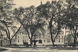
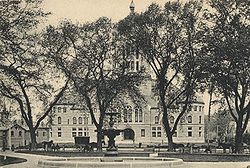
- Bristol County Superior Courthouse (in Taunton)
- Map of cities and towns of Massachusetts
- Southeastern Regional Planning & Economic Development's Official Home Page
- Taunton River Stewardship Program: The Wildlands Trust of Southeastern Massachusetts' Official Home Page
- Taunton River Watershed Alliance's Official Home Page
- Bristol County Quidditch Club
- Bristol County Sheriff's Office
- Taunton Northern District Registry of Deeds
- Fall River Southwest District Registry of Deeds
- New Bedford Southeast District Registry of Deeds
- Bristol County Retirement System
- Wall & Gray. 1871 Atlas of Massachusetts. Map of Massachusetts. USA. New England. Counties—Berkshire, Franklin, Hampshire and Hampden, Worcester, Middlesex, Essex and Norfolk, Boston-Suffolk,Plymouth, Bristol, Barnstable and Dukes (Cape Cod). Cities—Springfield, Worcester, Lowell, Lawrence, Haverhill, Newburyport, Salem, Lynn, Taunton, Fall River. New Bedford. These 1871 maps of the Counties and Cities are useful to see the roads and rail lines.
- Beers, D.G. (1872). Atlas of Essex County, Map of Massachusetts Plate 5. Click on the map for a very large image.