

Bonner County, Idaho
Encyclopedia
Bonner County is a county located in the northern part of the U.S. state
of Idaho
. Established in 1907, it was named for Edwin L. Bonner, a ferry operator. As of the 2010 census, the county had a population of 40,877. The county seat
and largest city is Sandpoint
.
. It was named for travel entrepreneur Edwin L. Bonner, a ferry operator. Bonners Ferry
is now in Boundary County
, which was formed in 1915 from the northern portion of Bonner County.
of 2000, there were 36,835 people, 14,693 households, and 10,270 families residing in the county. The population density
was 21 people per square mile (8/km²). There were 19,646 housing units at an average density of 11 per square mile (4/km²). The racial makeup of the county was 96.58% White
, 0.11% Black
or African American
, 0.87% Native American
, 0.27% Asian
, 0.05% Pacific Islander
, 0.42% from other races
, and 1.70% from two or more races. 1.64% of the population were Hispanic
or Latino
of any race. 20.9% were of German
, 11.7% English
, 11.7% American
, 9.6% Irish
and 5.3% Norwegian ancestry according to Census 2000.
There were 14,693 households out of which 30.60% had children under the age of 18 living with them, 58.60% were married couples
living together, 7.50% had a female householder with no husband present, and 30.10% were non-families. 24.00% of all households were made up of individuals and 8.20% had someone living alone who was 65 years of age or older. The average household size was 2.49 and the average family size was 2.94.
In the county the population was spread out with 25.50% under the age of 18, 6.70% from 18 to 24, 25.40% from 25 to 44, 29.30% from 45 to 64, and 13.10% who were 65 years of age or older. The median age was 41 years. For every 100 females there were 100.30 males. For every 100 females age 18 and over, there were 98.20 males.
The median income for a household in the county was $32,803, and the median income for a family was $37,930. Males had a median income of $32,504 versus $21,086 for females. The per capita income
for the county was $17,263. About 11.90% of families and 15.50% of the population were below the poverty line, including 21.20% of those under age 18 and 10.20% of those age 65 or over.
U.S. state
A U.S. state is any one of the 50 federated states of the United States of America that share sovereignty with the federal government. Because of this shared sovereignty, an American is a citizen both of the federal entity and of his or her state of domicile. Four states use the official title of...
of Idaho
Idaho
Idaho is a state in the Rocky Mountain area of the United States. The state's largest city and capital is Boise. Residents are called "Idahoans". Idaho was admitted to the Union on July 3, 1890, as the 43rd state....
. Established in 1907, it was named for Edwin L. Bonner, a ferry operator. As of the 2010 census, the county had a population of 40,877. The county seat
County seat
A county seat is an administrative center, or seat of government, for a county or civil parish. The term is primarily used in the United States....
and largest city is Sandpoint
Sandpoint, Idaho
Sandpoint is the largest city in, and the county seat of, Bonner County, Idaho, United States. Its population was 7,365 at the 2010 census.Sandpoint's major economic contributors include forest products and light manufacturing, tourism and recreation and government services...
.
History
Bonner County was formed on February 21, 1907, from sections of Kootenai CountyKootenai County, Idaho
Kootenai County is a county located in the U.S. state of Idaho. The county was established in 1864, named after Kootenai tribe. The entire county comprises the Coeur d'Alene, Idaho Metropolitan Statistical Area. The population was 138,494 at the 2010 census...
. It was named for travel entrepreneur Edwin L. Bonner, a ferry operator. Bonners Ferry
Bonners Ferry, Idaho
Bonners Ferry is a city in and the county seat of Boundary County, Idaho, United States. The population was 2,543 at the 2010 census.-History:...
is now in Boundary County
Boundary County, Idaho
Boundary County is a county located in the U.S. state of Idaho. As of the 2010 Census the county had a population of 10,972. The county seat and largest city is Bonners Ferry....
, which was formed in 1915 from the northern portion of Bonner County.
Geography
According to the 2000 census, the county has a total area of 1919.59 square miles (4,971.7 km²), of which 1737.67 square miles (4,500.5 km²) (or 90.52%) is land and 181.92 square miles (471.2 km²) (or 9.48%) is water.Adjacent counties
- Boundary CountyBoundary County, IdahoBoundary County is a county located in the U.S. state of Idaho. As of the 2010 Census the county had a population of 10,972. The county seat and largest city is Bonners Ferry....
- north - Lincoln CountyLincoln County, Montana-National protected areas:* Pacific Northwest National Scenic Trail *Flathead National Forest *Kaniksu National Forest *Kootenai National Forest -Demographics:...
, MontanaMontanaMontana is a state in the Western United States. The western third of Montana contains numerous mountain ranges. Smaller, "island ranges" are found in the central third of the state, for a total of 77 named ranges of the Rocky Mountains. This geographical fact is reflected in the state's name,...
- east - Sanders CountySanders County, MontanaSanders County is a county located in the U.S. state of Montana. As of 2010, the population was 11,413. Its county seat is Thompson Falls.-Geography:According to the U.S...
, MontanaMontanaMontana is a state in the Western United States. The western third of Montana contains numerous mountain ranges. Smaller, "island ranges" are found in the central third of the state, for a total of 77 named ranges of the Rocky Mountains. This geographical fact is reflected in the state's name,...
- southeast - Shoshone CountyShoshone County, IdahoShoshone County is a county located in the U.S. state of Idaho. The county was established in 1864, named for the Native American Shoshone tribe. The population was 12,765 at the 2010 census. Shoshone County is commonly referred to as the Silver Valley, due to its century-old mining history...
- southeast - Kootenai CountyKootenai County, IdahoKootenai County is a county located in the U.S. state of Idaho. The county was established in 1864, named after Kootenai tribe. The entire county comprises the Coeur d'Alene, Idaho Metropolitan Statistical Area. The population was 138,494 at the 2010 census...
- south - Spokane County, WashingtonSpokane County, WashingtonSpokane County is a county located in the U.S. state of Washington, named after the Spokane tribe. As of the 2010 census the population was 471,221, making it the fourth most populous county in Washington state. The largest city and county seat is Spokane, the second largest city in the state,...
- southwest - Pend Oreille County, Washington - northwest
National protected areas
- Pacific Northwest National Scenic Trail (part)
- Coeur d'Alene National ForestCoeur d'Alene National ForestThe Coeur d'Alene is a U.S. National Forest located in the Idaho panhandle and is one of three forests that are aggregated into the Idaho Panhandle National Forest . Coeur d'Alene National Forest is located in Shoshone, Kootenai, and Bonner counties in northern Idaho...
(part) - Kaniksu National ForestKaniksu National ForestThe Kaniksu National Forest is a U.S. National Forest located in northeastern Washington, the Idaho panhandle, and northwestern Montana. The Idaho portion is one of three forests that are aggregated into the Idaho Panhandle National Forest, along with the Coeur d'Alene National Forest and St. Joe...
(part) - Kootenai National ForestKootenai National ForestKootenai National Forest is located in the far northwestern section of Montana and the northeasternmost lands in the Idaho panhandle, United States along the Canadian border. Of the 2.2 million acres administered by the forest, less than 3 percent is located in the state of Idaho. Forest...
(part)
Highways
 - US 2U.S. Route 2 in IdahoUS Route 2 is a state highway in the U.S. state of Idaho, running in Bonner and Boundary Counties. It extends from the Washington state line and SH-41 in Oldtown, east to the Montana state line near Moyie Springs.-Route description:...
 - US 95U.S. Route 95 in IdahoIn the U.S. state of Idaho, U.S. Route 95 is a north–south highway near the western border of the state, stretching from Oregon to British Columbia for over .-Route description:...
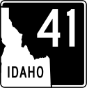 - SH-41Idaho State Highway 41State Highway 41, abbreviated SH-41, is a state highway mostly in the U.S. state of Idaho. It runs from Interstate 90 in Post Falls to U.S. Route 2 on the Washington state line. The northernmost of SH-41 run along State Street along the state line, with the southbound lane in the town of...
 - SH-57Idaho State Highway 57Idaho State Highway 57 is a state highway located entirely within Bonner County in the Idaho Panhandle region of the U.S. state of Idaho. SH-57 runs from U.S. Route 2 in Priest River north to the end of state maintenance in Nordman. The highway is maintained by the Idaho Transportation...
 - SH-200Idaho State Highway 200State Highway 200 is a two-lane highway from Ponderay, Idaho eastward to the Montana border. The highway has been dedicated as a national scenic byway and given the name Pend Oreille Scenic Byway.-Route description:...
Demographics
As of the censusCensus
A census is the procedure of systematically acquiring and recording information about the members of a given population. It is a regularly occurring and official count of a particular population. The term is used mostly in connection with national population and housing censuses; other common...
of 2000, there were 36,835 people, 14,693 households, and 10,270 families residing in the county. The population density
Population density
Population density is a measurement of population per unit area or unit volume. It is frequently applied to living organisms, and particularly to humans...
was 21 people per square mile (8/km²). There were 19,646 housing units at an average density of 11 per square mile (4/km²). The racial makeup of the county was 96.58% White
Race (United States Census)
Race and ethnicity in the United States Census, as defined by the Federal Office of Management and Budget and the United States Census Bureau, are self-identification data items in which residents choose the race or races with which they most closely identify, and indicate whether or not they are...
, 0.11% Black
Race (United States Census)
Race and ethnicity in the United States Census, as defined by the Federal Office of Management and Budget and the United States Census Bureau, are self-identification data items in which residents choose the race or races with which they most closely identify, and indicate whether or not they are...
or African American
Race (United States Census)
Race and ethnicity in the United States Census, as defined by the Federal Office of Management and Budget and the United States Census Bureau, are self-identification data items in which residents choose the race or races with which they most closely identify, and indicate whether or not they are...
, 0.87% Native American
Race (United States Census)
Race and ethnicity in the United States Census, as defined by the Federal Office of Management and Budget and the United States Census Bureau, are self-identification data items in which residents choose the race or races with which they most closely identify, and indicate whether or not they are...
, 0.27% Asian
Race (United States Census)
Race and ethnicity in the United States Census, as defined by the Federal Office of Management and Budget and the United States Census Bureau, are self-identification data items in which residents choose the race or races with which they most closely identify, and indicate whether or not they are...
, 0.05% Pacific Islander
Race (United States Census)
Race and ethnicity in the United States Census, as defined by the Federal Office of Management and Budget and the United States Census Bureau, are self-identification data items in which residents choose the race or races with which they most closely identify, and indicate whether or not they are...
, 0.42% from other races
Race (United States Census)
Race and ethnicity in the United States Census, as defined by the Federal Office of Management and Budget and the United States Census Bureau, are self-identification data items in which residents choose the race or races with which they most closely identify, and indicate whether or not they are...
, and 1.70% from two or more races. 1.64% of the population were Hispanic
Race (United States Census)
Race and ethnicity in the United States Census, as defined by the Federal Office of Management and Budget and the United States Census Bureau, are self-identification data items in which residents choose the race or races with which they most closely identify, and indicate whether or not they are...
or Latino
Race (United States Census)
Race and ethnicity in the United States Census, as defined by the Federal Office of Management and Budget and the United States Census Bureau, are self-identification data items in which residents choose the race or races with which they most closely identify, and indicate whether or not they are...
of any race. 20.9% were of German
Germans
The Germans are a Germanic ethnic group native to Central Europe. The English term Germans has referred to the German-speaking population of the Holy Roman Empire since the Late Middle Ages....
, 11.7% English
English people
The English are a nation and ethnic group native to England, who speak English. The English identity is of early mediaeval origin, when they were known in Old English as the Anglecynn. England is now a country of the United Kingdom, and the majority of English people in England are British Citizens...
, 11.7% American
United States
The United States of America is a federal constitutional republic comprising fifty states and a federal district...
, 9.6% Irish
Irish people
The Irish people are an ethnic group who originate in Ireland, an island in northwestern Europe. Ireland has been populated for around 9,000 years , with the Irish people's earliest ancestors recorded having legends of being descended from groups such as the Nemedians, Fomorians, Fir Bolg, Tuatha...
and 5.3% Norwegian ancestry according to Census 2000.
There were 14,693 households out of which 30.60% had children under the age of 18 living with them, 58.60% were married couples
Marriage
Marriage is a social union or legal contract between people that creates kinship. It is an institution in which interpersonal relationships, usually intimate and sexual, are acknowledged in a variety of ways, depending on the culture or subculture in which it is found...
living together, 7.50% had a female householder with no husband present, and 30.10% were non-families. 24.00% of all households were made up of individuals and 8.20% had someone living alone who was 65 years of age or older. The average household size was 2.49 and the average family size was 2.94.
In the county the population was spread out with 25.50% under the age of 18, 6.70% from 18 to 24, 25.40% from 25 to 44, 29.30% from 45 to 64, and 13.10% who were 65 years of age or older. The median age was 41 years. For every 100 females there were 100.30 males. For every 100 females age 18 and over, there were 98.20 males.
The median income for a household in the county was $32,803, and the median income for a family was $37,930. Males had a median income of $32,504 versus $21,086 for females. The per capita income
Per capita income
Per capita income or income per person is a measure of mean income within an economic aggregate, such as a country or city. It is calculated by taking a measure of all sources of income in the aggregate and dividing it by the total population...
for the county was $17,263. About 11.90% of families and 15.50% of the population were below the poverty line, including 21.20% of those under age 18 and 10.20% of those age 65 or over.
Cities
- Clark ForkClark Fork, IdahoClark Fork is a city in Bonner County, Idaho, United States. The population was 536 at the 2010 census.-Geography:Clark Fork is located at ....
- DoverDover, IdahoDover is a city in Bonner County, Idaho, United States. The population was 556 at the 2010 census.-Geography:Dover is located at .According to the United States Census Bureau, the city has a total area of , all of it land....
- East HopeEast Hope, IdahoEast Hope is a city in Bonner County, Idaho, United States. The population was 210 at the 2010 census.-Geography:East Hope is located at ....
- HopeHope, IdahoHope is a city in Bonner County, Idaho, United States. The population was 86 at the 2010 census.-Geography:Hope is located at ....
- KootenaiKootenai, IdahoKootenai is a city in Bonner County, Idaho, United States. The population was 678 at the 2010 census.-Geography:Kootenai is located at .According to the United States Census Bureau, the city has a total area of , all of it land....
- OldtownOldtown, IdahoOldtown is a city in Bonner County, Idaho, United States. The population was 184 at the 2010 census.-Geography:Oldtown is located at ....
- PonderayPonderay, IdahoPonderay is a city in Bonner County, Idaho, United States. The population was 638 at the 2000 census and 1,137 at the 2010 census. Ponderay's city motto is "Little City with the Big Future".-Geography:Ponderay is located at ....
- Priest RiverPriest River, IdahoPriest River is a city in Bonner County, Idaho, United States. The population was 1,751 at the 2010 census.-Geography:Priest River is located at ....
- SandpointSandpoint, IdahoSandpoint is the largest city in, and the county seat of, Bonner County, Idaho, United States. Its population was 7,365 at the 2010 census.Sandpoint's major economic contributors include forest products and light manufacturing, tourism and recreation and government services...
- Bonnerville, west of Oldtown.
Rivers and lakes
Kelso Lake was named after Minnie Kelso who was the first child born, just before her cousin, last name Clark, and that is why it is called "Kelso Lake" and not "Clark Lake."- Albeni Falls DamAlbeni Falls DamAlbeni Falls Dam is located on the Pend Oreille River between Oldtown, Idaho, and Priest River, Idaho. It is located on the site of a natural waterfall named Albeni Falls, named after early pioneer Albeni Poirier....
- Clark Fork River
- Cocolalla
- Kelso Lake
- Lake Pend OreilleLake Pend OreilleLake Pend Oreille is a lake in the northern Idaho Panhandle, with a surface area of . It is 65 miles long, and 1,150 feet deep in some regions, making it the fifth deepest in the United States. It is fed by the Clark Fork River and the Pack River, and drains via the Pend Oreille River...
- Pack RiverPack RiverThe Pack River is a medium-sized river located in Northern Idaho. It is about long and drains a high mountainous area of the Idaho Panhandle's Rocky Mountains and Selkirk Mountains...
- Pend Oreille RiverPend Oreille RiverThe Pend Oreille River is a tributary of the Columbia River, approximately long, in northern Idaho and northeastern Washington in the United States, as well as southeastern British Columbia in Canada. In its passage through British Columbia its name is spelled Pend-d'Oreille River...
- Priest LakePriest LakePriest Lake, Idaho, United States is located in the northernmost portion of the Idaho Panhandle, 80 miles north of Spokane Washington, with the northern end of the lake extending to within 15 miles of the Canadian border. The primary lake, lower Priest is 19 miles long and over 300 feet deep...