

Blythe Bay
Encyclopedia
Desolation Island (South Shetland Islands)
Desolation Island is one of the minor islands in the South Shetlands archipelago, Antarctica situated at the entrance to Hero Bay, Livingston Island. The island is V-shaped with its northern coast indented by Kozma Cove. Surface area ....
, lying north of Livingston Island in the South Shetland Islands
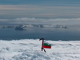
South Shetland Islands
The South Shetland Islands are a group of Antarctic islands, lying about north of the Antarctic Peninsula, with a total area of . By the Antarctic Treaty of 1959, the Islands' sovereignty is neither recognized nor disputed by the signatories and they are free for use by any signatory for...
, Antarctica. The bay is bounded by Craggy Island to the northeast, Desolation Island to the northwest, the Miladinovi Islets
Miladinovi Islets
Miladinovi Islets is a group of two small rocky islands, , and respectively, situated south of Iratais Point on Desolation Island off the north coast of Livingston Island, Antarctica. The islands are separated from Desolation Island by Neck or Nothing Passage...
to the west and Wood Island to the south.
The feature was known to American
United States
The United States of America is a federal constitutional republic comprising fifty states and a federal district...
and British
United Kingdom
The United Kingdom of Great Britain and Northern IrelandIn the United Kingdom and Dependencies, other languages have been officially recognised as legitimate autochthonous languages under the European Charter for Regional or Minority Languages...
sealers as Blythe Bay as early as 1821. In the 1930s, however, the name was applied to a large bay between Williams Point
Williams Point
Williams Point is the point forming both the north extremity of Varna Peninsula and the northeast tip of Livingston Island in the South Shetland Islands, Antarctica...
and Cape Shirreff
Cape Shirreff
Cape Shirreff is a prominent cape at the north end of the rocky peninsula which separates Hero Bay and Barclay Bay on the north coast of Livingston Island, in the South Shetland Islands...
(now Hero Bay
Hero Bay
Hero Bay is a 17 mi wide bay, which indents for 6 mi the north side of Livingston Island between Cape Shirreff and Williams Point, in the South Shetland Islands. The name ‘Blythe Bay’, originally applied to a small bay on the southeast side of Desolation Island on Powell's chart of 1822...
). This error has now been rectified and the name Blythe Bay is approved as originally used. The name is probably after Blythe (now Blyth
Blyth, Northumberland
Blyth is a town and civil parish in southeast Northumberland, England. It lies on the coast, to the south of the River Blyth and is approximately 21 kilometres northeast of Newcastle upon Tyne...
), England, home of William Smith
William Smith (mariner)
William Smith was the English captain who discovered the South Shetland Islands, an archipelago off the Graham Land in Antarctica....
who reported the discovery of the South Shetland Islands in 1819.
Maps
- L.L. Ivanov et al. Antarctica: Livingston Island and Greenwich Island, South Shetland Islands. Scale 1:100000 topographic map. Sofia: Antarctic Place-names Commission of Bulgaria, 2005.
- L.L. Ivanov. Antarctica: Livingston Island and Greenwich, Robert, Snow and Smith Islands. Scale 1:120000 topographic map. Troyan: Manfred Wörner Foundation, 2009. ISBN 978-954-92032-6-4