

Belle Haven, Fairfax County, Virginia
Encyclopedia
Census-designated place
A census-designated place is a concentration of population identified by the United States Census Bureau for statistical purposes. CDPs are delineated for each decennial census as the statistical counterparts of incorporated places such as cities, towns and villages...
(CDP) in Fairfax County
Fairfax County, Virginia
Fairfax County is a county in Virginia, in the United States. Per the 2010 Census, the population of the county is 1,081,726, making it the most populous jurisdiction in the Commonwealth of Virginia, with 13.5% of Virginia's population...
, Virginia
Virginia
The Commonwealth of Virginia , is a U.S. state on the Atlantic Coast of the Southern United States. Virginia is nicknamed the "Old Dominion" and sometimes the "Mother of Presidents" after the eight U.S. presidents born there...
, United States
United States
The United States of America is a federal constitutional republic comprising fifty states and a federal district...
. Nearby CDPs are Huntington, Virginia
Huntington, Virginia
Huntington is a census-designated place in Fairfax County, Virginia, United States. The population was 11,267 at the 2010 census. To the east is Belle Haven, Fairfax County, Virginia and to the south Groveton, Virginia. Its main component is the namesake Huntington subdivision, a late-1940s...
(west), Groveton, Virginia
Groveton, Virginia
Groveton is a census-designated place in Fairfax County, Virginia, United States. Nearby CDPs are Mount Vernon, Virginia , Belle Haven, Fairfax County, Virginia and Hybla Valley, Virginia . The population was 14,598 at the 2010 census, down from 21,296 in 2000 due to a reduction in area...
(southwest) and Fort Hunt, Virginia
Fort Hunt, Virginia
Fort Hunt is a census-designated place in Fairfax County, Virginia, United States. . It is one of the wealthiest places in the United States with a median household income surpassing that of Greenwich, Connecticut and Malibu, California, and is most famous for the site of former P.O...
(south). The population was 6,518 at the 2010 census.
The CDP is located just south of Old Town Alexandria
Alexandria, Virginia
Alexandria is an independent city in the Commonwealth of Virginia. As of 2009, the city had a total population of 139,966. Located along the Western bank of the Potomac River, Alexandria is approximately six miles south of downtown Washington, D.C.Like the rest of northern Virginia, as well as...
and bounded on the west by Richmond Highway (U.S. 1
U.S. Route 1 in Virginia
U.S. Route 1 in the U.S. state of Virginia runs north–south through South Hill, Petersburg, Richmond, Fredericksburg, and Alexandria on its way from North Carolina to the 14th Street Bridge into the District of Columbia...
) and on the east by the Potomac River
Potomac River
The Potomac River flows into the Chesapeake Bay, located along the mid-Atlantic coast of the United States. The river is approximately long, with a drainage area of about 14,700 square miles...
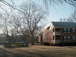
. It encompasses Belle Haven, a wealthy subdivision dating from the 1920s, and several adjoining neighborhoods. Some, particularly New Alexandria and Belle View, are among the lowest-lying residential areas of Fairfax County, and sustained extensive flood damage from storms including 2003's Hurricane Isabel
Hurricane Isabel
Hurricane Isabel was the costliest and deadliest hurricane in the 2003 Atlantic hurricane season. The ninth named storm, fifth hurricane, and second major hurricane of the season, Isabel formed near the Cape Verde Islands from a tropical wave on September 6 in the tropical Atlantic Ocean...
and 1972's Hurricane Agnes
Hurricane Agnes
Hurricane Agnes was the first tropical storm and first hurricane of the 1972 Atlantic hurricane season. A rare June hurricane, it made landfall on the Florida Panhandle before moving northeastward and ravaging the Mid-Atlantic region as a tropical storm...
. The Belle View branch of the Alexandria Post Office
United States Postal Service
The United States Postal Service is an independent agency of the United States government responsible for providing postal service in the United States...
is located here, and serves the 22307 ZIP code
ZIP Code
ZIP codes are a system of postal codes used by the United States Postal Service since 1963. The term ZIP, an acronym for Zone Improvement Plan, is properly written in capital letters and was chosen to suggest that the mail travels more efficiently, and therefore more quickly, when senders use the...
in which the majority of the CDP falls.
Geography
Belle Haven is located at 38°46′44"N 77°3′39"W (38.779013, -77.060721).According to the United States Census Bureau
United States Census Bureau
The United States Census Bureau is the government agency that is responsible for the United States Census. It also gathers other national demographic and economic data...
, the CDP has a total area of 2.7 square miles (6.9 km²), of which, 2.0 square miles (5.1 km²) of it is land and 0.7 square miles (1.8 km²) of it (25.66%) is water.
Demographics
As of the censusCensus
A census is the procedure of systematically acquiring and recording information about the members of a given population. It is a regularly occurring and official count of a particular population. The term is used mostly in connection with national population and housing censuses; other common...
of 2000, there were 6,269 people, 3,116 households, and 1,570 families residing in the CDP. The population density
Population density
Population density is a measurement of population per unit area or unit volume. It is frequently applied to living organisms, and particularly to humans...
was 3,182.3 people per square mile (1,228.7/km²). There were 3,220 housing units at an average density of 1,634.6/sq mi (631.1/km²). The racial makeup of the CDP was 86.17% White, 6.88% African American, 0.26% Native American, 2.27% Asian, 0.06% Pacific Islander, 1.93% from other races
Race (United States Census)
Race and ethnicity in the United States Census, as defined by the Federal Office of Management and Budget and the United States Census Bureau, are self-identification data items in which residents choose the race or races with which they most closely identify, and indicate whether or not they are...
, and 2.44% from two or more races. Hispanic or Latino of any race were 5.47% of the population.
There were 3,116 households out of which 19.5% had children under the age of 18 living with them, 40.7% were married couples
Marriage
Marriage is a social union or legal contract between people that creates kinship. It is an institution in which interpersonal relationships, usually intimate and sexual, are acknowledged in a variety of ways, depending on the culture or subculture in which it is found...
living together, 7.5% had a female householder with no husband present, and 49.6% were non-families. 41.8% of all households were made up of individuals and 9.6% had someone living alone who was 65 years of age or older. The average household size was 2.01 and the average family size was 2.77.
In the CDP the population was spread out with 17.2% under the age of 18, 4.1% from 18 to 24, 35.0% from 25 to 44, 28.8% from 45 to 64, and 14.9% who were 65 years of age or older. The median age was 41 years. For every 100 females there were 87.3 males. For every 100 females age 18 and over, there were 83.5 males.
The median income for a household in the CDP was $65,262, and the median income for a family was $92,195. Males had a median income of $55,446 versus $42,485 for females. The per capita income
Per capita income
Per capita income or income per person is a measure of mean income within an economic aggregate, such as a country or city. It is calculated by taking a measure of all sources of income in the aggregate and dividing it by the total population...
for the CDP was $46,483. About 3.3% of families and 5.0% of the population were below the poverty line, including 4.7% of those under age 18 and 3.4% of those age 65 or over.
Population history of Belle Haven CDP from the U.S. Census Bureau
- 1980...6,520
- 1990...6,427
- 2000...6,269
- 2010...6,518
External links
- I love Belle Haven -- a site with pictures and information about Belle Haven