Beinn Ime
Encyclopedia
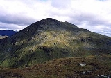
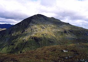
Beinn Ìme is the highest mountain in the Arrochar Alps
, in the Southern Highlands
of Scotland
. There are three usual routes of ascent. From Succoth, one may follow the same path that is used to reach The Cobbler
before taking the right fork near the base of the Cobbler's main crags and continuing up the valley, across the bealach and up Ben Ìme's eastern ridge. Alternatively, the summit can be reached from the pass of Rest and be Thankful
and from the Loch Lomond
side, using the private road that leads to Loch Sloy
.
Beinn Ìme separates the Dumbartonshire landscape of Loch Lomond in the East and the Argyll Highlands of Loch Fyne
and Loch Goil
anywhere north, west, south west. Beinn Ìme is the landmark to the entrance to Argyll.


Arrochar Alps
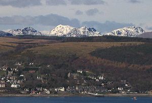
The Arrochar Alps are a group of mountains located around the head of Loch Long, Loch Fyne,and Loch Goil, near the villages of Arrochar and Lochgoilhead in Argyll, Scotland. The mountains are especially popular with hillwalkers, due to their proximity and accessibility from Glasgow...
, in the Southern Highlands
Scottish Highlands
The Highlands is an historic region of Scotland. The area is sometimes referred to as the "Scottish Highlands". It was culturally distinguishable from the Lowlands from the later Middle Ages into the modern period, when Lowland Scots replaced Scottish Gaelic throughout most of the Lowlands...
of Scotland
Scotland
Scotland is a country that is part of the United Kingdom. Occupying the northern third of the island of Great Britain, it shares a border with England to the south and is bounded by the North Sea to the east, the Atlantic Ocean to the north and west, and the North Channel and Irish Sea to the...
. There are three usual routes of ascent. From Succoth, one may follow the same path that is used to reach The Cobbler
The Cobbler
The Cobbler is a mountain of 884 m height located near the head of Loch Long in Scotland. It is a Corbett...
before taking the right fork near the base of the Cobbler's main crags and continuing up the valley, across the bealach and up Ben Ìme's eastern ridge. Alternatively, the summit can be reached from the pass of Rest and be Thankful
A83 road
The A83 is a major road in Argyll and Bute, Scotland, running from Tarbet, on the western shore of Loch Lomond, where it splits from the A82, to Campbeltown at the southern end of the Kintyre peninsula.-Route:...
and from the Loch Lomond
Loch Lomond
Loch Lomond is a freshwater Scottish loch, lying on the Highland Boundary Fault. It is the largest lake in Great Britain by surface area. The lake contains many islands, including Inchmurrin, the largest fresh-water island in the British Isles, although the lake itself is smaller than many Irish...
side, using the private road that leads to Loch Sloy
Loch Sloy
Loch Sloy was a Scottish sailing barque that operated between Great Britain and Australia from the late 19th century until 1899. Her name was drawn from Loch Sloy, a freshwater lake which lies to the north of the Burgh of Helensburgh, in the region of Argyll and Bute, Scotland.In the early hours of...
.
Beinn Ìme separates the Dumbartonshire landscape of Loch Lomond in the East and the Argyll Highlands of Loch Fyne
Loch Fyne
Loch Fyne is a sea loch on the west coast of Argyll and Bute, Scotland. It extends inland from the Sound of Bute, making it the longest of the sea lochs...
and Loch Goil
Loch Goil
Loch Goil is a small sea loch in Scotland.It is an arm of Loch Long. The village of Lochgoilhead stands at its head.Located in the Loch Lomond & Trossachs National Park, Lochgoilhead sits at the head of Loch Goil, a fjord type sea loch. Only an hour from the Erskine Bridge, Glasgow Airport the M8...
anywhere north, west, south west. Beinn Ìme is the landmark to the entrance to Argyll.


