
Beaverhead Rock
Encyclopedia
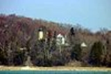
Beaverhead Rock is a rock feature identified by Sacagawea
during the Lewis and Clark Expedition
as a landmark
not distant from the summer retreat of her nation. According to the Journal of Lewis "the Indian woman recognized the point of a high plain to our right which she informed us was not very distant from the summer retreat of her nation on a river beyond the mountains which runs to the west. This hill she says her nation calls the Beaver's Head, from a conceived resemblance of its figure to the head of that animal...as it is now all important with us to meet with those people as soon as possible I determined to proceed tomorrow with a small party...and pass the mountains to the Columbia; and down that river until I found the Indians...without horses we shall be obliged to leave a great part of our stores..."
The rock itself is located 14 miles south of Twin Bridges
on Montana 41 in Montana
. The rock is part of Beaverhead Rock State Park, and is located on the Beaverhead River
.
Sacagawea
Sacagawea ; was a Lemhi Shoshone woman, who accompanied the Lewis and Clark Expedition, acting as an interpreter and guide, in their exploration of the Western United States...
during the Lewis and Clark Expedition
Lewis and Clark Expedition
The Lewis and Clark Expedition, or ″Corps of Discovery Expedition" was the first transcontinental expedition to the Pacific Coast by the United States. Commissioned by President Thomas Jefferson and led by two Virginia-born veterans of Indian wars in the Ohio Valley, Meriwether Lewis and William...
as a landmark
Landmark
This is a list of landmarks around the world.Landmarks may be split into two categories - natural phenomena and man-made features, like buildings, bridges, statues, public squares and so forth...
not distant from the summer retreat of her nation. According to the Journal of Lewis "the Indian woman recognized the point of a high plain to our right which she informed us was not very distant from the summer retreat of her nation on a river beyond the mountains which runs to the west. This hill she says her nation calls the Beaver's Head, from a conceived resemblance of its figure to the head of that animal...as it is now all important with us to meet with those people as soon as possible I determined to proceed tomorrow with a small party...and pass the mountains to the Columbia; and down that river until I found the Indians...without horses we shall be obliged to leave a great part of our stores..."
The rock itself is located 14 miles south of Twin Bridges
Twin Bridges, Montana
Twin Bridges is a town in Madison County, Montana, United States. It lies at the confluence of the Ruby, Beaverhead and Big Hole Rivers which form the Jefferson River. Twin Bridges is a well known fly fishing mecca for trout fisherman...
on Montana 41 in Montana
Montana
Montana is a state in the Western United States. The western third of Montana contains numerous mountain ranges. Smaller, "island ranges" are found in the central third of the state, for a total of 77 named ranges of the Rocky Mountains. This geographical fact is reflected in the state's name,...
. The rock is part of Beaverhead Rock State Park, and is located on the Beaverhead River
Beaverhead River
The Beaverhead River is an approximately -long tributary of the Jefferson River in southwest Montana . It drains an area of roughly . The river's original headwaters, formed by the confluence of the Red Rock River and Horse Prairie Creek, are now flooded under Clark Canyon Reservoir, which also...
.