
Barossa Valley Highway
Encyclopedia
The Barossa Valley Highway (also known as Barossa Valley Way) is the main road linking most of the major towns of the Barossa Valley
in South Australia
. It is designated as highway B19. It is 34 km long, roughly following the North Para River
from the Sturt Highway
at Nuriootpa
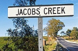
through Tanunda
, Rowland Flat
and Lyndoch
to Gawler
, where it again meets the Sturt Highway
(almost - the Barossa Valley Highway approaches from the East and terminates in the main street, but the Sturt Highway bypasses the town to the West).
Barossa Valley
The Barossa Valley is a major wine-producing region and tourist destination of South Australia, located 60 km northeast of Adelaide. It is the valley formed by the North Para River, and the Barossa Valley Way is the main road through the valley, connecting the main towns on the valley floor of...
in South Australia
South Australia
South Australia is a state of Australia in the southern central part of the country. It covers some of the most arid parts of the continent; with a total land area of , it is the fourth largest of Australia's six states and two territories.South Australia shares borders with all of the mainland...
. It is designated as highway B19. It is 34 km long, roughly following the North Para River
North Para River
The North Para River rises from the Barossa Ranges near Eden Valley and flows southwest through thhe Barossa Valley, passing through the towns of Nuriootpa, Tanunda, before merging with the South Para River in Gawler forming the Gawler River....
from the Sturt Highway
Sturt Highway
The Sturt Highway is an Australian highway in New South Wales, Victoria, and South Australia. It is part of the Auslink National network and is part of the main highway route between Sydney and Adelaide.-Route:...
at Nuriootpa
Nuriootpa, South Australia
Nuriootpa is the major commercial centre in the Barossa Valley in South Australia, about an hour's drive north of the capital, Adelaide, and 77 kilometres by rail...
through Tanunda
Tanunda, South Australia
Tanunda is a town situated in the Barossa Valley region of South Australia, 70 kilometres north east of the state capital, Adelaide. The town derives its name from an Aboriginal word meaning water hole. Town population is approximately 3500.-Settlement:...
, Rowland Flat
Rowland Flat, South Australia
Rowland Flat is a small South Australian town in the Barossa Valley, located on the Barossa Valley Highway between Lyndoch and Tanunda. The town has an elevation of 294m and is nestled at the foot of the Barossa Ranges...
and Lyndoch
Lyndoch, South Australia
Lyndoch is a town in Barossa Valley, located on the Barossa Valley Highway between Gawler and Tanunda, 58 km northeast of Adelaide. The town has an elevation of 175m and an average rainfall of 560.5mm. It is one of the oldest towns in South Australia....
to Gawler
Gawler, South Australia
Gawler is the first country town in the state of South Australia, and is named after the second Governor of the colony of South Australia, George Gawler. It is located north of the centre of the state capital, Adelaide, and is close to the major wine producing district of the Barossa Valley...
, where it again meets the Sturt Highway
Sturt Highway
The Sturt Highway is an Australian highway in New South Wales, Victoria, and South Australia. It is part of the Auslink National network and is part of the main highway route between Sydney and Adelaide.-Route:...
(almost - the Barossa Valley Highway approaches from the East and terminates in the main street, but the Sturt Highway bypasses the town to the West).
See also
- Highways in AustraliaHighways in AustraliaThis is a list of highways in Australia, listed alphabetically along with each highway's route number and location. Note that some highways service more than one state or territory.-Route numbering systems:...
- List of highways in South Australia
- Barossa Valley (wine)Barossa Valley (wine)The Barossa Valley is one of Australia's oldest wine regions. Located in South Australia, the Barossa Valley is about 56km northeast of the city of Adelaide...