

Barlow, Ohio
Encyclopedia
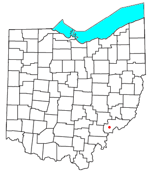
Unincorporated area
In law, an unincorporated area is a region of land that is not a part of any municipality.To "incorporate" in this context means to form a municipal corporation, a city, town, or village with its own government. An unincorporated community is usually not subject to or taxed by a municipal government...
in western Barlow Township
Barlow Township, Washington County, Ohio
Barlow Township is one of the twenty-two townships of Washington County, Ohio, United States. The 2000 census found 2,417 people in the township.-Geography:Located in the western part of the county, it borders the following townships:...
, Washington County
Washington County, Ohio
Washington County is a county located in the state of Ohio. As of the 2010 census, the population was 61,778. Its county seat is Marietta. The county, the oldest in the state, is named for George Washington. Washington County is included in the Parkersburg-Marietta-Vienna, West Virginia-Ohio...
, Ohio
Ohio
Ohio is a Midwestern state in the United States. The 34th largest state by area in the U.S.,it is the 7th‑most populous with over 11.5 million residents, containing several major American cities and seven metropolitan areas with populations of 500,000 or more.The state's capital is Columbus...
, United States
United States
The United States of America is a federal constitutional republic comprising fifty states and a federal district...
. Although it is unincorporated, it has a post office
Post office
A post office is a facility forming part of a postal system for the posting, receipt, sorting, handling, transmission or delivery of mail.Post offices offer mail-related services such as post office boxes, postage and packaging supplies...
, with the ZIP code
ZIP Code
ZIP codes are a system of postal codes used by the United States Postal Service since 1963. The term ZIP, an acronym for Zone Improvement Plan, is properly written in capital letters and was chosen to suggest that the mail travels more efficiently, and therefore more quickly, when senders use the...
of 45712. It lies at the intersection of State Routes 339
Ohio State Route 339
State Route 339 is a north–south state highway in southeastern Ohio, a U.S. state. The southern terminus of SR 339 is at SR 618 approximately west of Belpre, and less than south of the U.S. Route 50 /SR 7/SR 32 expressway...
and 550
Ohio State Route 550
State Route 550 is an east–west state highway in the southeastern portion of the U.S. state of Ohio. The western terminus of State Route 550 is at an interchange with U.S. Route 33 just north of the city limits of Athens, immediately south of the southern terminus of State Route 13...
near the South Fork of Wolf Creek, which meets the Muskingum River
Muskingum River
The Muskingum River is a tributary of the Ohio River, approximately 111 miles long, in southeastern Ohio in the United States. An important commercial route in the 19th century, it flows generally southward through the eastern hill country of Ohio...
at Waterford
Waterford, Ohio
Waterford is an unincorporated community in central Waterford Township, Washington County, Ohio, United States. Although it is unincorporated, it has a post office, with the ZIP code of 45786. It is located on State Route 339 across the Muskingum River from the village of Beverly, slightly below...
to the north.