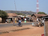
Bantè
Encyclopedia
Bantè is a town, arrondissement
, and commune
in western Benin
. It is located in the former Zou Province of which since 1999 is part of the Collines Department
. The commune covers an area of 2695 square kilometres and as of 2002 had a population of 82,129 people. The majority of the population is ethnically Nagot, who themselves are descendents of the Yoruba
.
The town is connected by the RNIE 3
highway.
Arrondissements of Benin
The Arrondissements of Benin refer to the third-level administrative units of Benin, after Departments and communes. In turn they contain villages and may often have several quartiers or city districts/urban neighborhoods:...
, and commune
Communes of Benin
The departments of Benin are subdivided into 77 communes, which in turn are divided into arrondissements and finally into villages or city districts. Prior to 1999 provinces were broken down into 84 districts, titled either urban or rural...
in western Benin
Benin
Benin , officially the Republic of Benin, is a country in West Africa. It borders Togo to the west, Nigeria to the east and Burkina Faso and Niger to the north. Its small southern coastline on the Bight of Benin is where a majority of the population is located...
. It is located in the former Zou Province of which since 1999 is part of the Collines Department
Collines Department
Collines is one of the twelve departments of Benin. Collines was created in 1999 after the Benin government split up the former six departments of Atakora, Atlantique, Borgou, Mono, Oueme and Zou into twelve. Collinies was split from Zou. Since 2008, the capital is Savalou. The departments that...
. The commune covers an area of 2695 square kilometres and as of 2002 had a population of 82,129 people. The majority of the population is ethnically Nagot, who themselves are descendents of the Yoruba
Yoruba people
The Yoruba people are one of the largest ethnic groups in West Africa. The majority of the Yoruba speak the Yoruba language...
.
The town is connected by the RNIE 3
RNIE 3
RNIE 3 is a national highway of Benin. It passes from north to south in the west of the country running near the border with Togo.-External links:*...
highway.
Arrondissements
The nine Arrondissements in the commune of Bantè are:- AgouaAgouaAgoua is a town and arrondissement in the Collines Department of Benin. It is an administrative division under the jurisdiction of the commune of Bantè. According to the population census conducted by the Institut National de la Statistique Benin on February 15, 2002, the arrondissement had a total...
- AkpassiAkpassiAkpassi is a town and arrondissement in the Collines Department of Benin. It is an administrative division under the jurisdiction of the commune of Bantè. According to the population census conducted by the Institut National de la Statistique Benin on February 15, 2002, the arrondissement had a...
- Atokolibe
- BanteBantèBantè is a town, arrondissement, and commune in western Benin. It is located in the former Zou Province of which since 1999 is part of the Collines Department. The commune covers an area of 2695 square kilometres and as of 2002 had a population of 82,129 people...
- BobeBobèBobè is a town and arrondissement in the Collines Department of Benin. It is an administrative division under the jurisdiction of the commune of Bantè. According to the population census conducted by the Institut National de la Statistique Benin on February 15, 2002, the arrondissement had a total...
- Gouka
- KokoKoko-People, animals, and plants:* Emperor Kōkō , 58th emperor of Japan* Koko Taylor , R&B singer* Koko Pimentel , Philippine politician* Koko , ape that underwent training in Gorilla Sign Language...
- LougbaLougbaLougba is a town and arrondissement in the Collines department of Benin. It is an administrative division under the jurisdiction of the commune of Bantè. According to the population census conducted by the Institut National de la Statistique Benin on February 15, 2002, the arrondissement had a...
- Pirosborne
External links
- Satellite map at Maplandia.com
- http://encarta.msn.com/encnet/features/mapcenter/map.aspx?TextLatitude=8.09934077063867&TextLongitude=1.88324771904283&TextAltitude=7&TextSelectedEntity=10384920&MapStyle=Comprehensive&MapSize=Large&MapStyleSelectedIndex=0&searchTextMap=Bant%C3%A8&MapStylesList=Comprehensive&ZoomOnMapClickCheck=on&ResultsListbox=8.09934077063867%3B1.88324771904283%3B7%3B10384920%3BAbidzi%2C+Benin%3BLarge%3BComprehensive#map_frameLocation on MSN encarta map]

