
Avalon, Saskatoon
Encyclopedia
Avalon is a mostly residential neighbourhood located in south-central Saskatoon
, Saskatchewan
, Canada
. It is a suburb
an subdivision
, consisting mostly of low-density, single detached dwellings. As of 2007, the area is home to 3,214 residents. The neighbourhood is considered a middle-income area, with an average family income of $65,000, an average dwelling value of $168,444 and a home ownership rate of 77.3%.
. The layout of the streets reflects the changing urban planning philosophies of the day as the land was developed. The north part of the neighbourhood follows a traditional grid pattern. By the 1950s, the design of residential neighbourhoods used a modern system of curving residential streets, feeding into collector road
s that connected to arterial road
s. Thus, the southern part of the neighbourhood follows this design practice.
John Lake School was opened in 1958. Georges Vanier School was opened that same year, and renovated in 1963.
of the Conservative Party of Canada
, first elected in 2000 and re-elected in 2004 and 2006.
Provincially, the neighbourhood is within the boundaries of the Saskatoon Eastview
constituency. It is currently represented by Judy Junor
of the Saskatchewan New Democratic Party
, first elected in 1998 and re-elected in 1999, 2003 and 2007.
In Saskatoon's non-partisan municipal politics, Avalon lies within ward 7. It is currently represented by Councillor Bob Pringle, who was elected to city council in 2006 and re-elected by acclamation in 2009. Previously, he served in provincial politics as the NDP MLA for Saskatoon Eastview from 1988 to 1998.
The Avalon Community Association exists to represent the educational, recreational, and social needs of residents, to promote a sense of community and enhance quality of life in the area.
's patrol system. Saskatoon Fire & Protective Services' east division covers the neighbourhood. Transit services to Avalon are provided by Saskatoon Transit
on routes No. 6 (Clarence - Broadway) and 13 (Lawson - Exhibition).
/Idylwyld Freeway
to the south and west, and Clarence Avenue to the east. Roads are laid in a grid fashion in the north part of the neighbourhood, while the south part features crescents and cul-de-sacs.
Vernon Avenue is a local oddity. On maps it is a one-block
long one-way
street for northbound traffic between Bute and Ruth Streets. It actually begins at Bute Street as the back alley for houses along McPherson Avenue to the east. It then merges with the Idylwyld Freeway offramp to become a true road until terminating at Ruth Street. St. George Avenue in the neighbouring Exhibition
neighbourhood is similarly used as the southbound exit from the Idylwyld Freeway to Ruth Street. The combination of houses and exiting freeway traffic makes this type of street a rarity in Saskatoon. Another oddity in the neighborhood is Niderost Street. It starts as a gravel road from McPherson to Melrose Avenues, with a paved patch at the intersection of Kelvin Avenue in between the two blocks, before turning into a paved street from Melrose to Wilson Crescent.
Saskatoon
Saskatoon is a city in central Saskatchewan, Canada, on the South Saskatchewan River. Residents of the city of Saskatoon are called Saskatonians. The city is surrounded by the Rural Municipality of Corman Park No. 344....
, Saskatchewan
Saskatchewan
Saskatchewan is a prairie province in Canada, which has an area of . Saskatchewan is bordered on the west by Alberta, on the north by the Northwest Territories, on the east by Manitoba, and on the south by the U.S. states of Montana and North Dakota....
, Canada
Canada
Canada is a North American country consisting of ten provinces and three territories. Located in the northern part of the continent, it extends from the Atlantic Ocean in the east to the Pacific Ocean in the west, and northward into the Arctic Ocean...
. It is a suburb
Suburb
The word suburb mostly refers to a residential area, either existing as part of a city or as a separate residential community within commuting distance of a city . Some suburbs have a degree of administrative autonomy, and most have lower population density than inner city neighborhoods...
an subdivision
Subdivision (land)
Subdivision is the act of dividing land into pieces that are easier to sell or otherwise develop, usually via a plat. The former single piece as a whole is then known in the United States as a subdivision...
, consisting mostly of low-density, single detached dwellings. As of 2007, the area is home to 3,214 residents. The neighbourhood is considered a middle-income area, with an average family income of $65,000, an average dwelling value of $168,444 and a home ownership rate of 77.3%.
History
Most of the land for the neighbourhood was annexed by the city between 1910 and 1919, with the remaining southern piece annexed between 1960 and 1969. A 1913 map shows that the present-day Avalon area overlaps three registered subdivisions of the day: Avalon in the northwest, Pacific Addition in the east and railway stock yards in the south. Home construction, however, did not begin in earnest until after World War IIWorld War II
World War II, or the Second World War , was a global conflict lasting from 1939 to 1945, involving most of the world's nations—including all of the great powers—eventually forming two opposing military alliances: the Allies and the Axis...
. The layout of the streets reflects the changing urban planning philosophies of the day as the land was developed. The north part of the neighbourhood follows a traditional grid pattern. By the 1950s, the design of residential neighbourhoods used a modern system of curving residential streets, feeding into collector road
Collector road
A collector road or distributor road is a low to moderate-capacity road which serve to move traffic from local streets to arterial roads. Unlike arterials, collectors are also designed to provide access to residential properties...
s that connected to arterial road
Arterial road
An arterial road, or arterial thoroughfare, is a high-capacity urban road. The primary function of an arterial road is to deliver traffic from collector roads to freeways, and between urban centres at the highest level of service possible. As such, many arteries are limited-access roads, or feature...
s. Thus, the southern part of the neighbourhood follows this design practice.
John Lake School was opened in 1958. Georges Vanier School was opened that same year, and renovated in 1963.
Government and politics
Avalon exists within the federal electoral district of Blackstrap. It is currently represented by Lynne YelichLynne Yelich
Lynne Yelich , PC, MP is a third-generation Croatian-Canadian politician and the MP for the riding of Blackstrap. The riding of Blackstrap includes Yelich's home town of Kenaston, Saskatchewan, identified as the largest Croatian farming settlement in Canada...
of the Conservative Party of Canada
Conservative Party of Canada
The Conservative Party of Canada , is a political party in Canada which was formed by the merger of the Canadian Alliance and the Progressive Conservative Party of Canada in 2003. It is positioned on the right of the Canadian political spectrum...
, first elected in 2000 and re-elected in 2004 and 2006.
Provincially, the neighbourhood is within the boundaries of the Saskatoon Eastview
Saskatoon Eastview
Saskatoon Eastview is a provincial electoral district for the Legislative Assembly of Saskatchewan, Canada. This district includes the neighbourhoods of Eastview, Lakeview, Nutana Park, Adelaide/Churchill and Avalon....
constituency. It is currently represented by Judy Junor
Judy Junor
Judy Junor is a Canadian provincial politician. She is the Saskatchewan New Democratic Party member of the Legislative Assembly of Saskatchewan for the constituency of Saskatoon Eastview....
of the Saskatchewan New Democratic Party
Saskatchewan New Democratic Party
The Saskatchewan New Democratic Party is a social-democratic political party in the Canadian province of Saskatchewan. It currently forms the official opposition, but has been a dominant force in Saskatchewan politics since the 1940s...
, first elected in 1998 and re-elected in 1999, 2003 and 2007.
In Saskatoon's non-partisan municipal politics, Avalon lies within ward 7. It is currently represented by Councillor Bob Pringle, who was elected to city council in 2006 and re-elected by acclamation in 2009. Previously, he served in provincial politics as the NDP MLA for Saskatoon Eastview from 1988 to 1998.
Education
- John Lake School - public elementary school, part of the Saskatoon Public School DivisionSaskatoon Public School DivisionSaskatoon Public Schools is the largest school system in Saskatoon and is the second largest in Saskatchewan.Saskatoon Public Schools has approximately 22,000 students with 44 elementary schools and 9 high schools. The offices of the Saskatoon School Board are housed in the Eaton's Building. ...
. The school was constructed in 1959.
- Georges Vanier School - separate (Catholic) elementary, part of the Greater Saskatoon Catholic School DivisionGreater Saskatoon Catholic School DivisionGreater Saskatoon Catholic School Division is Saskatchewan’s largest Catholic school division. The Greater Saskatoon Catholic School Division has approximately 15,000 students in 44 schools located in Saskatoon and surrounding rural districts. St. Pauls R.C.S.S.D No. 20 belongs to Department of...
Parks and recreation
- C.P. Seeley Park (1.3 acres)
- John Lake Park (4.1 acres)
- Avalon Park (4.2 acres)
The Avalon Community Association exists to represent the educational, recreational, and social needs of residents, to promote a sense of community and enhance quality of life in the area.
Public services
Avalon is a part of the east division of the Saskatoon Police ServiceSaskatoon Police Service
Saskatoon Police Service is the municipal police force in Saskatoon, Saskatchewan, Canada and holds both municipal and provincial jurisdiction. Police Chief Clive Weighill is the head of the force. The deputy chiefs are Deputy Chief Gary Broste , and Deputy Chief Bernie Pannell...
's patrol system. Saskatoon Fire & Protective Services' east division covers the neighbourhood. Transit services to Avalon are provided by Saskatoon Transit
Saskatoon Transit
Saskatoon Transit is the public transport arm of the City of Saskatoon, Saskatchewan, Canada. It operates a fleet of diesel buses. A total of 23 bus routes serve every area of the city, carrying approximately 11 million passengers in 2008...
on routes No. 6 (Clarence - Broadway) and 13 (Lawson - Exhibition).
Commercial
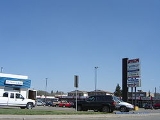
The main commercial development is the Avalon Shopping Centre, a strip mall located on the corner of Broadway Avenue and Cascade Street. There are also two small commercial areas along Ruth Street: one between Lorne and Vernon Avenues, and another at Melrose Avenue. In addition, there are 40 home-based businesses in the neighbourhood.Location
Avalon is located within the Nutana Suburban Development Area. It is bounded by Ruth Street to the north, Circle DriveCircle Drive
Circle Drive is a major road constructed as a ring road in Saskatoon, Saskatchewan, Canada. The northeastern portion of the road is part of the Yellowhead Highway.-History:...
/Idylwyld Freeway
Idylwyld Drive
Idylwyld Drive is an arterial road in Saskatoon, Saskatchewan. It is one of the main roads in and out of the downtown area of the city.On the south side of the Senator Sid Buckwold Bridge, it is a freeway and is known as the Idylwyld Freeway. It eventually turns into Circle Drive, just east of...
to the south and west, and Clarence Avenue to the east. Roads are laid in a grid fashion in the north part of the neighbourhood, while the south part features crescents and cul-de-sacs.
Vernon Avenue is a local oddity. On maps it is a one-block
City block
A city block, urban block or simply block is a central element of urban planning and urban design. A city block is the smallest area that is surrounded by streets. City blocks are the space for buildings within the street pattern of a city, they form the basic unit of a city's urban fabric...
long one-way
One-way traffic
One-way traffic is traffic that moves in a single direction. A one-way street is a street either facilitating only one-way traffic, or designed to direct vehicles to move in one direction.-General signs:...
street for northbound traffic between Bute and Ruth Streets. It actually begins at Bute Street as the back alley for houses along McPherson Avenue to the east. It then merges with the Idylwyld Freeway offramp to become a true road until terminating at Ruth Street. St. George Avenue in the neighbouring Exhibition
Exhibition, Saskatoon
The Exhibition subdivision of Saskatoon, Saskatchewan, Canada, is located on the banks of the South Saskatchewan River and was developed between the two major World Wars. To the west is the Diefenbaker Management Area which boasts the Diefenbaker park and Pioneer Cemetery...
neighbourhood is similarly used as the southbound exit from the Idylwyld Freeway to Ruth Street. The combination of houses and exiting freeway traffic makes this type of street a rarity in Saskatoon. Another oddity in the neighborhood is Niderost Street. It starts as a gravel road from McPherson to Melrose Avenues, with a paved patch at the intersection of Kelvin Avenue in between the two blocks, before turning into a paved street from Melrose to Wilson Crescent.