

Atwood, Kansas
Encyclopedia
Atwood is a city in and the county seat
of Rawlins County
, Kansas
, United States
. As of the 2010 census, the city population was 1,194.
.
, the city has a total area of 1.1 square miles (2.8 km²), of which, 1 square miles (2.6 km²) of it is land and 0.1 square mile (0.258998811 km²) of it (5.45%) is water.
of 2000, there were 1,279 people, 577 households, and 347 families residing in the city. The population density
was 1,229.7 people per square mile (474.8/km²). There were 708 housing units at an average density of 680.7 per square mile (262.8/km²). The racial makeup of the city was 98.67% White, 0.16% African American, 0.23% Native American, and 0.94% from two or more races. Hispanic or Latino of any race were 0.39% of the population.
There were 577 households out of which 23.4% had children under the age of 18 living with them, 52.0% were married couples
living together, 6.6% had a female householder with no husband present, and 39.7% were non-families. 36.9% of all households were made up of individuals and 20.3% had someone living alone who was 65 years of age or older. The average household size was 2.12 and the average family size was 2.78.
In the city the population was spread out with 21.7% under the age of 18, 3.5% from 18 to 24, 21.7% from 25 to 44, 23.5% from 45 to 64, and 29.6% who were 65 years of age or older. The median age was 48 years. For every 100 females there were 89.8 males. For every 100 females age 18 and over, there were 84.2 males.
The median income for a household in the city was $30,221, and the median income for a family was $39,375. Males had a median income of $27,768 versus $19,063 for females. The per capita income
for the city was $16,161. About 4.5% of families and 10.7% of the population were below the poverty line, including 10.8% of those under age 18 and 10.7% of those age 65 or over.
105. The district has two schools in Atwood:
County
Schools
Newspapers
Photos and Videos
Maps
County seat
A county seat is an administrative center, or seat of government, for a county or civil parish. The term is primarily used in the United States....
of Rawlins County
Rawlins County, Kansas
Rawlins County is a county located in the U.S. state of Kansas. As of the 2010 census, the county population was 2,519. The largest city and county seat is Atwood...
, Kansas
Kansas
Kansas is a US state located in the Midwestern United States. It is named after the Kansas River which flows through it, which in turn was named after the Kansa Native American tribe, which inhabited the area. The tribe's name is often said to mean "people of the wind" or "people of the south...
, United States
United States
The United States of America is a federal constitutional republic comprising fifty states and a federal district...
. As of the 2010 census, the city population was 1,194.
History
In 1875, T.A. Andrews and J.M. Matheny traveled to Rawlins County and started a town site about two miles east of the current city. The city of Attwood (with two t's) was named after Attwood Matheny, the 14-year-old son who accompanied his father on the journey. In 1882, the U.S. Post Office requested permission to drop one "t" thus becoming Atwood. In 1881, Atwood became the county seat of Rawlins CountyRawlins County, Kansas
Rawlins County is a county located in the U.S. state of Kansas. As of the 2010 census, the county population was 2,519. The largest city and county seat is Atwood...
.
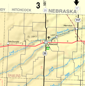
Geography
Atwood is located at 39°48′32"N 101°2′29"W (39.808971, -101.041370). According to the United States Census BureauUnited States Census Bureau
The United States Census Bureau is the government agency that is responsible for the United States Census. It also gathers other national demographic and economic data...
, the city has a total area of 1.1 square miles (2.8 km²), of which, 1 square miles (2.6 km²) of it is land and 0.1 square mile (0.258998811 km²) of it (5.45%) is water.
Area attractions
- Rawlins County Historical Museum, 308 State Street.
- Shirley Opera House (NRHPNational Register of Historic PlacesThe National Register of Historic Places is the United States government's official list of districts, sites, buildings, structures, and objects deemed worthy of preservation...
), 503 Main Street.
Area events
- Rawlins County Fair, held in July.
- Beaver Creek Festival, held annually in October.
Demographics
As of the censusCensus
A census is the procedure of systematically acquiring and recording information about the members of a given population. It is a regularly occurring and official count of a particular population. The term is used mostly in connection with national population and housing censuses; other common...
of 2000, there were 1,279 people, 577 households, and 347 families residing in the city. The population density
Population density
Population density is a measurement of population per unit area or unit volume. It is frequently applied to living organisms, and particularly to humans...
was 1,229.7 people per square mile (474.8/km²). There were 708 housing units at an average density of 680.7 per square mile (262.8/km²). The racial makeup of the city was 98.67% White, 0.16% African American, 0.23% Native American, and 0.94% from two or more races. Hispanic or Latino of any race were 0.39% of the population.
There were 577 households out of which 23.4% had children under the age of 18 living with them, 52.0% were married couples
Marriage
Marriage is a social union or legal contract between people that creates kinship. It is an institution in which interpersonal relationships, usually intimate and sexual, are acknowledged in a variety of ways, depending on the culture or subculture in which it is found...
living together, 6.6% had a female householder with no husband present, and 39.7% were non-families. 36.9% of all households were made up of individuals and 20.3% had someone living alone who was 65 years of age or older. The average household size was 2.12 and the average family size was 2.78.
In the city the population was spread out with 21.7% under the age of 18, 3.5% from 18 to 24, 21.7% from 25 to 44, 23.5% from 45 to 64, and 29.6% who were 65 years of age or older. The median age was 48 years. For every 100 females there were 89.8 males. For every 100 females age 18 and over, there were 84.2 males.
The median income for a household in the city was $30,221, and the median income for a family was $39,375. Males had a median income of $27,768 versus $19,063 for females. The per capita income
Per capita income
Per capita income or income per person is a measure of mean income within an economic aggregate, such as a country or city. It is calculated by taking a measure of all sources of income in the aggregate and dividing it by the total population...
for the city was $16,161. About 4.5% of families and 10.7% of the population were below the poverty line, including 10.8% of those under age 18 and 10.7% of those age 65 or over.
Primary and secondary education
Atwood is part of Unified School DistrictUnified school district
A unified school district or unit school district is a school district which includes both primary school and high school under the same district control....
105. The district has two schools in Atwood:
- Rawlins County Junior/Senior High School
- Rawlins County Elementary School
Infrastructure
Notable people
- Ted UhlaenderTed UhlaenderTheodore Otto Uhlaender was a Major League Baseball outfielder for the Minnesota Twins, Cleveland Indians and Cincinnati Reds from –. He was also the father of Olympic women's skeleton competitor Katie Uhlaender.Signed by the Twins out of Baylor University in 1961, he made his major league...
, Major League BaseballMajor League BaseballMajor League Baseball is the highest level of professional baseball in the United States and Canada, consisting of teams that play in the National League and the American League...
outfielderOutfielderOutfielder is a generic term applied to each of the people playing in the three defensive positions in baseball farthest from the batter. These defenders are the left fielder, the center fielder, and the right fielder...
for the Minnesota TwinsMinnesota TwinsThe Minnesota Twins are a professional baseball team based in Minneapolis, Minnesota. They play in the Central Division of Major League Baseball's American League. The team is named after the Twin Cities area of Minneapolis and St. Paul. They played in Metropolitan Stadium from 1961 to 1981 and the...
, Cleveland IndiansCleveland IndiansThe Cleveland Indians are a professional baseball team based in Cleveland, Ohio. They are in the Central Division of Major League Baseball's American League. Since , they have played in Progressive Field. The team's spring training facility is in Goodyear, Arizona...
and Cincinnati RedsCincinnati RedsThe Cincinnati Reds are a Major League Baseball team based in Cincinnati, Ohio. They are members of the National League Central Division. The club was established in 1882 as a charter member of the American Association and joined the National League in 1890....
from –.
Further reading
- History of the State of Kansas; William G. Cutler; A.T. Andreas Publisher; 1883. (Online HTML eBook)
- Kansas : A Cyclopedia of State History, Embracing Events, Institutions, Industries, Counties, Cities, Towns, Prominent Persons, Etc; 3 Volumes; Frank W. Blackmar; Standard Publishing Co; 944 / 955 / 824 pages; 1912. (Volume1 - Download 54MB PDF eBook),(Volume2 - Download 53MB PDF eBook), (Volume3 - Download 33MB PDF eBook)
External links
CityCounty
Schools
- USD 105, local school district
Newspapers
Photos and Videos
- Historic city photograph
- KWCH 'One of a Kind' Kansas road trip in 2011: Photos, Video 1, Video 2, Video 3, Video 4, Video 5. Towns included were ColdwaterColdwater, KansasColdwater is a city in and the county seat of Comanche County, Kansas, United States. As of the 2010 census, the city population was 828.-Geography:Coldwater is located at...
, SterlingSterling, KansasSterling is a city in Rice County, Kansas, United States. As of the 2010 census, the city population was 2,328. Sterling is home to Sterling College.- History :...
, Atwood, LucasLucas, KansasLucas is a city in Russell County, Kansas, United States. As of the 2010 census, the city population was 393.-Geography:Lucas is located at at an elevation of 1,489 feet . According to the United States Census Bureau, the city has a total area of , all of it land. It lies in the Smoky Hills...
, MarionMarion, KansasMarion is a city in and the county seat of Marion County, Kansas, United States. It was named in honor of Francis Marion, a Brigadier General of the American Revolutionary War, known as the "Swamp Fox". As of the 2010 census, the city population was 1,927....
.
Maps
- Atwood City Map, KDOT
- Rawlins County Map, KDOT