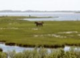
Assateague State Park
Encyclopedia
Assateague State Park is a public beach and state park of Maryland
that lies at the northern end of Assateague Island
. Reachable via Route 611
, across Sinepuxent Bay
via the Verrazano Bridge
(not to be confused with the Verrazano Narrows Bridge), Assateague State Park offers beaches and campsites to the public for a fee. The park lies adjacent to Assateague Island National Seashore
which is run by the National Park Service
.
Assateague Island National Seashore offers a guarded beach, public bathrooms, showers and concessions. It also offers public campgrounds, available on a reservation basis.
Maryland
Maryland is a U.S. state located in the Mid Atlantic region of the United States, bordering Virginia, West Virginia, and the District of Columbia to its south and west; Pennsylvania to its north; and Delaware to its east...
that lies at the northern end of Assateague Island
Assateague Island
Assateague Island is a long barrier island located off the eastern coast of Maryland and Virginia. It is best known for its herds of feral horses, pristine beaches, and the Assateague Lighthouse. The island also contains numerous marshes, bays and coves, including Toms Cove...
. Reachable via Route 611
Maryland Route 611
Maryland Route 611 is a state highway in the U.S. state of Maryland. Known as Stephen Decatur Highway, the state highway runs from Assateague Island north to U.S. Route 50 in West Ocean City. MD 611 is named for Stephen Decatur, the U.S. naval officer of the early 19th century who was born in...
, across Sinepuxent Bay
Sinepuxent Bay
Sinepuxent Bay is an inland waterway which connects Chincoteague Bay to the Ocean City Inlet. It separates Sinepuxent Neck, in Worcester County, Maryland, from Assateague Island, and is crossed by the Verrazano Bridge on Maryland State Highway 611 Sinepuxent Bay is an inland waterway which connects...
via the Verrazano Bridge
Verrazano Bridge (Maryland)
The Verrazano Bridge in Maryland is a bridge on Maryland Route 611 over Sinepuxent Bay that connects Assateague Island to the mainland. Like the larger and more famous Verrazano-Narrows Bridge, it is named for Giovanni da Verrazzano. The crossing contains two spans, one carrying automobiles and the...
(not to be confused with the Verrazano Narrows Bridge), Assateague State Park offers beaches and campsites to the public for a fee. The park lies adjacent to Assateague Island National Seashore
Assateague Island National Seashore
Assateague Island National Seashore is a unit of the National Park Service occupying much of Assateague Island along the Atlantic coast of Maryland and Virginia. It is a barrier island shaped by stormy seas and gentle winds. It lies adjacent to Assateague State Park and Chincoteague National...
which is run by the National Park Service
National Park Service
The National Park Service is the U.S. federal agency that manages all national parks, many national monuments, and other conservation and historical properties with various title designations...
.
Assateague Island National Seashore offers a guarded beach, public bathrooms, showers and concessions. It also offers public campgrounds, available on a reservation basis.

