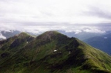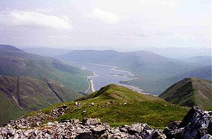
Aonach Meadhoin
Encyclopedia

Munro
A Munro is a mountain in Scotland with a height over . They are named after Sir Hugh Munro, 4th Baronet , who produced the first list of such hills, known as Munros Tables, in 1891. A Munro top is a summit over 3,000 ft which is not regarded as a separate mountain...
mountain situated in the Kintail
Kintail
Kintail is an area of mountains in the Northwest Highlands of Scotland. It consists of the mountains to the north of Glen Shiel and the A87 road between the heads of Loch Duich and Loch Cluanie; its boundaries, other than Glen Shiel, are generally taken to be the valleys of Strath Croe and Gleann...
region of Scotland
Scotland
Scotland is a country that is part of the United Kingdom. Occupying the northern third of the island of Great Britain, it shares a border with England to the south and is bounded by the North Sea to the east, the Atlantic Ocean to the north and west, and the North Channel and Irish Sea to the...
. It stands on the northern side of Glen Shiel
Glen Shiel
Glen Shiel is a glen in the Northwest Highlands of Scotland.The glen runs approximately 9 miles from north-west to south-east, from sea level at the village of Shiel Bridge and Loch Duich to the Cluanie Inn at the western end of Loch Cluanie and the start of Glenmoriston.W. H...
some 31 kilometres south east of Kyle of Lochalsh
Kyle of Lochalsh
Kyle of Lochalsh is a village on the northwest coast of Scotland, 63 miles west of Inverness. It is located at the entrance to Loch Alsh, opposite the village of Kyleakin on the Isle of Skye...
.
Overview
Aonach Meadhoin reaches a height of 1001 metres (3284 feet) and along with the Munros of SaileagSàileag
Sàileag is Scottish mountain located on the northern side of Glen Shiel, 27 kilometres south east of Kyle of Lochalsh.-Overview:It lies just to the east of the famous Five Sisters of Kintail group of hills to which it is connected by the Bealach an Lapain...
and Sgurr a' Bhealaich Dheirg
Sgurr a' Bhealaich Dheirg
Sgurr a' Bhealaich Dheirg is a Scottish mountain situated in Kintail on the northern side of Glen Shiel, 30 kilometres south east of Kyle of Lochalsh.-Overview:...
it forms a group of mountains sometimes referred to as the North Glen Shiel Ridge. The group are also known as the “Brothers of Kintail” in a nodding acquaintance to the better known Five Sisters of Kintail
Sgurr Fhuaran
Sgùrr Fhuaran is a Scottish mountain that is situated on the northern side of Glen Shiel, east south east of Kyle of Lochalsh.- Overview :...
just to the north west. The mountain's name translates from Gaelic
Scottish Gaelic language
Scottish Gaelic is a Celtic language native to Scotland. A member of the Goidelic branch of the Celtic languages, Scottish Gaelic, like Modern Irish and Manx, developed out of Middle Irish, and thus descends ultimately from Primitive Irish....
as Middle Ridge, the mountain is shaped like a horseshoe with the summit ridge lying centrally between the two ridges on either side of Coire na Cadha which lies between the mountain and the A87 road
A87 road
The A87 is a major road in the Highland region of Scotland.It runs west from its junction with the A82 road at Invergarry , along the north shores of Loch Garry and Loch Cluanie, then down through Glen Shiel and along Loch Duich to Kyle of Lochalsh before crossing the Skye Bridge to Kyleakin,...
two kilometres to the south.
Geography
Aonach Meadhoin’s north and south faces are steep as they drop to the corrieCirque
Cirque may refer to:* Cirque, a geological formation* Makhtesh, an erosional landform found in the Negev desert of Israel and Sinai of Egypt*Cirque , an album by Biosphere* Cirque Corporation, a company that makes touchpads...
s of Coire nan Eun (north) and Coire na Cadha (south); the northern face is craggy and holds snow well into summer. The mountain is made up of three main ridges which radiate from its summit; the western ridge connects to the adjoining Munro of Sgurr a' Bhealaich Dheirg which lies two kilometres away. Another ridge goes north east for a kilometre to the subsidiary “Top” of Sgurr an Fhuarail (Peak of the Cold Place) where it splits, the northern spur going for 2.5 kilometres to the Munro of Ciste Dhubh
Ciste Dhubh
Ciste Dhubh is a mountain situated in the Scottish Highlands between Glen Shiel and Glen Affric. It is a long distance from any centres of population, with Kyle of Lochalsh being almost 30 kilometres away to the west north-west.- Overview :...
, while the south eastern ridge descends to the Cluanie Inn on the A87. Sgurr an Fhuarail reaches a height of 987 metres (3238 feet) and is listed in the Munro Tables as a “Top” of Aonach Meadhoin. It is a fine viewpoint towards the east including an aerial view of Loch Cluanie
Loch Cluanie
Loch Cluanie is a loch in the Northwest Highlands of Scotland at the south-east end of Glen Shiel. It is a reservoir, contained behind the Cluanie Dam, constructed by Mitchell Construction and completed in 1957 as part of the North of Scotland Hydro-Electric Board's Glenmoriston project to...
, which is better than from the main summit.
All drainage from Aonach Meadhoin goes to the east coast of Scotland, over 70 kilometres distant, even though the mountain only stands 15 kilometres from Loch Duich
Loch Duich
Loch Duich is a sea loch situated on the western coast of Scotland, in the Highlands.-History:In 1719, British forces burned many homesteads along the loch’s shores in the month preceding the Battle of Glen Shiel....
on the west coast. The mountain's two main corries are major gathering grounds for Scottish rivers. To the north Coire nan Eun is the source of the River Affric which eventually finds its way to the Beauly Firth
Beauly Firth
The Beauly Firth is a firth in northern Scotland. It is effectively a continuation of the Moray Firth westward, and is bounded at one end by Beauly and at the other by Inverness . The Kessock Ferry has crossed at the eastern end since the 15th Century...
, while to the south Coire na Cadha supplies much of the water for the hydro reservoir of Loch Cluanie, eventually reaching the Moray Firth
Moray Firth
The Moray Firth is a roughly triangular inlet of the North Sea, north and east of Inverness, which is in the Highland council area of north of Scotland...
via the River Moriston and Loch Ness
Loch Ness
Loch Ness is a large, deep, freshwater loch in the Scottish Highlands extending for approximately southwest of Inverness. Its surface is above sea level. Loch Ness is best known for the alleged sightings of the cryptozoological Loch Ness Monster, also known affectionately as "Nessie"...
.
Ascents
Ascents of Aonach Meadhoin are usually started from the Cluanie Inn on the A87 road. When viewed from the inn, the main summit is hidden behind Sgurr an Fhuarail. The direct ascent goes up the south east ridge passing over Sgurr an Fhuarail before reaching the summit. The mountain is quite often climbed in conjunction with other peaks, the SMC’sScottish Mountaineering Club
The Scottish Mountaineering Club is Scotland's second oldest mountaineering club. Founded in 1889, in Glasgow, the private club, with about 400 members, publishes guidebooks and runs a list of Munroists.-History:At the time of the club's founding there were a number of experienced Alpinists...
Munro guide recommends climbing it with Ciste Dhubh, three kilometres to the north, however it is often scaled with the other two Munros of the North Glen Shiel Ridge. This latter walk begins two kilometres west of Cluanie Inn at grid reference and uses two subsidiary ridges to ease the climb and descent onto and off the main ridge.

