

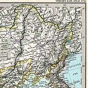
Anyuy River (Khabarovsk Krai)
Encyclopedia
River
A river is a natural watercourse, usually freshwater, flowing towards an ocean, a lake, a sea, or another river. In a few cases, a river simply flows into the ground or dries up completely before reaching another body of water. Small rivers may also be called by several other names, including...
in the Khabarovsk Krai
Khabarovsk Krai
Khabarovsk Krai is a federal subject of Russia , located in the Russian Far East. It lies mostly in the basin of the lower Amur River, but also occupies a vast mountainous area along the coastline of the Sea of Okhotsk, an arm of the Pacific Ocean. The administrative center of the krai is the...
in Russia
Russia
Russia or , officially known as both Russia and the Russian Federation , is a country in northern Eurasia. It is a federal semi-presidential republic, comprising 83 federal subjects...
. It is a right tributary
Tributary
A tributary or affluent is a stream or river that flows into a main stem river or a lake. A tributary does not flow directly into a sea or ocean...
of the Amur River. It originates on slope of Tordoki Yani
Tordoki Yani
Tordoki Yani or Tardoki Yani is the highest peak of Sikhote-Alin Mountains. It is located in the southeast of Khabarovsk Krai to north of border of Primorsky Krai.An elevation of Tordoki Yani is 2,090 m .Tordoki Yani is a table mountain....
in the Sikhote-Alin
Sikhote-Alin
The Sikhote-Alin is a mountain range in Primorsky and Khabarovsk Krais, Russia, extending about 900 km to the northeast of the Russian Pacific seaport of Vladivostok...
mountain range
Mountain range
A mountain range is a single, large mass consisting of a succession of mountains or narrowly spaced mountain ridges, with or without peaks, closely related in position, direction, formation, and age; a component part of a mountain system or of a mountain chain...
, and falls into the Amur between Khabarovsk
Khabarovsk
Khabarovsk is the largest city and the administrative center of Khabarovsk Krai, Russia. It is located some from the Chinese border. It is the second largest city in the Russian Far East, after Vladivostok. The city became the administrative center of the Far Eastern Federal District of Russia...
and Komsomolsk-on-Amur
Komsomolsk-on-Amur
Komsomolsk-on-Amur is a city in Khabarovsk Krai, Russia, situated on the left bank of Amur River. It is located on the BAM railway line, northeast of Khabarovsk. Population: -Geography and climate:...
.
The length of the Anyuy River is 393 km. The area of its basin
Drainage basin
A drainage basin is an extent or an area of land where surface water from rain and melting snow or ice converges to a single point, usually the exit of the basin, where the waters join another waterbody, such as a river, lake, reservoir, estuary, wetland, sea, or ocean...
is 12,700 km². The Manoma River is a main tributary of the Anuyu River.
History
