

Anabar Bay
Encyclopedia
Laptev Sea
The Laptev Sea is a marginal sea of the Arctic Ocean. It is located between the northern coast of Siberia, the Taimyr Peninsula, Severnaya Zemlya and the New Siberian Islands. Its northern boundary passes from the Arctic Cape to a point with co-ordinates of 79°N and 139°E, and ends at the Anisiy...
. Lat 74° 30' and long 113° 15'. It stretches between the eastern cape off the mouth of the Anabar River
Anabar River
The Anabar River is a river in Sakha, Russia, located just west of the Lena River. Its catchment extends into the Putoran Mountains that form the highest part of the Central Siberian Plateau....
and the Nordvik Peninsula. Nordvik Bay
Nordvik Bay
Nordvik Bay is a gulf in the Laptev Sea. Lat 73° 45' and long 112°. It is located Southeast of the mouth of the Khatanga Gulf, between two small peninsulas. The landspit in the west is the Uryung Tumus Peninsula, where there was formerly a village called Nordvik and an infamous penal colony that...
lies further west of it, beyond Cape Paksa at the tip of the peninsula.
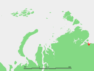
Anabar Bay opens towards the north and it is about 76 km in width. It includes the estuary of the Anabar River
Anabar River
The Anabar River is a river in Sakha, Russia, located just west of the Lena River. Its catchment extends into the Putoran Mountains that form the highest part of the Central Siberian Plateau....
which is about 40 km long with an average width of 10 km. Three rivers have their mouths at the beginning of the estuary, the Anabar in the center, the Tistyakh-Yuryage from the right, and the Suolama River from the left.
The Sibirskaya ryapushka
Least cisco
The least cisco, Coregonus sardinella, is a freshwater species of fish that inhabits some marginal seas of the Arctic. It is found from the Murchison River in Canada to Bristol Bay in Alaska, and in the Russian Arctic from the Kara Sea eastwards across the Laptev Sea, the East Siberian Sea, the...
fish often arrives in great numbers to the mouth of river Anabar.
The climate is Arctic and extremely severe, with prolonged, bitter winters so that the bay is covered by ice most of the year.
Anabar Bay and its surrounding area belongs to the Sakha Republic administrative division of the Russian Federation.
History
Baron Eduard Von Toll explored the Anabar Bay region in 1893. At that time it was a very little-known area of the Russian Arctic. He was the first one to map the plateau between the Anabar and Popigay Rivers.There were two settlements in the Anabar Bay area, during Soviet
Soviet Union
The Soviet Union , officially the Union of Soviet Socialist Republics , was a constitutionally socialist state that existed in Eurasia between 1922 and 1991....
times. One was Khorgo, at the mouth of the bay, and the other Tostuya, further inland at the point where the estuarine area begins.