

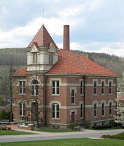
Alfred (village), New York
Encyclopedia
Village
A village is a clustered human settlement or community, larger than a hamlet with the population ranging from a few hundred to a few thousand , Though often located in rural areas, the term urban village is also applied to certain urban neighbourhoods, such as the West Village in Manhattan, New...
located in the Town of Alfred
Alfred (town), New York
Alfred is a town in Allegany County, New York, United States. The population was 5,140 at the 2000 census.The Town of Alfred has a village named Alfred in the center of the town....
in Allegany County
Allegany County, New York
Allegany County is a county located in the U.S. state of New York. As of the 2010 census, the population was 48,946. Its name derives from a Delaware Indian word, applied by settlers of Western New York State to a trail that followed the Allegheny River. Its county seat is...
, New York
New York
New York is a state in the Northeastern region of the United States. It is the nation's third most populous state. New York is bordered by New Jersey and Pennsylvania to the south, and by Connecticut, Massachusetts and Vermont to the east...
, USA. The population was 3,954 at the 2000 census. The village is named after Alfred the Great
Alfred the Great
Alfred the Great was King of Wessex from 871 to 899.Alfred is noted for his defence of the Anglo-Saxon kingdoms of southern England against the Vikings, becoming the only English monarch still to be accorded the epithet "the Great". Alfred was the first King of the West Saxons to style himself...
.
The Village of Alfred lies in the north-central part of the Town of Alfred
Alfred (town), New York
Alfred is a town in Allegany County, New York, United States. The population was 5,140 at the 2000 census.The Town of Alfred has a village named Alfred in the center of the town....
on the eastern edge of Allegany County.
Alfred is located in the hills of Western New York
New York
New York is a state in the Northeastern region of the United States. It is the nation's third most populous state. New York is bordered by New Jersey and Pennsylvania to the south, and by Connecticut, Massachusetts and Vermont to the east...
along the Southern Tier
Southern Tier
The Southern Tier is a geographical term that refers to the counties of New York State west of the Catskill Mountains along the northern border of Pennsylvania. It is a loosely defined term that generally includes the counties that border Pennsylvania west of Delaware County inclusive...
. The layout of the valley is such that the lowest part contains the village, and upon the hills to the East and West are Alfred University
Alfred University
Alfred University is a small, comprehensive university in the Village of Alfred in Western New York, USA, an hour and a half south of Rochester and two hours southeast of Buffalo. Alfred has an undergraduate population of around 2,000, and approximately 300 graduate students...
and Alfred State College
Alfred State College
Alfred State College is a State University of New York College of Technology located in Alfred, New York in Allegany County. This college, formerly the Agricultural and Technical College at Alfred, now grants baccalaureate degrees in 18 areas, associate degrees in nearly 60 areas, as well as a...
(respectively). The valley was originally called "Kanakadea" (or "Canakadea," or other spellings) by Native Americans
Native Americans in the United States
Native Americans in the United States are the indigenous peoples in North America within the boundaries of the present-day continental United States, parts of Alaska, and the island state of Hawaii. They are composed of numerous, distinct tribes, states, and ethnic groups, many of which survive as...
. Local college legends state that Kanakadea means "valley of the insane," as it was cursed either due to its being a burial ground, or purposely by the Indians as they were forced out by European settlers.
Alfred is located in the 607 (telephone) area code, 14802 zip
ZIP Code
ZIP codes are a system of postal codes used by the United States Postal Service since 1963. The term ZIP, an acronym for Zone Improvement Plan, is properly written in capital letters and was chosen to suggest that the mail travels more efficiently, and therefore more quickly, when senders use the...
(postal) code, and is in the second poorest county in the state (Allegany
Allegany County, New York
Allegany County is a county located in the U.S. state of New York. As of the 2010 census, the population was 48,946. Its name derives from a Delaware Indian word, applied by settlers of Western New York State to a trail that followed the Allegheny River. Its county seat is...
), neighboring one of the wealthiest, in terms of per capita income (Steuben
Steuben County, New York
Steuben County is a county located in the U.S. state of New York. As of the 2010 census, the population was 98,990. Its name is in honor of Baron von Steuben, a German general who fought on the American side in the American Revolutionary War, though it is not pronounced the same...
). The closest cities are Hornell
Hornell, New York
Hornell is a city in Steuben County, New York, United States. The population was 9,019 at the 2000 census. The city is named after the Hornell family, early settlers. Its current population has not yet been released by the new census....
and Olean
Olean, New York
Olean is a city in Cattaraugus County, New York, United States. Olean is the largest city in Cattaraugus County, and serves as the financial, business, transportation and entertainment center of the county. It is one of the principal cities of the Southern Tier region of New York.The city is...
.
The elevation of Alfred is about 1700 feet (518.2 m), but due to the hilliness of the region, this varies greatly within the town. The hills greatly affect the weather in Western New York
Western New York
Western New York is the westernmost region of the state of New York. It includes the cities of Buffalo, Rochester, Niagara Falls, the surrounding suburbs, as well as the outlying rural areas of the Great Lakes lowlands, the Genesee Valley, and the Southern Tier. Some historians, scholars and others...
, which results in quick changes as well as different conditions in neighboring valleys. The weather is often described by the truism
Truism
A truism is a claim that is so obvious or self-evident as to be hardly worth mentioning, except as a reminder or as a rhetorical or literary device and is the opposite of falsism....
that says: "If you don't like the weather, wait ten minutes; it'll change."
The Village of Alfred hosts the annual Hot Dog Day
Hot dog day
Hot Dog Days are informal events that are celebrated in communities throughout the hotdog-eating world, including the USA, Canada, Great Britain and Australia. Their origin is obscure. As the name suggests the festivals revolve around eating hot dogs, but usually there are many other activities...
festival (early April).
The village of Alfred is home to the largest optical telescope in New York State, at the Stull Observatory
Stull Observatory
Stull Observatory is an astronomical observatory owned and operated by Alfred University. Named after Dr. John Stull, who helped establish the observatory in 1966, it is located in Alfred, New York . It is notable for housing 7 independently housed telescopes ranging in size from 8 to 32 inches...
at Alfred University
Alfred University
Alfred University is a small, comprehensive university in the Village of Alfred in Western New York, USA, an hour and a half south of Rochester and two hours southeast of Buffalo. Alfred has an undergraduate population of around 2,000, and approximately 300 graduate students...
.
History
The village was first settled around 1807 and was incorporated in 1881. The village was previously called "Alfred Centre."Geography
Alfred is approximately located at the 42.3° North latitude, 77.8° West longitude.According to the United States Census Bureau
United States Census Bureau
The United States Census Bureau is the government agency that is responsible for the United States Census. It also gathers other national demographic and economic data...
, the village has a total area of 1.2 square miles (3.1 km²), all of it land. but there is a small stream known as Canacadea Creek, that flows throughout the year. This stream flows to the Canisteo River which is a tributary to the Susquehanna River watershed. The topography is steep hill country as it is part of the Allegheny Plateau, being the northern part of the Appalachian Mountain chain.
Demographics
As of the censusCensus
A census is the procedure of systematically acquiring and recording information about the members of a given population. It is a regularly occurring and official count of a particular population. The term is used mostly in connection with national population and housing censuses; other common...
of 2000, there were 3,954 people, 530 households, and 169 families residing in the village. The population density
Population density
Population density is a measurement of population per unit area or unit volume. It is frequently applied to living organisms, and particularly to humans...
was 3,352.5 people per square mile (1,293.8/km²). There were 576 housing units at an average density of 488.4 per square mile (188.5/km²). The racial makeup of the village was 90.21% White, 4.40% Black or African American
Race (United States Census)
Race and ethnicity in the United States Census, as defined by the Federal Office of Management and Budget and the United States Census Bureau, are self-identification data items in which residents choose the race or races with which they most closely identify, and indicate whether or not they are...
, 0.33% Native American, 2.71% Asian, 0.03% Pacific Islander, 1.21% from other races
Race (United States Census)
Race and ethnicity in the United States Census, as defined by the Federal Office of Management and Budget and the United States Census Bureau, are self-identification data items in which residents choose the race or races with which they most closely identify, and indicate whether or not they are...
, and 1.11% from two or more races. Hispanic or Latino of any race were 2.73% of the population.
There were 530 households out of which 12.3% had children under the age of 18 living with them, 26.0% were married couples
Marriage
Marriage is a social union or legal contract between people that creates kinship. It is an institution in which interpersonal relationships, usually intimate and sexual, are acknowledged in a variety of ways, depending on the culture or subculture in which it is found...
living together, 4.2% had a female householder with no husband present, and 68.1% were non-families. 38.9% of all households were made up of individuals and 10.6% had someone living alone who was 65 years of age or older. The average household size was 2.05 and the average family size was 2.73.
In the village the population was spread out with 3.0% under the age of 18, 83.1% from 18 to 24, 5.9% from 25 to 44, 4.6% from 45 to 64, and 3.3% who were 65 years of age or older. The median age was 20 years. For every 100 females there were 144.8 males. For every 100 females age 18 and over, there were 147.2 males.
The median income for a household in the village was $21,313, and the median income for a family was $70,694. Males had a median income of $15,750 versus $39,375 for females. The per capita income
Per capita income
Per capita income or income per person is a measure of mean income within an economic aggregate, such as a country or city. It is calculated by taking a measure of all sources of income in the aggregate and dividing it by the total population...
for the village was $8,224. About 2.0% of families and 37.7% of the population were below the poverty line, including none of those under age 18 and 2.8% of those age 65 or over.