
Albany, Kentucky
Encyclopedia
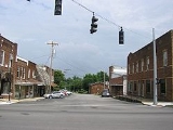
Albany is a city in Clinton County
, Kentucky
, United States
. The population was 2,220 at the 2000 census. It is the county seat
of Clinton County
. It is located on U.S. Route 127
about six miles from the Tennessee
border.
, but A local legend holds that, during the vote to determine the location of the county seat, patrons of Dowell's tavern shouted "All for Benny!", which led to the town being called Albany.
During the Civil War
, Albany was attacked by Confederate
forces, and many buildings, including the courthouse, were burned. By the 1870s, Albany had recovered from the destruction and boasted a new courthouse, a confectionery
and several dry goods, grocery, and drug stores.
According to the United States Census Bureau
, the city has a total area of 3.4 square miles (8.8 km²), all of it land.
of 2000, there were 2,220 people, 1,018 households, and 561 families residing in the city. The population density
was 653.0 people per square mile (252.1/km²). There were 1,165 housing units at an average density of 342.7 per square mile (132.3/km²). The racial makeup of the city was 98.38% White, 0.05% African American, 0.14% Native American, 0.05% Asian, 0.50% Pacific Islander, 0.18% from other races
, and 0.72% from two or more races. Hispanic or Latino of any race were 3.11% of the population.
There were 1,018 households out of which 25.1% had children under the age of 18 living with them, 37.5% were married couples
living together, 14.5% had a female householder with no husband present, and 44.8% were non-families. 41.6% of all households were made up of individuals and 19.3% had someone living alone who was 65 years of age or older. The average household size was 2.12 and the average family size was 2.86.
In the city the population was spread out with 21.5% under the age of 18, 9.9% from 18 to 24, 24.4% from 25 to 44, 24.8% from 45 to 64, and 19.4% who were 65 years of age or older. The median age was 40 years. For every 100 females there were 80.2 males. For every 100 females age 18 and over, there were 77.0 males.
The median income for a household in the city was $14,558, and the median income for a family was $22,652. Males had a median income of $21,389 versus $16,685 for females. The per capita income
for the city was $12,919. About 28.9% of families and 35.9% of the population were below the poverty line, including 49.8% of those under age 18 and 36.5% of those age 65 or over.
Clinton County, Kentucky
Clinton County is a county located in the U.S. state of Kentucky. It was formed in 1836. As of 2000, the population was 9,634. Its name is in honor of the seventh Governor of New York State, DeWitt Clinton. Its county seat is Albany, Kentucky, and it is a prohibition or dry county...
, Kentucky
Kentucky
The Commonwealth of Kentucky is a state located in the East Central United States of America. As classified by the United States Census Bureau, Kentucky is a Southern state, more specifically in the East South Central region. Kentucky is one of four U.S. states constituted as a commonwealth...
, United States
United States
The United States of America is a federal constitutional republic comprising fifty states and a federal district...
. The population was 2,220 at the 2000 census. It is the county seat
County seat
A county seat is an administrative center, or seat of government, for a county or civil parish. The term is primarily used in the United States....
of Clinton County
Clinton County, Kentucky
Clinton County is a county located in the U.S. state of Kentucky. It was formed in 1836. As of 2000, the population was 9,634. Its name is in honor of the seventh Governor of New York State, DeWitt Clinton. Its county seat is Albany, Kentucky, and it is a prohibition or dry county...
. It is located on U.S. Route 127
U.S. Route 127
U.S. Route 127 is a long north–south United States highway in the eastern half of the United States. The southern terminus of the route is at U.S. Route 27 in Chattanooga, Tennessee. The northern terminus is at Interstate 75 near Grayling, Michigan...
about six miles from the Tennessee
Tennessee
Tennessee is a U.S. state located in the Southeastern United States. It has a population of 6,346,105, making it the nation's 17th-largest state by population, and covers , making it the 36th-largest by total land area...
border.
History
The community of Albany grew up around a tavern established by Benjamin Dowell in the early 19th century. In 1837, residents voted to make the location the seat of county government. It is generally accepted that the town, formally incorporated on January 27, 1838, was named after Albany, New YorkAlbany, New York
Albany is the capital city of the U.S. state of New York, the seat of Albany County, and the central city of New York's Capital District. Roughly north of New York City, Albany sits on the west bank of the Hudson River, about south of its confluence with the Mohawk River...
, but A local legend holds that, during the vote to determine the location of the county seat, patrons of Dowell's tavern shouted "All for Benny!", which led to the town being called Albany.
During the Civil War
American Civil War
The American Civil War was a civil war fought in the United States of America. In response to the election of Abraham Lincoln as President of the United States, 11 southern slave states declared their secession from the United States and formed the Confederate States of America ; the other 25...
, Albany was attacked by Confederate
Confederate States of America
The Confederate States of America was a government set up from 1861 to 1865 by 11 Southern slave states of the United States of America that had declared their secession from the U.S...
forces, and many buildings, including the courthouse, were burned. By the 1870s, Albany had recovered from the destruction and boasted a new courthouse, a confectionery
Confectionery
Confectionery is the set of food items that are rich in sugar, any one or type of which is called a confection. Modern usage may include substances rich in artificial sweeteners as well...
and several dry goods, grocery, and drug stores.
Geography
Albany is located at 36°41′36"N 85°8′7"W (36.693280, -85.135286).According to the United States Census Bureau
United States Census Bureau
The United States Census Bureau is the government agency that is responsible for the United States Census. It also gathers other national demographic and economic data...
, the city has a total area of 3.4 square miles (8.8 km²), all of it land.
Demographics
As of the censusCensus
A census is the procedure of systematically acquiring and recording information about the members of a given population. It is a regularly occurring and official count of a particular population. The term is used mostly in connection with national population and housing censuses; other common...
of 2000, there were 2,220 people, 1,018 households, and 561 families residing in the city. The population density
Population density
Population density is a measurement of population per unit area or unit volume. It is frequently applied to living organisms, and particularly to humans...
was 653.0 people per square mile (252.1/km²). There were 1,165 housing units at an average density of 342.7 per square mile (132.3/km²). The racial makeup of the city was 98.38% White, 0.05% African American, 0.14% Native American, 0.05% Asian, 0.50% Pacific Islander, 0.18% from other races
Race (United States Census)
Race and ethnicity in the United States Census, as defined by the Federal Office of Management and Budget and the United States Census Bureau, are self-identification data items in which residents choose the race or races with which they most closely identify, and indicate whether or not they are...
, and 0.72% from two or more races. Hispanic or Latino of any race were 3.11% of the population.
There were 1,018 households out of which 25.1% had children under the age of 18 living with them, 37.5% were married couples
Marriage
Marriage is a social union or legal contract between people that creates kinship. It is an institution in which interpersonal relationships, usually intimate and sexual, are acknowledged in a variety of ways, depending on the culture or subculture in which it is found...
living together, 14.5% had a female householder with no husband present, and 44.8% were non-families. 41.6% of all households were made up of individuals and 19.3% had someone living alone who was 65 years of age or older. The average household size was 2.12 and the average family size was 2.86.
In the city the population was spread out with 21.5% under the age of 18, 9.9% from 18 to 24, 24.4% from 25 to 44, 24.8% from 45 to 64, and 19.4% who were 65 years of age or older. The median age was 40 years. For every 100 females there were 80.2 males. For every 100 females age 18 and over, there were 77.0 males.
The median income for a household in the city was $14,558, and the median income for a family was $22,652. Males had a median income of $21,389 versus $16,685 for females. The per capita income
Per capita income
Per capita income or income per person is a measure of mean income within an economic aggregate, such as a country or city. It is calculated by taking a measure of all sources of income in the aggregate and dividing it by the total population...
for the city was $12,919. About 28.9% of families and 35.9% of the population were below the poverty line, including 49.8% of those under age 18 and 36.5% of those age 65 or over.