

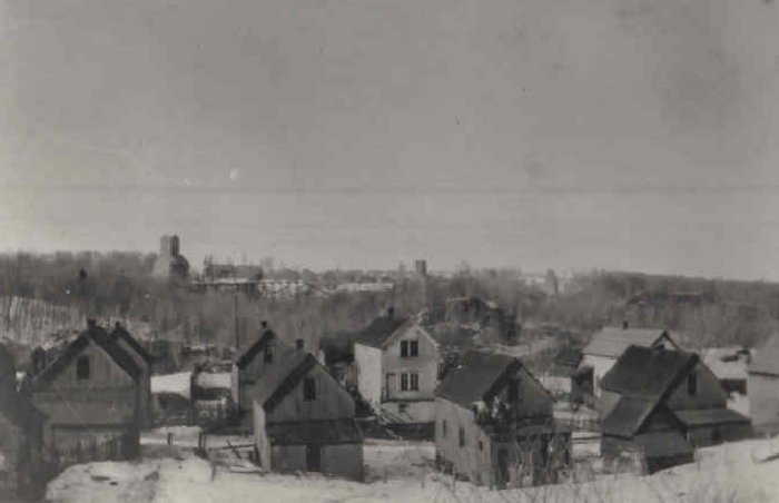
Adams Township, Houghton County, Michigan
Encyclopedia
Adams Township is a civil township
of Houghton County
in the U.S. state
of Michigan
. As of the 2000 census
, the township population was 2,747.
, the township has a total area of 47.7 square miles (123.5 km²), of which, 47.2 square miles (122.2 km²) of it is land and 0.5 square miles (1.3 km²) of it (1.01%) is water.
of 2000, there were 2,747 people, 1,011 households, and 630 families residing in the township. The population density
was 58.1 per square mile (22.4/km²). There were 1,160 housing units at an average density of 24.6 per square mile (9.5/km²). The racial makeup of the township was 92.61% White, 5.17% African American, 0.15% Native American, 0.55% Asian, 0.04% Pacific Islander, 0.22% from other races
, and 1.27% from two or more races. Hispanic or Latino of any race were 0.62% of the population. 47.1% were of Finnish, 8.6% Italian
, 7.8% German and 5.6% English
ancestry according to Census 2000.
There were 1,011 households out of which 29.7% had children under the age of 18 living with them, 47.5% were married couples
living together, 10.3% had a female householder with no husband present, and 37.6% were non-families. 31.4% of all households were made up of individuals and 14.5% had someone living alone who was 65 years of age or older. The average household size was 2.48 and the average family size was 3.19.
In the township the population was spread out with 25.2% under the age of 18, 10.2% from 18 to 24, 29.5% from 25 to 44, 20.0% from 45 to 64, and 15.0% who were 65 years of age or older. The median age was 35 years. For every 100 females there were 124.1 males. For every 100 females age 18 and over, there were 132.1 males.
The median income for a household in the township was $28,776, and the median income for a family was $35,903. Males had a median income of $26,739 versus $20,099 for females. The per capita income
for the township was $12,741. About 8.0% of families and 11.9% of the population were below the poverty line, including 14.6% of those under age 18 and 14.4% of those age 65 or over.
Civil township
A civil township is a widely used unit of local government in the United States, subordinate to, and geographic divisions of, a county. Specific responsibilities and the degree of autonomy vary based on each state. Civil townships are distinct from survey townships, but in states that have both,...
of Houghton County
Houghton County, Michigan
-National protected areas:* Keweenaw National Historical Park * Ottawa National Forest -Demographics:As of the census of 2000, there were 36,016 people, 13,793 households, and 8,137 families residing in the county. The population density was 36 people per square mile . There were 17,748 housing...
in the U.S. state
U.S. state
A U.S. state is any one of the 50 federated states of the United States of America that share sovereignty with the federal government. Because of this shared sovereignty, an American is a citizen both of the federal entity and of his or her state of domicile. Four states use the official title of...
of Michigan
Michigan
Michigan is a U.S. state located in the Great Lakes Region of the United States of America. The name Michigan is the French form of the Ojibwa word mishigamaa, meaning "large water" or "large lake"....
. As of the 2000 census
United States Census, 2000
The Twenty-second United States Census, known as Census 2000 and conducted by the Census Bureau, determined the resident population of the United States on April 1, 2000, to be 281,421,906, an increase of 13.2% over the 248,709,873 persons enumerated during the 1990 Census...
, the township population was 2,747.
Communities
- Atlantic Mine is an unincorporated community about five miles (8 km) southwest of HoughtonHoughton, MichiganHoughton is a city in the U.S. state of Michigan's Upper Peninsula and largest city in the Copper Country on the Keweenaw Peninsula. As of the 2010 census, the city population was 7,708. It is the county seat of Houghton County...
on M-26M-26 (Michigan highway)M-26 is a state trunkline highway in the U.S. state of Michigan, running from two miles east of Rockland to its junction with US Highway 41 in Copper Harbor. It generally runs southwest-to-northeast in the western half or Michigan's Upper Peninsula...
at 47°05′50"N 88°37′39"W. The ZIP codeZIP CodeZIP codes are a system of postal codes used by the United States Postal Service since 1963. The term ZIP, an acronym for Zone Improvement Plan, is properly written in capital letters and was chosen to suggest that the mail travels more efficiently, and therefore more quickly, when senders use the...
is 49905. It was settled in 1872. - Baltic is an unincorporated community southeast of South Range at 47°04′03"N 88°38′00"W. It was a station on the Copper Range RailroadCopper Range RailroadThe Copper Range Railroad was a small railroad company that operated from 1899 to 1972 in the western Upper Peninsula of the state of Michigan, United States....
and the settlement was founded by and named after the Baltic Mining Company in 1898. A post office operated here from November 6, 1902 until October 10, 1975. - Brooklyn is an unincorporated community in the township, less than a quarter mile south of Baltic.
- Coles Creek is an unincorporated community in the township.
- PainesdalePainesdale, MichiganPainesdale is an unincorporated community in Houghton County, Michigan, United States. Painesdale is located in Adams Township along M-26, southwest of South Range. Painesdale has a post office with ZIP code 49955.-History:...
is an incorporated village in the township. - Seeberville is an unincorporated community in the township, immediately southwest of Painesdale.
- South RangeSouth Range, MichiganSouth Range is a village in Adams Township, Houghton County in the U.S. state of Michigan. It is bordered on the east by the unincorporated community of Baltic. It is about five miles southwest of Houghton on M-26. The population was 727 at the 2000 census...
is an incorporated village about one mile (1.6 km) south of Atlantic Mine.
Geography
According to the United States Census BureauUnited States Census Bureau
The United States Census Bureau is the government agency that is responsible for the United States Census. It also gathers other national demographic and economic data...
, the township has a total area of 47.7 square miles (123.5 km²), of which, 47.2 square miles (122.2 km²) of it is land and 0.5 square miles (1.3 km²) of it (1.01%) is water.
Demographics
As of the censusCensus
A census is the procedure of systematically acquiring and recording information about the members of a given population. It is a regularly occurring and official count of a particular population. The term is used mostly in connection with national population and housing censuses; other common...
of 2000, there were 2,747 people, 1,011 households, and 630 families residing in the township. The population density
Population density
Population density is a measurement of population per unit area or unit volume. It is frequently applied to living organisms, and particularly to humans...
was 58.1 per square mile (22.4/km²). There were 1,160 housing units at an average density of 24.6 per square mile (9.5/km²). The racial makeup of the township was 92.61% White, 5.17% African American, 0.15% Native American, 0.55% Asian, 0.04% Pacific Islander, 0.22% from other races
Race (United States Census)
Race and ethnicity in the United States Census, as defined by the Federal Office of Management and Budget and the United States Census Bureau, are self-identification data items in which residents choose the race or races with which they most closely identify, and indicate whether or not they are...
, and 1.27% from two or more races. Hispanic or Latino of any race were 0.62% of the population. 47.1% were of Finnish, 8.6% Italian
Italian people
The Italian people are an ethnic group that share a common Italian culture, ancestry and speak the Italian language as a mother tongue. Within Italy, Italians are defined by citizenship, regardless of ancestry or country of residence , and are distinguished from people...
, 7.8% German and 5.6% English
English people
The English are a nation and ethnic group native to England, who speak English. The English identity is of early mediaeval origin, when they were known in Old English as the Anglecynn. England is now a country of the United Kingdom, and the majority of English people in England are British Citizens...
ancestry according to Census 2000.
There were 1,011 households out of which 29.7% had children under the age of 18 living with them, 47.5% were married couples
Marriage
Marriage is a social union or legal contract between people that creates kinship. It is an institution in which interpersonal relationships, usually intimate and sexual, are acknowledged in a variety of ways, depending on the culture or subculture in which it is found...
living together, 10.3% had a female householder with no husband present, and 37.6% were non-families. 31.4% of all households were made up of individuals and 14.5% had someone living alone who was 65 years of age or older. The average household size was 2.48 and the average family size was 3.19.
In the township the population was spread out with 25.2% under the age of 18, 10.2% from 18 to 24, 29.5% from 25 to 44, 20.0% from 45 to 64, and 15.0% who were 65 years of age or older. The median age was 35 years. For every 100 females there were 124.1 males. For every 100 females age 18 and over, there were 132.1 males.
The median income for a household in the township was $28,776, and the median income for a family was $35,903. Males had a median income of $26,739 versus $20,099 for females. The per capita income
Per capita income
Per capita income or income per person is a measure of mean income within an economic aggregate, such as a country or city. It is calculated by taking a measure of all sources of income in the aggregate and dividing it by the total population...
for the township was $12,741. About 8.0% of families and 11.9% of the population were below the poverty line, including 14.6% of those under age 18 and 14.4% of those age 65 or over.