
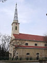
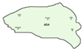
Ada, Serbia
Encyclopedia
Serbia
Serbia , officially the Republic of Serbia , is a landlocked country located at the crossroads of Central and Southeast Europe, covering the southern part of the Carpathian basin and the central part of the Balkans...
. It is situated near the river Tisa
Tisá
Tisá is a village and municipality in Ústí nad Labem District in the Ústí nad Labem Region of the Czech Republic.The municipality covers an area of , and has a population of 786 ....
in Vojvodina
Vojvodina
Vojvodina, officially called Autonomous Province of Vojvodina is an autonomous province of Serbia. Its capital and largest city is Novi Sad...
province. Although the town is geographically located in Bačka
Backa
Bačka is a geographical area within the Pannonian plain bordered by the river Danube to the west and south, and by the river Tisza to the east of which confluence is located near Titel...
, it is part of the North Banat District
North Banat District
North Banat District is a northern district of Serbia. It lies in the regions of Banat and Bačka, in the autonomous province of Vojvodina. As of the 2002 census, the district has a population of 165,881. The seat of the district is Kikinda....
. The town has a population of 10,546, while Ada municipality has 18,972 inhabitants (2002 census).
Inhabited places
Ada municipality includes the town of Ada, the nearby town of MolMol, Serbia
Mol is a town located in the Ada municipality, in the North Banat District of Serbia. It is situated in the Autonomous Province of Vojvodina...
(Hungarian: Mohol), and the following villages (Hungarian names are in italics):
- Utrine (Törökfalu)
- ObornjačaObornjaca (Ada)Obornjača is a village in Serbia. It is situated in the Ada municipality, in the North Banat District, Vojvodina province. The village has a Hungarian ethnic majority and its population numbering 389 people .-External links:*...
(Völgypart-Nagyvölgy) - SterijinoSterijinoSterijino is a village in Serbia. It is situated in the Ada municipality, in the North Banat District, Vojvodina province. The village has a Hungarian ethnic majority and its population numbering 234 people .-See also:*List of places in Serbia*List of cities, towns and villages in Vojvodina...
(Valkaisor)
Ethnic groups (2002 census)
The population of the Ada municipality:- Hungarians = 14,558 (forming an absolute majority of 76.64%)
- SerbsSerbsThe Serbs are a South Slavic ethnic group of the Balkans and southern Central Europe. Serbs are located mainly in Serbia, Montenegro and Bosnia and Herzegovina, and form a sizable minority in Croatia, the Republic of Macedonia and Slovenia. Likewise, Serbs are an officially recognized minority in...
= 3,324 (17.5%) - Roma = 277 (1,45%)
- YugoslavsYugoslavsYugoslavs is a national designation used by a minority of South Slavs across the countries of the former Yugoslavia and in the diaspora...
= 275 (1,44%) - Others.
All local communities in the municipality have a Hungarian majority.
Famous inhabitants
- In 1892 Ada, then part of the Kingdom of HungaryKingdom of HungaryThe Kingdom of Hungary comprised present-day Hungary, Slovakia and Croatia , Transylvania , Carpatho Ruthenia , Vojvodina , Burgenland , and other smaller territories surrounding present-day Hungary's borders...
, was the birthplace of the Mátyás RákosiMátyás RákosiMátyás Rákosi was a Hungarian communist politician. He was born as Mátyás Rosenfeld, in present-day Serbia...
, who would become the Communist ruler of post-1945 Hungary.
External links
Twin towns — Sister cities
Ada (Serbia) is twinnedTown twinning
Twin towns and sister cities are two of many terms used to describe the cooperative agreements between towns, cities, and even counties in geographically and politically distinct areas to promote cultural and commercial ties.- Terminology :...
with: Budapest XI
Újbuda
Újbuda is the 11th district of Budapest , Hungary. Currently it is the most populous district of Budapest with 137,426 inhabitants . Until the 1890s Újbuda's present territory was a field south to the historical town of Buda. The construction of a new residential area started in the 1900s, the...
, Hungary
Hungary
Hungary , officially the Republic of Hungary , is a landlocked country in Central Europe. It is situated in the Carpathian Basin and is bordered by Slovakia to the north, Ukraine and Romania to the east, Serbia and Croatia to the south, Slovenia to the southwest and Austria to the west. The...
Makó
Makó
Makó is a town in Csongrád County in southeastern Hungary. It lies on the Maros River, near the Romanian border. The area of the town is of which is arable land. The climate is very warm with hot and dry summers. Makó and the surrounding region get the most sunshine in Hungary, about 85-90...
, Hungary
Hungary
Hungary , officially the Republic of Hungary , is a landlocked country in Central Europe. It is situated in the Carpathian Basin and is bordered by Slovakia to the north, Ukraine and Romania to the east, Serbia and Croatia to the south, Slovenia to the southwest and Austria to the west. The...
Inárcs
Inárcs
-References:...
, Hungary
Hungary
Hungary , officially the Republic of Hungary , is a landlocked country in Central Europe. It is situated in the Carpathian Basin and is bordered by Slovakia to the north, Ukraine and Romania to the east, Serbia and Croatia to the south, Slovenia to the southwest and Austria to the west. The...
Nemesnádudvar
Nemesnádudvar
Nemesnádudvar is a village in Bács-Kiskun county, Hungary.The parish of Nádudvar was founded in 1739, separating from parish Hajos...
, Hungary
Hungary
Hungary , officially the Republic of Hungary , is a landlocked country in Central Europe. It is situated in the Carpathian Basin and is bordered by Slovakia to the north, Ukraine and Romania to the east, Serbia and Croatia to the south, Slovenia to the southwest and Austria to the west. The...
Joseni
Joseni, Harghita
Joseni is a commune in Harghita County, Romania. It lies in the Székely Land, an ethno-cultural region in eastern Transylvania, and is composed of three villages:*Borzont / Borzont*Bucin / Bucsin*Joseni / Gyergyóalfalu-History:...
, Romania
Romania
Romania is a country located at the crossroads of Central and Southeastern Europe, on the Lower Danube, within and outside the Carpathian arch, bordering on the Black Sea...