

A338 road
Encyclopedia
The A338 is a major trunk road in southern England
, that runs from the junction with the A35 at Bournemouth
in Dorset
to the junction with the A420
at Besselsleigh
in Oxfordshire
, roughly 92 miles (148.1 km) long.
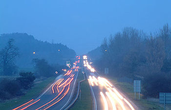
dual carriageway
, one of the main roads in the South East Dorset conurbation
. From near Bournemouth International Airport
it follows the western side of the Avon
valley, joining the route
of the A31 road
heading north-east for 1+1/2 mi to cross the valley, before turning left at Ringwood
in Hampshire
where it joins the original, single carriageway
route to the east of the river.
Heading northward up the east side of the Avon, it crosses to the west again near the town of Fordingbridge
. After crossing into Wiltshire
near Downton, it meets the A354 road
at a roundabout on the southern outskirts of Salisbury
(Britford
), before joining the route of the A36 road
as it bypasses the city centre to dual carriageway standard. It meets the A30 road
at a roundabout, before continuing in a north-easterly direction, to follow the entire length of the River Bourne
. It has a junction with the main A303 road
, which it crosses, and then travels through the town of Tidworth
. From there the road travels north to Collingbourne Ducis
, where it twists through the village around the church to a mini-roundabout. It turns right to continue northwards alongside the Bourne through another narrow stretch at Collingbourne Kingston
to another mini-roundabout before again heading north.
Near Burbage
the continued route north to Swindon
is designated A346, the A338 turning off to the right at a roundabout and heading east then north-east and crossing the border into Berkshire
. It passes through the town of Hungerford
, where it meets the A4 road (to Marlborough and Newbury
). It meets the M4 motorway
at junction 14, passes through the village of Great Shefford
and heads roughly northward into Oxfordshire. It goes through Wantage
where it meets the A417 road
, and past the villages of Grove
, East Hanney
and Frilford
. It terminates at its junction with the A420 road
near Bessels Leigh, 6 miles (9.7 km) south-west of Oxford
.
The section of the A338 south of the A31
to the west of the Avon consists mostly of a relatively newly built road. Part is constructed along the trackbed of the former railway line between Ringwood and Christchurch, which closed in 1935. Originally, the A338 went from Ringwood to Christchurch
on the east side of the valley, along what is now the B3347.
's 'Jude the Obscure
', chapter 3. The point where the road crests the downs before beginning the steep drop into Wantage
('Alfredston') is the spot where young Jude stands one evening and looks out for the first time on Oxford
('Christminster').
Following four fatal head-on collision accidents in 2008 alone, local residents have renewed their calls for the road to be upgraded to dual carriageway to provide a safe overtaking facility and deal with the capacity problems.
England
England is a country that is part of the United Kingdom. It shares land borders with Scotland to the north and Wales to the west; the Irish Sea is to the north west, the Celtic Sea to the south west, with the North Sea to the east and the English Channel to the south separating it from continental...
, that runs from the junction with the A35 at Bournemouth
Bournemouth
Bournemouth is a large coastal resort town in the ceremonial county of Dorset, England. According to the 2001 Census the town has a population of 163,444, making it the largest settlement in Dorset. It is also the largest settlement between Southampton and Plymouth...
in Dorset
Dorset
Dorset , is a county in South West England on the English Channel coast. The county town is Dorchester which is situated in the south. The Hampshire towns of Bournemouth and Christchurch joined the county with the reorganisation of local government in 1974...
to the junction with the A420
A420 road
The A420 is a road between Bristol and Oxford in England. Between Swindon and Oxford it is a primary route.-Present route:Since the opening of the M4 motorway, the road is in two sections. The first section begins on Old Market Street near the centre of Bristol, it passes through Kingswood before...
at Besselsleigh
Besselsleigh
Besselsleigh or Bessels Leigh is a village and civil parish about south-west of Oxford. Besselsleigh was part of Berkshire until the 1974 boundary changes transferred to Oxfordshire.The village is just off the A420 road between Oxford and Swindon....
in Oxfordshire
Oxfordshire
Oxfordshire is a county in the South East region of England, bordering on Warwickshire and Northamptonshire , Buckinghamshire , Berkshire , Wiltshire and Gloucestershire ....
, roughly 92 miles (148.1 km) long.
Route
The road begins on the very edge of Poole - by the border with Bournemouth, before heading northward as a grade separatedGrade separation
Grade separation is the method of aligning a junction of two or more transport axes at different heights so that they will not disrupt the traffic flow on other transit routes when they cross each other. The composition of such transport axes does not have to be uniform; it can consist of a...
dual carriageway
Dual carriageway
A dual carriageway is a class of highway with two carriageways for traffic travelling in opposite directions separated by a central reservation...
, one of the main roads in the South East Dorset conurbation
South East Dorset conurbation
The South east Dorset conurbation is a multi-centred conurbation on the south coast of Dorset in England. The area is rapidly becoming an amalgamation with the area of South West Hampshire immediately on the fringe of the newly formed New Forest National Park...
. From near Bournemouth International Airport
Bournemouth Airport
Bournemouth Airport is an airport located north-northeast of Bournemouth, in southern England...
it follows the western side of the Avon
River Avon, Hampshire
The River Avon is a river in the south of England. The river rises in the county of Wiltshire and flows through the city of Salisbury and the county of Hampshire before reaching the English Channel through Christchurch Harbour in the county of Dorset....
valley, joining the route
Concurrency (road)
A concurrency, overlap, or coincidence in a road network is an instance of one physical road bearing two or more different highway, motorway, or other route numbers...
of the A31 road
A31 road
The A31 is a major trunk road in southern England that runs from Guildford in Surrey to Bere Regis in Dorset.-Route of road:The road begins in the centre of Guildford, meeting the A3 road before running south west along the Hog's Back. It continues past Farnham, Alton and New Alresford before...
heading north-east for 1+1/2 mi to cross the valley, before turning left at Ringwood
Ringwood
Ringwood is a historic market town and civil parish in Hampshire, England, located on the River Avon, close to the New Forest and north of Bournemouth. It has a history dating back to Anglo-Saxon times, and has held a weekly market since the Middle Ages....
in Hampshire
Hampshire
Hampshire is a county on the southern coast of England in the United Kingdom. The county town of Hampshire is Winchester, a historic cathedral city that was once the capital of England. Hampshire is notable for housing the original birthplaces of the Royal Navy, British Army, and Royal Air Force...
where it joins the original, single carriageway
Single carriageway
A single carriageway is a road with 1, 2 or more lanes arranged within a single carriageway with no central reservation to separate opposing flows of traffic. Two-lane road or two-lane highway are single carriageway with one lane for each direction...
route to the east of the river.
Heading northward up the east side of the Avon, it crosses to the west again near the town of Fordingbridge
Fordingbridge
Fordingbridge is a town and civil parish with a population of 5,700 on the River Avon in the New Forest District of Hampshire, England, near to the Dorset and Wiltshire borders and on the edge of the New Forest. It is south west of London, and south of the city of Salisbury. Fordingbridge is a...
. After crossing into Wiltshire
Wiltshire
Wiltshire is a ceremonial county in South West England. It is landlocked and borders the counties of Dorset, Somerset, Hampshire, Gloucestershire, Oxfordshire and Berkshire. It contains the unitary authority of Swindon and covers...
near Downton, it meets the A354 road
A354 road
The A354 is a primary route in England which runs from Salisbury in Wiltshire to Easton on the Isle of Portland in Dorset, a total distance of . From Salisbury the road crosses Cranborne Chase and briefly merges with the A350 at the Blandford Forum bypass before crossing the Dorset Downs and...
at a roundabout on the southern outskirts of Salisbury
Salisbury
Salisbury is a cathedral city in Wiltshire, England and the only city in the county. It is the second largest settlement in the county...
(Britford
Britford
Britford is a village and civil parish beside the River Avon about southeast of Salisbury in Wiltshire, England. The village is just off the A338 road.-Archaeology:Little Woodbury, southwest of the village, is the site of an Iron Age settlement...
), before joining the route of the A36 road
A36 road
The A36 is a trunk road and primary route in England that links the port city of Southampton to the city of Bath. At Bath, the A36 connects with the A4 road to Bristol, thus enabling a road link between the major ports of Southampton and Bristol. Originally, the A36 continued onto Avonmouth, but...
as it bypasses the city centre to dual carriageway standard. It meets the A30 road
A30 road
The 284 miles A30 road from London to Land's End, historically known as the Great South West Road used to provide the most direct route from London to the south west; more recently the M3 motorway and A303 road performs this function for much of the route and only parts of A30 now retain trunk...
at a roundabout, before continuing in a north-easterly direction, to follow the entire length of the River Bourne
River Bourne, Wiltshire
The River Bourne is a river in the English county of Wiltshire, and a tributary of the River Avon.The Bourne's source is at the eastern end of the Vale of Pewsey, near the village of Burbage. The river cuts through the chalk escarpment at Collingbourne Kingston, to flow south across Salisbury Plain...
. It has a junction with the main A303 road
A303 road
The A303 is a 92-mile long trunk road in England. It is the main road between Basingstoke in Hampshire and Honiton in Devon. The M3, the A303 and the A30 together make up one of the main routes from London to South West England, running from London to Land's End in Cornwall...
, which it crosses, and then travels through the town of Tidworth
Tidworth
Tidworth is a town in south-east Wiltshire, England with a growing civilian population. Situated at the eastern edge of Salisbury Plain, it is approximately 10 miles west of Andover, 12 miles south of Marlborough, 24 miles south of Swindon, 15 miles north by north-east of Salisbury and 6 miles east...
. From there the road travels north to Collingbourne Ducis
Collingbourne Ducis
Collingbourne Ducis is a village and civil parish on Salisbury Plain in Wiltshire, England. It is one of several villages on the River Bourne, which is a seasonal river usually dry in summer.The United Kingdom Census 2001 recorded a parish population of 849....
, where it twists through the village around the church to a mini-roundabout. It turns right to continue northwards alongside the Bourne through another narrow stretch at Collingbourne Kingston
Collingbourne Kingston
Collingbourne Kingston is a village and civil parish about south of the market town of Marlborough in Wiltshire, England. It is one of several villages on the River Bourne, which is a seasonal river usually dry in summer....
to another mini-roundabout before again heading north.
Near Burbage
Burbage, Wiltshire
Burbage is a village and civil parish in the Vale of Pewsey, Wiltshire, England. It is about south of Marlborough and west of Newbury.-Local government:...
the continued route north to Swindon
Swindon
Swindon is a large town within the borough of Swindon and ceremonial county of Wiltshire, in South West England. It is midway between Bristol, west and Reading, east. London is east...
is designated A346, the A338 turning off to the right at a roundabout and heading east then north-east and crossing the border into Berkshire
Berkshire
Berkshire is a historic county in the South of England. It is also often referred to as the Royal County of Berkshire because of the presence of the royal residence of Windsor Castle in the county; this usage, which dates to the 19th century at least, was recognised by the Queen in 1957, and...
. It passes through the town of Hungerford
Hungerford
Hungerford is a market town and civil parish in Berkshire, England, 9 miles west of Newbury. It covers an area of and, according to the 2001 census, has a population of 5,559 .- Geography :...
, where it meets the A4 road (to Marlborough and Newbury
Newbury, Berkshire
Newbury is a civil parish and the principal town in the west of the county of Berkshire in England. It is situated on the River Kennet and the Kennet and Avon Canal, and has a town centre containing many 17th century buildings. Newbury is best known for its racecourse and the adjoining former USAF...
). It meets the M4 motorway
M4 motorway
The M4 motorway links London with South Wales. It is part of the unsigned European route E30. Other major places directly accessible from M4 junctions are Reading, Swindon, Bristol, Newport, Cardiff and Swansea...
at junction 14, passes through the village of Great Shefford
Great Shefford
Great Shefford is a village and civil parish in the English county of Berkshire.-Topography and history:The parish is in the district of West Berkshire, on the River Lambourn. The modern civil parish includes the historical parish of Little or East Shefford, a small hamlet and lost settlement...
and heads roughly northward into Oxfordshire. It goes through Wantage
Wantage
Wantage is a market town and civil parish in the Vale of the White Horse, Oxfordshire, England. The town is on Letcombe Brook, about south-west of Abingdon and a similar distance west of Didcot....
where it meets the A417 road
A417 road
-Streatley - Gloucester :It runs from Streatley at its junction with the A329 to Wantage, over the picturesque Berkshire Downs. In Wantage, it negotiates the market place -Streatley - Gloucester (M5):It runs from Streatley at its junction with the A329 (between Reading and Wallingford) to Wantage,...
, and past the villages of Grove
Grove, Oxfordshire
Grove is a village and civil parish on Letcombe Brook about north of Wantage in the Vale of White Horse. It was part of Berkshire until the 1974 boundary changes transferred it to Oxfordshire.-Parish churches:...
, East Hanney
Hanney
Hanney was an ancient ecclesiastical parish about north of Wantage in the Vale of White Horse. It included the villages of East Hanney and West Hanney and Lyford...
and Frilford
Frilford
Frilford is a hamlet and civil parish about west of Abingdon, at the junction of the A415 and A338 roads. It was part of Berkshire until the 1974 Boundary Changes transferred it to Oxfordshire.-Archaeology:...
. It terminates at its junction with the A420 road
A420 road
The A420 is a road between Bristol and Oxford in England. Between Swindon and Oxford it is a primary route.-Present route:Since the opening of the M4 motorway, the road is in two sections. The first section begins on Old Market Street near the centre of Bristol, it passes through Kingswood before...
near Bessels Leigh, 6 miles (9.7 km) south-west of Oxford
Oxford
The city of Oxford is the county town of Oxfordshire, England. The city, made prominent by its medieval university, has a population of just under 165,000, with 153,900 living within the district boundary. It lies about 50 miles north-west of London. The rivers Cherwell and Thames run through...
.
The section of the A338 south of the A31
A31 road
The A31 is a major trunk road in southern England that runs from Guildford in Surrey to Bere Regis in Dorset.-Route of road:The road begins in the centre of Guildford, meeting the A3 road before running south west along the Hog's Back. It continues past Farnham, Alton and New Alresford before...
to the west of the Avon consists mostly of a relatively newly built road. Part is constructed along the trackbed of the former railway line between Ringwood and Christchurch, which closed in 1935. Originally, the A338 went from Ringwood to Christchurch
Christchurch, Dorset
Christchurch is a borough and town in the county of Dorset on the south coast of England. The town adjoins Bournemouth in the west and the New Forest lies to the east. Historically in Hampshire, it joined Dorset with the reorganisation of local government in 1974 and is the most easterly borough in...
on the east side of the valley, along what is now the B3347.
Trivia
The A338 figures in Thomas HardyThomas Hardy
Thomas Hardy, OM was an English novelist and poet. While his works typically belong to the Naturalism movement, several poems display elements of the previous Romantic and Enlightenment periods of literature, such as his fascination with the supernatural.While he regarded himself primarily as a...
's 'Jude the Obscure
Jude the Obscure
Jude the Obscure, the last of Thomas Hardy's novels, began as a magazine serial and was first published in book form in 1895. The book was burned publicly by William Walsham How, Bishop of Wakefield, in that same year. Its hero, Jude Fawley, is a working-class young man who dreams of becoming a...
', chapter 3. The point where the road crests the downs before beginning the steep drop into Wantage
Wantage
Wantage is a market town and civil parish in the Vale of the White Horse, Oxfordshire, England. The town is on Letcombe Brook, about south-west of Abingdon and a similar distance west of Didcot....
('Alfredston') is the spot where young Jude stands one evening and looks out for the first time on Oxford
Oxford
The city of Oxford is the county town of Oxfordshire, England. The city, made prominent by its medieval university, has a population of just under 165,000, with 153,900 living within the district boundary. It lies about 50 miles north-west of London. The rivers Cherwell and Thames run through...
('Christminster').
A338 Ringwood to Salisbury
The section of A338 between the A31 dual carriageway at Ringwood and Salisbury's A36 Churchill Way is built on a substandard single carriageway alignment with multiple sharp bends as the road follows the line of the River Avon. This section of the road has a poor safety record; it is heavily trafficked and the resulting risky overtaking is responsible for a number of head-on collisions.Following four fatal head-on collision accidents in 2008 alone, local residents have renewed their calls for the road to be upgraded to dual carriageway to provide a safe overtaking facility and deal with the capacity problems.