

A20 road (Northern Ireland)
Encyclopedia
.jpg)
Northern Ireland
Northern Ireland is one of the four countries of the United Kingdom. Situated in the north-east of the island of Ireland, it shares a border with the Republic of Ireland to the south and west...
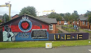
. It runs from Belfast
Belfast
Belfast is the capital of and largest city in Northern Ireland. By population, it is the 14th biggest city in the United Kingdom and second biggest on the island of Ireland . It is the seat of the devolved government and legislative Northern Ireland Assembly...
to Newtownards
Newtownards
Newtownards is a large town in County Down, Northern Ireland. It lies at the most northern tip of Strangford Lough, 10 miles east of Belfast, on the Ards Peninsula. Newtownards is the largest town in the Borough of Ards. According to the 2001 Census, it has a population of 27,821 people in...
and on to Portaferry
Portaferry
Portaferry is a small town in County Down, Northern Ireland, at the southern end of the Ards Peninsula, near the Narrows at the entrance to Strangford Lough. It had a population of 2,467 people in the 2001 Census. It has an aquarium and is well-known for the annual Galway Hookers Regatta. It hosts...
in County Down
County Down
-Cities:*Belfast *Newry -Large towns:*Dundonald*Newtownards*Bangor-Medium towns:...
.
Beginning as the Newtownards Road at the junction of Bridge End close to Belfast city centre
Belfast City Centre
Belfast city centre is the central business district of Belfast, Northern Ireland.The city centre was originally centred around the Donegall Street area. Donegall Street is now mainly a business area, but with expanding residential and entertainment development as part of the Cathedral Quarter...
, the road runs in an easterly direction through east Belfast. The early parts of the road are mainly working-class Protestant districts with strong links to the nearby Harland & Wolff shipyard. After the junction of the Holywood Road, it becomes the Upper Newtownard Road and enters the middle-class areas of Ballyhackamore, Knock and Stormont, where is passes the Parliament Buildings
Parliament Buildings (Northern Ireland)
The Parliament Buildings, known as Stormont because of its location in the Stormont area of Belfast is the seat of the Northern Ireland Assembly and the Northern Ireland Executive...
.
After leaving Belfast and passing through Dundonald
Dundonald
Dundonald is a large settlement in County Down, Northern Ireland. It lies east of Belfast and is often deemed to be a suburb of the city. It includes the large housing estate of Ballybeen, and many new housing estates have emerged in the past ten years....
, the road becomes a dual carriageway
Dual carriageway
A dual carriageway is a class of highway with two carriageways for traffic travelling in opposite directions separated by a central reservation...
, passing through a mainly agricultural area before arriving in Newtownards.
After Newtownards, the road follows the Strangford Lough
Strangford Lough
Strangford Lough, sometimes Strangford Loch, is a large sea loch or inlet in County Down, Northern Ireland. It is separated from the Irish Sea by the Ards Peninsula. The name Strangford is derived ; describing the fast-flowing narrows at its mouth...
shore to Portaferry
Portaferry
Portaferry is a small town in County Down, Northern Ireland, at the southern end of the Ards Peninsula, near the Narrows at the entrance to Strangford Lough. It had a population of 2,467 people in the 2001 Census. It has an aquarium and is well-known for the annual Galway Hookers Regatta. It hosts...
, close to the end of the Ards Peninsula
Ards Peninsula
The Ards Peninsula is a peninsula in County Down, Northern Ireland which separates Strangford Lough from the North Channel of the Irish Sea, on Ireland's northeast coast. A number of towns and villages are located on the peninsula, such as the seaside town of Donaghadee, with the surrounding area...
. Here, a ferry service is available to Strangford
Strangford
Strangford is a small village at the mouth of Strangford Lough in County Down, Northern Ireland. It had a population of 475 people at the 2001 Census.On the other side of the lough is Portaferry and there is a ferry service between the two villages...
. In Portaferry the road joins the A2 coast
A2 road (Northern Ireland)
The A2 is a major road in Northern Ireland, a large section of which is often called the Antrim Coast Road because it follows the scenic coastline of County Antrim....
road.