.gif)
36 Views of Mount Fuji (Hokusai)
Encyclopedia
Ukiyo-e
' is a genre of Japanese woodblock prints and paintings produced between the 17th and the 20th centuries, featuring motifs of landscapes, tales from history, the theatre, and pleasure quarters...
series of large, color woodblock prints
Woodblock printing in Japan
Woodblock printing in Japan is a technique best known for its use in the ukiyo-e artistic genre; however, it was also used very widely for printing books in the same period. Woodblock printing had been used in China for centuries to print books, long before the advent of movable type, but was only...
by the Japanese artist Katsushika Hokusai (1760–1849). The series depicts Mount Fuji
Mount Fuji
is the highest mountain in Japan at . An active stratovolcano that last erupted in 1707–08, Mount Fuji lies about south-west of Tokyo, and can be seen from there on a clear day. Mount Fuji's exceptionally symmetrical cone is a well-known symbol of Japan and it is frequently depicted in art and...
in differing seasons and weather conditions from a variety of different places and distances. It actually consists of 46 prints created between 1826 and 1833. The first 36 were included in the original publication and, due to their popularity, ten more were added after the original publication.
History
While Hokusai's Thirty-six Views of Mount Fuji is the most famous ukiyo-e series to focus on Mount Fuji, there are several other series with the same subject, including HiroshigeHiroshige
was a Japanese ukiyo-e artist, and one of the last great artists in that tradition. He was also referred to as Andō Hiroshige and by the art name of Ichiyūsai Hiroshige ....
's Thirty-six Views of Mount Fuji and Hokusai's own later series One Hundred Views of Mount Fuji. Mount Fuji is a popular subject for Japanese art due to its cultural and religious significance. This belief can be traced to The Tale of the Bamboo Cutter
The Tale of the Bamboo Cutter
, also known as , is a 10th century Japanese folktale. It is considered the oldest extant Japanese narrative and an early example of proto-science fiction....
, where a goddess deposits the elixir of life on the peak. As Henry Smith explains, "Thus from an early time, Mt. Fuji was seen as the source of the secret of immortality, a tradition that was at the heart of Hokusai's own obsession with the mountain."
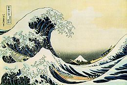
The most famous single image from the series is widely known in English as , although a more literal translation
Literal translation
Literal translation, or direct translation, is the rendering of text from one language to another "word-for-word" rather than conveying the sense of the original...
might be, "Off Kanagawa, the back (or underside) of a wave." It depicts three boats being threatened by a large wave while Mount Fuji rises in the background. While generally assumed to be a tsunami, the wave was probably intended to simply be a large ocean wave.
Each of the images was made through a process whereby an image drawn on paper was used to guide the cutting of a wood block. This block was then covered with ink and applied to paper to create the image (see Woodblock printing in Japan
Woodblock printing in Japan
Woodblock printing in Japan is a technique best known for its use in the ukiyo-e artistic genre; however, it was also used very widely for printing books in the same period. Woodblock printing had been used in China for centuries to print books, long before the advent of movable type, but was only...
for further details). The complexity of Hokusai's images includes the wide range of colors he used, which required the use of a series of blocks for each of the colors used in the images.
Original thirty-six
These images are of modern facsimile prints made using the same techniques.| № | Image | English title | Japanese title |
|---|---|---|---|
| 1 | 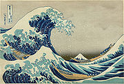 |
The Great Wave off Kanagawa The Great Wave off Kanagawa , also known as The Great Wave or simply The Wave, is a woodblock print by the Japanese artist Hokusai. An example of ukiyo-e art, it was published sometime between 1830 and 1833 as the first in Hokusai's series Thirty-six Views of Mount Fuji , and is his most famous work... |
Kanagawa oki nami-ura |
| 2 | 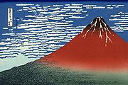 |
South Wind, Clear Sky (also known as Red Fuji) | Gaifū kaisei |
| 3 |  |
Rainstorm Beneath the Summit | Sanka hakū |
| 4 | 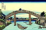 |
Under Mannen Bridge at Fukagawa | Fukagawa Mannen-bashi shita |
| 5 | 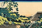 |
Sundai, Edo | Tōto sundai |
| 6 | 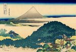 |
The Circular Pine Trees of Aoyama | Aoyama enza-no-matsu |
| 7 | 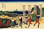 |
Senju, Musashi Province | Bushū Senju |
| 8 |  |
Inume Pass, Kōshū | Kōshū inume-tōge |
| 9 | 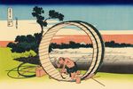 |
Fuji View Field in Owari Province Owari Province was an old province of Japan that is now the western half of present day Aichi Prefecture, including much of modern Nagoya. Its abbreviation is Bishū .-History:The province was created in 646.... |
Bishū Fujimigahara |
| 10 | 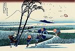 |
Ejiri Ejiri-juku was the eighteenth of the fifty-three stations of the Tōkaidō. It is one of four former post stations located in what is now part of the Shimizu-ku area of Shizuoka, Shizuoka Prefecture, Japan. It was 3.4 kilometers from Okitsu-juku, the preceding post station.... in the Suruga Province Suruga Province was an old province in the area that is today the central part of Shizuoka prefecture. It was sometimes called . Suruga bordered on Izu, Kai, Sagami, Shinano, and Tōtōmi provinces; and had access to the Pacific Ocean through Suruga Bay.-History:... |
Sunshū Ejiri |
| 11 | 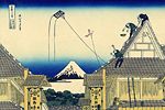 |
A sketch of the Mitsui Mitsui is one of the largest corporate conglomerates in Japan and one of the largest publicly traded companies in the world.-History:Founded by Mitsui Takatoshi , who was the fourth son of a shopkeeper in Matsusaka, in what is now today's Mie prefecture... shop in Suruga in Edo Edo , also romanized as Yedo or Yeddo, is the former name of the Japanese capital Tokyo, and was the seat of power for the Tokugawa shogunate which ruled Japan from 1603 to 1868... |
Kōto Suruga-cho Mitsui Miseryakuzu |
| 12 |  |
Sunset across the Ryōgoku Ryogoku is a neighborhood in Sumida, Tokyo. It is surrounded by various neighborhoods in Sumida, Chūō, and Taitō wards: Yokoami, Midori, Chitose, Higashi Nihonbashi, and Yanagibashi.... bridge from the bank of the Sumida River Sumida River The is a river which flows through Tokyo, Japan. It branches from the Arakawa River at Iwabuchi and flows into Tokyo Bay. Its tributaries include the Kanda and Shakujii rivers.... at Onmayagashi |
Ommayagashi yori ryōgoku-bashi yūhi mi |
| 13 | 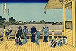 |
Sazai hall - Temple of Five Hundred Rakan | Gohyaku-rakanji Sazaidō |
| 14 | 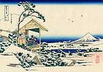 |
Tea house Tea house A tea house or tearoom is a venue centered on drinking tea. Its function varies widely depending on the culture, and some cultures have a variety of distinct tea-centered houses or parlors that all qualify under the English language term "tea house" or "tea room."-Asia:In Central Asia this term... at Koishikawa Koishikawa is a locality within Bunkyo, Tokyo. It consists of five sub-areas, . It is located nearby with the same name are two well regarded gardens: the Koishikawa Botanical Garden in Hakusan, and the Koishikawa Korakuen Garden in Korakuen.... . The morning after a snowfall |
Koishikawa yuki no ashita |
| 15 |  |
Below Meguro Meguro, Tokyo is one of the 23 special wards of Tokyo, Japan. It calls itself Meguro City in English.Meguro hosts fifteen foreign embassies and consulates. One of Tokyo's most exclusive residential neighborhoods is located in Meguro.... |
Shimo-Meguro |
| 16 | 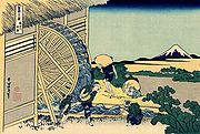 |
Watermill at Onden | Onden no suisha |
| 17 | 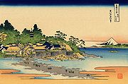 |
Enoshima Enoshima is a small island, about 4 km in circumference, at the mouth of the Katase River, which flows into Sagami Bay in Japan. Part of the city of Fujisawa, it is linked to the Katase section of the same city on the mainland by a 600 meter-long bridge... in Sagami Province Sagami Province was an old province in the area that is today the central and western Kanagawa prefecture. It was sometimes called . Sagami bordered on Izu, Musashi, Suruga provinces; and had access to the Pacific Ocean through Sagami Bay... |
Soshū Enoshima |
| 18 |  |
Shore of Tago Bay, Ejiri Ejiri-juku was the eighteenth of the fifty-three stations of the Tōkaidō. It is one of four former post stations located in what is now part of the Shimizu-ku area of Shizuoka, Shizuoka Prefecture, Japan. It was 3.4 kilometers from Okitsu-juku, the preceding post station.... at Tōkaidō Tokaido (region) The was originally an old Japanese geographical region that made up the gokishichidō system and was situated along the southeastern edge of Honshū, its name literally meaning 'Eastern Sea Way'.... |
Tōkaidō Ejiri tago-no-ura |
| 19 |  |
Yoshida Yoshida, Shizuoka is a town located in Haibara District, southern Shizuoka, Japan. As of February 2010, the town has an estimated population of 29,872 and a density of 1430 persons per km². The total area was 20.84 km².-Geography:... at Tōkaidō Tokaido (region) The was originally an old Japanese geographical region that made up the gokishichidō system and was situated along the southeastern edge of Honshū, its name literally meaning 'Eastern Sea Way'.... |
Tōkaidō Yoshida |
| 20 |  |
The Kazusa Province Kazusa Province was a province of Japan in the area of modern Chiba Prefecture. It lies on in the middle of the Bōsō Peninsula , whose name takes its first kanji from the name of Awa Province and its second from Kazusa and Shimōsa Provinces. Its abbreviated form name was or .Kazusa is classified as one of the... sea route |
Kazusa no kairo |
| 21 | 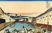 |
Nihonbashi Nihonbashi , or Nihombashi, is a business district of Chūō, Tokyo, Japan which grew up around the bridge of the same name which has linked two sides of the Nihonbashi River at this site since the 17th century. The first wooden bridge was completed in 1603, and the current bridge made of stone dates from 1911... bridge in Edo Edo , also romanized as Yedo or Yeddo, is the former name of the Japanese capital Tokyo, and was the seat of power for the Tokugawa shogunate which ruled Japan from 1603 to 1868... |
Edo Nihon-bashi |
| 22 | 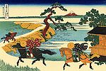 |
Barrier Town on the Sumida River Sumida River The is a river which flows through Tokyo, Japan. It branches from the Arakawa River at Iwabuchi and flows into Tokyo Bay. Its tributaries include the Kanda and Shakujii rivers.... |
Sumidagawa Sekiya no sato |
| 23 | 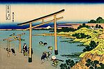 |
Bay of Noboto | Noboto-ura |
| 24 |  |
The lake of Hakone Hakone, Kanagawa is a town in Ashigarashimo District in Kanagawa Prefecture, Japan. As of 2010, the town had an estimated population of 13,339 and a density of 144 persons per km². The total area was 92.82 km².-Geography:... in Sagami Province Sagami Province was an old province in the area that is today the central and western Kanagawa prefecture. It was sometimes called . Sagami bordered on Izu, Musashi, Suruga provinces; and had access to the Pacific Ocean through Sagami Bay... |
Sōshū Hakone kosui |
| 25 | 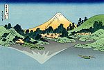 |
Mount Fuji reflects in Lake Kawaguchi Lake Kawaguchi is a lake near Mount Fuji, Japan. Located in Fujikawaguchiko, Yamanashi Prefecture, it is the most popular of the Fuji Five Lakes in terms of tourists, and is part of the Fuji-Hakone-Izu National Park. Kawaguchiko also serves as a major hub for those wishing to climb Mount Fuji during the climbing... , seen from the Misaka Pass in Kai Province Kai Province , also known as , is an old province in Japan in the area of Yamanashi Prefecture. It lies in central Honshū, west of Tokyo, in a landlocked mountainous region that includes Mount Fuji along its border with Shizuoka Prefecture.... |
Kōshū Misaka suimen |
| 26 |  |
Hodogaya Hodogaya-ku, Yokohama is one of the 18 wards of the city of Yokohama in Kanagawa Prefecture, Japan. As of 2010, Hodogaya Ward had an estimated population of 205,887 and a density of 9,400 persons per km². The total area was 21.91 km².-Geography:... on the Tōkaidō Tokaido (road) The ' was the most important of the Five Routes of the Edo period, connecting Edo to Kyoto in Japan. Unlike the inland and less heavily travelled Nakasendō, the Tōkaidō travelled along the sea coast of eastern Honshū, hence the route's name.... |
Tōkaidō Hodogaya |
| 27 | 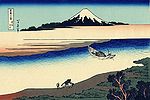 |
Tama River in Musashi Province | Bushū Tamagawa |
| 28 | 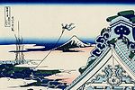 |
Asakusa Hongan-ji temple in the Eastern capital [Edo] | Tōto Asakusa honganji |
| 29 | 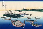 |
Tsukuda Island in Musashi Province Musashi Province was a province of Japan, which today comprises Tokyo Prefecture, most of Saitama Prefecture and part of Kanagawa Prefecture. It was sometimes called . The province encompassed Kawasaki and Yokohama... |
Buyō Tsukuda-jima |
| 30 | 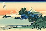 |
Shichiri beach in Sagami Province Sagami Province was an old province in the area that is today the central and western Kanagawa prefecture. It was sometimes called . Sagami bordered on Izu, Musashi, Suruga provinces; and had access to the Pacific Ocean through Sagami Bay... |
Soshū Shichiri-ga-hama |
| 31 |  |
Umegawa in Sagami Province Sagami Province was an old province in the area that is today the central and western Kanagawa prefecture. It was sometimes called . Sagami bordered on Izu, Musashi, Suruga provinces; and had access to the Pacific Ocean through Sagami Bay... |
Soshū umezawanoshō |
| 32 |  |
Kajikazawa Kajikazawa, Yamanashi was a town located in Minamikoma District, Yamanashi, Japan.As of 2003, the town had an estimated population of 4,402 and a density of 94.04 persons per km². The total area was 46.81 km².... in Kai Province Kai Province , also known as , is an old province in Japan in the area of Yamanashi Prefecture. It lies in central Honshū, west of Tokyo, in a landlocked mountainous region that includes Mount Fuji along its border with Shizuoka Prefecture.... |
Kōshū Kajikazawa |
| 33 | 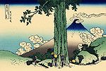 |
Mishima Pass in Kai Province Kai Province , also known as , is an old province in Japan in the area of Yamanashi Prefecture. It lies in central Honshū, west of Tokyo, in a landlocked mountainous region that includes Mount Fuji along its border with Shizuoka Prefecture.... |
Kōshū Mishima-goe |
| 34 |  |
Mount Fuji from the mountains of Tōtōmi Totomi Province was a province of Japan in the area of Japan that is today western Shizuoka Prefecture. Tōtōmi bordered on Mikawa, Suruga and Shinano Provinces. Its abbreviated form name was .-History:... |
Tōtōmi sanchū |
| 35 | 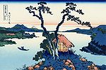 |
Lake Suwa Lake Suwa is a lake in the central part of Nagano Prefecture, Japan. It ranks 24th in Japan in surface area.Lake Suwa is the site of , an interesting natural phenomenon. The lake has a natural hot spring under the surface, so that when the top freezes in the winter, the lower waters are still warm and... in Shinano Province Shinano Province or is an old province of Japan that is now present day Nagano Prefecture.Shinano bordered on Echigo, Etchū, Hida, Kai, Kōzuke, Mikawa, Mino, Musashi, Suruga, and Tōtōmi Provinces... |
Shinshū Suwa-ko |
| 36 |  |
Ushibori in Hitachi Province Hitachi Province was an old province of Japan in the area of Ibaraki Prefecture. It was sometimes called . Hitachi Province bordered on Iwashiro, Iwaki, Shimousa, and Shimotsuke Provinces.... |
Jōshū Ushibori |
Additional 10
| № | Image | English title | Japanese title |
|---|---|---|---|
| 1 | 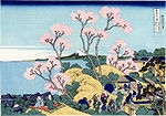 |
Goten-yama-hill, Shinagawa Shinagawa-juku was the first of the fifty-three stations of the Tōkaidō. It is presently located in Shinagawa, Tokyo, Japan. Along with Itabashi-shuku , Naitō Shinjuku and Senju-shuku , it was one of the Four Stations of Edo . It was located in the present-day Shinagawa Port area near Shinagawa Station.... on the Tōkaidō |
Tōkaidō Shinagawa Goten'yama no Fuji |
| 2 |  |
Honjo Tatekawa, the timberyard at Honjo Honjo Honjō or Honjo can refer to:Places* Honjō, Akita* Honjō, Nagano* Honjō, Ōita* Honjō, Saitama* Honjo StadiumPeople* Shigeru HonjōFictional characters* Mika Honjō of Ginban Kaleidoscope* Ren Honjo of Nana----... |
Honjo Tatekawa |
| 3 | 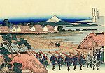 |
Pleasure District at Senju | Senju Hana-machi Yori Chōbō no Fuji |
| 4 | 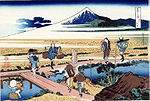 |
Nakahara in Sagami Province Sagami Province was an old province in the area that is today the central and western Kanagawa prefecture. It was sometimes called . Sagami bordered on Izu, Musashi, Suruga provinces; and had access to the Pacific Ocean through Sagami Bay... |
Sōshū Nakahara |
| 5 | 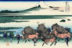 |
Ōno Shinden in the Suruga Province Suruga Province was an old province in the area that is today the central part of Shizuoka prefecture. It was sometimes called . Suruga bordered on Izu, Kai, Sagami, Shinano, and Tōtōmi provinces; and had access to the Pacific Ocean through Suruga Bay.-History:... |
Sunshū Ōno-shinden |
| 6 | 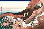 |
Climbing on Fuji | Shojin tozan |
| 7 |  |
The Tea plantation of Katakura in Suruga Province Suruga Province was an old province in the area that is today the central part of Shizuoka prefecture. It was sometimes called . Suruga bordered on Izu, Kai, Sagami, Shinano, and Tōtōmi provinces; and had access to the Pacific Ocean through Suruga Bay.-History:... |
Sunshū Katakura chaen no Fuji |
| 8 | 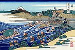 |
The Fuji from Kanaya Kanaya-juku was the twenty-fourth of the fifty-three stations of the Tōkaidō. It is located in what is now part of Shimada, Shizuoka Prefecture, Japan. During the Edo period, it was the easternmost post station of Tōtōmi Province.-History:... on the Tōkaidō Tokaido (road) The ' was the most important of the Five Routes of the Edo period, connecting Edo to Kyoto in Japan. Unlike the inland and less heavily travelled Nakasendō, the Tōkaidō travelled along the sea coast of eastern Honshū, hence the route's name.... |
Tōkaidō Kanaya no Fuji |
| 9 | 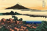 |
Dawn at Isawa Isawa, Yamanashi was a town located in Higashiyatsushiro District, Yamanashi, Japan.On October 12, 2004 Isawa was merged the towns of Ichinomiya, Misaka and Yatsushiro, the village of Sakaigawa, all from Higashiyatsushiro District, and the town of Kasugai, from Higashiyamanashi District, to form the new city of... in Kai Province Kai Province , also known as , is an old province in Japan in the area of Yamanashi Prefecture. It lies in central Honshū, west of Tokyo, in a landlocked mountainous region that includes Mount Fuji along its border with Shizuoka Prefecture.... |
Kōshū Isawa no Akatsuki |
| 10 | 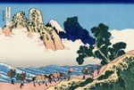 |
The back of Fuji from the Minobu river | Minobu-gawa ura Fuji |

