
Wokha
Encyclopedia
Wokha is a town and a town area committee in Wokha district
in the Indian state of Nagaland
.
, Wokha had a population of 37,696. Males constitute 54% of the population and females 46%. Wokha has an average literacy rate of 80%, higher than the national average of 59.5%: male literacy is 82%, and female literacy is 77%. In Wokha, 12% of the population is under 6 years of age.
 Wokha's agglomeration consists of Wokha town, Longsa village, Wokha village and Vakhosung. It has a combined population of 43,089. Wokha is on the main route from Kohima to Mokokchung and has been one of the earliest locations of the Assam Rifles.
occupied Wokha as the District Headquarters of the Naga Hills
under Assam
. By the year 1878 the headquarters was shifted to Kohima
, but Wokha remained a subdivision. Later in 1889 the subdivision was shifted to Mokokchung
. In the year 1957 Wokha became a subdivision again. After India
had gained its independence
, Wokha was created a district in the year 1973.
legends associated with it. Most Nagas
believe that this mountain is the abode of departed souls. According to local Wokhan folklore the mountain had an orchard that could only be found by the 'lucky ones.' Rhododendrons are found commonly on Mount Tiyi.
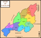
Wokha District
Wokha is a district of Nagaland state in India.-Economy:In 2006 the Ministry of Panchayati Raj named Wokha one of the country's 250 most backward districts...
in the Indian state of Nagaland
Nagaland
Nagaland is a state in the far north-eastern part of India. It borders the state of Assam to the west, Arunachal Pradesh and part of Assam to the north, Burma to the east and Manipur to the south. The state capital is Kohima, and the largest city is Dimapur...
.
Geography
Wokha is located at 26.1°N 94.27°E. It has an average elevation of 1313 metres (4793 feet).Demographics
India censusCensus
A census is the procedure of systematically acquiring and recording information about the members of a given population. It is a regularly occurring and official count of a particular population. The term is used mostly in connection with national population and housing censuses; other common...
, Wokha had a population of 37,696. Males constitute 54% of the population and females 46%. Wokha has an average literacy rate of 80%, higher than the national average of 59.5%: male literacy is 82%, and female literacy is 77%. In Wokha, 12% of the population is under 6 years of age.
Greater Wokha
Statistics
- The altitude of Wokha is 1,313.69 meters.
- The area of Wokha district is 1,628 square kilometres.
- The population of the entire district of Wokha is 161,098 denizens. (2001 provisional census)
- The summer temperature of Wokha is between 16.1 °C, and 32 °C. The winter temperature is a 2 °C minimum.
- The rainfall of Wokha is between 2 and 2.5 meters per year.
- Men occupy about 51.92% the population of Wokha, while women occupy 48.08%.
- The rural population constitutes 76.61% of the population of the district, while the remaining 23.39% of the population is urban
Brief history
In 1876 the British GovernmentUnited Kingdom of Great Britain and Ireland
The United Kingdom of Great Britain and Ireland was the formal name of the United Kingdom during the period when what is now the Republic of Ireland formed a part of it....
occupied Wokha as the District Headquarters of the Naga Hills
Naga hills
Naga hills, reaching a height of around 3825 metres, lie on the border of India and Burma . These hills are part of a complex mountain system, and the parts of the mountain ranges inside the Indian state of Nagaland and the Burmese region of Sagaing are called the Naga Hills.In British India, the...
under Assam
Assam
Assam , also, rarely, Assam Valley and formerly the Assam Province , is a northeastern state of India and is one of the most culturally and geographically distinct regions of the country...
. By the year 1878 the headquarters was shifted to Kohima
Kohima
Kohima is the hilly capital of India's north eastern border state of Nagaland which shares its borders with Burma. It lies in Kohima District and is also one of the three Nagaland towns with Municipal council status along with Dimapur and Mokokchung....
, but Wokha remained a subdivision. Later in 1889 the subdivision was shifted to Mokokchung
Mokokchung
Mokokchung is a town and a municipality in Mokokchung district in the Indian state of Nagaland. It is the district headquarter as well as the main urban hub of Mokokchung district. Mokokchung is the cultural center of the Ao people and is economically and politically the most important urban...
. In the year 1957 Wokha became a subdivision again. After India
India
India , officially the Republic of India , is a country in South Asia. It is the seventh-largest country by geographical area, the second-most populous country with over 1.2 billion people, and the most populous democracy in the world...
had gained its independence
Independence
Independence is a condition of a nation, country, or state in which its residents and population, or some portion thereof, exercise self-government, and usually sovereignty, over its territory....
, Wokha was created a district in the year 1973.
Language
Lotha Language is the common language used for communication, English and Nagamese language are also used for communication.Mount Tiyi
Mount Tiyi is a hill which has supernaturalSupernatural
The supernatural or is that which is not subject to the laws of nature, or more figuratively, that which is said to exist above and beyond nature...
legends associated with it. Most Nagas
Naga (clan)
The Naga were one of the ancient most kshatriya tribes of India who ruled large parts of the world at different times. They spread throughout India during the period of the epic Mahabharata. Anthropologist Gelek Lonbsang believes they have distant ancestry with East Asians based on their similar...
believe that this mountain is the abode of departed souls. According to local Wokhan folklore the mountain had an orchard that could only be found by the 'lucky ones.' Rhododendrons are found commonly on Mount Tiyi.