Whenby
Encyclopedia
Whenby is a civil parish
, and small village
, in Hambleton
district of North Yorkshire
, England
.
 Whenby lies between Sheriff Hutton
and Brandsby
, on Main Street, and a little to the east of the Howardian Hills
. It has an area of 1041 acres (4.2 km²), and is situated approximately 12 miles (19.3 km) north of York
and 8 miles (12.9 km) east of Easingwold
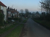
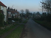
. There is a track that leads from Main Street to St Martin's Church. This track has the village's telephone box (old, red and falling down!), post box, and village notice board on it. The village has nothing else but houses and farms.
Whenby has approximately 14 houses, most of these are old cottages, and all but 3 are on the north and east side of Main Street. All surrounding land is farmland, and strict planning permissions prevent any development. The surface is undulating, and the soil generally a rich clay loam.
St Martin's Church
still has its stained glass
windows, doors, altar, pews and fonts. Few people from outside the village are buried or wed in the church. The church of St. Martin is an ancient stone building in the Early English style of architecture, and has a chancel, north aisle, porch, nave, mortuary chapel, and a fine, lofty tower, containing three bells. It was restored, at a cost of £700, in 1871, when a north aisle of stone was added. The principal entrance is by the north porch, through a handsome Norman doorway. There is a doorway of ancient date, which is generally supposed to have been used for public access to the church, or in connection with the priest's house.
Civil parish
In England, a civil parish is a territorial designation and, where they are found, the lowest tier of local government below districts and counties...
, and small village
Village
A village is a clustered human settlement or community, larger than a hamlet with the population ranging from a few hundred to a few thousand , Though often located in rural areas, the term urban village is also applied to certain urban neighbourhoods, such as the West Village in Manhattan, New...
, in Hambleton
Hambleton
Hambleton is a local government district of North Yorkshire, England. The main town and administrative centre is Northallerton, and includes the market towns and major villages of Bedale, Thirsk, Great Ayton, Stokesley and Easingwold....
district of North Yorkshire
North Yorkshire
North Yorkshire is a non-metropolitan or shire county located in the Yorkshire and the Humber region of England, and a ceremonial county primarily in that region but partly in North East England. Created in 1974 by the Local Government Act 1972 it covers an area of , making it the largest...
, England
England
England is a country that is part of the United Kingdom. It shares land borders with Scotland to the north and Wales to the west; the Irish Sea is to the north west, the Celtic Sea to the south west, with the North Sea to the east and the English Channel to the south separating it from continental...
.

Sheriff Hutton
Sheriff Hutton is a village and civil parish in the Ryedale district of North Yorkshire, England. It lies about ten miles north by north-east of York...
and Brandsby
Brandsby
Brandsby is a village in North Yorkshire, England. The village toponymy is of Danish origin named after a Norseman called Brand....
, on Main Street, and a little to the east of the Howardian Hills
Howardian Hills
The Howardian Hills form an Area of Outstanding Natural Beauty in North Yorkshire, England. located between the Yorkshire Wolds, the North York Moors National Park and the Vale of York. The AONB includes farmland, wooded rolling countryside, villages and historic houses with parkland...
. It has an area of 1041 acres (4.2 km²), and is situated approximately 12 miles (19.3 km) north of York
York
York is a walled city, situated at the confluence of the Rivers Ouse and Foss in North Yorkshire, England. The city has a rich heritage and has provided the backdrop to major political events throughout much of its two millennia of existence...
and 8 miles (12.9 km) east of Easingwold
Easingwold
Easingwold is a small market town and a civil parish in North Yorkshire, England. It has a population of 4,233.It is located north of York, at the foot of the Howardian Hills....
. There is a track that leads from Main Street to St Martin's Church. This track has the village's telephone box (old, red and falling down!), post box, and village notice board on it. The village has nothing else but houses and farms.
Whenby has approximately 14 houses, most of these are old cottages, and all but 3 are on the north and east side of Main Street. All surrounding land is farmland, and strict planning permissions prevent any development. The surface is undulating, and the soil generally a rich clay loam.
St Martin's Church
St Martin's Church, Whenby
St Martin's Church, Whenby, is a redundant Anglican church in the village of Whenby, North Yorkshire, England . It has been designated by English Heritage as a Grade II* listed building, and is under the care of the Churches Conservation Trust....
still has its stained glass
Stained glass
The term stained glass can refer to coloured glass as a material or to works produced from it. Throughout its thousand-year history, the term has been applied almost exclusively to the windows of churches and other significant buildings...
windows, doors, altar, pews and fonts. Few people from outside the village are buried or wed in the church. The church of St. Martin is an ancient stone building in the Early English style of architecture, and has a chancel, north aisle, porch, nave, mortuary chapel, and a fine, lofty tower, containing three bells. It was restored, at a cost of £700, in 1871, when a north aisle of stone was added. The principal entrance is by the north porch, through a handsome Norman doorway. There is a doorway of ancient date, which is generally supposed to have been used for public access to the church, or in connection with the priest's house.

