
Wecota, South Dakota
Encyclopedia
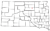
Wecota is an unincorporated community
in Faulk County
, South Dakota
, United States
.
Wecota was founded in 1907 as a station stop on a branch line of the Minneapolis and St. Louis Railway
built that year between Conde
and LeBeau
, South Dakota. Railway service to Wecota ended in 1940.
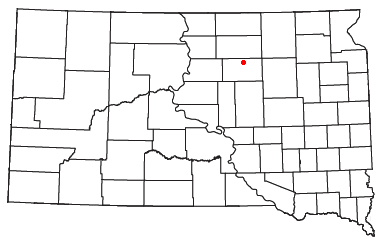 Wecota is located at Latitude: 45.1725 and Longitude: -99.11722. Elevation: 1558 ft.
Wecota has been assigned the ZIP code
57438 and the FIPS place code 4669900. The local area code is 605.
The town has two streets.
Unincorporated area
In law, an unincorporated area is a region of land that is not a part of any municipality.To "incorporate" in this context means to form a municipal corporation, a city, town, or village with its own government. An unincorporated community is usually not subject to or taxed by a municipal government...
in Faulk County
Faulk County, South Dakota
As of the census of 2000, there were 2,640 people, 1,014 households, and 708 families residing in the county. The population density was 3 people per square mile . There were 1,235 housing units at an average density of 1 per square mile...
, South Dakota
South Dakota
South Dakota is a state located in the Midwestern region of the United States. It is named after the Lakota and Dakota Sioux American Indian tribes. Once a part of Dakota Territory, South Dakota became a state on November 2, 1889. The state has an area of and an estimated population of just over...
, United States
United States
The United States of America is a federal constitutional republic comprising fifty states and a federal district...
.
Wecota was founded in 1907 as a station stop on a branch line of the Minneapolis and St. Louis Railway
Minneapolis and St. Louis Railway
The Minneapolis and St. Louis Railway was an American Class I railroad that built and operated lines radiating south and west from Minneapolis, Minnesota which existed for 90 years from 1870 to 1960....
built that year between Conde
Conde, South Dakota
Conde is a city in Spink County, South Dakota, United States. The population was 140 at the 2010 census.-Geography:Conde is located at .According to the United States Census Bureau, the city has a total area of , all of it land....
and LeBeau
LeBeau, South Dakota
LeBeau was a town in Walworth County, South Dakota, United States. It was on the east bank of the Missouri River, near the mouth of Swan Creek....
, South Dakota. Railway service to Wecota ended in 1940.
Geography
Wecota has been assigned the ZIP code
ZIP Code
ZIP codes are a system of postal codes used by the United States Postal Service since 1963. The term ZIP, an acronym for Zone Improvement Plan, is properly written in capital letters and was chosen to suggest that the mail travels more efficiently, and therefore more quickly, when senders use the...
57438 and the FIPS place code 4669900. The local area code is 605.
The town has two streets.
External links
- http://www.placenames.com/us/p1258856/
- http://www.weatherunderground.com/US/SD/Wecota.html