
Wabash Avenue
Encyclopedia

Baltimore
Baltimore is the largest independent city in the United States and the largest city and cultural center of the US state of Maryland. The city is located in central Maryland along the tidal portion of the Patapsco River, an arm of the Chesapeake Bay. Baltimore is sometimes referred to as Baltimore...
, Maryland
Maryland
Maryland is a U.S. state located in the Mid Atlantic region of the United States, bordering Virginia, West Virginia, and the District of Columbia to its south and west; Pennsylvania to its north; and Delaware to its east...
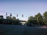
, that runs from Patterson Avenue to Hilton Street, mostly through the Arlington community, crossing over Northern Parkway
Northern Parkway
The following roads are called Northern Parkway:*Northern Parkway *Northern Parkway , unbuilt road north from Washington, D.C.*Northern State Parkway on Long Island, New York*Northern Parkway...
and Cold Spring Lane along the way. The road starts near the Reisterstown Plaza Metro Subway Station and continues to just past the West Coldspring Metro Subway Station, where it narrows and becomes a one-way pair
One-way pair
A one-way pair, one-way couple, or just couplet is a pair of parallel, usually one-way streets that carry opposite directions of a signed route or major traffic flow, or sometimes opposite directions of a bus or streetcar route....
with Dorithan Road, which ends several blocks later at Hilton Street.
Wabash Avenue actually begins as a stub near the Reisterstown Road Plaza
Reisterstown Road Plaza
The Reisterstown Road Plaza, usually known since its inception simply as "The Plaza," is a shopping center and mall located near the Reisterstown Plaza Metro Subway Station...
. The stub exists where a longer road was intended as part of the original plans of Interstate 795. This portion of I-795, which would have run through historic Sudbrook Park
Sudbrook Park
Sudbrook Park is a historic neighborhood near Pikesville, Maryland located just northwest of the Baltimore City limits in Baltimore County.The community dates to 1889 when it was designed by American landscape architect Frederick Law Olmsted, Sr. and developed by the Sudbrook Company...
before reaching the city, was fought and ultimately cancelled as a result of complaints from Sudbrook Park residents. This led to the cancellation of all parts of I-795 within the city. Still, the road was constructed as a Boulevard, and the Metro Subway was constructed along an overhead track directly parallel to the road. Three stations of the Metro system (Reisterstown Plaza, Rogers Avenue and West Coldspring) are located along Wabash Avenue.
Hilton Street
Hilton Street is a mostly two-lane road that runs north-south for 3.8 miles (6.1 km) through West Baltimore, mostly through the neighborhood of AshburtonAshburton, Baltimore
Ashburton is a neighborhood in the Forest Park region of Northwestern Baltimore City. It is located near Liberty Heights Avenue and Hilton Street and home to many prominent African-Americans including Baltimore's former mayor Kurt L. Schmoke, State Senator Lisa Gladden, State Senator Catherine E....
.
A mile-long portion of this road that runs through Leakin Park is known as Hilton Parkway. Hilton Parkway is a four-lane road from North Avenue to Edmondson Avenue, where there is an exit ramp. In 1990, a concrete barrier was installed in the median of Hilton Parkway due to a series of fatal accidents
Car accident
A traffic collision, also known as a traffic accident, motor vehicle collision, motor vehicle accident, car accident, automobile accident, Road Traffic Collision or car crash, occurs when a vehicle collides with another vehicle, pedestrian, animal, road debris, or other stationary obstruction,...
that had occurred.
Caton Avenue
Hilton Street after passing Frederick RoadMaryland Route 144
Maryland Route 144 is a collection of state highways in the U.S. state of Maryland. These highways are sections of old alignment of U.S. Route 40 between Cumberland and Baltimore...
/Frederick Avenue becomes Caton Avenue, which continues in a north-south direction for 1.6 miles (2.6 km). Caton Avenue is exit 50 off Interstate 95.
The portion of Caton Avenue from Wilkens Avenue
Maryland Route 372
Maryland Route 372 is a state highway in the U.S. state of Maryland. The state highway runs from MD 166 in Arbutus east to U.S. Route 1 in Baltimore.-Route description:...
to Washington Boulevard is a part of US-1.
St. Agnes Hospital
St. Agnes Hospital (Baltimore)
St. Agnes Hospital in Baltimore, Maryland is a full service teaching hospital located at 900 S. Caton Avenue.It is licensed and accredited with a Gold Seal of Approval from the JCAHO, is designated as an American Society for Bariatric Surgery Bariatric Surgery Center of Excellence and is a Level...
is located at the corner of Caton Avenue and Wilkens Avenue.
Patapsco Avenue
Patapsco Avenue is a 5.2 miles (8.4 km), mostly six-lane road that runs from Washington Boulevard to a dead end in Fairfield shortly after Fairfield Road. The road has few landmarks and is mostly used for thru traffic.One of the stops of the Baltimore Light Rail
Baltimore Light Rail
The Maryland Transit Administration Light Rail is a light rail system serving Baltimore, Maryland, United States, and the surrounding suburbs.In downtown Baltimore it uses city streets...
known as the Patapsco Light Rail Stop is located on Patapsco Avenue. This location is also a hub for several Maryland Transit Administration
Maryland Transit Administration
The Maryland Transit Administration is a state-operated mass transit administration in Maryland, and is part of the Maryland Department of Transportation. It is better known as MTA Maryland to avoid confusion with other cities' transit agencies who share the initials MTA. The MTA operates a...
bus lines.