Viroinval
Encyclopedia
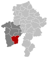
Viroinval is a Walloon municipality
located in Belgium
in the province of Namur
. On January 1, 2006 Viroinval had a total population of 5,680. The total area is 120.90 km² which gives a population density
of 47 inhabitants per km².
Dourbes,
Mazée,
Le Mesnil,
Nismes,
Oignies-en-Thiérache,
Olloy-sur-Viroin,
Treignes,
Vierves-sur-Viroin.

name="SteamTrainLine"> The latter village has a relevant museum.
Municipality
A municipality is essentially an urban administrative division having corporate status and usually powers of self-government. It can also be used to mean the governing body of a municipality. A municipality is a general-purpose administrative subdivision, as opposed to a special-purpose district...
located in Belgium
Belgium
Belgium , officially the Kingdom of Belgium, is a federal state in Western Europe. It is a founding member of the European Union and hosts the EU's headquarters, and those of several other major international organisations such as NATO.Belgium is also a member of, or affiliated to, many...
in the province of Namur
Namur (province)
Namur is a province of Wallonia, one of the three regions of Belgium. It borders on the Walloon provinces of Hainaut, Walloon Brabant, Liège and Luxembourg in Belgium, and on France. Its capital is the city of Namur...
. On January 1, 2006 Viroinval had a total population of 5,680. The total area is 120.90 km² which gives a population density
Population density
Population density is a measurement of population per unit area or unit volume. It is frequently applied to living organisms, and particularly to humans...
of 47 inhabitants per km².
Villages in Viroinval
The name Viroinval, Viroin (River) Valley, was chosen for the municipality that was formed by fusing eight villages, in 1977:Dourbes,
Mazée,
Le Mesnil,
Nismes,
Oignies-en-Thiérache,
Olloy-sur-Viroin,
Treignes,
Vierves-sur-Viroin.
Curiosities

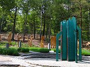
- From 1995 to 2004, Viroinval was the location of the geographical centre of the European Union, at coordinates 50°00′33"N 4°39′59"E in Oignies-en-Thiérache, and a monument there records that finding. On May 1, 2004 the EU expanded from fifteen states to twenty-five, and the geographical centre of the union moved eastwards to the village of KleinmaischeidKleinmaischeidKleinmaischeid is a municipality in the district of Neuwied, in Rhineland-Palatinate, Germany and was the centre point of the European Union from 1 May 2004 until 31 December 2006....
, Rhineland-PalatinateRhineland-PalatinateRhineland-Palatinate is one of the 16 states of the Federal Republic of Germany. It has an area of and about four million inhabitants. The capital is Mainz. English speakers also commonly refer to the state by its German name, Rheinland-Pfalz ....
, GermanyGermanyGermany , officially the Federal Republic of Germany , is a federal parliamentary republic in Europe. The country consists of 16 states while the capital and largest city is Berlin. Germany covers an area of 357,021 km2 and has a largely temperate seasonal climate...
. On 1 January 2007 it shifted even further south-eastwards. - The tourist steam train line Mariembourg - Treignes has most of its stations in villages of Viroinval: Nismes, Olloy-sur-Viroin, Vierves-sur-Viroin, and Treignes.
name="SteamTrainLine"> The latter village has a relevant museum.

