
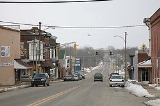
Veedersburg, Indiana
Encyclopedia
Veedersburg is a town in Van Buren Township
, Fountain County
, Indiana
, United States
. The population was 2,180 at the 2010 census.
just west of its intersection with U.S. Route 41
, and less than a mile south of Interstate 74
.
According to the United States Census Bureau
, the town has a total area of 2.7 square miles (7 km²), all of it land.
of 2000, there were 2,299 people, 921 households, and 652 families residing in the town. The population density
was 846.4 people per square mile (326.3/km²). There were 996 housing units at an average density of 366.7 per square mile (141.4/km²). The racial makeup of the town was 98.91% White, 0.09% African American, 0.26% Native American, 0.39% from other races
, and 0.35% from two or more races. Hispanic or Latino of any race were 2.74% of the population.
There were 921 households out of which 35.3% had children under the age of 18 living with them, 56.1% were married couples
living together, 9.7% had a female householder with no husband present, and 29.2% were non-families. 25.2% of all households were made up of individuals and 13.2% had someone living alone who was 65 years of age or older. The average household size was 2.50 and the average family size was 2.96.
In the town the population was spread out with 27.3% under the age of 18, 7.1% from 18 to 24, 27.8% from 25 to 44, 22.8% from 45 to 64, and 15.0% who were 65 years of age or older. The median age was 36 years. For every 100 females there were 97.0 males. For every 100 females age 18 and over, there were 92.8 males.
The median income for a household in the town was $35,944, and the median income for a family was $39,770. Males had a median income of $31,315 versus $21,285 for females. The per capita income
for the town was $17,435. About 9.3% of families and 10.9% of the population were below the poverty line, including 13.8% of those under age 18 and 8.6% of those age 65 or over.
Van Buren Township, Fountain County, Indiana
Van Buren Township is one of eleven townships in Fountain County, Indiana. As of the 2000 census, its population was 3,121.-Geography:Van Buren Township covers an area of ; of this is water.-Unincorporated towns:* Harrison Lake...
, Fountain County
Fountain County, Indiana
Fountain County lies in the western part of the U.S. state of Indiana on the east side of the Wabash River. The county was officially established in 1826 and was the 53rd in Indiana. The county seat is Covington....
, Indiana
Indiana
Indiana is a US state, admitted to the United States as the 19th on December 11, 1816. It is located in the Midwestern United States and Great Lakes Region. With 6,483,802 residents, the state is ranked 15th in population and 16th in population density. Indiana is ranked 38th in land area and is...
, United States
United States
The United States of America is a federal constitutional republic comprising fifty states and a federal district...
. The population was 2,180 at the 2010 census.
Geography
Veedersburg is located at 40°6′50"N 87°15′37"W (40.113879, -87.260336) on U.S. Route 136U.S. Route 136
U.S. Highway 136 is a spur of U.S. Highway 36. It runs from Edison, Nebraska, at U.S. Highway 6 and U.S. Highway 34 to the Interstate 74/Interstate 465 interchange in Speedway, Indiana. This is a distance of 804 miles .-Nebraska:...
just west of its intersection with U.S. Route 41
U.S. Route 41
U.S. Route 41 is a north–south United States Highway that runs from Miami, Florida to the Upper Peninsula of Michigan. Until 1949, the part in southern Florida, from Naples to Miami, was U.S...
, and less than a mile south of Interstate 74
Interstate 74
Interstate 74 is an Interstate Highway in the Midwestern and Southeastern United States. Its western end is at an intersection with Interstate 80 in Davenport, Iowa; the eastern end of its Midwest segment is at an intersection with Interstate 75 in Cincinnati, Ohio...
.
According to the United States Census Bureau
United States Census Bureau
The United States Census Bureau is the government agency that is responsible for the United States Census. It also gathers other national demographic and economic data...
, the town has a total area of 2.7 square miles (7 km²), all of it land.
Demographics
As of the censusCensus
A census is the procedure of systematically acquiring and recording information about the members of a given population. It is a regularly occurring and official count of a particular population. The term is used mostly in connection with national population and housing censuses; other common...
of 2000, there were 2,299 people, 921 households, and 652 families residing in the town. The population density
Population density
Population density is a measurement of population per unit area or unit volume. It is frequently applied to living organisms, and particularly to humans...
was 846.4 people per square mile (326.3/km²). There were 996 housing units at an average density of 366.7 per square mile (141.4/km²). The racial makeup of the town was 98.91% White, 0.09% African American, 0.26% Native American, 0.39% from other races
Race (United States Census)
Race and ethnicity in the United States Census, as defined by the Federal Office of Management and Budget and the United States Census Bureau, are self-identification data items in which residents choose the race or races with which they most closely identify, and indicate whether or not they are...
, and 0.35% from two or more races. Hispanic or Latino of any race were 2.74% of the population.
There were 921 households out of which 35.3% had children under the age of 18 living with them, 56.1% were married couples
Marriage
Marriage is a social union or legal contract between people that creates kinship. It is an institution in which interpersonal relationships, usually intimate and sexual, are acknowledged in a variety of ways, depending on the culture or subculture in which it is found...
living together, 9.7% had a female householder with no husband present, and 29.2% were non-families. 25.2% of all households were made up of individuals and 13.2% had someone living alone who was 65 years of age or older. The average household size was 2.50 and the average family size was 2.96.
In the town the population was spread out with 27.3% under the age of 18, 7.1% from 18 to 24, 27.8% from 25 to 44, 22.8% from 45 to 64, and 15.0% who were 65 years of age or older. The median age was 36 years. For every 100 females there were 97.0 males. For every 100 females age 18 and over, there were 92.8 males.
The median income for a household in the town was $35,944, and the median income for a family was $39,770. Males had a median income of $31,315 versus $21,285 for females. The per capita income
Per capita income
Per capita income or income per person is a measure of mean income within an economic aggregate, such as a country or city. It is calculated by taking a measure of all sources of income in the aggregate and dividing it by the total population...
for the town was $17,435. About 9.3% of families and 10.9% of the population were below the poverty line, including 13.8% of those under age 18 and 8.6% of those age 65 or over.