

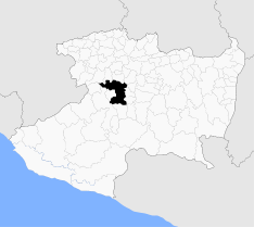
Uruapan
Encyclopedia
Mexico
The United Mexican States , commonly known as Mexico , is a federal constitutional republic in North America. It is bordered on the north by the United States; on the south and west by the Pacific Ocean; on the southeast by Guatemala, Belize, and the Caribbean Sea; and on the east by the Gulf of...
state
States of Mexico
The United Mexican States is a federal republic formed by 32 federal entities .According to the Constitution of 1917, the states of the federation are free and sovereign. Each state has their own congress and constitution, while the Federal District has only limited autonomy with a local Congress...
of Michoacán
Michoacán
Michoacán officially Estado Libre y Soberano de Michoacán de Ocampo is one of the 31 states which, with the Federal District, comprise the 32 Federal Entities of Mexico. It is divided in 113 municipalities and its capital city is Morelia...
. The city is the municipal seat of the municipality. The town and surroundings are world famous for the Monarch Butterfly Sanctuary nearby,Uruapan is in the crossroads of Michoacan, is the middle city anywhere in Michoacan, in part because of the great quantity of avocado
Avocado
The avocado is a tree native to Central Mexico, classified in the flowering plant family Lauraceae along with cinnamon, camphor and bay laurel...
farming and packaging, exported in large parts to the United States, Japan and other countries.
Uruapan is one of the oldest cities in Mexico. Its main natural attraction is the Cupatitzio River (dubbed "the river that sings"), because along its flow are tourist attractions. The National Park Eduardo Ruiz is home of "La Rodilla del Diablo", the source of the river which courses through the city and out toward "La Tzaráracua" and "La Tzararacuita", waterfalls on the southern outskirts of the city, and flows into the Presa Infernillo and eventually the Pacific Ocean. Paricutín
Paricutín
Parícutin is a cinder cone volcano in the Mexican state of Michoacán, close to a lava-covered village of the same name. It appears on many versions of the Seven Natural Wonders of the World...
volcano emerged in the vicinity in 1943, scaring away much of the population. As of the 2010 census, the population of the municipality was 315,379. The municipality has an area of 954.17 km² (368.4 sq mi). The city and the municipality are both the second-largest in the state, behind only the state capital of Morelia
Morelia
Morelia is a city and municipality in the north central part of the state of Michoacán in central Mexico. The city is in the Guayangareo Valley and is the capital of the state. The main pre-Hispanic cultures here were the P'urhépecha and the Matlatzinca, but no major cities were founded in the...
.
Uruapan is served by Uruapan International Airport
Uruapan International Airport
-Accidents and incidents:*TAESA Flight 725, a DC-9, crashed on take-off from Uruapan international airport en route to Mexico City on November 25, 1999, killing 18 people.- External links:* The Airport Guide: * A-Z World Airports: *....
. Uruapan has a sister city: Culver City, California
Culver City, California
Culver City is a city in western Los Angeles County, California. As of the 2010 census, the city had a population of 38,883, up from 38,816 at the 2000 census. It is mostly surrounded by the city of Los Angeles, but also shares a border with unincorporated areas of Los Angeles County. Culver...
, the street where the National Park is has that name (Culver City Street); also, the firefighters of Uruapan received a few years ago personal equipment and vehicles from Culver City and Kansas City Fire Department
Kansas City Fire Department
The Kansas City Fire Department provides fire protection, emergency medical service, emergency rescue and hazardous materials response for residents of Kansas City, Missouri.It operates 34 fire stations that are organized into seven battalions and cover ....
to do a better job. Large numbers of residents live in Mexican communities throughout Southern California
Southern California
Southern California is a megaregion, or megapolitan area, in the southern area of the U.S. state of California. Large urban areas include Greater Los Angeles and Greater San Diego. The urban area stretches along the coast from Ventura through the Southland and Inland Empire to San Diego...
such as Culver City, Coachella
Coachella, California
Coachella is a city in Riverside County, California; it is the easternmost city in the region collectively known as the Coachella Valley...
and Los Angeles California where some local businesses carry the name "Uruapan", along with other Michoacanos from the towns of Jiquilpan, Sahuayo and Jucutacato.
The word Uruapan comes from the Purépecha word ulhupani, meaning "place of eternal formation and fertility of flower buds." Uruapan, "place where the god-prince of flowers is revered, was established before the arrival of the Spaniards and was an exuberant paradise and a peaceful chiefdom corresponding to the Purépecha King." Reséndiz 1991 said there are various interpretations of the meaning of Uruapan, for some meaning "water jug," for others it means "where the trees always give fruit." Others have determined it comes from the word urhuapani, meaning "blooming" or "sprouting." The place where everything flowers also translates to "where the hearts of plants bloom like the flowers and enjoy a perpetual spring."
Foundation

Despite the lack of facts regarding Uruapan's history, people attribute its foundation to a Fray Juan de San Miguel; however, it is recognized that P'urhépecha
P'urhépecha
The P'urhépecha, normally spelled Purépecha in Spanish and in English and traditionally referred to as Tarascans, are an indigenous people centered in the northwestern region of the Mexican state of Michoacán, principally in the area of the cities of Uruapan and Pátzcuaro...
Indians had already settled in these lands many years before the arrival of the Spanish.
An ethnic group with its own language, the P'urhépecha managed to have some military and political control, but in no way were the first nor only peoples in this region. When Fray Juan de San Miguel arrived in Uruapan in 1531, he found the place forsaken, but realized the adjacent areas were already inhabited by small families of Indian tribes like the Otomí
Otomi people
The Otomi people . Smaller Otomi populations exist in the states of Puebla, Mexico, Tlaxcala, Michoacán and Guanajuato. The Otomi language belonging to the Oto-Pamean branch of the Oto-Manguean language family is spoken in many different varieties some of which are not mutually intelligible.One of...
, the Aztec
Aztec
The Aztec people were certain ethnic groups of central Mexico, particularly those groups who spoke the Nahuatl language and who dominated large parts of Mesoamerica in the 14th, 15th and 16th centuries, a period referred to as the late post-classic period in Mesoamerican chronology.Aztec is the...
s and other Nahuas, the Chichimeca
Chichimeca
Chichimeca was the name that the Nahua peoples of Mexico generically applied to a wide range of semi-nomadic peoples who inhabited the north of modern-day Mexico and southwestern United States, and carried the same sense as the European term "barbarian"...
s, and the Oaxaca Chontal.
Around 1400, the triumvirate of chiefs
Tribal chief
A tribal chief is the leader of a tribal society or chiefdom. Tribal societies with social stratification under a single leader emerged in the Neolithic period out of earlier tribal structures with little stratification, and they remained prevalent throughout the Iron Age.In the case of ...
from Pátzcuaro
Pátzcuaro
Pátzcuaro is a large town and municipality located in the state of Michoacán. The town was founded sometime in the 1320s, at first becoming the capital of the Tarascan state and later its ceremonial center...
, Tzintzuntzan
Tzintzuntzan
Tzintzuntzan was the ceremonial center of the pre-Columbian Tarascan state capital of the same name. The name comes from the P'urhépecha word Ts’intsuntsani, which means "place of hummingbirds". After being in Pátzcuaro for the first years of the Tarascan empire, power was consolidated in...
and Ihuatzio
Ihuatzio
Ihuatzio is a city located near Lake Pátzcuaro in the Mexican state of Michoacán. It was once the capital of the P'urhépecha kingdom, also known as the Tarascan state...
conquered and annexed Uruapan. At the arrival of the Spaniards and before the proceeding conquest by the Tarascan kingdom, the last calzonci (king), Tanganxuan II, found refuge in 1522 in what is today known as Uruapan, when fleeing the conquistador Cristóbal de Olid
Cristóbal de Olid
Cristóbal de Olid was a Spanish adventurer, conquistador and rebel who played a part in the conquest of Mexico and Honduras.Born in Zaragoza, Olid grew up in the household of the governor of Cuba, Diego Velázquez de Cuéllar. In 1518 Velázquez sent Olid to relieve Juan de Grijalva, but en route a...
, according to historian Fray Pablo Beaumont.
Uruapan was a pre-Hispanic town inhabited mainly by the P'urhépecha Indians. Archeologists have found plenty of remains which are yet to be studied, with the exception of the Canvass of Jucutacato, found in the community of Jicalán. It is the oldest document related to the study of Michoacán's history.
Considering Fray Juan de San Miguel's arrival in 1531, there then exists a difference of 11 years, which clearly shows there were settlers already in these lands, before the arrival of who is thought to be the founder of Uruapan. In the Canvass of Jucutacato, Uruapan is mentioned as a point where the pilgrimage of the Nonoalcas took place.
Organization

Barrio
Barrio is a Spanish word meaning district or neighborhood.-Usage:In its formal usage in English, barrios are generally considered cohesive places, sharing, for example, a church and traditions such as feast days...
s, which he founded under names of patron saints, each with their own chapel, choir, and school. These barrios were considered in autonomous communities, each with its own identity and customs. The founder of the town was especially interested in the inhabitants learning certain trades, among them craftwork.
The names of the barrios, clockwise from the northern part or Uruapan, are as follows: San Juan Bautista, San Miguel, San Francisco, La Magdalena, San Juan Evangelista, San Pedro y Santiago. In the downtown area, or center of town, there is the Barrio de la Trinidad and Los Riyitos in the Barrio de los Reyes.
Uruapan's city planning was subject to Spaniard urbanization norms, where streets flow from north to south and from east to west, and in the center of town are the government buildings and places of religious and social importance.
The chapels in the barrios were undoubtedly built under Spanish and Moorish influence. La Huatapera (hospital for Indians) is the architectural gemstone of greatest historical value for Uruapan, considered by some to be the first Hospital of América, although there are historical facts that contradict this point.
External links
- Ayuntamiento de Uruapan Official website
- Portal web de Uruapan Uruapan Guide. Everything about the city.