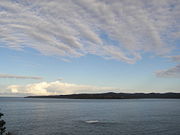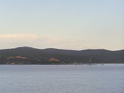
Twofold Bay
Encyclopedia


New South Wales
New South Wales is a state of :Australia, located in the east of the country. It is bordered by Queensland, Victoria and South Australia to the north, south and west respectively. To the east, the state is bordered by the Tasman Sea, which forms part of the Pacific Ocean. New South Wales...
, Australia
Australia
Australia , officially the Commonwealth of Australia, is a country in the Southern Hemisphere comprising the mainland of the Australian continent, the island of Tasmania, and numerous smaller islands in the Indian and Pacific Oceans. It is the world's sixth-largest country by total area...
, close to the border with Victoria
Victoria (Australia)
Victoria is the second most populous state in Australia. Geographically the smallest mainland state, Victoria is bordered by New South Wales, South Australia, and Tasmania on Boundary Islet to the north, west and south respectively....
. The bay has an area of about 30 square kilometres. Close to North Head is a conspicuous islet, Mewstone Rock. About five km south of the islet is Red Point
Red Point, Twofold Bay
Red Point is a coastal headland in New South Wales, Australia at the southern end of Twofold Bay.The point got its name from George Bass's description when he passed it on his whaleboat voyage to Bass Strait in 1797/8. He noted Twofold Bay "may be known by a red point on the south side of the...
which forms the southern headland of the bay. Eden
Eden, New South Wales
Eden is a coastal town in the South Coast region of New South Wales, Australia. The town, south of the state capital Sydney near the border with Victoria, is located between Nullica Bay to the south and Calle Calle Bay, the northern reach of Twofold Bay, and built on undulating land adjacent to a...
and the Port of Eden
Port of Eden
The Port of Eden is a small seaport in Twofold Bay adjacent to the town of Eden on the south coast of New South Wales, Australia.The bay was first charted by explorer George Bass in 1797 and has been used for commercial whaling and fishing since the 1840's....
are located in the bay. Boydtown
Boydtown, New South Wales
Boydtown is a village on Twofold Bay near Eden, on the far south coast of New South Wales, Australia. It was the original settlement in the bay, founded by Benjamin Boyd in 1843 to service his properties on the Monaro plains...
is to the west of the bay, located on Boydtown Beach which stretches south from the mouth of the Nullica River.
The bay was named by George Bass
George Bass
George Bass was a British naval surgeon and explorer of Australia.-Early years:He was born on 30 January 1771 at Aswarby, a hamlet near Sleaford, Lincolnshire, the son of a tenant farmer, George Bass, and a local beauty named Sarah Nee Newman. His father died in 1777 when Bass was 6...
, for its shape of two bight
Bight (geography)
In geography, bight has two meanings. A bight can be simply a bend or curve in any geographical feature—usually a bend or curve in the line between land and water....
s, when he passed it on his whaleboat voyage to Bass Strait
Bass Strait
Bass Strait is a sea strait separating Tasmania from the south of the Australian mainland, specifically the state of Victoria.-Extent:The International Hydrographic Organization defines the limits of the Bass Strait as follows:...
in 1797/8. The northern bight is called Calle Calle Bay while the southern bight is known as Nullica Bay.
It is also famous for the "Killers of Eden", the killer whales which helped a group of whalers in their search for other whales. The best-known of these was Old Tom
Old Tom
Old Tom was the name given to an orca by whalers in the port of Eden on the southeast coast of Australia. Old Tom measured 22 feet and weighed 6 tons. The skull measured 1.02 m and the teeth measured about 5.31 inches. Old Tom was thought to be the leader of a pod of killer whales who helped the...
whose skeleton is preserved in Eden's local museum.
History
The original inhabitants of the area surrounding Twofold Bay were AboriginesIndigenous Australians
Indigenous Australians are the original inhabitants of the Australian continent and nearby islands. The Aboriginal Indigenous Australians migrated from the Indian continent around 75,000 to 100,000 years ago....
of the Thaua
Thaua people
Thaua people, or Thauaira or Thawa or Tharawal people of the Yuin nation of the South Coast of New South Wales.The associated language name is Thurga /Thoorga / Durga/ Dhurga.-Country:...
clan of the Yuin nation. The first recorded visit to the bay by a European was by George Bass
George Bass
George Bass was a British naval surgeon and explorer of Australia.-Early years:He was born on 30 January 1771 at Aswarby, a hamlet near Sleaford, Lincolnshire, the son of a tenant farmer, George Bass, and a local beauty named Sarah Nee Newman. His father died in 1777 when Bass was 6...
. Bass' diaries show that he noted the bay on the south-bound leg of a voyage to Van Diemen's Land
Van Diemen's Land
Van Diemen's Land was the original name used by most Europeans for the island of Tasmania, now part of Australia. The Dutch explorer Abel Tasman was the first European to land on the shores of Tasmania...
(Tasmania
Tasmania
Tasmania is an Australian island and state. It is south of the continent, separated by Bass Strait. The state includes the island of Tasmania—the 26th largest island in the world—and the surrounding islands. The state has a population of 507,626 , of whom almost half reside in the greater Hobart...
) in December 1797 and took shelter in it on the return journey in February 1798 [4]. Bass named the place where he sheltered "Snug Cove", a name by which the bay is still known [4].
On 7 October 1798 Bass and Matthew Flinders
Matthew Flinders
Captain Matthew Flinders RN was one of the most successful navigators and cartographers of his age. In a career that spanned just over twenty years, he sailed with Captain William Bligh, circumnavigated Australia and encouraged the use of that name for the continent, which had previously been...
set out from Port Jackson
Port Jackson
Port Jackson, containing Sydney Harbour, is the natural harbour of Sydney, Australia. It is known for its beauty, and in particular, as the location of the Sydney Opera House and Sydney Harbour Bridge...
in the Norfolk on a voyage to determine whether or not Van Diemen's Land (now called Tasmania
Tasmania
Tasmania is an Australian island and state. It is south of the continent, separated by Bass Strait. The state includes the island of Tasmania—the 26th largest island in the world—and the surrounding islands. The state has a population of 507,626 , of whom almost half reside in the greater Hobart...
) was attached to the mainland of Australia. Accompanying them on this voyage was the Nautilus. Two days later a survey of Twofold Bay was commenced. This very accurate survey has required little subsequent modification apart from the addition of water depths and of shore-to-shore distances between important landmarks [4]. They also made their first contact with the local Thaua people .
The bay is mentioned in the logs of many ships which sheltered in it from the storms battering that part of the New South Wales coastline. Some of these ships were shipwrecked in the bay including the Mary (1821) and the Sophia (1825).
Quarantine Bay, 3km south of Eden, is so named because a sailing ship with a smallpox epidemic amongst the people on board took refuge in this (then) isolated area. Many people died and were buried on shore in a communal grave.
In 1843 Benjamin Boyd
Benjamin Boyd
Benjamin Boyd was a Scottish-born Australian pioneer and entrepreneur.Boyd was a man of "an imposing personal appearance, fluent oratory, aristocratic connexions, and a fair share of commercial acuteness". Mrs Georgiana McCrae, with whom he had dinner when he first came to Port Phillip, looked at...
purchased land in Twofold Bay with the aim of transporting cattle from the district [5]. Soon afterwards he started to build the Seahorse Inn adjacent to what is now called Boydtown Beach. Boydtown Beach lies on the western shore of Twofold Bay just south of the entrance to the Nullica River, which is located at the southern end of Quarantine Bay. The Seahorse Inn is still used for tourist accommodation. Nearby are the ruins of the church which Ben Boyd had constructed.
Industry
In the mid 2000's two major wharves dominate the south-eastern section of the bay.The most easterly wharf services the woodchip mill. Usually two ships per month use the wharf. The forestry industry plays a significant role in the region.
The Eden woodchip mill is owned by South East Fibre Exports(SEFE), a subsidiary of Japan's biggest paper manufacturer, Nippon Paper Industries. The mill can only process whole tree logs and cannot process waste wood. The Eden chipmill was Australia's first chipmill and has been vigorously opposed by conservationists for over 40 years http://www.chipstop.savetheforests.org.au/. Conservationists argue that woodchipping
Woodchipping
Woodchipping is the act and industry of chipping wood for pulp, processed wood products, and mulch.-Papermaking:Timber is converted to woodchips and sold, primarily, for pulp production used in paper manufacture...
not only kills millions of native animals and birds, it is a major contributor to climate change.
The second wharf belongs to the Department of Defence and is used by the Navy to service its ships. Parallel to the woodchip mill is a naval munitions storage depot.It is a multi-purpose wharf which allows other vessels, including cruise ships, to also moor at the wharf when the Naval ships are not using it.
Mussel farming occupies the westerly part of the bay off the small peninsular between Cattle Bay and Quarantine Bay.

