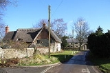
Turweston
Encyclopedia
Turweston is a village
and also a civil parish within Aylesbury Vale
district in Buckinghamshire
, England
. It is located in the north of the county, near the border with Oxfordshire
and Northamptonshire
, about a mile east of Brackley
in the latter.
The village name is Scandinavian in origin, and means 'Þorfrøthr's village'. It was recorded in the Domesday Book
of 1086 as Turvestone.
There is also an operational former World War II
airfield at Turweston Airfield
, now also a conference centre, business park and rally school.
Village
A village is a clustered human settlement or community, larger than a hamlet with the population ranging from a few hundred to a few thousand , Though often located in rural areas, the term urban village is also applied to certain urban neighbourhoods, such as the West Village in Manhattan, New...
and also a civil parish within Aylesbury Vale
Aylesbury Vale
The Aylesbury Vale is a large area of flat land mostly in Buckinghamshire, England. Its boundary is marked by Milton Keynes to the north, Leighton Buzzard and the Chiltern Hills to the east and south, Thame to the south and Bicester and Brackley to the west.The vale is named after Aylesbury, the...
district in Buckinghamshire
Buckinghamshire
Buckinghamshire is a ceremonial and non-metropolitan home county in South East England. The county town is Aylesbury, the largest town in the ceremonial county is Milton Keynes and largest town in the non-metropolitan county is High Wycombe....
, England
England
England is a country that is part of the United Kingdom. It shares land borders with Scotland to the north and Wales to the west; the Irish Sea is to the north west, the Celtic Sea to the south west, with the North Sea to the east and the English Channel to the south separating it from continental...
. It is located in the north of the county, near the border with Oxfordshire
Oxfordshire
Oxfordshire is a county in the South East region of England, bordering on Warwickshire and Northamptonshire , Buckinghamshire , Berkshire , Wiltshire and Gloucestershire ....
and Northamptonshire
Northamptonshire
Northamptonshire is a landlocked county in the English East Midlands, with a population of 629,676 as at the 2001 census. It has boundaries with the ceremonial counties of Warwickshire to the west, Leicestershire and Rutland to the north, Cambridgeshire to the east, Bedfordshire to the south-east,...
, about a mile east of Brackley
Brackley
Brackley is a town in south Northamptonshire, England. It is about from Oxford and miles form Northampton. Historically a market town based on the wool and lace trade, it was built on the intersecting trade routes between London, Birmingham and the English Midlands and between Cambridge and Oxford...
in the latter.
The village name is Scandinavian in origin, and means 'Þorfrøthr's village'. It was recorded in the Domesday Book
Domesday Book
Domesday Book , now held at The National Archives, Kew, Richmond upon Thames in South West London, is the record of the great survey of much of England and parts of Wales completed in 1086...
of 1086 as Turvestone.
There is also an operational former World War II
World War II
World War II, or the Second World War , was a global conflict lasting from 1939 to 1945, involving most of the world's nations—including all of the great powers—eventually forming two opposing military alliances: the Allies and the Axis...
airfield at Turweston Airfield
Turweston Aerodrome
Turweston Aerodrome located near the village of Turweston, on the Northamptonshire and Buckinghamshire border, is a former Royal Air Force World War II bomber training facility, now a business park and airfield....
, now also a conference centre, business park and rally school.

